


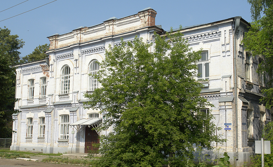


Why visit Osa
Townapedia lists 7 museums and landmarks, 5 places to eat, 4 places to stay and 1 attraction in and around town.
Weather in Osa
Forecast from MET Norway (CC BY 4.0). Full forecast
About Osa
Osa (Russian: Оса́) is a town and the administrative center of Osinsky District in Perm Krai, Russia, located on the left bank of the Kama River near its confluence with the Tulva, 146 kilometers (91 mi) southwest of Perm, the administrative center of the krai. As of the 2010 Census, its population was 21,188.
From the Wikipedia article Osa, Perm Krai (this version), under CC BY-SA 4.0.
Things to do1

Museums and landmarks7


Мемориал у вечного огня павшим Советским Воинам
Monument and historic site · 1.2 km
Основателям Ново Никольской (Осинской) слободы
Monument and historic site · 1.3 km
Restaurants and cafes5


Where to stay4



History
It was founded in 1591 (according to other sources—in 1596) as the sloboda of Novonikolskaya (Новонико́льская) and later became a fortress. In a 1623 document, the settlement is referred to as the sloboda of Osinskaya Nikolskaya (Осинская Никольская), in 1678—as the sloboda of Osinskaya (Осинская), in 1732—as the village (selo) of Osa. It was granted town status in 1739. In 1960, oil fields were discovered near Osa. Oil extraction started in 1963.
From the History section of Osa, Perm Krai on Wikipedia, under CC BY-SA 4.0.
Churches and places of worship3
Церковь Иконы Божией Матери Казанская
Church · Russian Orthodox · 1.5 km
4 Южная улица, Оса
Собор Троицы Живоначальной
Church · Russian Orthodox · 1.0 km
2 улица Степана Разина, Оса
Собор Успения Пресвятой Богородицы
Church · Russian Orthodox · 1.3 km
2 улица Свердлова, Оса
Shopping23
Gas and EV charging4
Schools, colleges and libraries5
Муниципальное бюджетное общеобразовательное учреждение "Средняя общеобразовательная школа №4
School · 0.8 km
Healthcare4
Map of Osa
56 places. The map loads OpenStreetMap tiles when you open it.
Getting there and nearby towns
Bolshoye Savino Airport (PEE) is the nearest airport with scheduled flights listed in OpenStreetMap, 78 km away.
- Chastyye 29 km west, about 29 min by car
- Barda 40 km south, about 40 min by car
- Yelovo 41 km southwest, about 41 min by car
- Yugo-Kamskiy 47 km north, about 47 min by car
- Okhansk 48 km north, about 48 min by car
- Yug 65 km northeast, about 1 h by car
- Troyel’ga 68 km east, about 1 h 15 min by car
- Zvëzdnyy 71 km northeast, about 1 h 15 min by car
- Nytva 73 km north, about 1 h 15 min by car
- Ural’skiy 73 km north, about 1 h 15 min by car
Drive times are estimates from straight-line distance, not routes.
Local news
Headlines from INDB.
Reviews, tips and questions
Loading what members have shared...
Sources and licences
- GeoNames (CC BY 4.0): population, coordinates, regions and time zone
- OpenStreetMap contributors (ODbL 1.0): places, airports, map data
- Wikidata (CC0 1.0): elevation, founding date, time zone, website
- Wikimedia Commons (see each image): photos
- Wikipedia (CC BY-SA 4.0): overview and history text
Photo credits
- Оса. Возведение здания летнего театра 1909, Unknown author Unknown author, Public domain
- Оса, ярмарка - panoramio, Николай Максимович, CC BY 3.0
- Здание Осинского профессионально-педагогического колледжа, Ильдар Юнусович Маматов, CC BY-SA 4.0
- Оса, улица Степана Разина - panoramio (1), Николай Максимович, CC BY 3.0
- Оса - исторический город - panoramio, Николай Максимович, CC BY 3.0
- Оса - panoramio (10), Николай Максимович, CC BY 3.0
- Оса, улица Степана Разина 27 - panoramio, Николай Максимович, CC BY 3.0
- Оса, улица Степана Разина - panoramio, Николай Максимович, CC BY 3.0
- Оса, улица Степана Разина - panoramio (2), Николай Максимович, CC BY 3.0
- Оса, улица Степана Разина - panoramio (3), Николай Максимович, CC BY 3.0
- Торицкий собор, Оса - panoramio, Николай Максимович, CC BY 3.0
- Оса, улица Урицкого - panoramio, Николай Максимович, CC BY 3.0
- Оса - panoramio (8), Николай Максимович, CC BY 3.0
- Оса - panoramio (13), Николай Максимович, CC BY 3.0
- Оса - panoramio (7), Николай Максимович, CC BY 3.0
- Оса, здание склада купца Темир-Палатова, середина 19 века - panoramio, Николай Максимович, CC BY 3.0
- Оса - panoramio (12), Николай Максимович, CC BY 3.0
- Оса - panoramio (15), Николай Максимович, CC BY 3.0
- Оса, памятник В.И.Ленину - panoramio, Николай Максимович, CC BY 3.0
- Оса - panoramio (2), Николай Максимович, CC BY 3.0
- Оса - panoramio (6), Николай Максимович, CC BY 3.0
- Оса - panoramio, Николай Максимович, CC BY 3.0
- Оса - panoramio (4), Николай Максимович, CC BY 3.0
- Оса - panoramio (3), Николай Максимович, CC BY 3.0
- Осинский краеведческий музей - panoramio, Николай Максимович, CC BY 3.0
- Оса - panoramio (11), Николай Максимович, CC BY 3.0
- Оса - panoramio (14), Николай Максимович, CC BY 3.0
- Оса - panoramio (1), Николай Максимович, CC BY 3.0
- Оса - panoramio (5), Николай Максимович, CC BY 3.0
- Оса - panoramio (9), Николай Максимович, CC BY 3.0
- Южное кладбище в Осе, Часовня 2016, Mnavi, CC BY-SA 4.0
- Южное кладбище в Осе, Часовня, табличка 2016, Mnavi, CC BY-SA 4.0
- Деревня Пещеры - panoramio, Николай Максимович, CC BY 3.0


Page built November 4, 2026. Spotted a mistake? Tell us or suggest a place.