
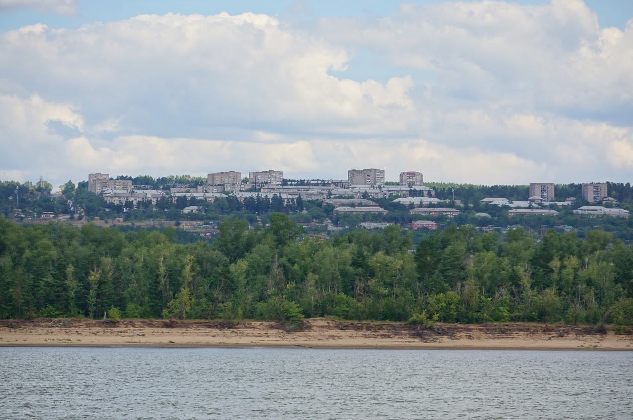


Pribrezhnyy, Russia
Прибрежный
Pribrezhnyy is a town of 11,500 people in Samara Oblast, Russia, founded in 1959.
Why visit Pribrezhnyy
Townapedia lists 4 museums and landmarks, 1 park or trail and 3 places to eat in and around town.
Weather in Pribrezhnyy
Forecast from MET Norway (CC BY 4.0). Full forecast
About Pribrezhnyy
Pribrezhny is an urban-type settlement in the Krasnoglinsky District of Samara, Russia. It is situated approximately 60 km from the city center and is surrounded by the territory of Stavropolsky District.
From the Wikipedia article Pribrezhny, Samara Oblast (this version), under CC BY-SA 4.0.
Museums and landmarks4

Parks, trails and playgrounds1

Restaurants and cafes3


Churches and places of worship2

Храм святых Новомучеников и исповедников Российских
Church · Orthodox · 0.7 km
15 Звёздная улица
History
Construction of the settlement began in 1959, prompted by the development of nearby aerospace industry enterprises, including branches of the Kuybyshev Frunze Motor Plant and the Kuybyshev NPO "Trud." The location attracted skilled workers from across the USSR.
Before development began, archaeological surveys uncovered remains of Late Neolithic and Bronze Age settlements. Artifacts included clay animal figurines—goats and pigs—interpreted as ritual objects with symbolic meanings related to fertility and agriculture.
Initial housing consisted of barracks for construction teams, later followed by multi-story residential buildings with views of the Volga River. In 1959–1960, five such buildings were completed. In that same year, a detached station of the 29th Militarized Fire Unit was established.
Among early residents was Andrei Ivanovich Tikhiy, a World War II veteran, who contributed significantly to the organization of local governance and infrastructure.
In 1960, by resolution of the Kuybyshev Regional Executive Committee, Priberezhny was designated as a workers' settlement and placed under the Novo-Buyansky District of the Kuybyshev region.
From the History section of Pribrezhny, Samara Oblast on Wikipedia, under CC BY-SA 4.0.
Shopping4
Schools, colleges and libraries4
Healthcare4
Map of Pribrezhnyy
22 places. The map loads OpenStreetMap tiles when you open it.
Getting there and nearby towns
Kurumoch International Airport (KUF) is the nearest airport with scheduled flights listed in OpenStreetMap, 20 km away.
- Zol’noye 6 km southwest, about 6 min by car
- Zhigulëvsk 25 km west, about 25 min by car
- Tolyatti 34 km west, about 34 min by car
- Samara 36 km southeast, about 36 min by car
- Novokuybyshevsk 44 km south, about 44 min by car
- Chapayevsk 58 km south, about 58 min by car
- Kinel’ 59 km southeast, about 59 min by car
- Bezenchuk 63 km southwest, about 1 h by car
- Dimitrovgrad 82 km north, about 1 h 15 min by car
- Oktyabr’sk 85 km southwest, about 1 h 30 min by car
Drive times are estimates from straight-line distance, not routes.
Local news
Headlines from INDB.
Reviews, tips and questions
Loading what members have shared...
Sources and licences
- GeoNames (CC BY 4.0): population, coordinates, regions and time zone
- OpenStreetMap contributors (ODbL 1.0): places, airports, map data
- Wikidata (CC0 1.0): elevation, founding date, time zone, website
- Wikimedia Commons (see each image): photos
- Wikipedia (CC BY-SA 4.0): overview and history text
Photo credits
- Pribrezhny (Samara), Sergei Sorokin, CC BY-SA 3.0
- Pribrezhnyy, Samarskaya oblast', Russia, 443902 - panoramio (4), Sergey Kozorezov, CC BY 3.0
- Pribrezhnyy, Samarskaya oblast', Russia, 443902 - panoramio (2), Sergey Kozorezov, CC BY 3.0
- Pribrezhnyy, Samarskaya oblast', Russia, 443902 - panoramio (3), Sergey Kozorezov, CC BY 3.0
- Pribrezhnyy, Samarskaya oblast', Russia, 443902 - panoramio (1), Sergey Kozorezov, CC BY 3.0
- Pribrezhnyy, Samarskaya oblast', Russia, 443902 - panoramio, Sergey Kozorezov, CC BY 3.0
- Волга (29191062601), Raymond Zoller from Bar, Montenegro, CC BY-SA 2.0
- На Волге (32213455943), Raymond Zoller from Bar, Montenegro, CC BY-SA 2.0
- Волга (30762480181), Raymond Zoller from Bar, Montenegro, CC BY-SA 2.0
- Wolga (28405839530), Raymond Zoller from Bar, Montenegro, CC BY-SA 2.0
- Волга (28471794390), Raymond Zoller from Bar, Montenegro, CC BY-SA 2.0


Page built November 4, 2026. Spotted a mistake? Tell us or suggest a place.