
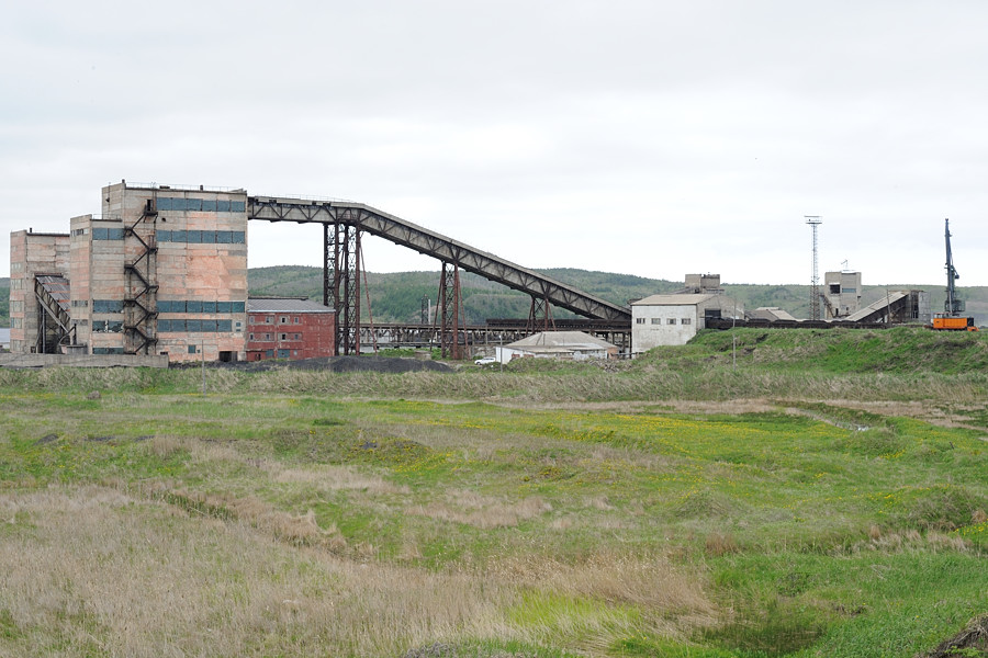


Shakhtërsk, Russia
Шахтёрск
Shakhtërsk is a town of 10,100 people in Sakhalin Oblast, Russia.
Why visit Shakhtërsk
Townapedia lists 1 museum or landmark, 2 places to eat and 1 place to stay in and around town.
Weather in Shakhtërsk
Forecast from MET Norway (CC BY 4.0). Full forecast
About Shakhtërsk
Shakhtyorsk (Russian: Шахтёрск; Japanese: 塔路, Tōro) is a town in Uglegorsky District of Sakhalin Oblast, Russia, located on the western coast of the Sakhalin Island, 376 kilometers (234 mi) northwest of Yuzhno-Sakhalinsk, the administrative center of the oblast. Population: 8,382 (2010 census); 10,643 (2002 census); 12,945 (1989 Soviet census).
From the Wikipedia article Shakhtyorsk (this version), under CC BY-SA 4.0.
Museums and landmarks1

Restaurants and cafes2

Gora i more
Restaurant · Asian, International, Russian · 1.8 km
30 улица Мира
Fr-Sa 12:00-02:00; Su-Th 12:00-24:00

Where to stay1

Schools, colleges and libraries6

МОУ Средняя общеобразовательная школа №1
School · 0.7 km
1А Коммунистическая улица

History
It was founded after 1905 as Tōro, in the region then known as the Karafuto Prefecture of Japan. After the Soviet Union gained control over the southern part of the Sakhalin Island in August 1945, it became part of Sakhalin Oblast. It was granted town status and given its present name in 1947.
From the History section of Shakhtyorsk on Wikipedia, under CC BY-SA 4.0.
Healthcare3
Городская поликлиника Шахтерской городской больницы
Clinic and pharmacy · 1.3 km
3А улица Мира, Шахтёрск
Map of Shakhtërsk
13 places. The map loads OpenStreetMap tiles when you open it.
Getting there and nearby towns
Shakhtersk (EKS) is the nearest airport with scheduled flights listed in OpenStreetMap, 4 km away.
- Udarnyy 6 km south, about 6 min by car
- Uglegorsk 10 km south, about 10 min by car
- Boshnyakovo 54 km north, about 54 min by car
- Leonidovo 56 km east, about 56 min by car
- Tikhmenevo 57 km east, about 57 min by car
- Vakhrushev 57 km east, about 57 min by car
- Gastello 61 km east, about 1 h by car
- Vostok 62 km east, about 1 h by car
- Poronaysk 71 km east, about 1 h 15 min by car
- Makarov 77 km southeast, about 1 h 15 min by car
Drive times are estimates from straight-line distance, not routes.
Local news
Headlines from INDB.
Reviews, tips and questions
Loading what members have shared...
Sources and licences
- GeoNames (CC BY 4.0): population, coordinates, regions and time zone
- OpenStreetMap contributors (ODbL 1.0): places, airports, map data
- Wikidata (CC0 1.0): elevation, founding date, time zone, website
- Wikimedia Commons (see each image): photos
- Wikipedia (CC BY-SA 4.0): overview and history text
Photo credits
- Schachtjorsk-ZOF, MBxd1, CC BY-SA 3.0
- Schachtjorsk-Zentrum, MBxd1, CC BY-SA 3.0
- Depo Schachtjorsk, MBxd1, CC BY-SA 3.0
Page built November 4, 2026. Spotted a mistake? Tell us or suggest a place.