
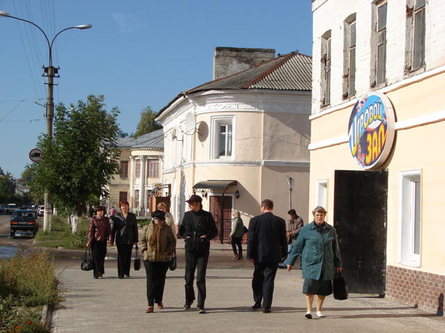


Why visit Sudogda
Townapedia lists 12 museums and landmarks, 1 park or trail, 2 places to eat and 1 place to stay in and around town.
Highlights include Усадьба Храповицкого в Муромцеве.
Weather in Sudogda
Forecast from MET Norway (CC BY 4.0). Full forecast
About Sudogda
Sudogda (Russian: Су́догда) is a town and the administrative center of Sudogodsky District in Vladimir Oblast, Russia, located on the left bank of the river Sudogda (Klyazma's tributary) 40 kilometers (25 mi) southeast of Vladimir, the administrative center of the oblast. Population: 10,408 (2021 census); 11,848 (2010 census); 13,328 (2002 census); 14,191 (1989 Soviet census).
From the Wikipedia article Sudogda (this version), under CC BY-SA 4.0.
Museums and landmarks12
Усадьба Храповицкого в Муромцеве
Monument and historic site · 3.1 km
22 Парковая улица

1941-1945
Monument and historic site · 1.6 km
Вечная память воинам Судогодского района павшим в боях на независимость нашей родины 1941-1945 гг.

Памятник погибшим работникам техникума и жителей Муромцево во время Великой Отечественной войны
Monument and historic site · 3.0 km
Parks, trails and playgrounds1

Restaurants and cafes2


Where to stay1

History
First mentioned in the 17th century documents as the sloboda of Sudogodskaya (Судогодская), it was later known as the selo of Sudogda. Town status was granted to it in 1778.
From the History section of Sudogda on Wikipedia, under CC BY-SA 4.0.
Churches and places of worship4
Храм Святой мученицы царицы Александры Римской
Church · Russian Orthodox · 2.9 km
Shopping10
Gas and EV charging4
Schools, colleges and libraries3
Healthcare5
Map of Sudogda
42 places. The map loads OpenStreetMap tiles when you open it.
Getting there and nearby towns
Иваново (Южный) (IWA) is the nearest airport with scheduled flights listed in OpenStreetMap, 110 km away.
- Muromtsevo 3 km southeast, about 3 min by car
- Andreyevo 17 km east, about 17 min by car
- Krasnyy Bogatyr’ 17 km northeast, about 17 min by car
- Golovino 28 km west, about 28 min by car
- Orgtrud 30 km northwest, about 30 min by car
- Vladimir 36 km northwest, about 36 min by car
- Kovrov 53 km northeast, about 53 min by car
- Suzdal’ 59 km northwest, about 59 min by car
- Roshal’ 70 km southwest, about 1 h 15 min by car
- Murom 84 km southeast, about 1 h 30 min by car
Drive times are estimates from straight-line distance, not routes.
Local news
Headlines from INDB.
Reviews, tips and questions
Loading what members have shared...
Sources and licences
- GeoNames (CC BY 4.0): population, coordinates, regions and time zone
- OpenStreetMap contributors (ODbL 1.0): places, airports, map data
- Wikidata (CC0 1.0): elevation, founding date, time zone, website
- Wikimedia Commons (see each image): photos
- Wikipedia (CC BY-SA 4.0): overview and history text
Photo credits
- Sudogda-zentr-1, Илья Карташев, CC BY-SA 3.0
- Усадьба Храповицкого на старой открытке. Дом, Unknown author Unknown author, Public domain
- Церковь Александры Римской в Муромцеве, 2018-07-01, Евгений Катышев, CC BY-SA 4.0
Page built November 4, 2026. Spotted a mistake? Tell us or suggest a place.