


Why visit Tarki
Townapedia lists 6 museums and landmarks, 4 parks and trails, 102 places to eat, 14 places to stay and 8 attractions in and around town.
Highlights include Church of Saint Vladimir in MakhachkaӀa, Dagestan State Medical University and Dagestan Museum of Fine Arts.
Weather in Tarki
Forecast from MET Norway (CC BY 4.0). Full forecast
About Tarki
Tarki (Kumyk: Таргъу, Tarğu; Russian: Тарки́) formerly also spelled Tarkou and also known as Tarku, is an urban locality (an urban-type settlement) under the administrative jurisdiction of Sovetsky City District of the City of Makhachkala in the Republic of Dagestan, Russia, located on the Tarki-tau (Kumyk: Tarğu-taw) mountain. As of the 2010 Census, its population was 15,356.
From the Wikipedia article Tarki (this version), under CC BY-SA 4.0.
Things to do8
Church of Saint Vladimir in MakhachkaӀa
Monument and historic site · 4.5 km
Church of the Holy Equal-to-the-Apostles Prince Vladimir of Makhachkala

Dagestan State Medical University
School · 4.4 km
Russian medical school in Dagestan
Dagestan State Pedagogical University
School · 3.2 km
Education organization in Makhachkala, Russia

Dagestan State University
School · 4.7 km
Public university in Makhachkala, Republic of Dagestan, Russia
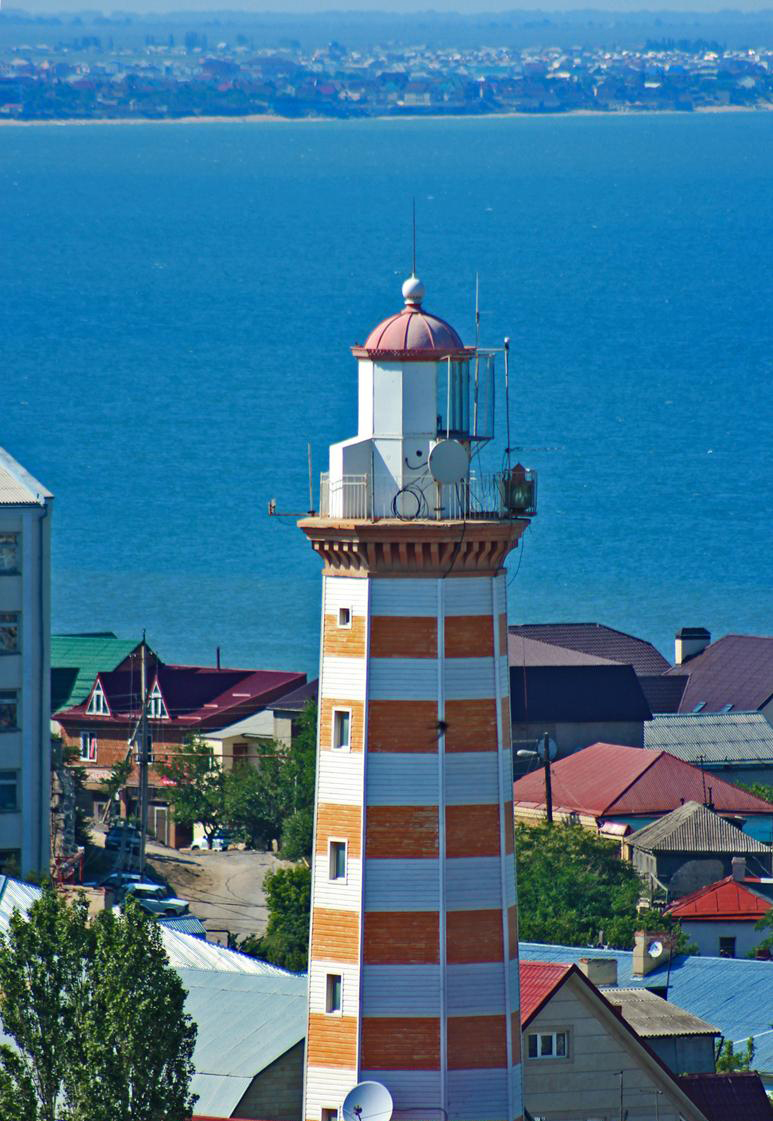
Makhachkala Lighthouse
Monument and historic site · 4.6 km
Lighthouse in Dagestan

Makhachkala Synagogue
Monument and historic site · 3.7 km
Center for the spiritual life of the Jews of Makhachkala

National Museum of the Republic of Dagestan
Monument and historic site · 4.5 km
Building in Russia

Парамакс
Cinema and theater · 2.2 km
64 проспект Имама Шамиля, Махачкала
Mo-Su 08:00-00:00
Museums and landmarks6



Parks, trails and playgrounds4

Octagon
Sports field and stadium · 1.0 km
1А проспект Аметхана Султана, Махачкала

Restaurants and cafes102

Maru
Cafe · Asian, Burger, Coffee Shop, Chicken, International, Regional, Sandwich, Turkish, Friture, Kebab · 2.4 km
Бистро "Мару"
9:00-21:00
Broadway
Cafe · International, Pizza, Pasta, Coffee Shop, Italian Pizza, Chicken · 2.1 km
43 проспект Имама Шамиля, Махачкала
Mo-Su 12:00-02:00



Paradise
Restaurant · 1.1 km
Ресторан-кальянная Парадайс(Paradise)
15А проспект Аметхана Султана, Махачкала
90 more on the map.
History
Tarki had been the capital of Kumyk historical states before they were abolished by Russia.
According to some scholars, Tarki sits on the site of Samandar, the capital of Khazaria until the early 8th century. In 1396, Timur passed through Tarki during the Tokhtamysh–Timur war. In the Middle Ages the Shamkhalate state is formed, lately becoming Shamkhalate of Tarki. Tarki had been the capital of the Kumyk state at least from the 16th century. This state was not abolished until 1867.
Tarki is mentioned by Armenian chronicles of the 7-8th century, by Giovanni Carpini in the Catalan Atlas of 1375, and by Timurid historians.
The shamkhals submitted to Russian authority more than once, first in the early 17th century. In 1668, the town was sacked by Cossacks under Stepan Razin.
The shamkhals were again obliged to submit to Russian suzerainty during Peter the Great's 1722 Persian Expedition and during Catherine the Great's 1796 Persian Expedition.
Tarki finally came under Russian control under the terms of the Treaty of Gulistan in 1813. Eight years later, the Russians built Burnaya Fortress there, which was succeeded by Fort-Petrovsk (on the grounds of original Kumyk town called Andzhi-kala (or Anji), now known as Makhachkala.
From the History section of Tarki on Wikipedia, under CC BY-SA 4.0.
Where to stay14
Churches and places of worship3
Shopping52
Gas and EV charging8
Schools, colleges and libraries24
Реабилитационный центр для слабослышащих детей
School · 1.4 km
34А улица Олега Кошевого, Махачкала
Healthcare40
Детская поликлиника № 2
Clinic and pharmacy · 1.1 km
79 проспект Гамидова, Махачкала
Map of Tarki
250 places. The map loads OpenStreetMap tiles when you open it.
Getting there and nearby towns
Makhachkala Uytash Airport (MCX) is the nearest airport with scheduled flights listed in OpenStreetMap, 19 km away.
- Makhachkala 4 km north, about 4 min by car
- Kyakhulay 3 km north, about 3 min by car
- Al’burikent 4 km northwest, about 4 min by car
- Novyy Khushet 7 km southeast, about 7 min by car
- Semender 9 km northwest, about 9 min by car
- Leninkent 12 km west, about 12 min by car
- Kaspiysk 14 km southeast, about 14 min by car
- Shamkhal 18 km northwest, about 18 min by car
- Shamkhal-Termen 18 km northwest, about 18 min by car
- Khasavyurt 81 km northwest, about 1 h 15 min by car
Drive times are estimates from straight-line distance, not routes.
Local news
Headlines from INDB.
Reviews, tips and questions
Loading what members have shared...
Sources and licences
- GeoNames (CC BY 4.0): population, coordinates, regions and time zone
- OpenStreetMap contributors (ODbL 1.0): places, airports, map data
- Wikidata (CC0 1.0): elevation, founding date, time zone, website, landmarks and historic places
- Wikimedia Commons (see each image): photos
- Wikipedia (CC BY-SA 4.0): overview and history text
Photo credits
- Тарки1, Ksenia Romanenko, CC BY-SA 4.0
- Храм Святого Князя Владимира в Махачкале, Пресс-служба Главы и Правительства РД, CC BY 3.0
- Makhachkala 20180917 131925, Bogdanov-62, CC BY-SA 4.0
- Улица Ярагского, 57, Shamil Magomedov, CC BY-SA 4.0
- ДГУ, Шамиль Магомедов, CC BY-SA 2.0
- Makhachkala lighthouse, Шамиль Магомедов, CC0
- Makhachkala Synagogue, Alandislands, CC BY-SA 4.0
- Baryatinsky-Vanetsov House in Makhachkala (March 2026) - 0 3, Vyacheslav Bukharov, CC BY-SA 4.0
- Art museum in Makhachkala (March 2026), Vyacheslav Bukharov, CC BY-SA 4.0
- Дагестанский ГТУ, Шамиль Магомедов, CC BY-SA 2.0
- Dagestan-031, Alexander Novikov, CC BY-SA 4.0
- Dagestan-032, Alexander Novikov, CC BY-SA 4.0
- Транспупиллярная лазерная коагуляция сетчатки, MarkPanin, CC BY-SA 4.0
- ДГТУ Махачкала, АбуУбайда, CC BY-SA 3.0


Page built November 4, 2026. Spotted a mistake? Tell us or suggest a place.