
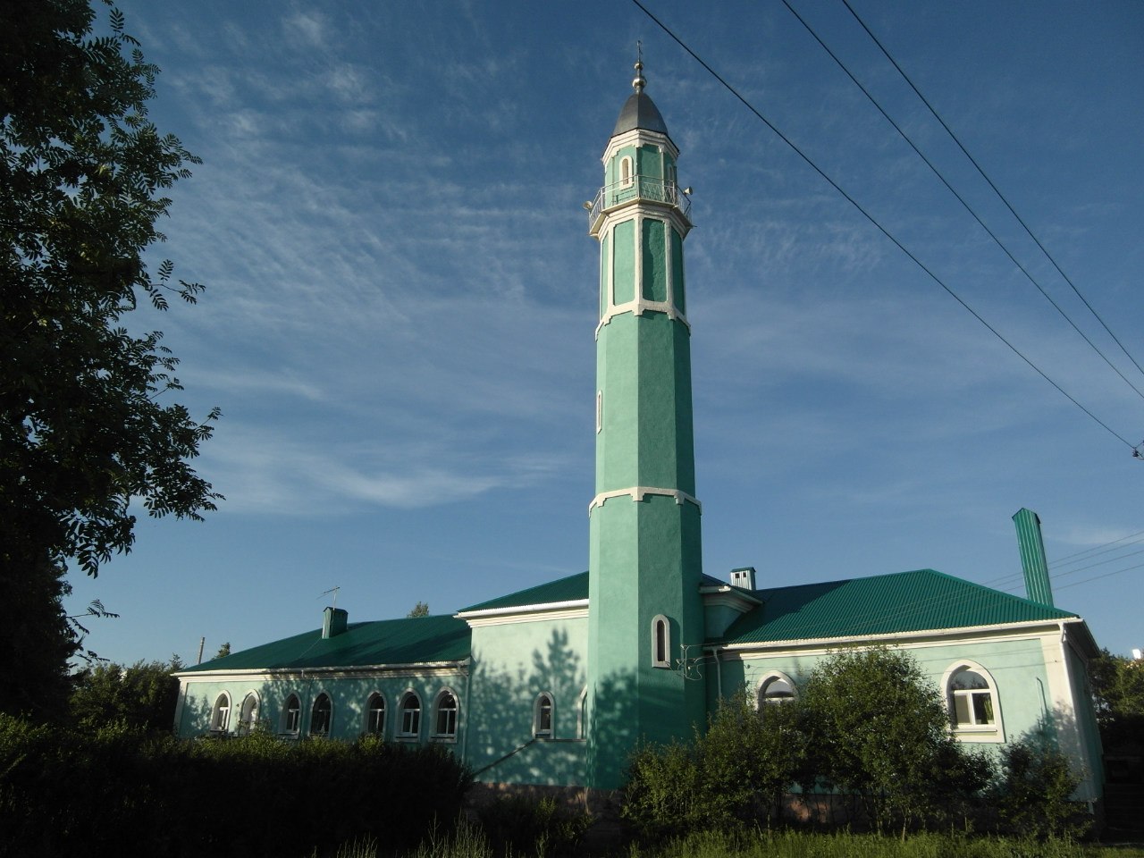


Tuymazy, Russia
Туймазы
Tuymazy is a town of 68,829 people in Bashkortostan Republic, Russia, founded in 1912.
Why visit Tuymazy
Townapedia lists 1 museum or landmark, 2 parks and trails, 3 places to eat, 1 place to stay and 1 attraction in and around town.
Highlights include Туймазинский государственный татарский драматический театр.
Weather in Tuymazy
Forecast from MET Norway (CC BY 4.0). Full forecast
About Tuymazy
Tuymazy (Russian: Туймазы́; Bashkir: Туймазы, Tuymazı) is a town in the Republic of Bashkortostan, Russia, located 145 kilometers (90 mi) from Ufa. Population: 66,836 (2010 census); 66,687 (2002 census); 57,887 (1989 Soviet census). It is an industrial town, with petroleum and natural gas industries and mechanical engineering being the most important economic assets.
From the Wikipedia article Tuymazy (this version), under CC BY-SA 4.0.
Things to do1

Туймазинский государственный татарский драматический театр
Cinema and theater · 1.3 km
Museums and landmarks1

Parks, trails and playgrounds2

Restaurants and cafes3



History
It was founded in 1912 as a railway station and was granted town status in 1960.
From the History section of Tuymazy on Wikipedia, under CC BY-SA 4.0.
Where to stay1
Shopping25
Gas and EV charging8
Schools, colleges and libraries10
Healthcare25
Map of Tuymazy
76 places. The map loads OpenStreetMap tiles when you open it.
Getting there and nearby towns
Oktyabrsky Airport (OKT) is the nearest airport with scheduled flights listed in OpenStreetMap, 28 km away.
- Subkhankulovo 8 km southeast, about 8 min by car
- Urussu 16 km west, about 16 min by car
- Oktyabrsky 21 km southwest, about 21 min by car
- Serafimovskiy 21 km south, about 21 min by car
- Kandry 26 km east, about 26 min by car
- Sharan 30 km northeast, about 30 min by car
- Nizhnetroitskiy 30 km south, about 30 min by car
- Bavly 38 km southwest, about 38 min by car
- Aznakayevo 49 km northwest, about 49 min by car
- Bugulma 59 km west, about 59 min by car
Drive times are estimates from straight-line distance, not routes.
Local news
Headlines from INDB.
Reviews, tips and questions
Loading what members have shared...
Sources and licences
- GeoNames (CC BY 4.0): population, coordinates, regions and time zone
- OpenStreetMap contributors (ODbL 1.0): places, airports, map data
- Wikidata (CC0 1.0): elevation, founding date, time zone, website
- Wikimedia Commons (see each image): photos
- Wikipedia (CC BY-SA 4.0): overview and history text
Photo credits
- ТуймазыМечеть, Гиндуллин Арслан, CC BY-SA 3.0
- Tuymazy, Republic of Bashkortostan, Russia - panoramio (1), эдик magic, CC BY 3.0
- Tuymazy, Republic of Bashkortostan, Russia - panoramio, эдик magic, CC BY 3.0
- Tuymazy, Republic of Bashkortostan, Russia - panoramio (2), эдик magic, CC BY 3.0
- Tuymazy, Republic of Bashkortostan, Russia - panoramio (3), эдик magic, CC BY 3.0
- Возле вогзала - panoramio, эдик magic, CC BY 3.0
- Жгут-турникет рычажный для экстренной остановки кровотечения, KobrAtq, CC BY-SA 4.0
- C6e8 Туймазы-фест, Муниципальный район Туймазинский район Республики Башкортостан, CC BY 4.0
- 3951 Туймазы-фест, Муниципальный район Туймазинский район Республики Башкортостан, CC BY 4.0
- 81c6 Туймазы-фест, Муниципальный район Туймазинский район Республики Башкортостан, CC BY 4.0
- C257 Туймазы-фест, Муниципальный район Туймазинский район Республики Башкортостан, CC BY 4.0
- E8ee Туймазы-фест, Муниципальный район Туймазинский район Республики Башкортостан, CC BY 4.0
- 1318 Сабантуй, Туймазинский вестник, CC BY 4.0
- 1354 Сабантуй, Туймазинский вестник, CC BY 4.0
- 1326 Сабантуй, Туймазинский вестник, CC BY 4.0
- 1324 Сабантуй, Туймазинский вестник, CC BY 4.0
- 1327 Сабантуй, Туймазинский вестник, CC BY 4.0
- 1345 Сабантуй, Туймазинский вестник, CC BY 4.0
- 1323 Сабантуй, Туймазинский вестник, CC BY 4.0
- 1343 Сабантуй, Туймазинский вестник, CC BY 4.0
- 1339 Сабантуй, Туймазинский вестник, CC BY 4.0
- 1325 Сабантуй, Туймазинский вестник, CC BY 4.0
- 1334 Сабантуй, Туймазинский вестник, CC BY 4.0
- 1340 Сабантуй, Туймазинский вестник, CC BY 4.0
- 1342 Сабантуй, Туймазинский вестник, CC BY 4.0
- 1311 Сабантуй, Туймазинский вестник, CC BY 4.0
- 1328 Сабантуй, Туймазинский вестник, CC BY 4.0
- 1315 Сабантуй, Туймазинский вестник, CC BY 4.0
- 1313 Сабантуй, Туймазинский вестник, CC BY 4.0
- 1350 Сабантуй, Туймазинский вестник, CC BY 4.0
- 1308 Сабантуй, Туймазинский вестник, CC BY 4.0
- 1310 Сабантуй, Туймазинский вестник, CC BY 4.0


Page built November 4, 2026. Spotted a mistake? Tell us or suggest a place.