


Why visit Ukhta
Townapedia lists 53 museums and landmarks, 17 parks and trails, 60 places to eat, 20 places to stay and 10 attractions in and around town.
Highlights include Ukhta State Technical University and Музей геологической коллекции.
Weather in Ukhta
Forecast from MET Norway (CC BY 4.0). Full forecast
About Ukhta
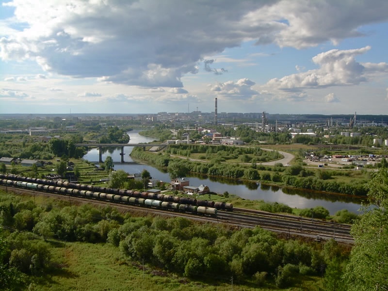
Ukhta (Russian: Ухта́; Komi: Уква, Ukva) is an important industrial town and the second-largest city in the Komi Republic of Russia. Population: 97,899 (2021 census); 99,591 (2010 census); 103,340 (2002 census); 110,548 (1989 Soviet census).
From the Wikipedia article Ukhta (this version), under CC BY-SA 4.0.
Things to do10


Ukhta State Technical University
School · 1.4 km
Technical university in Ukhta, Russia




Museums and landmarks53

Историко-краеведческий музей
Museum · 1.7 km
5Б улица Мира, Ухта

Chapel at the site of the fire in the shopping center "Passage"
Monument and historic site · 1.6 km
41 more on the map.
Parks, trails and playgrounds17




5 more on the map.
Restaurants and cafes60


Buta Bar&Lounge
Bar and pub · Italian, Kebab, Coffee Shop, Friture, Chicken, Burger, Heuriger, Greek, Breakfast, Ice Cream, Cake, Local, Seafood, Pasta, Savory Pancakes, Fish And Chips, Steak House, Sandwich, Tea · 1.6 km
Mo-Th 12:00-24:00; Fr-Su 11:00-24:00

Отдых
Cafe · Chicken, Russian, Cake, Donut, Beef Bowl, Coffee Shop, Local · 6.3 km
Mo-Fr 09:00-18:00; Sa 09:00-16:00
48 more on the map.
History
Oil springs along the Ukhta River were already known in the 17th century. In the mid-19th century, industrialist M. K. Sidorov started to drill for oil in this area. It was one of the first oil wells in Russia. There was homecraft oil field in 1920–1921 in Ukhta. Lying on the river of the same name, the settlement was founded as the village of Chibyu in 1929, but in 1939 it was renamed Ukhta. It was granted town status in 1943 when it was linked to the Pechora Railway. To the east of the town is Sosnogorsk, and to the southwest Yarega. In addition to the rail link, there is Ukhta Airport.
The town expanded in the 1940s and 1950s by use of political prisoners' forced labor (see: gulag).
From the History section of Ukhta on Wikipedia, under CC BY-SA 4.0.
Where to stay20
Churches and places of worship5
Сосногорская церковь Христа
Church · Protestant · 12.5 km
5 улица Пушкина, Сосногорск
Храм Стефана Великопермского
Church · Russian Orthodox · 1.4 km
8 Октябрьская улица, Ухта
Shopping64
Gas and EV charging16
Schools, colleges and libraries52
Healthcare37
Map of Ukhta
250 places. The map loads OpenStreetMap tiles when you open it.
Getting there and nearby towns
Ukhta Airport (UCT) is the nearest airport with scheduled flights listed in OpenStreetMap, 6 km away.
- Shudayag 6 km southwest, about 6 min by car
- Sosnogorsk 10 km east, about 10 min by car
- Yarega 16 km south, about 16 min by car
- Vodnyy 16 km southwest, about 16 min by car
- Borovoy 55 km southwest, about 55 min by car
- Nizhniy Odes 58 km east, about 58 min by car
Drive times are estimates from straight-line distance, not routes.
Local news
Headlines from INDB.
Reviews, tips and questions
Loading what members have shared...
Sources and licences
- GeoNames (CC BY 4.0): population, coordinates, regions and time zone
- OpenStreetMap contributors (ODbL 1.0): places, airports, map data
- Wikidata (CC0 1.0): elevation, founding date, time zone, website, landmarks and historic places
- Wikimedia Commons (see each image): photos
- Wikipedia (CC BY-SA 4.0): overview and history text
Photo credits
- ViewFromVetlosyan, Dmitry Murashev, Public domain
- Ukhta - panoramio - Ivan Z., Ivan Z., CC BY-SA 3.0
- Ukhta - panoramio, Ivan Z., CC BY-SA 3.0
- Ukhta - panoramio - Ivan Z. (9), Ivan Z., CC BY-SA 3.0
- Ukhta - panoramio - Ivan Z. (8), Ivan Z., CC BY-SA 3.0
- Ukhta - panoramio - Ivan Z. (5), Ivan Z., CC BY-SA 3.0
- Ukhta - panoramio - Ivan Z. (4), Ivan Z., CC BY-SA 3.0
- Ukhta - panoramio - Ivan Z. (1), Ivan Z., CC BY-SA 3.0
- Ukhta university, Andreykor, CC0
- Рынок - panoramio (5), Burdik, CC BY 3.0
- RRASKATT, RRASKATT, CC BY-SA 4.0
- Ухта река в черте Ухты, Апатинаити, CC BY-SA 3.0
- Бушуеву памятник, Апатинаити, CC BY-SA 3.0
- Алексеев памдоска чибьюкская, Апатинаити, CC BY-SA 3.0
- Старая школа - panoramio (1), Burdik, CC BY 3.0
- Тропинка к власти - panoramio, Burdik, CC BY 3.0
- Парк КиО лето - panoramio, Burdik, CC BY 3.0
- Архивный отдел в Коми, Апатинаити, CC BY-SA 3.0
- Ул. Оплеснина - panoramio, kacheg1987, CC BY 3.0
- Пожарная башня - panoramio, Burdik, CC BY 3.0
- Народная тропа II - panoramio, Burdik, CC BY 3.0
- Университетская башня - panoramio, Burdik, CC BY 3.0
- Взгляд ввысь - panoramio, Burdik, CC BY 3.0
- АВТО-вокзальная площадь - panoramio, Burdik, CC BY 3.0
- Ул. Оплеснина (остановка школа №3) - panoramio, kacheg1987, CC BY 3.0
- Народная тропа - panoramio, Burdik, CC BY 3.0
- Ул. Семяшкина д.1 - panoramio, Burdik, CC BY 3.0
- Взгляд из двора - panoramio, Burdik, CC BY 3.0
- Бывший ГЛАВК - panoramio, Burdik, CC BY 3.0
- Прогулочная зона - panoramio, Burdik, CC BY 3.0
- Пешеходный мостик - panoramio (2), Burdik, CC BY 3.0
- Ул. 40-лет Коми - panoramio, Burdik, CC BY 3.0
- Alma mater - panoramio, Burdik, CC BY 3.0
- Перекресток Космонавтов - Строителей - panoramio, kacheg1987, CC BY 3.0
- Первые кирпичные дома - panoramio, Burdik, CC BY 3.0
- Памятник Ленину на Первомайской пл., Ухта, JIOPKA, CC BY-SA 4.0
- Памятник Ленину на Первомайской пл, JIOPKA, CC BY-SA 4.0


Page built November 4, 2026. Spotted a mistake? Tell us or suggest a place.