
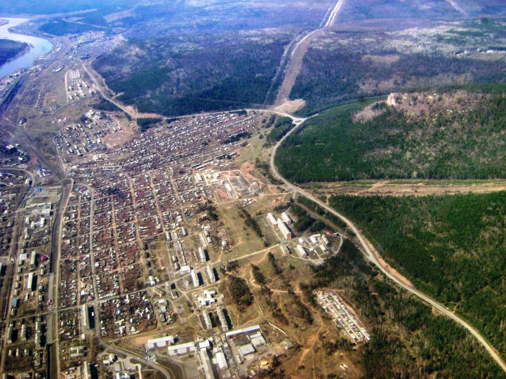


Ust’-Kut, Russia
Усть-Кут
Ust’-Kut is a town of 48,202 people in Irkutsk Oblast, Russia, founded in 1631.
Why visit Ust’-Kut
Townapedia lists 7 museums and landmarks, 2 parks and trails, 14 places to eat, 3 places to stay and 1 attraction in and around town.
Weather in Ust’-Kut
Forecast from MET Norway (CC BY 4.0). Full forecast
About Ust’-Kut
Ust-Kut (Russian: Усть-Кут) is a town and the administrative center of Ust-Kutsky District in Irkutsk Oblast, Russia, located 961 kilometers (597 mi) from Irkutsk, the administrative center of the oblast. Located on a western loop of the Lena River, the town spreads out for over 20 kilometers (12 mi) along the left bank, near the point where the Kuta River joins from the west. Population: 45,375 (2010 census); 49,951 (2002 census); 61,165 (1989 Soviet census).
From the Wikipedia article Ust-Kut (this version), under CC BY-SA 4.0.
Things to do1

Museums and landmarks7


Parks, trails and playgrounds2

Restaurants and cafes14



2 more on the map.
History
It was founded in 1631 by Siberian Cossack ataman Ivan Galkin, who built an ostrog (fort) there. The fort's military importance declined in the latter half of the 17th century; however, the settlement was increasingly important as a river port, becoming one of the main starting points for trade along the Lena.
Mineral springs to the west of the town were reportedly discovered as early as the 17th century by Yerofey Khabarov and a spa was built at the site in 1925.
In the early 20th century Ust-Kut served as a destination for political exiles, most notably Leon Trotsky.
In 1951, the railway from Tayshet reached Ust-Kut. The town thus became the first and only river port on the Lena served by the railway and an important railhead through which cargoes could travel to and from the locations along the Lena, such as most of Yakutia. Ust-Kut was granted town status in 1954, with the merger of the original settlement of Ust-Kut and the river port suburb of Osetrovo.
Ust-Kut remained the end of the line until 1974, when construction work started to extend the railway, now known as the Baikal–Amur Mainline, east toward Lake Baikal and beyond. The town became the headquarters of the construction of the western section of the BAM.
From the History section of Ust-Kut on Wikipedia, under CC BY-SA 4.0.
Where to stay3
Churches and places of worship1
Shopping16
Gas and EV charging4
Schools, colleges and libraries5
Средняя общеобразовательная школа №9
School · 2.6 km
2 Школьный переулок, Усть-Кут
Усть-Кутский промышленный техникум № 19
School · 1.2 km
2 улица Речников, Усть-Кут
Healthcare10
ОГБУЗ «Усть-Кутская РБ» филиал поликлиники
Clinic and pharmacy · 0.9 km
13 Коммунистическая улица, Усть-Кут
ОГБУЗ «Усть-Кутская РБ» филиал поликлиники
Clinic and pharmacy · 6.2 km
14 улица Нефтяников, Усть-Кут
Map of Ust’-Kut
63 places. The map loads OpenStreetMap tiles when you open it.
Getting there and nearby towns
Ust-Kut Airport (UKX) is the nearest airport with scheduled flights listed in OpenStreetMap, 8 km away.
- Yantal’ 33 km west, about 33 min by car
- Zvëzdnyy 43 km east, about 43 min by car
Drive times are estimates from straight-line distance, not routes.
Local news
Headlines from INDB.
Reviews, tips and questions
Loading what members have shared...
Sources and licences
- GeoNames (CC BY 4.0): population, coordinates, regions and time zone
- OpenStreetMap contributors (ODbL 1.0): places, airports, map data
- Wikidata (CC0 1.0): elevation, founding date, time zone, website
- Wikimedia Commons (see each image): photos
- Wikipedia (CC BY-SA 4.0): overview and history text
Photo credits
- Полет над городом усть-кут, Lucky Fighter, CC BY-SA 3.0
- Школьный переулок, 1 в Усть-Куте 05.06.2017, Artem Svetlov, CC BY 2.0
- Улица Реброва-Денисова, 11 в Усть-Куте 05.06.2017, Artem Svetlov, CC BY 2.0
- EP1-225, msv1974, CC0
- Улица Кирова, 23 в Усть-Куте 05.06.2017, Artem Svetlov, CC BY 2.0
- Ust-Kut - Yakutsk Lena River Cruise 2017 RZD BAM line EP1-234 Taishet station Kislovodsk - Tynda train (35310383771), Artem Svetlov from Moscow, Russia, CC BY 2.0
- Ust-Kut - Yakutsk Lena River Cruise 2017 Накат Лена Осетрово (35273353312), Artem Svetlov from Moscow, Russia, CC BY 2.0
- Ust-Kut - Yakutsk Lena River Cruise 2017 Осетрово Лена (34598244554), Artem Svetlov from Moscow, Russia, CC BY 2.0
- Ust-Kut - Yakutsk Lena River Cruise 2017 Осетрово Лена (34598245684), Artem Svetlov from Moscow, Russia, CC BY 2.0
- Аян Осетрово (35053011550), Artem Svetlov from Moscow, Russia, CC BY 2.0
- Ust-Kut city (35053010570), Artem Svetlov from Moscow, Russia, CC BY 2.0
- Ust-Kut city (35310382791), Artem Svetlov from Moscow, Russia, CC BY 2.0


Page built November 4, 2026. Spotted a mistake? Tell us or suggest a place.