
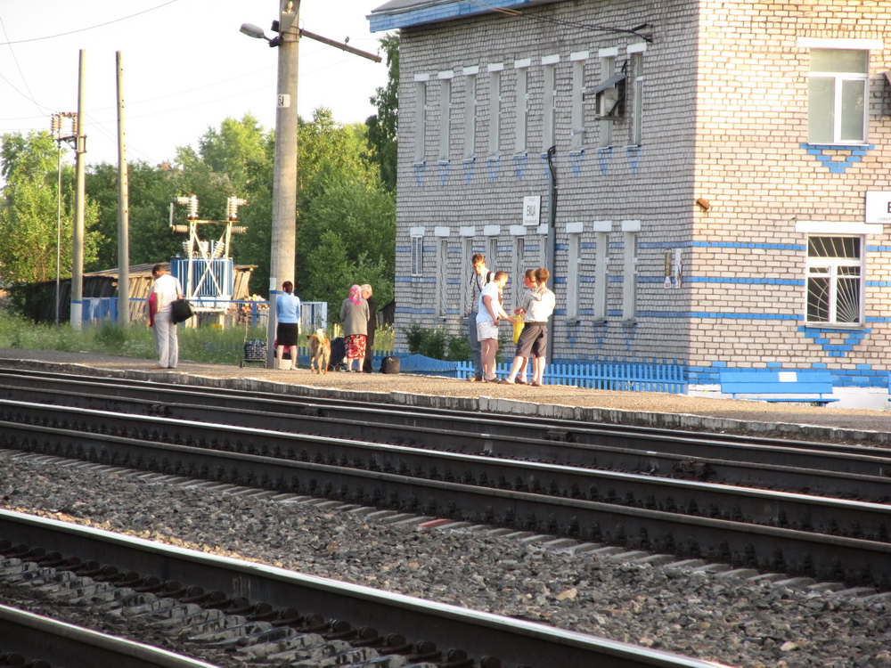


Yemtsa, Russia
Емца
Yemtsa is a town of 1,441 people in Arkhangelskaya, Russia, founded in 1894.
Why visit Yemtsa
Townapedia lists 1 museum or landmark in and around town.
Weather in Yemtsa
Forecast from MET Norway (CC BY 4.0). Full forecast
About Yemtsa
Yemtsa (Russian: Е́мца) is a rural locality (a settlement) in Plesetsky District of Arkhangelsk Oblast, Russia, located 42 kilometers (26 mi) north of Plesetsk and 172 kilometers (107 mi) south of Arkhangelsk. Within the framework of municipal divisions, it serves as the administrative center of Yemtsovskoye Rural Settlement, one of the thirteen rural settlements in the district. Population: 1,067 (2010 census); 1,498 (2002 census); 2,266 (1989 Soviet census)..
From the Wikipedia article Yemtsa (this version), under CC BY-SA 4.0.
Museums and landmarks1

Schools, colleges and libraries1

History
In 1894–1897, Yemtsa railway station was built during the construction of the railroad between Vologda and Arkhangelsk. Yemtsa was incorporated in 1943 with a decree No. 617/5 of the Presidium of the Supreme Soviet of RSFSR by merging a number of settlements. Previously, it was located on the territory of Savinsky Selsoviet, with the center in Savinsky.
During the Russian Civil War in 1918, heavy battles were fought between the Red Army and the British troops around Yemtsa. A monument to the Red Army is situated near the train station.
Yemtsa had work settlement status until it was demoted to a rural locality in February 2013.
From the History section of Yemtsa on Wikipedia, under CC BY-SA 4.0.
Map of Yemtsa
2 places. The map loads OpenStreetMap tiles when you open it.
Getting there and nearby towns
- Savinskiy 19 km southwest, about 19 min by car
- Mirnyy 34 km south, about 34 min by car
- Plesetsk 40 km south, about 40 min by car
- Puksoozero 55 km south, about 55 min by car
- Oksovskiy 56 km southwest, about 56 min by car
- Samoded 60 km north, about 1 h by car
- Kodino 80 km northwest, about 1 h 15 min by car
Drive times are estimates from straight-line distance, not routes.
Local news
Headlines from INDB.
Reviews, tips and questions
Loading what members have shared...
Sources and licences
- GeoNames (CC BY 4.0): population, coordinates, regions and time zone
- OpenStreetMap contributors (ODbL 1.0): places, airports, map data
- Wikidata (CC0 1.0): elevation, founding date, time zone, website
- Wikimedia Commons (see each image): photos
- Wikipedia (CC BY-SA 4.0): overview and history text
Photo credits
- Емца 1, Артём Архангел, CC BY-SA 3.0
- Плесецкий р-н, Емца, братская могила ВОВ, Avsolov, CC BY-SA 4.0
- Плесецкий р-н, Емца, часовня Пахомия, Avsolov, CC BY-SA 4.0
- Плесецкий р-н, Емца, ж.д. станция, Avsolov, CC BY-SA 4.0
- Плесецкий р-н, Емца, братская могила гражданской войны, Avsolov, CC BY-SA 4.0
- Плесецкий р-н, Емца, водонапорная башня, Avsolov, CC BY-SA 4.0
- Emtsa station, Ssr, CC BY-SA 3.0

Page built November 4, 2026. Spotted a mistake? Tell us or suggest a place.