
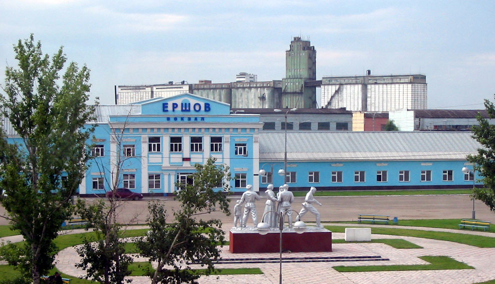

Yershov, Russia
Ершов
Yershov is a town of 23,681 people in Saratov Oblast, Russia, founded in 1893.
Why visit Yershov
Townapedia lists 6 museums and landmarks, 1 park or trail, 2 places to eat and 1 place to stay in and around town.
Weather in Yershov
Forecast from MET Norway (CC BY 4.0). Full forecast
About Yershov
Yershov (Russian: Ершо́в) is a town and the administrative center of Yershovsky District in Saratov Oblast, Russia, located in the upper streams of the Maly Uzen River, 178 kilometers (111 mi) east of Saratov, the administrative center of the oblast. Population: 21,448 (2010 census); 23,848 (2002 census); 24,468 (1989 Soviet census).
From the Wikipedia article Yershov, Saratov Oblast (this version), under CC BY-SA 4.0.
Museums and landmarks6

Мемориал памяти погибших во время Великой Отечественной войны. Вечный огонь
Monument and historic site · 0.8 km
Parks, trails and playgrounds1

Restaurants and cafes2


Where to stay1

History
It was founded as a settlement serving the Yershovo railway station, which was opened in 1893 and named after the engineer who was in charge of building it. Town status was granted to Yershov in 1963.
In 1897, Yershov was first mentioned in the report of the Zemstvo Council of Novouzensky district as a settlement. Until October 1917, Yershov was part of the Novouzensky district of the Samara province.
By the beginning of the First World War, several private enterprises had opened in the city, and the population reached 1,000 people. At that time, the population mainly consisted of railroad workers.
During the years of Soviet rule, the city of Yershov was greatly transformed: the first newspaper was founded, the city became the district center, and in 1963 it received the status of a city.
There were no military operations in the city during the Second World War.
From the History section of Yershov, Saratov Oblast on Wikipedia, under CC BY-SA 4.0.
Churches and places of worship1
Shopping3
Gas and EV charging3
Schools, colleges and libraries4
Healthcare8
Map of Yershov
29 places. The map loads OpenStreetMap tiles when you open it.
Getting there and nearby towns
Balakovo Airport (BWO) is the nearest airport with scheduled flights listed in OpenStreetMap, 67 km away.
- Dergachi 37 km east, about 37 min by car
- Gornyy 48 km north, about 48 min by car
- Mokrous 54 km west, about 54 min by car
- Kormëzhka 63 km north, about 1 h by car
- Balakovo 81 km northwest, about 1 h 15 min by car
- Pugachëv 82 km northeast, about 1 h 15 min by car
Drive times are estimates from straight-line distance, not routes.
Local news
Headlines from INDB.
Reviews, tips and questions
Loading what members have shared...
Sources and licences
- GeoNames (CC BY 4.0): population, coordinates, regions and time zone
- OpenStreetMap contributors (ODbL 1.0): places, airports, map data
- Wikidata (CC0 1.0): elevation, founding date, time zone, website
- Wikimedia Commons (see each image): photos
- Wikipedia (CC BY-SA 4.0): overview and history text
Photo credits
- Ershov-vokzal, The original uploader was Zimin.V.G. at Russian Wikipedia ., CC BY-SA 1.0
Page built November 4, 2026. Spotted a mistake? Tell us or suggest a place.