




Yuzhno-Kurilsk, Russia
Южно-Курильск
Yuzhno-Kurilsk is a town of 7,777 people in Sakhalin Oblast, Russia, founded in 1946.
Why visit Yuzhno-Kurilsk
Townapedia lists 19 museums and landmarks, 5 parks and trails, 12 places to eat, 11 places to stay and 11 attractions in and around town.
Highlights include Kurils Nature Reserve.
Weather in Yuzhno-Kurilsk
Forecast from MET Norway (CC BY 4.0). Full forecast
About Yuzhno-Kurilsk
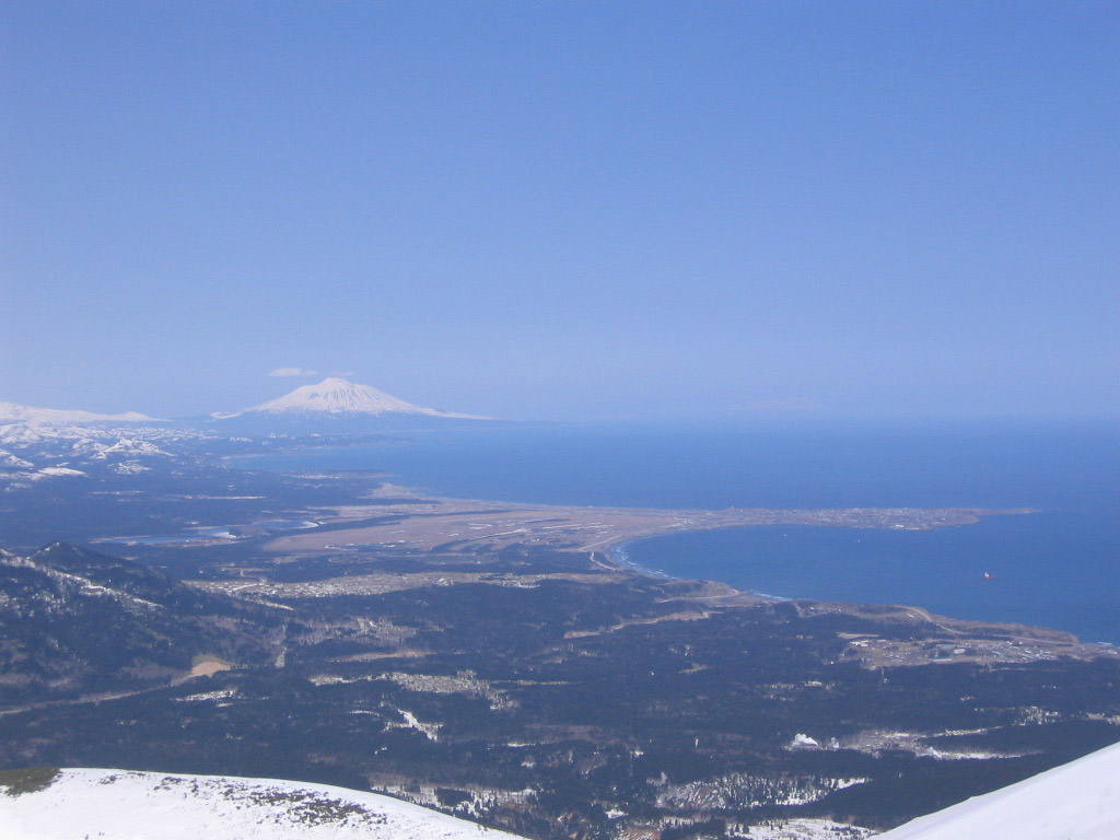
Yuzhno-Kurilsk (Russian: Ю́жно-Кури́льск; Japanese: ユジノ・クリリスク, romanized: Yujino-Kuririsuku) is an urban locality (an urban-type settlement) and the administrative center of Yuzhno-Kurilsky District of Sakhalin Oblast, Russia. Population: 5,832 (2010 census); 5,751 (2002 census); 6,344 (1989 Soviet census). It is the largest settlement on the Kunashir Island of the Kuril Islands.
From the Wikipedia article Yuzhno-Kurilsk (this version), under CC BY-SA 4.0.
Travel tips from other travellers: Yuzhno-Kurilsk on Wikivoyage (CC BY-SA 4.0).
Things to do11



Museums and landmarks19


9-й км- начало маршрута на источник Росинка, на Верхне-докторские источники, на водопады( пороги) Кислого ручья
Monument and historic site · 7.5 km
7 more on the map.
Parks, trails and playgrounds5

Restaurants and cafes12


Бриз
Cafe · Breakfast, Coffee Shop, Local, Russian · 0.6 km
23 Набережная улица
Mo-Su 08:00-20:00


History
The history of Yuzhno-Kurilsk is connected with the history of the Kuril Islands as a whole. In Russia, the Kuril Islands first became known after an expedition by Russian explorer Ivan Moskvitin and his companions, after which another explorer named Kolobov in 1646 talked of the Ainus—the indigenous inhabitants of the Kuriles. According to some Japanese sources, Kunashir became known to Russians later than the other islands of the Kuril chain.
After that, the Kuriles, Sakhalin, and Hokkaido were explored and settled both by the Russians and Japanese. By the end of the 18th century, first settlements of Russian exiles and volunteers appeared on the Kuriles. Also, along with Ainu settlements, the islands had a Japanese trading post and fortified settlements with military garrisons. In 1769, Lieutenant Ivan Chyorny was informed that the Japanese on Kunashir had founded a settlement with a fortress and a permanent garrison.
From the History section of Yuzhno-Kurilsk on Wikipedia, under CC BY-SA 4.0.
Where to stay11
Churches and places of worship3
Церковь Всех Святых, в земле Российской просиявших
Church · Russian Orthodox · 0.8 km
7 улица 3-е Сентября
Shopping8
Schools, colleges and libraries1
Healthcare4
Map of Yuzhno-Kurilsk
74 places. The map loads OpenStreetMap tiles when you open it.
Getting there and nearby towns
Yuzhno-Kurilsk Mendeleyevo Airport (DEE) is the nearest airport with scheduled flights listed in OpenStreetMap, 16 km away.
- Otrada 5 km north, about 5 min by car
- Rausu 54 km west, about 54 min by car
- Shibetsu 71 km southwest, about 1 h 15 min by car
- Shikotan 73 km east, about 1 h 15 min by car
- Nemuro 82 km south, about 1 h 15 min by car
- Nakashibetsu 89 km southwest, about 1 h 30 min by car
Drive times are estimates from straight-line distance, not routes.
Local news
Headlines from INDB.
Reviews, tips and questions
Loading what members have shared...
Sources and licences
- GeoNames (CC BY 4.0): population, coordinates, regions and time zone
- OpenStreetMap contributors (ODbL 1.0): places, airports, map data
- Wikidata (CC0 1.0): elevation, founding date, time zone, website
- Wikimedia Commons (see each image): photos
- Wikipedia (CC BY-SA 4.0): overview and history text
Photo credits
- Yuzhno kurilsk sverhu, kunashir.ru, Attribution
- Yuzhno-Kurilsk central square, Marcuch, CC BY-SA 3.0
- Yuzhno-Kurilsk anchor, Marcuch, CC BY-SA 3.0
- Regional museum of Yuzhno-Kurilsk, Keenset, CC BY-SA 4.0
- Kurils nature reserve, Игорь Шпиленок, CC BY-SA 3.0
- MuneoHouse, 敷香 at Japanese Wikipedia, CC BY-SA 3.0
- Larus crassirostris 411338457, kirinzi, CC BY 4.0
- USSRKunashirMonument, 敷香, CC BY-SA 3.0
- Tyatya volcano in Russia - 2010-09-11, Dmitry Demezhko (Institute of Geophysics UB RAS, Yekaterinburg, Russia) ( https://imaggeo.egu.eu/user/666/ ), CC BY 3.0
- ISS066-E-59691 - View of Earth, Earth Science and Remote Sensing Unit , Lyndon B. Johnson Space Center, Public domain
- О. Кунашир, Горячий ключ, Khakhaev Vladimir, CC BY-SA 4.0
- Picea jezoensis, Mendeleev Volcano, Kunashir, Kuril Islands, Russia, Original: Ляховец Сергей ; this edit: MPF, CC BY-SA 4.0
- Вулкан Тятя с вулкана Менделеева, Ляховец Сергей, CC BY-SA 4.0
- ISS053-E-198605 - View of Earth, Earth Science and Remote Sensing Unit , Lyndon B. Johnson Space Center, Public domain
- ISS048-E-67251 - View of Earth, Earth Science and Remote Sensing Unit , Lyndon B. Johnson Space Center, Public domain


Page built November 4, 2026. Spotted a mistake? Tell us or suggest a place.