


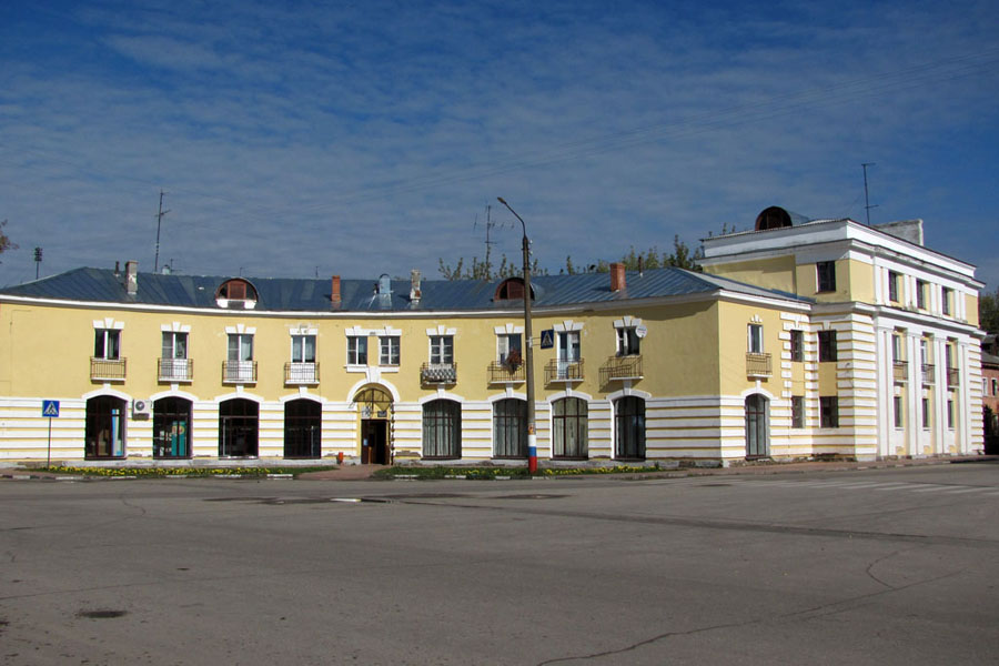


Zavolzh’ye, Russia
Заволжье
Zavolzh’ye is a town of 42,900 people in Nizhny Novgorod Oblast, Russia, founded in 1947.
Why visit Zavolzh’ye
Townapedia lists 7 museums and landmarks, 3 parks and trails, 10 places to eat, 2 places to stay and 2 attractions in and around town.
Highlights include Продукты and Центр детского творчества.
Weather in Zavolzh’ye
Forecast from MET Norway (CC BY 4.0). Full forecast
About Zavolzh’ye
Zavolzhye (Russian: Заво́лжье) is a town in Gorodetsky District of Nizhny Novgorod Oblast, Russia, located on the right bank of the Volga River, opposite Gorodets, the administrative centre of the district, and 56 kilometers (35 mi) northwest of Nizhny Novgorod, the administrative center of the oblast. Population: 40,460 (2010 census); 43,971 (2002 census); 44,630 (1989 Soviet census).
From the Wikipedia article Zavolzhye, Nizhny Novgorod Oblast (this version), under CC BY-SA 4.0.
Things to do2


Museums and landmarks7


Parks, trails and playgrounds3

Ледовый дворец спорта им. Г.Воронина
Sports field and stadium · 0.9 km
1А улица Мичурина

Restaurants and cafes10

Chocolate
Bar and pub
Mo-Fr 12:00-24:00; Sa 00:00-04:00,15:00-24:00; Su 00:00-05:00,15:00-24:00



History
It was founded in 1950 as a settlement serving the construction of the Gorky Hydroelectric Station (now Nizhny Novgorod Hydroelectric Station). It was granted town status in 1964.
From the History section of Zavolzhye, Nizhny Novgorod Oblast on Wikipedia, under CC BY-SA 4.0.
Where to stay2
Churches and places of worship1
Shopping12
Gas and EV charging4
Schools, colleges and libraries7
Healthcare6
Взрослая поликлиника № 1
Clinic and pharmacy · 0.9 km
26 улица Пирогова, Заволжье
Map of Zavolzh’ye
54 places. The map loads OpenStreetMap tiles when you open it.
Getting there and nearby towns
Nizhny Novgorod (Strigino) (GOJ) is the nearest airport with scheduled flights listed in OpenStreetMap, 52 km away.
- Pervomayskiy 4 km southwest, about 4 min by car
- Gorodets 5 km east, about 5 min by car
- Chkalovsk 17 km northwest, about 17 min by car
- Purekh 20 km west, about 20 min by car
- Novaya Balakhna 21 km southeast, about 21 min by car
- Gidrotorf 20 km southeast, about 20 min by car
- Katunki 24 km northwest, about 24 min by car
- Dzerzhinsk 44 km south, about 44 min by car
- Nizhniy Novgorod 51 km southeast, about 51 min by car
- Yur’yevets 77 km north, about 1 h 15 min by car
Drive times are estimates from straight-line distance, not routes.
Local news
Headlines from INDB.
Reviews, tips and questions
Loading what members have shared...
Sources and licences
- GeoNames (CC BY 4.0): population, coordinates, regions and time zone
- OpenStreetMap contributors (ODbL 1.0): places, airports, map data
- Wikidata (CC0 1.0): elevation, founding date, time zone, website
- Wikimedia Commons (see each image): photos
- Wikipedia (CC BY-SA 4.0): overview and history text
Photo credits
- Technicum-front Zavolzhye, Nordprod, Public domain
- Lenina-square Zavolzhye, Nordprod, Public domain
- Cinema Zavolzhye, Nordprod, Public domain
- Церковь в г.Завллжье (2012.07.14) - panoramio, Aleksey Igonin, CC BY-SA 3.0
- Церковь (2012.07.14) - panoramio, Aleksey Igonin, CC BY-SA 3.0
- Technicum-side Zavolzhye, Nordprod, Public domain
- Trinity-church Zavolzhye, Nordprod, Public domain
- Мандарин (2012.07.14) - panoramio, Aleksey Igonin, CC BY-SA 3.0
- Nizhny Novgorod Oblast, Zavolzhye, pr. Dzerzhinskogo. (2012.07.14) - panoramio, Aleksey Igonin, CC BY-SA 3.0
- Дома 7 и 8, дом Дементьевой слева, по улице Набережная Революции, Городец, Olga-lisenkova, CC BY-SA 4.0
- Заволжский Бизнес-инкубатор (2015.07) - panoramio, Aleksey Igonin, CC BY-SA 3.0
- Заволжье, ул.Рождественская (2015.07) - panoramio, Aleksey Igonin, CC BY-SA 3.0


Page built November 4, 2026. Spotted a mistake? Tell us or suggest a place.