




Why visit Sac City
Townapedia lists 11 museums and landmarks, 9 parks and trails, 2 places to eat and 1 place to stay in and around town.
Highlights include George and Lola Perkins House and Park Hotel.
July is the warmest month, with average highs of 83°F; January lows average 8°F, and about 31 inches of snow fall in a normal year.
Weather in Sac City
Forecast from the National Weather Service. Full forecast
About Sac City
Sac City is a city in and the county seat of Sac County, Iowa, United States, just southwest of the eastern intersection of U.S. Routes 20 and 71 in the rolling hills along the valley of the Raccoon River. The city is one of 45 designated Main Street Iowa communities in the Main Street Iowa development program. The population was 2,063 in the 2020 census, a decline from 2,368 in 2000.
From the Wikipedia article Sac City, Iowa (this version), under CC BY-SA 4.0.
Museums and landmarks11

George and Lola Perkins House
Monument and historic site · National Register of Historic Places
Historic house in Iowa, United States

Park Hotel
Monument and historic site · National Register of Historic Places · 0.4 mi
Historic building in Sac City, Iowa, United States

Sac City Chicago and North Western Depot
Monument and historic site · National Register of Historic Places
Building in Iowa, United States
Sac City Monument Square Historic District
Monument and historic site · National Register of Historic Places · 0.5 mi
Historic district in Iowa, United States
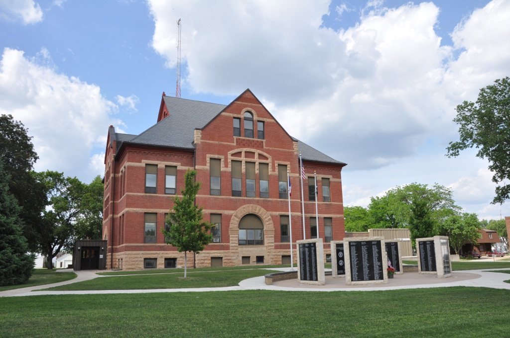
Sac County Courthouse
Monument and historic site · National Register of Historic Places
County courthouse in Sac City, United States of America


Seven Oaks
Monument and historic site · National Register of Historic Places
Villa in Sac City, Iowa

Chautauqua Park Historic District
Monument and historic site · National Register of Historic Places · 0.7 mi

Parks, trails and playgrounds9


Restaurants and cafes2


Subway
Fast food · Sandwich · 0.6 mi
1916 West Main Street, Sac City
Mo-Fr 07:00-21:00; Sa 08:00-21:00; Su 09:00-21:00
Where to stay1

History
Sac City was first platted in 1855 by Joshua Keith Powell of Fort Dodge, Iowa. The town was so named because the Sac and Meskwaki peoples were in possession of the land at the time of the Louisiana Purchase. The City of Sac City was incorporated 19 years later, in 1874.
Judge Eugene Criss, credited as the father of Sac City, left Wisconsin and crossed the Mississippi River in early 1855 by covered wagon. He was in search of waterpower and wanted to establish a settlement in new, untried country. Deciding upon the North Raccoon River for his settlement, Criss erected the first log cabin in Sac City, established himself in the hotel business, and kept a stage station and general store for nearby settlers.
As early as 1859, there was talk of building a railroad through Sac County, but the first one did not come to Sac City till 1879. Railroad companies refused to lay tracks through undeveloped or semi-developed areas, and Sac City did not meet the requirements. The companies demanded that communities be advanced enough to provide a quick return to capital before they would construct a steam and iron highway through the area. When it came, the railroad greatly benefited Sac City. The Chicago and North Western Transportation Company connected Sac City, Wall Lake, Auburn, Odebolt, Lake View, Early, and Schaller, as well as the cities where crops were sold.
From the History section of Sac City, Iowa on Wikipedia, under CC BY-SA 4.0.
Churches and places of worship7
Shopping1
Schools, colleges and libraries4
Healthcare1
Map of Sac City
36 places. The map loads OpenStreetMap tiles when you open it.
Climate by month
Monthly table
| Month | High | Low | Rain | Snow |
|---|---|---|---|---|
| Jan | 26°F | 8°F | 0.7 in | 7.0 in |
| Feb | 31°F | 12°F | 1.0 in | 7.4 in |
| Mar | 44°F | 24°F | 1.8 in | 4.2 in |
| Apr | 59°F | 34°F | 3.5 in | 1.9 in |
| May | 70°F | 47°F | 4.6 in | 0.0 in |
| Jun | 80°F | 58°F | 5.1 in | 0.0 in |
| Jul | 83°F | 62°F | 3.9 in | 0.0 in |
| Aug | 81°F | 59°F | 4.4 in | 0.0 in |
| Sep | 75°F | 50°F | 2.9 in | 0.0 in |
| Oct | 62°F | 37°F | 2.4 in | 0.5 in |
| Nov | 45°F | 24°F | 1.6 in | 2.7 in |
| Dec | 32°F | 14°F | 1.2 in | 7.2 in |
U.S. Climate Normals 1991-2020 for Sac City (1 mi away), NOAA NCEI.
People and cost of living
American Community Survey 5-year estimates, 2020-2024, U.S. Census Bureau. Estimates have margins of error, larger for small towns.
Disaster history
Sac County has had 14 federal disaster declarations since 2000, most often for severe storms.
- 2022-02-23: Severe Storms, Straight-Line Winds, And Tornadoes (Severe Storm)
- 2020-03-23: Covid-19 Pandemic (Biological)
- 2020-03-13: Covid-19 (Biological)
- 2019-03-23: Severe Storms And Flooding (Flood)
- 2014-07-24: Severe Storms, Tornadoes, Straight-Line Winds, And Flooding (Flood)
- 2013-07-02: Severe Storms, Tornadoes, And Flooding (Severe Storm)
OpenFEMA disaster declarations summaries.
Getting there and nearby towns
Storm Lake Municipal Airport (SLB) is the nearest airport with scheduled flights listed in OpenStreetMap, 17 miles away.
- Lake City 17 mi southeast, about 28 min by car
- Storm Lake 18 mi northwest, about 29 min by car
- Alta 23 mi northwest, about 37 min by car
- Manson 24 mi east, about 39 min by car
- Carroll 25 mi south, about 41 min by car
- Ida Grove 25 mi west, about 40 min by car
- Pocahontas 28 mi northeast, about 44 min by car
- Denison 33 mi southwest, about 54 min by car
- Cherokee 36 mi northwest, about 58 min by car
- Fort Dodge 42 mi east, about 1 h 15 min by car
Drive times are estimates from straight-line distance, not routes.
Local news
Headlines from INDB, the NEMICO news database.
Reviews, tips and questions
Loading what members have shared...
Sources and licences
- NCES EDGE (Public domain): public schools
- NOAA NCEI U.S. Climate Normals 1991-2020 (Public domain): climate by month
- OpenFEMA (Public domain): disaster declarations
- OpenStreetMap contributors (ODbL 1.0): places, airports, map data
- U.S. Census Bureau (Public domain): population, income, housing, education, commute
- Wikidata (CC0 1.0): elevation, founding date, time zone, website, landmarks and historic places
- Wikimedia Commons (see each image): photos
- Wikipedia (CC BY-SA 4.0): overview and history text
Photo credits
- Sac city iowa, Bill Whittaker ( talk ), CC BY-SA 3.0
- George and Lola Perkins House, Sac City, IA, TheCatalyst31, CC0
- SacCityIA GenShermanHall, User:Magicpiano, CC BY-SA 4.0
- SacCityIA CountyCourthouse, User:Magicpiano, CC BY-SA 4.0
- Park Hotel, Sac City, IA, TheCatalyst31, CC0
- Sac City Chicago and North Western Depot, TheCatalyst31, CC0
- Seven Oaks, Sac City, IA, TheCatalyst31, CC0
Page built October 30, 2026. Spotted a mistake? Tell us or suggest a place.