
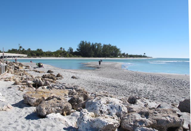


Sanibel, Florida
Sanibel is a city of 6,418 people in Lee County, Florida, founded in 1884.
Why visit Sanibel
Townapedia lists 4 museums and landmarks, 8 parks and trails, 13 places to eat, 4 places to stay and 6 attractions in and around town.
Highlights include Sanibel Causeway, Island Cinemas, Galt Island Archeological District and Sanibel Colored School.
August is the warmest month, with average highs of 92°F; January lows average 54°F.
Weather in Sanibel
Forecast from the National Weather Service. Full forecast
About Sanibel
Sanibel is an island and city in Lee County, Florida, United States. Its population was 6,382 at the 2020 census, down from 6,469 at the 2010 census. It is part of the Cape Coral-Fort Myers, Florida metropolitan statistical area. The island, also known as Sanibel Island, constitutes the entire city.
From the Wikipedia article Sanibel, Florida (this version), under CC BY-SA 4.0.
Things to do6



Museums and landmarks4

Galt Island Archeological District
Monument and historic site · National Register of Historic Places · 4.5 mi
Archaeological site in Florida, United States

Sanibel Colored School
Monument and historic site · National Register of Historic Places · 2.7 mi
Historic school in Sanibel, Florida, USA

Parks, trails and playgrounds8




Restaurants and cafes13

400 Rabbits
Restaurant · Mexican · 0.6 mi
975 Rabbit Road, Sanibel Island
Mo-Su 11:00-22:00
Doc Ford's Rum Bar & Grille
Restaurant · 1.9 mi
2500 Island Inn Road, Sanibel
11:00-22:00
George and Wendy's Seafood Grill
Restaurant · 1.9 mi
2499 Periwinkle Way
Mo-Su 11:00-00:00

1 more on the map.
History
Sanibel and Captiva formed as one island about 6,000 years ago. The first known humans in the area were the Calusa, who arrived about 2,500 years ago. The Calusa were a powerful Indian nation who came to dominate most of Southwest Florida through trade via their elaborate system of canals and waterways. Sanibel remained an important Calusa settlement until the collapse of their empire, soon after the arrival of the Europeans.
During the 1700s, Cuban fishermen seasonally traveled from their homes and set up fishing camps along the Gulf Coast, called ranchos, including on Sanibel Island.
From the History section of Sanibel, Florida on Wikipedia, under CC BY-SA 4.0.
Where to stay4
Churches and places of worship3
Sanibel Congregational United Church of Christ
Church · 2.4 mi
2050 Periwinkle Way, Sanibel
Shopping5
Gas and EV charging1
Schools, colleges and libraries4
Healthcare1
Map of Sanibel
49 places. The map loads OpenStreetMap tiles when you open it.
Climate by month
Monthly table
| Month | High | Low | Rain |
|---|---|---|---|
| Jan | 75°F | 54°F | 2.4 in |
| Feb | 78°F | 57°F | 1.8 in |
| Mar | 81°F | 60°F | 2.1 in |
| Apr | 85°F | 64°F | 2.4 in |
| May | 90°F | 69°F | 3.5 in |
| Jun | 91°F | 74°F | 9.7 in |
| Jul | 92°F | 75°F | 9.4 in |
| Aug | 92°F | 75°F | 10.4 in |
| Sep | 90°F | 74°F | 9.0 in |
| Oct | 87°F | 69°F | 3.1 in |
| Nov | 81°F | 62°F | 1.8 in |
| Dec | 77°F | 57°F | 1.9 in |
U.S. Climate Normals 1991-2020 for Ft Myers Page Fld Ap Hcn (18 mi away), NOAA NCEI.
People and cost of living
American Community Survey 5-year estimates, 2020-2024, U.S. Census Bureau. Estimates have margins of error, larger for small towns.
Disaster history
Lee County has had 32 federal disaster declarations since 2000, most often for hurricanes.
- 2024-10-11: Hurricane Milton (Hurricane)
- 2024-10-07: Hurricane Milton (Hurricane)
- 2024-09-28: Hurricane Helene (Hurricane)
- 2024-09-24: Tropical Storm Helene (Tropical Storm)
- 2024-08-10: Hurricane Debby (Tropical Storm)
- 2024-08-03: Tropical Storm Debby (Tropical Storm)
OpenFEMA disaster declarations summaries.
Getting there and nearby towns
Page Field (FMY) is the nearest airport with scheduled flights listed in OpenStreetMap, 17 miles away.
- St. James City 7 mi north, about 11 min by car
- Punta Rassa 7 mi northeast, about 12 min by car
- Iona 10 mi northeast, about 16 min by car
- Fort Myers Beach 12 mi east, about 19 min by car
- Pine Island Center 12 mi north, about 19 min by car
- Harlem Heights 12 mi east, about 19 min by car
- Cypress Lake 14 mi northeast, about 23 min by car
- McGregor 14 mi northeast, about 23 min by car
- Cape Coral 15 mi northeast, about 24 min by car
- Villas 16 mi northeast, about 26 min by car
Drive times are estimates from straight-line distance, not routes.
Local news
Headlines from INDB, the NEMICO news database.
Reviews, tips and questions
Loading what members have shared...
Sources and licences
- NCES EDGE (Public domain): public schools
- NOAA NCEI U.S. Climate Normals 1991-2020 (Public domain): climate by month
- OpenFEMA (Public domain): disaster declarations
- OpenStreetMap contributors (ODbL 1.0): places, airports, map data
- U.S. Census Bureau (Public domain): population, income, housing, education, commute
- Wikidata (CC0 1.0): elevation, founding date, time zone, website, landmarks and historic places
- Wikimedia Commons (see each image): photos
- Wikipedia (CC BY-SA 4.0): overview and history text
Photo credits
- Blind Pass, Sanibel and Captiva, Invertzoo, CC BY-SA 4.0
- Egretta caerulea (little blue heron) (Sanibel Island, Florida, USA) 4 (24962053034), James St. John, CC BY 2.0
- Egretta caerulea (little blue heron) (Sanibel Island, Florida, USA) 1, James St. John, CC BY 2.0
- Egretta caerulea (little blue heron) (Sanibel Island, Florida, USA) 3, James St. John, CC BY 2.0
- Egretta caerulea (little blue heron) (Sanibel Island, Florida, USA) 2, James St. John, CC BY 2.0
- Aratus pisonii exoskeleton (mangrove tree crab) (Sanibel Island, Florida, USA), James St. John, CC BY 2.0
- Fiddler crab claw (Sanibel Island, Florida, USA), James St. John, CC BY 2.0
- Acrostichum danaeifolium (giant leather fern) (Sanibel Island, Florida, USA) 17, James St. John, CC BY 2.0
- Sanibel FL black school01, Ebyabe, CC BY-SA 3.0
- Sanibel Causeway, Sanibel sun at en.wikipedia, Public domain
- Florida-261, Hans Stieglitz, CC BY-SA 3.0
- Florida-222, Hans Stieglitz, CC BY-SA 3.0
- Pelican (4204302765), Mike's Birds from Riverside, CA, US, CC BY-SA 2.0
- Grebe with Fish (4205061486), Mike's Birds from Riverside, CA, US, CC BY-SA 2.0
- Pantherophis alleghaniensis ssp. quadrivittata 01, Jean-Lou Justine, CC BY-SA 4.0
- Pantherophis alleghaniensis ssp. quadrivittata 02, Jean-Lou Justine, CC BY-SA 4.0
- Pantherophis alleghaniensis ssp. quadrivittata 03, Jean-Lou Justine, CC BY-SA 4.0
- Juvenile Roseate Spoonbill (4205060854), Mike's Birds from Riverside, CA, US, CC BY-SA 2.0
- Juvenile Ibis from Ding Darling (4204952929), Mike's Birds from Riverside, CA, US, CC BY-SA 2.0
- Osprey-001, Hans Stieglitz, CC BY-SA 3.0
- Liriomyza schmidti - iNaturalist 31579894, Even Dankowicz, CC BY 4.0
- Maekistocera longipennis - iNaturalist 30038862, Even Dankowicz, CC BY 4.0
- Zenaida macroura (adult), Hans Hillewaert, CC BY-SA 3.0
- Ficus altissima 175042982, Brandon Corder, CC BY 4.0
- Anadara transversa 568859634, Lisa Biasillo, CC BY 4.0
- Anadara transversa 568859820, Lisa Biasillo, CC BY 4.0
- Pyrenula cruenta 30540670, Alison Northup, CC BY 4.0
- Pyrenula cruenta 30540668, Alison Northup, CC BY 4.0
- Egretta rufescens (preening), Hans Hillewaert, CC BY-SA 3.0
- Osprey (4204302411), Mike's Birds from Riverside, CA, US, CC BY-SA 2.0
- Egrets (5747467524), Chris M Morris, CC BY 2.0
- Reddish Egret (4205061612), Mike's Birds from Riverside, CA, US, CC BY-SA 2.0
- Ficus aurea 345557451, Bob Miller, CC BY 4.0
- Ficus aurea 345557466, Bob Miller, CC BY 4.0
- Beware, Gopher Tortoise ... - Flickr - JFGryphon, Jim Griffin, CC0
- Darling NWR 2016 5, Fredlyfish4, CC BY-SA 4.0
- Dryocopus pileatus (young male), Hans Hillewaert, CC BY-SA 3.0
- Swietenia mahagoni (West Indian mahogany tree) 11 (26059791828), James St. John, CC BY 2.0
- Swietenia mahagoni (West Indian mahogany) 8 (39221600244), James St. John, CC BY 2.0
- Swietenia mahagoni (West Indian mahogany) 9 (26059842728), James St. John, CC BY 2.0


Page built October 30, 2026. Spotted a mistake? Tell us or suggest a place.