


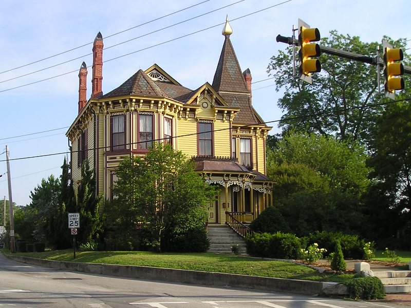


Smithfield, Virginia
Smithfield is a town of 8,834 people in Isle of Wight County, Virginia, founded in 1752.
Why visit Smithfield
Townapedia lists 15 museums and landmarks, 9 parks and trails, 36 places to eat, 3 places to stay and 1 attraction in and around town.
Highlights include Isle of Wight County Museum, Smithfield Historic District, Windsor Castle Park and Cypress Creek Golfers' Club.
July is the warmest month, with average highs of 88°F; January lows average 31°F.
Weather in Smithfield
Forecast from the National Weather Service. Full forecast
About Smithfield
Smithfield is a town in Isle of Wight County, in the South Hampton Roads subregion of the Hampton Roads region of Virginia, United States. The population was 8,533 at the 2020 census.
From the Wikipedia article Smithfield, Virginia (this version), under CC BY-SA 4.0.
Things to do1

Smithfield Little Theater
Cinema and theater · 1.2 mi
210 North Church Street, Smithfield
Museums and landmarks15

Isle of Wight County Museum
Museum · 1.1 mi
County museum displaying the world's oldest preserved ham and other historical artifacts. $2 admission.
103 Main Street, Smithfield
Mo-Sa 10:00-16:00; Su 12:00-16:00
Smithfield Historic District
Monument and historic site · National Register of Historic Places · 1.1 mi
Historic district in Smithfield, Virginia

Fort Boykin
Monument and historic site · National Register of Historic Places · 4.2 mi
Place in Virginia listed on National Register of Historic Places

Four Square
Monument and historic site · National Register of Historic Places · 4.3 mi
Building in Virginia, United States

Ivy Hill Cemetery
Monument and historic site · National Register of Historic Places · 1.5 mi
Cemetery in Smithfield, Virginia

Josiah Parker Family Cemetery
Monument and historic site · National Register of Historic Places · 4.3 mi
Historic cemetery in Virginia, United States

Old Isle of Wight Courthouse
Monument and historic site · National Register of Historic Places · 1.1 mi
Courthouse in Virginia, United States of America

P. D. Gwaltney, Jr., House
Monument and historic site · National Register of Historic Places · 0.9 mi
Historic house in Virginia, United States

Robert Tynes House
Monument and historic site · National Register of Historic Places · 2.7 mi
Human settlement in Virginia, United States of America
William Rand Tavern
Monument and historic site · National Register of Historic Places · 1.1 mi
Historic commercial building in Virginia, United States


Windsor Castle
Monument and historic site · National Register of Historic Places · 0.7 mi
Building in Virginia, United States

3 more on the map.
Parks, trails and playgrounds9


Cypress Creek Golfers' Club
Golf course · 1.1 mi
600 Cypress Creek Parkway, Smithfield
Mo-Su 07:00-18:00

Restaurants and cafes36

Anna's Ristorante
Restaurant · Italian · 0.9 mi
1810 South Church Street, Smithfield
Mo-Fr 11:00-21:00; Sa 11:00-22:00; Su 11:30-21:00
Farmer’s Table
Restaurant · Burger, Chicken, Ice Cream · 1.5 mi
13416 Benns Church Boulevard, Smithfield
Mo-Su 11:00-21:00
Jalapeños
Restaurant · Mexican · 1.5 mi
13432 Benns Church Boulevard, Smithfield
Mo-Th 11:00-22:00; Fr-Sa 11:00-23:00; Su 11:00-21:00
Pizza Hut
Restaurant · Pizza · 1.3 mi
1226 Smithfield Plaza, Smithfield
Su-Th 10:00-00:00; Fr-Sa 10:00-01:00

Taste of Smithfield
Cafe · American · 1.1 mi
217 Main Street, Smithfield
Tu-Sa 11:00-15:00, 16:30-20:00; Su 11:00-15:00
Tokyo Thai
Restaurant · Asian · 1.6 mi
13466 Benns Church Boulevard, Smithfield
Mo-Th 11:00-22:00; Fr 11:00-22:30; Sa 12:00-22:30; Su 12:00-21:30
Smithfield Gourmet Bakery & Cafe
Cafe · 1.2 mi
218 Main Street, Smithfield
Su-Fr 08:00-17:00; Sa 07:00-17:00

Smithfield Ice Cream Parlor
Ice cream · 1.1 mi
208 Main Street, Smithfield
Su-Th 11:00-20:00; Fr 11:00-21:00; Sa 10:00-21:00

Main Street Restaurant
Diner · American · 1.9 mi
837 West Main Street, Smithfield
Su-Tu 07:00-15:00; We-Sa 07:00-21:00
24 more on the map.
History
The area to later be called Smithfield was first colonized in 1634, is located on the Pagan River, south of Jamestown and on the south side of the James River. The Native Americans knew this area as Warascoyak, also spelled Warrosquoyacke, meaning "point of land."
The Virginia colony officially formed Warrosquyoake Shire (with numerous variant spellings, including Warrascoyack, Warrascocke and "Warwick Squeak") in 1634, but it had already been known as "Warascoyack County" before this. It was renamed as Isle of Wight County in 1637.
In 1730, the Tobacco Inspection Act of 1730 established "Warricksqueak Bay, in Isle of Wight County" as the site of an official tobacco inspection house.
The town was established as a seaport in 1752 by Arthur Smith IV. The original survey and plat of the Town of Smithfield was made by Jordan Thomas, County Surveyor, for "Captain Arthur Smith" in 1750.
As a river town, its life and growth were dependent on the river. "Wharf Hill" was the waterfront location of the beginning of the industries of Smithfield. They eventually included peanuts and the raising of pork as commodities, leading to the town claiming the titles of "Peanut Capital of the World" and later "Ham Capital of the World."
From the History section of Smithfield, Virginia on Wikipedia, under CC BY-SA 4.0.
Where to stay3
Mansion on Main Bed and Breakfast
Motel and hotel · 1.1 mi
36 Main Street, Smithfield
Churches and places of worship20
St. Luke's Church
Church · National Register of Historic Places · 2.8 mi
Kingdom Hall of Jehovah's Witnesses
Church · Jehovahs Witness · 2.9 mi
15673 Scotts Factory Road, Smithfield
Browns African Methodist Episcopal Church
Church · Methodist · 1.7 mi
655 West Main Street, Smithfield
Shopping10
Gas and EV charging8
Schools, colleges and libraries8
Healthcare6
Infinity Pediatric & Adolescent Medicine
Clinic and pharmacy · 0.8 mi
1809 South Church Street, Smithfield
Isle Of Wight Family Practice
Clinic and pharmacy · 0.8 mi
1807 South Church Street, Smithfield
Isle of Wight Health Clinic
Clinic and pharmacy
919 South Church Street, Smithfield
Riverside Lifelong Health
Clinic and pharmacy · 1.6 mi
13474 Benns Church Boulevard, Smithfield
Map of Smithfield
116 places. The map loads OpenStreetMap tiles when you open it.
Climate by month
Monthly table
| Month | High | Low | Rain |
|---|---|---|---|
| Jan | 49°F | 31°F | 3.0 in |
| Feb | 52°F | 32°F | 2.6 in |
| Mar | 59°F | 38°F | 3.4 in |
| Apr | 70°F | 47°F | 3.1 in |
| May | 77°F | 56°F | 3.7 in |
| Jun | 85°F | 64°F | 4.1 in |
| Jul | 88°F | 70°F | 4.7 in |
| Aug | 87°F | 68°F | 5.4 in |
| Sep | 81°F | 63°F | 5.0 in |
| Oct | 71°F | 51°F | 4.2 in |
| Nov | 61°F | 40°F | 3.0 in |
| Dec | 53°F | 34°F | 3.2 in |
U.S. Climate Normals 1991-2020 for Newport News Intl Ap (13 mi away), NOAA NCEI.
People and cost of living
American Community Survey 5-year estimates, 2020-2024, U.S. Census Bureau. Estimates have margins of error, larger for small towns.
Disaster history
Isle of Wight County has had 14 federal disaster declarations since 2000, most often for hurricanes.
- 2026-01-23: Severe Winter Storm (Winter Storm)
- 2020-04-02: Covid-19 Pandemic (Biological)
- 2020-03-13: Covid-19 (Biological)
- 2018-10-15: Hurricane Florence (Hurricane)
- 2018-09-11: Hurricane Florence (Hurricane)
- 2016-11-02: Hurricane Matthew (Hurricane)
OpenFEMA disaster declarations summaries.
Getting there and nearby towns
Felker Army Airfield (FAF) is the nearest airport with scheduled flights listed in OpenStreetMap, 11 miles away.
- Benns Church 3 mi southeast, about 5 min by car
- Carrollton 6 mi southeast, about 9 min by car
- Rushmere 7 mi northwest, about 12 min by car
- Newport News 9 mi northeast, about 14 min by car
- Windsor 13 mi southwest, about 21 min by car
- Bethel Manor 14 mi northeast, about 22 min by car
- Portsmouth 16 mi southeast, about 26 min by car
- Hampton 18 mi east, about 29 min by car
- Suffolk 19 mi south, about 31 min by car
- Norfolk 21 mi east, about 33 min by car
Drive times are estimates from straight-line distance, not routes.
Local news
Headlines from INDB, the NEMICO news database.
Reviews, tips and questions
Loading what members have shared...
Sources and licences
- NCES EDGE (Public domain): public schools
- NOAA NCEI U.S. Climate Normals 1991-2020 (Public domain): climate by month
- OpenFEMA (Public domain): disaster declarations
- OpenStreetMap contributors (ODbL 1.0): places, airports, map data
- U.S. Census Bureau (Public domain): population, income, housing, education, commute
- Wikidata (CC0 1.0): elevation, founding date, time zone, website, landmarks and historic places
- Wikimedia Commons (see each image): photos
- Wikipedia (CC BY-SA 4.0): overview and history text
Photo credits
- Smithfield14, Corvokarasu at English Wikipedia, Public domain
- Isle of Wight County Museum 014, Isle of Wight County Museum, CC BY-SA 3.0
- Smithfield mansion on main, Greg Vassilakos, Public domain
- Newport parish west facade, Kallicrates at English Wikipedia, Public domain
- Smithfield colonial tavern, Greg Vassilakos, Public domain
- Earthwork 1, Nat Webb, CC BY-SA 3.0
- Graves at Ivy Hill Cemetery, Smithfield, Ser Amantio di Nicolao, CC BY-SA 4.0
- Smithfield colonial courthouse, Greg Vassilakos, Public domain
- Smithfield gwaltney house, Greg Vassilakos, Public domain
- Windsor castle smithfield manor house 4, Greg Vassilakos, Public domain
- Foursquare, Isle of Wight County, Ser Amantio di Nicolao, CC BY-SA 4.0
- Old Macklesfield Road, leading to the site of Josiah Parker's grave, Ser Amantio di Nicolao, CC BY-SA 4.0
- Robert Tynes House, Ser Amantio di Nicolao, CC BY-SA 4.0
Page built October 30, 2026. Spotted a mistake? Tell us or suggest a place.