

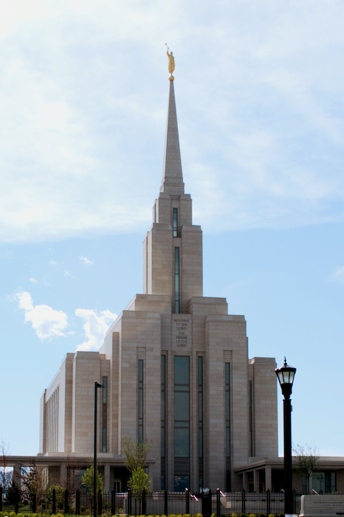

South Jordan, Utah
South Jordan is a city of 82,686 people in Salt Lake County, Utah, founded in 1859.
Why visit South Jordan
Townapedia lists 28 museums and landmarks, 130 parks and trails, 229 places to eat, 2 places to stay and 5 attractions in and around town.
Highlights include Joyce University of Nursing & Health Sciences, The Living Planet Aquarium, Alfred C. and Annie L. Olsen Anderson House and Copperton Historic District.
July is the warmest month, with average highs of 94°F; January lows average 25°F.
Weather in South Jordan
Forecast from the National Weather Service. Full forecast
About South Jordan
South Jordan is a city in south central Salt Lake County, Utah, United States, 18 miles (29 km) south of Salt Lake City. Part of the Salt Lake City metropolitan area, the city lies in the Salt Lake Valley along the banks of the Jordan River between the 10,000-foot (3,000 m) Oquirrh Mountains and the 11,000-foot (3,400 m) Wasatch Mountains. The city has 3.5 miles (5.6 km) of the Jordan River Parkway that contains fishing ponds, trails, parks, and natural habitats. The Salt Lake County fair grounds and equestrian park, 67-acre (27 ha) Oquirrh Lake, and 37 public parks are located inside the city.
From the Wikipedia article South Jordan, Utah (this version), under CC BY-SA 4.0.
Things to do5

Joyce University of Nursing & Health Sciences
School · 5.5 mi
Nursing school in Draper, Utah, US

The Living Planet Aquarium
Monument and historic site · 5.4 mi
Aquarium in Utah, United States

Megaplex 20/District
Cinema and theater · 1.2 mi
3761 South Parkway Plaza Drive, South Jordan
Museums and landmarks28
Alfred C. and Annie L. Olsen Anderson House
Monument and historic site · National Register of Historic Places · 6.0 mi
Historic house in Sandy, Utah, United States
Copperton Historic District
Monument and historic site · National Register of Historic Places · 5.6 mi
Historic district in Copperton, Utah, United States
Crescent Elementary School
Monument and historic site · National Register of Historic Places · 5.6 mi
School in Sandy, Salt Lake, Utah, United States
Draper-Steadman House
Monument and historic site · National Register of Historic Places · 4.5 mi
Historic residence in Riverton, Utah, United States
Garside-McMullin House
Monument and historic site · National Register of Historic Places · 3.3 mi
House in South Jordan, Utah
Hannah Nash Dowding House
Monument and historic site · National Register of Historic Places · 6.0 mi
Historic house in Sandy, Utah, United States
Mary Ellen Parmley House
Monument and historic site · National Register of Historic Places · 5.7 mi
Historic house in Sandy, Utah, United States
Orlando H. and Emma H. Hardcastle House
Monument and historic site · National Register of Historic Places · 6.0 mi
Single-family detached home in Sandy, United States of America
Riverton Elementary School
Monument and historic site · National Register of Historic Places · 3.8 mi
School building in Riverton, United States of America
Samuel and Geneva Holt Farmstead
Monument and historic site · National Register of Historic Places · 3.5 mi
Building in Utah, United States
West Jordan Ward Meetinghouse
Monument and historic site · National Register of Historic Places · 5.1 mi
Historic church in Utah, United States
Albert and Celestine Mabey House
Monument and historic site · National Register of Historic Places · 3.4 mi
16 more on the map.
Parks, trails and playgrounds130




118 more on the map.
Restaurants and cafes229

Sri Annapoorani
Restaurant · Indian · 2.8 mi
Fast-casual, all vegetarian, South Indian style
1776 West 10610 South, South Jordan
Tu-Fr 10:00-14:30, 17:00-21:00; Sa-Su 10:00-14:30, 17:00-21:00


Beans & Brews Coffee House
Cafe · Coffee Shop · 3.3 mi
3956 West 13400 South, Riverton
Mo-Fr 05:30-18:00; Sa-Su 06:30-18:00
Bep Viet Kitchen
Restaurant · Vietnamese · 3.2 mi
3703 West Market Center Drive, Riverton
Mo-Sa 11:00-21:00; Su 11:00-19:00

Blue Fish Sushi Bar
Restaurant · Sushi · 1.2 mi
11587 South District Drive, South Jordan
Mo-Sa 11:30-14:00,17:00-21:00; Su off
Cafe Rio
Restaurant · Mexican · 1.0 mi
11428 South Parkway Plaza Drive, South Jordan
Su-We 10:30-22:00; Th-Sa 10:30-23:00
Chili's
Restaurant · Tex-Mex · 3.3 mi
3766 West 13400 South, Riverton
Mo-Th 11:00-23:00; Fr-Sa 11:00-24:00; Su 11:00-22:00
Cubby's
Diner · American · 0.9 mi
11501 South 4000 West, South Jordan
Mo-Th 11:00-21:00; Fr 11:00-22:00; Sa 08:00-22:00; Su off
Fortune Cookie
Restaurant · Chinese · 3.3 mi
3728 West 13400 South, Riverton
Mo-Th 11:00-22:00; Fr-Sa 11:00-22:30; Su 12:00-21:00
Hires Big H
Restaurant · Burger · 1.5 mi
11098 South Grandville Avenue, South Jordan
Mo-Th 10:30-21:00; Fr,Sa 10:30-22:00; Su off
ICHI Japan Express
Restaurant · Japanese · 3.2 mi
4594 West Partridge Hill Lane, Riverton
Mo-Sa 11:00-20:30; Su 12:00-17:30
217 more on the map.
Where to stay2
SpringHill Suites Salt Lake City-South Jordan
Motel and hotel · 0.8 mi
11280 South River Heights Drive, South Jordan
Holiday Inn Express by IHG
Motel and hotel · 2.0 mi
12097 South Anthem Creek Lane, Herriman
Churches and places of worship57
The Church of Jesus Christ of Latter-day Saints
Church · Mormon · 1.2 mi
11122 South Black Hawk Drive, South Jordan
The Church of Jesus Christ of Latter-day Saints
Church · Latter Day Saints · 1.4 mi
11655 South Grandville Avenue, South Jordan
The Church of Jesus Christ of Latter-day Saints
Church · Mormon · 2.8 mi
11632 South Night Heron Road, South Jordan
The Church of Jesus Christ of Latter-day Saints
Church · Mormon · 3.2 mi
12737 South 6000 West, Herriman
The Church of Jesus Christ of Latter-day Saints
Church · Mormon · 0.7 mi
4484 West Willoughby Drive, South Jordan
The Church of Jesus Christ of Latter-day Saints
Church · Mormon · 1.2 mi
11685 South Kestrel Rise Road, South Jordan
The Church of Jesus Christ of Latter-day Saints
Church · Mormon · 1.7 mi
4881 West Cindy Lane, South Jordan
Shopping33
Gas and EV charging43
Schools, colleges and libraries83
Healthcare15
University of Utah Healthcare - South Jordan Health Center
Hospital · 1.5 mi
5126 West Daybreak Parkway, South Jordan
Smith's Pharmacy
Clinic and pharmacy · 3.0 mi
1634 W South Jordan Parkway, South Jordan
Copper View Medical Center
Clinic and pharmacy · 1.6 mi
3556 West 9800 South, South Jordan
South Jordan Clinic
Clinic and pharmacy · 2.9 mi
11444 South Redwood Road, South Jordan
Map of South Jordan
250 places. The map loads OpenStreetMap tiles when you open it.
Climate by month
Monthly table
| Month | High | Low | Rain |
|---|---|---|---|
| Jan | 40°F | 25°F | 1.8 in |
| Feb | 45°F | 28°F | 1.7 in |
| Mar | 56°F | 36°F | 2.2 in |
| Apr | 62°F | 40°F | 2.7 in |
| May | 74°F | 49°F | 2.6 in |
| Jun | 85°F | 58°F | 1.2 in |
| Jul | 94°F | 66°F | 0.8 in |
| Aug | 92°F | 64°F | 0.8 in |
| Sep | 81°F | 54°F | 1.2 in |
| Oct | 66°F | 42°F | 1.8 in |
| Nov | 51°F | 32°F | 1.6 in |
| Dec | 40°F | 26°F | 1.8 in |
U.S. Climate Normals 1991-2020 for Draper-Point Of Mtn (7 mi away), rain and snow from Taylorsville-Bennion 2.0 Wsw, NOAA NCEI.
People and cost of living
American Community Survey 5-year estimates, 2020-2024, U.S. Census Bureau. Estimates have margins of error, larger for small towns.
Disaster history
Salt Lake County has had 9 federal disaster declarations since 2000, most often for fires.
- 2021-08-14: Parleys Canyon Fire (Fire)
- 2021-01-12: Straight-Line Winds (Severe Storm)
- 2020-07-09: Earthquake And Aftershocks (Earthquake)
- 2020-04-04: Covid-19 Pandemic (Biological)
- 2020-03-13: Covid-19 (Biological)
- 2012-06-29: Rose Crest Fire (Fire)
OpenFEMA disaster declarations summaries.
Getting there and nearby towns
Salt Lake City International Airport (SLC) is the nearest airport with scheduled flights listed in OpenStreetMap, 16 miles away.
- Riverton 3 mi southeast, about 5 min by car
- West Jordan 3 mi north, about 5 min by car
- Herriman 5 mi south, about 7 min by car
- Bluffdale 6 mi southeast, about 10 min by car
- Midvale 7 mi northeast, about 11 min by car
- Kearns 7 mi north, about 11 min by car
- Sandy 8 mi east, about 12 min by car
- Draper 8 mi southeast, about 13 min by car
- Murray 9 mi northeast, about 14 min by car
- West Valley City 9 mi north, about 15 min by car
Drive times are estimates from straight-line distance, not routes.
Local news
Headlines from INDB, the NEMICO news database.
Reviews, tips and questions
Loading what members have shared...
Sources and licences
- NCES EDGE (Public domain): public schools
- NOAA NCEI U.S. Climate Normals 1991-2020 (Public domain): climate by month
- OpenFEMA (Public domain): disaster declarations
- OpenStreetMap contributors (ODbL 1.0): places, airports, map data
- U.S. Census Bureau (Public domain): population, income, housing, education, commute
- Wikidata (CC0 1.0): elevation, founding date, time zone, website, landmarks and historic places
- Wikimedia Commons (see each image): photos
- Wikipedia (CC BY-SA 4.0): overview and history text
Photo credits
- South Jordan - Towne Center, David Sallay, Public domain
- Oquirrh Mountain front view, Oqquirhtemple5252009.jpg : Cookiecaper derivative work: -- Trödel, CC BY-SA 3.0
- Jordan River Utah Temple Full View, Rick Willoughby, CC BY 2.0
Page built October 30, 2026. Spotted a mistake? Tell us or suggest a place.