


Springdale, New Jersey
Springdale is a community of 15,173 people in Camden County, New Jersey.
Why visit Springdale
Townapedia lists 19 museums and landmarks, 15 parks and trails, 73 places to eat, 3 places to stay and 5 attractions in and around town.
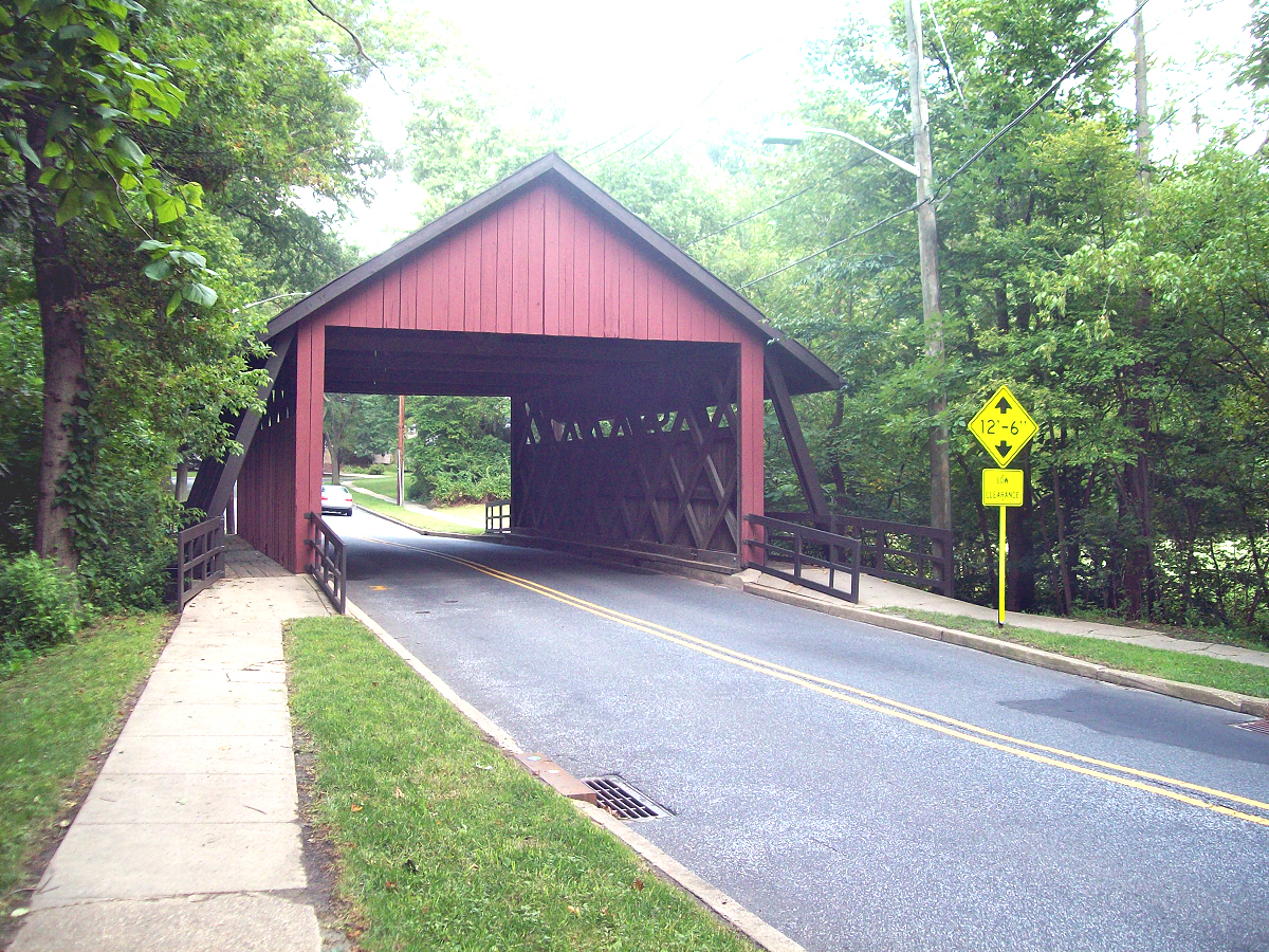
Highlights include AMC Voorhees 16, Scarborough Bridge, Cropwell Friends Meeting House and Amos Evans House.
July is the warmest month, with average highs of 88°F; January lows average 26°F.
Weather in Springdale
Forecast from the National Weather Service. Full forecast
About Springdale
Springdale is an unincorporated community and census-designated place (CDP) located within Cherry Hill Township, in Camden County, in the U.S. state of New Jersey. As of the 2020 census, Springdale had a population of 14,811.
From the Wikipedia article Springdale, New Jersey (this version), under CC BY-SA 4.0.
Things to do5


UMDNJ – School of Osteopathic Medicine
School · 3.6 mi
Public school in New Jersey


Museums and landmarks19

Cropwell Friends Meeting House
Monument and historic site · Quaker · National Register of Historic Places · 2.2 mi
Historic Quaker meeting house Cropwell
810 South Cropwell Road, Marlton

Amos Evans House
Monument and historic site · National Register of Historic Places · 4.0 mi
Historic house in Burlington County, New Jersey

Barclay Farm House
Monument and historic site · National Register of Historic Places · 2.4 mi
House in Cherry Hill, New Jersey

Four Echelon Plaza
Monument and historic site · National Register of Historic Places · 2.5 mi
Historic building in Camden County, New Jersey

Gatehouse at Colestown Cemetery
Monument and historic site · National Register of Historic Places · 4.1 mi
Cemetery gatehouse in Cherry Hill, New Jersey

Haddon Fortnightly Club House
Monument and historic site · National Register of Historic Places · 3.4 mi
House in New Jersey, United States of America

Haddonfield Historic District
Monument and historic site · National Register of Historic Places · 3.5 mi
Building in New Jersey, United States

Hadrosaurus Foulkii Leidy Site
Monument and historic site · National Register of Historic Places · 3.7 mi
Archaeological site in New Jersey, United States of America

Jacob Wills House
Monument and historic site · National Register of Historic Places · 3.8 mi
Historic house in Burlington County, New Jersey

John Inskeep Homestead
Monument and historic site · National Register of Historic Places · 3.3 mi
Historic house in Burlington County, New Jersey

Peter Mott House
Monument and historic site · National Register of Historic Places · 3.5 mi
Historic House and Underground Railroad Station in Lawnside, New Jersey


Samuel Coles House
Monument and historic site · National Register of Historic Places · 2.6 mi
Historic house in New Jersey, United States
7 more on the map.
Parks, trails and playgrounds15



Round Hill Road Playground
Park · 1.9 mi
Tot Lot (ages 2-10 years), Tennis Courts, Baseball Field, Swingsets

3 more on the map.
Restaurants and cafes73

Ciconte's Italia Pizza
Restaurant · Pizza · 2.1 mi
915 Route 70 West, Marlton
Su-We 11:00-21:00; Th-Sa 11:00-22:00
House of Biryanis and Kebabs
Restaurant · Indian · 1.8 mi
2091 Marlton Turnpike, Cherry Hill Township
Mo-Th 11:30-14:30, 17:30-22:00; Fr-Sa 11:30-15:00, 17:00-22:30; Su...
Sakura Spring
Restaurant · Japanese · 1.9 mi
1871 State Route 70, Cherry Hill
Mo-Th 11:00-22:00; Fr 11:00-23:00; Sa 11:30-23:00; Su 12:00-21:30


61 more on the map.
Where to stay3
Holiday Inn Express - Voorhees
Motel and hotel · 2.2 mi
121 Laurel Oak Road, Voorhees
Wingate by Wyndham
Motel and hotel · 2.2 mi
1000 Laurel Oak Road, Voorhees Township;Voorhees
Churches and places of worship14
Glendale Methodist Episcopal Church
Church · National Register of Historic Places · 1.6 mi
Congregation M'kor Shalom
Place of worship · 2.2 mi
850 East Evesham Road, Cherry Hill
Shopping9
Gas and EV charging14
Schools, colleges and libraries60
A. Russell Knight Elementary School
School · 2.7 mi
140 Old Carriage Rd., Cherry Hill
Clara Barton Elementary School
School · 3.9 mi
223 Rhode Island Ave., Cherry Hill
Healthcare18
South Jersey Health and Wellness Center
Clinic and pharmacy · 2.0 mi
1919 Greentree Road, Cherry Hill
advocare South Jersey Orthopedic Associates
Clinic and pharmacy · 1.9 mi
502 Centennial Boulevard, Voorhees
Children's Hospital of Philadelphia
Hospital · 2.1 mi
1012 Laurel Oak Road, Voorhees;Voorhees Township
Gupta Institute For Pain
Clinic and pharmacy · 1.1 mi
100 Springdale Road, Cherry Hill
Map of Springdale
230 places. The map loads OpenStreetMap tiles when you open it.
Climate by month
Monthly table
| Month | High | Low | Rain |
|---|---|---|---|
| Jan | 43°F | 26°F | 3.9 in |
| Feb | 46°F | 27°F | 2.7 in |
| Mar | 54°F | 34°F | 4.6 in |
| Apr | 66°F | 43°F | 3.7 in |
| May | 75°F | 52°F | 3.6 in |
| Jun | 84°F | 62°F | 4.4 in |
| Jul | 88°F | 67°F | 5.4 in |
| Aug | 85°F | 64°F | 4.6 in |
| Sep | 80°F | 59°F | 4.2 in |
| Oct | 68°F | 47°F | 4.1 in |
| Nov | 56°F | 37°F | 3.5 in |
| Dec | 47°F | 31°F | 4.5 in |
U.S. Climate Normals 1991-2020 for Moorestown Hcn (5 mi away), NOAA NCEI.
People and cost of living
American Community Survey 5-year estimates, 2020-2024, U.S. Census Bureau. Estimates have margins of error, larger for small towns.
Disaster history
Camden County has had 18 federal disaster declarations since 2000, most often for hurricanes.
- 2021-09-05: Remnants Of Hurricane Ida (Hurricane)
- 2021-09-02: Remnants Of Hurricane Ida (Hurricane)
- 2020-03-25: Covid-19 Pandemic (Biological)
- 2020-03-13: Covid-19 (Biological)
- 2016-03-14: Severe Winter Storm And Snowstorm (Severe Storm)
- 2015-07-22: Severe Storm (Severe Storm)
OpenFEMA disaster declarations summaries.
Getting there and nearby towns
South Jersey Regional Airport (LLY) is the nearest airport with scheduled flights listed in OpenStreetMap, 8 miles away.
- Greentree 2 mi north, about 3 min by car
- Echelon 2 mi southwest, about 4 min by car
- Marlton 3 mi northeast, about 5 min by car
- Haddonfield 4 mi west, about 6 min by car
- Cherry Hill Mall 5 mi northwest, about 8 min by car
- Moorestown-Lenola 6 mi north, about 10 min by car
- Collingswood 6 mi northwest, about 10 min by car
- Pine Hill 6 mi south, about 10 min by car
- Bellmawr 7 mi west, about 11 min by car
- Gloucester City 8 mi west, about 12 min by car
Drive times are estimates from straight-line distance, not routes.
Local news
Headlines from INDB, the NEMICO news database.
Reviews, tips and questions
Loading what members have shared...
Sources and licences
- NCES EDGE (Public domain): public schools
- NOAA NCEI U.S. Climate Normals 1991-2020 (Public domain): climate by month
- OpenFEMA (Public domain): disaster declarations
- OpenStreetMap contributors (ODbL 1.0): places, airports, map data
- U.S. Census Bureau (Public domain): population, income, housing, education, commute
- Wikidata (CC0 1.0): elevation, founding date, time zone, website, landmarks and historic places
- Wikimedia Commons (see each image): photos
- Wikipedia (CC BY-SA 4.0): overview and history text
Photo credits
- 2020-09-04 10 50 09 View west along New Jersey State Route 70 (Marlton Pike) at the exit for South Springdale Road (Voorhees) in Cherry Hill Township, Camden County, New Jersey, Famartin, CC BY-SA 4.0
- 2020-09-04 15 24 02 View east along New Jersey State Route 70 (Marlton Pike) at the exit for South Springdale Road (Voorhees) in Cherry Hill Township, Camden County, New Jersey, Famartin, CC BY-SA 4.0
- CROPWELL FRIENDS MEETING HOUSE - MARLTON - NJ, Jerrye and Roy Klotz MD, CC BY-SA 3.0
- John Inskeep Homestead (3), Apc106, CC BY-SA 3.0
- Amos Evans House, apc106, CC BY-SA 3.0
- NHL Marl Pit 2, Smallbones, Public domain
- Haddon Fortnightly, Smallbones, Public domain
- Baptist Chapel Haddonfield NJ, Smallbones, Public domain
- GATEHOUSE AT COLESTOWN CEMETERY, CAMDEN COUNTY, Jerrye & Roy Klotz, MD, CC BY-SA 3.0
- MICKLE HOUSE, JERRYE & ROY KLOTZ MD, CC BY-SA 3.0
- BARCLAY FARM HOUSE, JERRYE & ROY KLOTZ MD, CC BY-SA 3.0
- Peter Mott House 2012-10-20 12-08-26, Isablidine, CC BY-SA 3.0
- COLES HOUSE, JERRYE & ROY KLOTZ MD, CC BY-SA 3.0
- Stokes- Evans House, Apc106, CC BY-SA 3.0
- THOMAS HOLLINSHEAD HOUSE, MARLTON, BURLINGTON COUNTY, JERRYE AND ROY KLOTZ MD, CC BY-SA 3.0
- William & Susan Evans House (5), Apc106, CC BY-SA 3.0
- JACOB WILLS HOUSE - MARLTON - NJ, JERRYE AND ROY KLOTZ MD, CC BY-SA 3.0
- 7thDayHolyGhostChurchGlendaleNJ, Travellers & Tinkers, CC BY-SA 4.0
- Four Echelon Plaza, Voorhees Township, NJ, Zeete, CC BY-SA 4.0
- Indian King Tavern 2010, Smallbones, Public domain
- Barclaycoveredbridge, User:JSF0864, CC BY 2.0
- What a loser, Dannycookieswiki, CC BY-SA 4.0
- Cherry Hill High School East front, Nov. 2025, Mr. Matté (if there is an issue with this image, contact me using this image's Commons talk page , my Commons user talk page , or my English Wikipedia user talk page ; I'll know about it a lot faster), CC BY-SA 4.0
- I-295 NJ TPK and NJ 70 in Cherry Hill NJ from airplane approaching PHL, Dough4872, CC BY-SA 4.0
- Stafford Farm panorama, Voorhees Township, NJ, Zeete, CC BY-SA 4.0
- 1407 White Horse Road, Voorhees Township, NJ, Zeete, CC BY-SA 4.0
- CR 561 sb entering Voorhees Township, NJ, Feb. 2025, Mr. Matté (if there is an issue with this image, contact me using this image's Commons talk page , my Commons user talk page , or my English Wikipedia user talk page ; I'll know about it a lot faster), CC BY-SA 4.0
- 2018-10-02 16 41 26 View south along Camden County Route 561 (Haddonfield-Berlin Road) just south of Camden County Route 544 (Evesham Road) and Camden County Route 678 (Somerdale Road) in Voorhees..., Famartin, CC BY-SA 4.0
- 2021-05-21 16 29 50 View south along New Jersey State Route 700 (New Jersey Turnpike) from the overpass for Camden County Route 671 (Kresson Road) in Cherry Hill Township, Camden County, New Jersey, Famartin, CC BY-SA 4.0
- 2018-10-02 17 27 17 View north along Camden County Route 561 (Haddonfield-Berlin Road) just north of Camden County Route 673 (White Horse Road) in Voorhees Township, Camden County, New Jersey, Famartin, CC BY-SA 4.0
- 2018-10-02 15 21 08 View west along Camden County Route 544 (Evesham Road) at Hadleigh Drive along the border of Cherry Hill Township and Voorhees Township in Camden County, New Jersey, Famartin, CC BY-SA 4.0
- 2020-07-12 10 22 49 View south along New Jersey State Route 700 (New Jersey Turnpike) at the entrance to the Walt Whitman Service Area in Cherry Hill Township, Camden County, New Jersey, Famartin, CC BY-SA 4.0
- 2021-05-21 16 31 17 View north along New Jersey State Route 700 (New Jersey Turnpike) from the overpass for Camden County Route 671 (Kresson Road) in Cherry Hill Township, Camden County, New Jersey, Famartin, CC BY-SA 4.0
- Voorhees Township, NJ police department, Feb. 2025, Mr. Matté (if there is an issue with this image, contact me using this image's Commons talk page , my Commons user talk page , or my English Wikipedia user talk page ; I'll know about it a lot faster), CC BY-SA 4.0
- 20241017 1whitma71325, Alex Lozupone, CC BY 4.0
- 2021-07-15 13 56 10 View north along Interstate 295 (Camden Freeway) from the overpass for Camden County Route 671 (Kresson Road) in Cherry Hill Township, Camden County, New Jersey, Famartin, CC BY-SA 4.0
- 2021-07-15 13 54 34 View south along Interstate 295 (Camden Freeway) from the overpass for Camden County Route 671 (Kresson Road) in Cherry Hill Township, Camden County, New Jersey, Famartin, CC BY-SA 4.0
- 2018-10-02 11 02 13 View north along New Jersey State Route 700 (New Jersey Turnpike) between Exit 3 and Exit 4 in Cherry Hill Township, Camden County, New Jersey, Famartin, CC BY-SA 4.0
- 2018-10-02 09 51 45 View south along New Jersey State Route 700 (New Jersey Turnpike) between Exit 4 and Exit 3 in Cherry Hill Township, Camden County, New Jersey, Famartin, CC BY-SA 4.0
- Camden CR 673 sb in Voorhees Township, NJ, Feb. 2025, Mr. Matté (if there is an issue with this image, contact me using this image's Commons talk page , my Commons user talk page , or my English Wikipedia user talk page ; I'll know about it a lot faster), CC BY-SA 4.0


Page built October 30, 2026. Spotted a mistake? Tell us or suggest a place.