


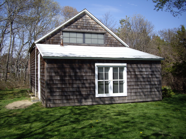


Why visit Springs
Townapedia lists 7 museums and landmarks, 22 parks and trails, 1 place to stay and 1 attraction in and around town.
Highlights include Cranberry Hole Road Bridge, Ambrose Parsons House, Amelia Cottage Museum and Cedar Point County Park.
July is the warmest month, with average highs of 82°F; February lows average 25°F, and about 27 inches of snow fall in a normal year.
Weather in Springs
Forecast from the National Weather Service. Full forecast
About Springs
Springs is a census-designated place (CDP) roughly corresponding to the hamlet by the same name in the Town of East Hampton in Suffolk County, New York, United States, on the South Fork of Long Island. As of the 2020 census, Springs had a population of 8,086.
From the Wikipedia article Springs, New York (this version), under CC BY-SA 4.0.
Things to do1

Cranberry Hole Road Bridge
Bridge · 4.4 mi
Bridge in Suffolk County, New York
Museums and landmarks7

Ambrose Parsons House
Monument and historic site · National Register of Historic Places · 0.8 mi
Springs, New York, listed on the NRHP in Suffolk County

Amelia Cottage Museum
Monument and historic site · National Register of Historic Places · 4.1 mi
Historic house in East Hampton, New York

Pantigo Road Historic District
Monument and historic site · National Register of Historic Places · 4.6 mi
Park in New York, United States of America, United States of America

Pleasants House
Monument and historic site · National Register of Historic Places · 4.0 mi
Historic house in New York, United States
Pollock-Krasner House and Studio
Monument and historic site · National Register of Historic Places · 0.6 mi
Historic house in New York, United States


Stephen Sherrill House
Monument and historic site · National Register of Historic Places · 4.2 mi
Historic house in New York, United States

Parks, trails and playgrounds22

Cedar Point County Park
Park · 3.8 mi
Park in East Hampton, Middlesex County, United States of America



10 more on the map.
Where to stay1

East Hampton Art House Bed & Breakfast
Motel and hotel · 1.4 mi
9 Bon Pinck Way, Springs
History
Springs is known in art circles as the cradle of the abstract expressionist movement. Artists such as Jackson Pollock, Willem de Kooning and John Ferren worked there. Writers such as Kurt Vonnegut, Joseph Heller, Philip Roth, Nora Ephron, and John Steinbeck have lived in or near Springs. Artists and writers were attracted to the area due to its rural nature, despite being within 100 miles (160 km) of New York City, and because housing prices "north of the Montauk Highway" on the bay side of the East Hampton peninsula have traditionally been lower than those closer to the Atlantic Ocean. Traditionally, locals are referred to as "Bonackers" which comes from Accabonac Harbor in Springs. East Hampton High School has adopted the Bonacker name for its sports teams.
The main roads connecting Springs to East Hampton are Springs-Fireplace Road and Three Mile Harbor Road. Jackson Pollock died in a car crash on Springs-Fireplace Road in 1956. Pollock and his wife Lee Krasner are buried in Green River Cemetery. Pollock's grave is marked by a large glacial erratic stone on top of a hill, Krasner's by a small stone lower on the hill. Since Pollock's burial, numerous other writers and artists have been buried in the cemetery, joining the locals.
From the History section of Springs, New York on Wikipedia, under CC BY-SA 4.0.
Churches and places of worship2
Saint Thomas' Chapel
Church · National Register of Historic Places · 4.1 mi
Springs Community Presbyterian Church
Church · 0.7 mi
802 Springs Fireplace Road, Springs
Shopping1
Schools, colleges and libraries5
Healthcare1
Map of Springs
40 places. The map loads OpenStreetMap tiles when you open it.
Climate by month
Monthly table
| Month | High | Low | Rain | Snow |
|---|---|---|---|---|
| Jan | 39°F | 25°F | 4.0 in | 7.2 in |
| Feb | 39°F | 25°F | 3.6 in | 8.6 in |
| Mar | 46°F | 32°F | 4.9 in | 6.0 in |
| Apr | 57°F | 42°F | 4.3 in | 0.8 in |
| May | 65°F | 49°F | 3.6 in | 0.0 in |
| Jun | 75°F | 60°F | 3.9 in | 0.0 in |
| Jul | 82°F | 67°F | 3.2 in | 0.0 in |
| Aug | 80°F | 67°F | 3.9 in | 0.0 in |
| Sep | 74°F | 60°F | 4.8 in | 0.0 in |
| Oct | 65°F | 50°F | 4.7 in | 0.0 in |
| Nov | 54°F | 41°F | 3.8 in | 0.1 in |
| Dec | 45°F | 32°F | 5.0 in | 4.1 in |
U.S. Climate Normals 1991-2020 for Orient Pt Sp (9 mi away), rain and snow from Bridgehampton Hcn, NOAA NCEI.
People and cost of living
American Community Survey 5-year estimates, 2020-2024, U.S. Census Bureau. Estimates have margins of error, larger for small towns.
Disaster history
Suffolk County has had 25 federal disaster declarations since 2000, most often for hurricanes.
- 2024-10-21: Severe Storm And Flooding (Severe Storm)
- 2024-08-25: Severe Storm And Flooding (Severe Storm)
- 2023-03-15: Severe Winter Storm And Snowstorm (Snowstorm)
- 2021-09-05: Remnants Of Hurricane Ida (Hurricane)
- 2021-09-02: Remnants Of Hurricane Ida (Hurricane)
- 2021-08-22: Hurricane Henri (Hurricane)
OpenFEMA disaster declarations summaries.
Getting there and nearby towns
East Hampton Airport (HTO) is the nearest airport with scheduled flights listed in OpenStreetMap, 7 miles away.
- Northwest Harbor 3 mi west, about 5 min by car
- East Hampton North 4 mi south, about 7 min by car
- East Hampton 6 mi south, about 9 min by car
- Sag Harbor 7 mi west, about 12 min by car
- Shelter Island 7 mi west, about 12 min by car
- Noyack 10 mi west, about 16 min by car
- Bridgehampton 10 mi southwest, about 16 min by car
- Orient 10 mi northwest, about 16 min by car
- Montauk 11 mi east, about 18 min by car
- Shelter Island Heights 11 mi west, about 17 min by car
Drive times are estimates from straight-line distance, not routes.
Local news
Headlines from INDB, the NEMICO news database.
Reviews, tips and questions
Loading what members have shared...
Sources and licences
- NCES EDGE (Public domain): public schools
- NOAA NCEI U.S. Climate Normals 1991-2020 (Public domain): climate by month
- OpenFEMA (Public domain): disaster declarations
- OpenStreetMap contributors (ODbL 1.0): places, airports, map data
- U.S. Census Bureau (Public domain): population, income, housing, education, commute
- Wikidata (CC0 1.0): elevation, founding date, time zone, website, landmarks and historic places
- Wikimedia Commons (see each image): photos
- Wikipedia (CC BY-SA 4.0): overview and history text
Photo credits
- Pollock-green, Americasroof, CC BY-SA 2.5
- Pantigo-road, Americasroof ( talk ), CC BY-SA 3.0
- Eh-sherrill, Americasroof, CC BY-SA 3.0
- Pollock-barn, Dmadeo, CC BY-SA 3.0
- Stthomas-amag, Americasroof ( talk ), CC BY 3.0
- Amy-cottage, Americasroof ( talk ), CC BY-SA 3.0
- Parsons-house, Americasroof ( talk ), CC BY-SA 3.0
- Pleasant-house, Americasroof ( talk ), CC BY-SA 3.0
Page built October 30, 2026. Spotted a mistake? Tell us or suggest a place.