


St. Francis, Wisconsin
St. Francis is a city of 9,004 people in Milwaukee County, Wisconsin.
Why visit St. Francis
Townapedia lists 11 museums and landmarks, 16 parks and trails and 57 places to eat in and around town.
Highlights include Bay View, Cudahy Chicago and North Western Railway Depot, Sheridan Park and Mitchell Airport Park.
July is the warmest month, with average highs of 82°F; January lows average 17°F, and about 49 inches of snow fall in a normal year.
Weather in St. Francis
Forecast from the National Weather Service. Full forecast
About St. Francis
St. Francis is a city in Milwaukee County, Wisconsin, United States. The population was 9,161 at the 2020 census. A suburb of Milwaukee along Lake Michigan, it is part of the Milwaukee metropolitan area.
From the Wikipedia article St. Francis, Wisconsin (this version), under CC BY-SA 4.0.
Museums and landmarks11
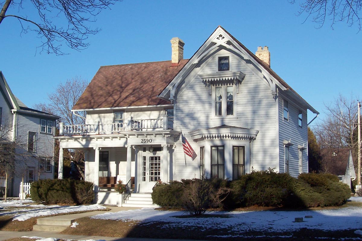
Bay View
Monument and historic site · National Register of Historic Places · 2.4 mi
Human settlement in Milwaukee, Wisconsin, United States of America

Cudahy Chicago and North Western Railway Depot
Monument and historic site · National Register of Historic Places · 0.8 mi
Historic railroad station built in 1893 by the Chicago and Northwestern Railway in Cudahy, Wisconsin

Light Vessel No. 57
Monument and historic site · National Register of Historic Places · 2.2 mi
Lightvessel boat

Milwaukee Fire Department High Pressure Pumping Station
Monument and historic site · National Register of Historic Places · 3.1 mi
Fire station in Milwaukee, United States of America

New Coeln House
Monument and historic site · National Register of Historic Places · 3.0 mi
Historical inn located in Wisconsin

Henni Hall
Monument and historic site · 0.8 mi
3257 South Lake Drive, Saint Francis

Wisconsin's Largest European Copper Beech Tree
Monument and historic site · 1.7 mi
Parks, trails and playgrounds16

Sheridan Park
Park · 1.5 mi
Municipal park in Cudahy, Wisconsin, United States
4800 South Lake Drive, Cudahy

Mitchell Airport Park
Park · 1.3 mi
4446 South Logan Avenue, Milwaukee
Morgan Triangle
Park · 0.9 mi
3404 South Kinnickinnic Avenue, Milwaukee

Seminary Woods St. Francis
Park · 0.8 mi
Park in Wisconsin, United States of America
South Shore Park
Park · 1.6 mi
2900 South Shore Drive, Milwaukee
Tippecanoe Park
Park · 1.1 mi
1411 East Warnimont Avenue, Milwaukee
Greene Park
Park · 0.4 mi
4235 South Lipton Avenue, St. Francis
4 more on the map.
Restaurants and cafes57

Anodyne Coffee Roasting Company - Bay View Cafe
Cafe · Coffee Shop · 1.6 mi
2920 South Kinnickinnic Avenue, Milwaukee
Mo-Fr 07:00-19:00; Sa,Su 07:00-17:00

Bert's Bar & Grill
Bar and pub · Burger, Regional, Pizza, American, Seafood · 0.8 mi
3907 South Lake Drive, Saint Francis
Mo off; Tu-Th 15:00-22:00; Fr-Sa 15:00-24:00; SH off

Botanas II
Restaurant · Mexican · 1.0 mi
1411,1421,1431 East Howard Avenue, Milwaukee
Tu-Th 16:00-22:00; Fr, Sa 11:00-22:00; Su 11:00-21:00
Café Le Crème Brûlée
Restaurant · Sandwich, Burger, Breakfast · 0.9 mi
3431 East Plankinton Avenue, Cudahy
Mo-Su 07:00-15:00
Faklandia Brewing
Bar and pub · Pizza, Regional, Burger, Mexican, American, Sandwich, Tex-Mex, Fish · 0.6 mi
3807 South Packard Avenue, Saint Francis
Mo off; Tu-Fr 16:00-22:00; Sa 13:00-22:00; Su 11:00-13:00
La Finca Coffeehouse
Cafe · Coffee Shop, Mexican, Coffee, Dessert, Sandwich · 0.7 mi
3558 East Sivyer Avenue, Saint Francis
Mo-Sa 07:00-17:00; Su 08:00-15:00
Pietro's Pizza
Restaurant · Pizza, Italian · 1.6 mi
2912 South Kinnickinnic Avenue, Milwaukee
Mo, We, Th 17:00-22:00; Tu off; Fr, Sa 16:00-23:00; Su 16:00-22:00
Brickyard Pub & Beer Garden
Bar and pub · American, Burger, Chicken, Fish And Chips, Pizza · 0.9 mi
3455 East Layton Avenue
Mo-Th 15:00-01:00; Fr 13:00-02:30; Sa 11:00-02:30; Su 11:00-01:00
Busby's Pub
Bar and pub · 0.8 mi
3475 South Kinnickinnic Avenue, Milwaukee
Mo,We,Fr 15:00-24:00; Tu off; Sa 12:00-26:30, Su 12:00-24:00
Axolotl Café
Restaurant · Mexican, Breakfast, Brunch · 1.5 mi
3001 South Kinnickinnic Avenue, Milwaukee
Mo-Fr 07:00-14:30; Sa-Su 07:00-15:00
45 more on the map.
Churches and places of worship11


Basilica of St. Josaphat
Church · National Register of Historic Places · 3.2 mi
Church building in Milwaukee, United States of America

St. Mark's Evangelical Lutheran Church
Place of worship · 0.8 mi
We 10:30-12:30; Th 10:00-13:00; Su 10:00-12:00; Tu 10:00-13:00

Unity Evangelical Lutheran Church
Church · Evangelical Lutheran · 1.7 mi
1007 East Oklahoma Avenue, Milwaukee
Changing Lives Assembly of God
Church · Assemblies Of God · 1.4 mi
4960,4970 South Swift Avenue, Cudahy
St. Paul's Lutheran Church
Church · Lutheran · 1.1 mi
3775 East Cudahy Avenue, Cudahy
History
The area that is now St. Francis was known as "Nojoshing" by local Native Americans at the time that the first white settlers arrived. St. Francis Seminary was established in what is now the city in 1845. The Sisters of St. Francis of Assisi settled there in the mid-19th century.
Historically, what is now the city of St. Francis was part of the Town of Lake. As large parts of the Town of Lake were gradually being annexed into the city of Milwaukee, residents in the St. Francis area sought to incorporate their community to prevent this from happening to them. A movement to split St. Francis off from the rest of the Town of Lake as a city existed as early as the 1920s, but faced resistance from residents of the rest of the town. Ultimately, the residents successfully voted to incorporate on July 24, 1951, and the result was certified the next day. The rest of the Town of Lake was annexed into Milwaukee in 1954.
The city took its name from Saint Francis de Sales Seminary, founded by Archbishop John Henni, the first Archbishop of Milwaukee, who placed it under the patronage of Francis de Sales, the first Catholic bishop of Switzerland after the Swiss Reformation.
From the History section of St. Francis, Wisconsin on Wikipedia, under CC BY-SA 4.0.
Shopping6
Gas and EV charging6
Schools, colleges and libraries61
Atlas Preparatory Academy - Kansas Campus
School · Catholic · 0.8 mi
3945 South Kansas Avenue, Milwaukee
Saint Francis High School
School · 0.9 mi
4225 South Lake Drive, St. Francis
Healthcare6
Ascension Columbia St. Mary's Milwaukee at Bay View
Clinic and pharmacy · 1.4 mi
3056 South Kinnickinnic Avenue, Milwaukee
Map of St. Francis
174 places. The map loads OpenStreetMap tiles when you open it.
Climate by month
Monthly table
| Month | High | Low | Rain | Snow |
|---|---|---|---|---|
| Jan | 31°F | 17°F | 1.8 in | 14.9 in |
| Feb | 34°F | 20°F | 1.7 in | 11.8 in |
| Mar | 44°F | 29°F | 2.2 in | 6.7 in |
| Apr | 55°F | 38°F | 3.9 in | 2.1 in |
| May | 66°F | 48°F | 3.5 in | 0.0 in |
| Jun | 77°F | 58°F | 4.4 in | 0.0 in |
| Jul | 82°F | 65°F | 3.4 in | 0.0 in |
| Aug | 80°F | 64°F | 3.6 in | 0.0 in |
| Sep | 74°F | 56°F | 3.2 in | 0.0 in |
| Oct | 61°F | 45°F | 2.8 in | 0.3 in |
| Nov | 48°F | 33°F | 2.2 in | 2.5 in |
| Dec | 36°F | 23°F | 1.9 in | 10.4 in |
U.S. Climate Normals 1991-2020 for Milwaukee Mitchell Ap 72640 (2 mi away), NOAA NCEI.
People and cost of living
American Community Survey 5-year estimates, 2020-2024, U.S. Census Bureau. Estimates have margins of error, larger for small towns.
Disaster history
Milwaukee County has had 13 federal disaster declarations since 2000, most often for severe storms.
- 2026-06-30: Severe Storms, Tornadoes, And Flooding (Flood)
- 2025-09-11: Severe Storms, Straight-Line Winds, Flooding, And Mudslides (Flood)
- 2020-04-04: Covid-19 Pandemic (Biological)
- 2020-03-13: Covid-19 (Biological)
- 2020-03-11: Severe Winter Storm And Flooding (Flood)
- 2011-04-05: Severe Winter Storm And Snowstorm (Snowstorm)
OpenFEMA disaster declarations summaries.
Getting there and nearby towns
Milwaukee Mitchell International Airport (MKE) is the nearest airport with scheduled flights listed in OpenStreetMap, 2 miles away.
- Cudahy 2 mi south, about 3 min by car
- South Milwaukee 4 mi south, about 7 min by car
- Oak Creek 7 mi south, about 10 min by car
- Greenfield 7 mi west, about 11 min by car
- Greendale 7 mi west, about 11 min by car
- Milwaukee 8 mi northwest, about 13 min by car
- West Allis 8 mi west, about 13 min by car
- Shorewood 8 mi north, about 13 min by car
- Franklin 9 mi southwest, about 15 min by car
- Hales Corners 9 mi west, about 15 min by car
Drive times are estimates from straight-line distance, not routes.
Local news
Headlines from INDB, the NEMICO news database.
Reviews, tips and questions
Loading what members have shared...
Sources and licences
- NCES EDGE (Public domain): public schools
- NOAA NCEI U.S. Climate Normals 1991-2020 (Public domain): climate by month
- OpenFEMA (Public domain): disaster declarations
- OpenStreetMap contributors (ODbL 1.0): places, airports, map data
- U.S. Census Bureau (Public domain): population, income, housing, education, commute
- Wikidata (CC0 1.0): elevation, founding date, time zone, website, landmarks and historic places
- Wikimedia Commons (see each image): photos
- Wikipedia (CC BY-SA 4.0): overview and history text
Photo credits
- St Francis Seminary, The original uploader was Sulfur at English Wikipedia ., CC BY-SA 3.0
- St. Francis July 2025 2 (Nojoshing Trail), Michael Barera, CC BY-SA 4.0
- St. Francis July 2025 1 (Nojoshing Trail), Michael Barera, CC BY-SA 4.0
- Milwaukee Cathedral 3, Paul Sableman, CC BY 2.0
- Light Vessel No.57, Bowling Green State University, Public domain
- Cudahy Chicago and North Western Railway Depot, David Wilson ( davidwilson1949 ), CC BY 2.0
- Mke Fire Dept Pump Station Dec2010, Freekee, Public domain
- Beulah Brinton House, Sulfur at English Wikipedia, CC BY-SA 3.0
- New Coeln House Dec09, Freekee, Public domain
- Oak Leaf Trail in Sheridan Park, NaturalHistory, CC BY-SA 4.0
- Beech Tree, E.L.Gamillo, CC BY-SA 4.0
- WI-794NR, paulthemapguy, CC BY-SA 4.0
- 20111121 36 former TMER&L substation, Cudahy, Wisconsin (6439617353), David Wilson from Oak Park, Illinois, USA, CC BY 2.0
- 20111121 41 Kinnickinnic & Morgan Aves. (6444327529), David Wilson from Oak Park, Illinois, USA, CC BY 2.0
- 20111121 42 Kinnickinnic & Morgan Aves. (6444327605), David Wilson from Oak Park, Illinois, USA, CC BY 2.0
- Cudahy, WI 53110, USA - panoramio, bogdanstepniak, CC BY 3.0
- 20111121 33 Immigrants Statue, Cudahy, Wisconsin (6439617147), David Wilson from Oak Park, Illinois, USA, CC BY 2.0
- BayView Park 4, Akaila of the Willows, CC0
- 20111121 34 D. A. Lubbert Bldg.,Cudahy, Wisconsin (6439617221), David Wilson from Oak Park, Illinois, USA, CC BY 2.0
- 20111121 28 Layton Ave. & Kinnickinnic Ave., Cudahy, Wisconsin (6439616853), David Wilson from Oak Park, Illinois, USA, CC BY 2.0
- 20111121 29 Cudahy, Wisconsin (6439616929), David Wilson from Oak Park, Illinois, USA, CC BY 2.0
- 20111121 30 Cudahy, Wisconsin (6439617041), David Wilson from Oak Park, Illinois, USA, CC BY 2.0
- 20111121 31 Cudahy, Wisconsin (6439617095), David Wilson from Oak Park, Illinois, USA, CC BY 2.0
- 20111121 27 Bus Stop, Cudahy, Wisconsin (6439616773), David Wilson from Oak Park, Illinois, USA, CC BY 2.0
- 20111121 25 Cudahy, Wisconsin (6439616597), David Wilson from Oak Park, Illinois, USA, CC BY 2.0
- 20111121 26 Cudahy, Wisconsin (6439617519), David Wilson from Oak Park, Illinois, USA, CC BY 2.0
- 20111121 24 Dretzka's Department Store, Cudahy, Wisconsin (6439616669), David Wilson from Oak Park, Illinois, USA, CC BY 2.0
- 20111121 23 Cudahy, Wisconsin (6434156927), David Wilson from Oak Park, Illinois, USA, CC BY 2.0
- 2025-11-08 Cudahy Family Library 1, Rorr404, CC0
- 2025-11-08 Cudahy Family Library 3, Rorr404, CC0
- 2025-11-08 Cudahy Family Library 2, Rorr404, CC0
- 2025-11-08 Cudahy Family Library 4, Rorr404, CC0
- 2025-11-08 Cudahy Family Library 5, Rorr404, CC0
- 20111121 19 Cudahy, Wisconsin (6434156805), David Wilson from Oak Park, Illinois, USA, CC BY 2.0
- 20111121 20 Cudahy, Wisconsin (6434156865), David Wilson from Oak Park, Illinois, USA, CC BY 2.0
- Mitchell airport park - milwaukee, Buster8079, CC BY-SA 3.0
- Milwaukee January 2025 13 (E. Oklahoma Avenue), Michael Barera, CC BY-SA 4.0
- Milwaukee January 2025 12 (Democratic Party of Milwaukee County), Michael Barera, CC BY-SA 4.0
- BayView Park 1, Akaila of the Willows, CC0
- 20111121 18 Cudahy, Wisconsin (6434156459), David Wilson from Oak Park, Illinois, USA, CC BY 2.0


Page built October 30, 2026. Spotted a mistake? Tell us or suggest a place.