


Stottville, New York
Stottville is a community of 1,045 people in Columbia County, New York.
Why visit Stottville
Townapedia lists 20 museums and landmarks, 8 parks and trails, 4 places to eat, 1 place to stay and 1 attraction in and around town.
Highlights include Hudson Movieplex 8, Albertus Van Loon House, Athens Lower Village Historic District and Hudson River Islands State Park.
July is the warmest month, with average highs of 85°F; January lows average 18°F, and about 31 inches of snow fall in a normal year.
Weather in Stottville
Forecast from the National Weather Service. Full forecast
About Stottville
Stottville is a hamlet and census-designated place (CDP) in Columbia County, New York, United States. As of the 2020 census, Stottville had a population of 1,665.
From the Wikipedia article Stottville, New York (this version), under CC BY-SA 4.0.
Things to do1

Museums and landmarks20

Albertus Van Loon House
Monument and historic site · National Register of Historic Places · 2.9 mi
Historic house in Athens, New York

Athens Lower Village Historic District
Monument and historic site · National Register of Historic Places · 3.6 mi
Athens, New York, listed on the National Register of Historic Places in Greene County, New York
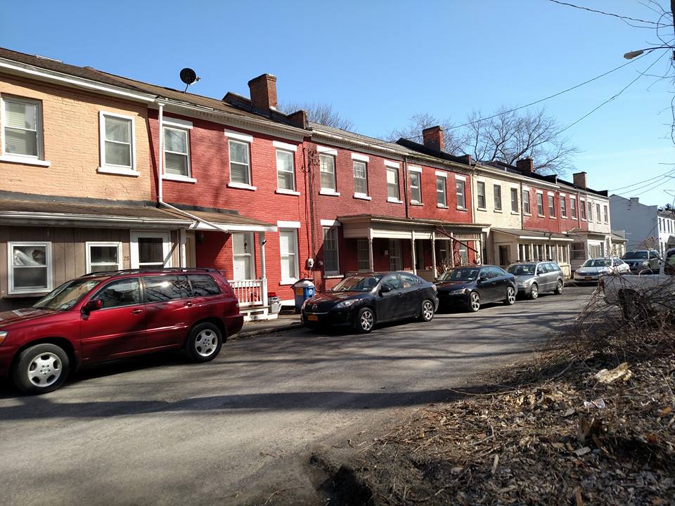
Brick Row Historic District
Monument and historic site · National Register of Historic Places · 2.2 mi
Historic district in New York, United States

Cornelius H. Evans House
Monument and historic site · National Register of Historic Places · 3.3 mi
Brick house built in mid-19th century located in Hudson, New York

Elisha Williams House
Monument and historic site · National Register of Historic Places · 3.3 mi
Historic house in Hudson, New York, United States

Henry A. and Evanlina Dubois House
Monument and historic site · National Register of Historic Places · 3.9 mi
Historic house in New York, United States

Houses at 37–47 North Fifth Street
Monument and historic site · National Register of Historic Places · 3.2 mi
Historic house

Hudson Almshouse
Monument and historic site · National Register of Historic Places · 3.1 mi
Poorhouse in Hudson, New York

Hudson Historic District
Monument and historic site · National Register of Historic Places · 3.3 mi
Historic district in Hudson, New York
Hudson–Athens lighthouse
Lighthouse · National Register of Historic Places · 3.8 mi
Lighthouse in New York, United States

Jan Van Hoesen House
Monument and historic site · National Register of Historic Places · 2.6 mi
Historic house in New York, United States

Oliver Bronson House
Monument and historic site · National Register of Historic Places · 3.7 mi
Hudson, NY, a U.S. National Historic Landmark, also known as Dr. Oliver Bronson House and Stables
8 more on the map.
Parks, trails and playgrounds8


Restaurants and cafes4




Where to stay1
Churches and places of worship9
Church of St. John the Evangelist
Church · National Register of Historic Places · 1.2 mi
Zion Lutheran Church
Church · National Register of Historic Places · 2.9 mi
Pentecostal Gospel Lighthouse
Church · Pentecostal · 1.1 mi
2885 Atlantic Avenue, Hudson
Calvary Assembly of God Church
Church · Pentecostal · 0.9 mi
2813 Atlantic Avenue, Hudson
Sacred Heart Lady Mt Carmel
Church · Catholic · 1.0 mi
442 Fairview Avenue, Hudson
Saint Joseph Catholic Church
Church · Roman Catholic · 1.0 mi
2826 Atlantic Avenue, Hudson
Trinity United Methodist Church
Church · Methodist · 0.9 mi
555 Joslen Boulevard, Hudson
Shopping5
Gas and EV charging1
Schools, colleges and libraries9
Montgomery C Smith Elementary School
School · 2.7 mi
102 Harry Howard Ave, Hudson
Map of Stottville
58 places. The map loads OpenStreetMap tiles when you open it.
Climate by month
Monthly table
| Month | High | Low | Rain | Snow |
|---|---|---|---|---|
| Jan | 35°F | 18°F | 2.7 in | 8.2 in |
| Feb | 38°F | 19°F | 2.6 in | 8.5 in |
| Mar | 48°F | 28°F | 3.3 in | 4.4 in |
| Apr | 63°F | 38°F | 3.6 in | 0.3 in |
| May | 74°F | 49°F | 3.5 in | 0.0 in |
| Jun | 81°F | 58°F | 5.0 in | 0.0 in |
| Jul | 85°F | 62°F | 3.9 in | 0.0 in |
| Aug | 83°F | 61°F | 4.5 in | 0.0 in |
| Sep | 75°F | 54°F | 4.3 in | 0.0 in |
| Oct | 64°F | 43°F | 4.2 in | 0.0 in |
| Nov | 51°F | 33°F | 3.0 in | 0.5 in |
| Dec | 40°F | 25°F | 3.6 in | 9.1 in |
U.S. Climate Normals 1991-2020 for Hudson Correctional Facility (4 mi away), NOAA NCEI.
People and cost of living
American Community Survey 5-year estimates, 2020-2024, U.S. Census Bureau. Estimates have margins of error, larger for small towns.
Disaster history
Columbia County has had 22 federal disaster declarations since 2000, most often for severe storms.
- 2021-08-22: Hurricane Henri (Hurricane)
- 2020-03-20: Covid-19 Pandemic (Biological)
- 2020-03-13: Covid-19 (Biological)
- 2017-07-12: Severe Winter Storm And Snowstorm (Snowstorm)
- 2012-10-28: Hurricane Sandy (Hurricane)
- 2011-08-31: Hurricane Irene (Hurricane)
OpenFEMA disaster declarations summaries.
Getting there and nearby towns
Great Barrington Airport (GBR) is the nearest airport with scheduled flights listed in OpenStreetMap, 20 miles away.
- Lorenz Park 2 mi southwest, about 3 min by car
- Sleepy Hollow Lake 3 mi west, about 4 min by car
- Athens 3 mi southwest, about 5 min by car
- Philmont 7 mi southeast, about 11 min by car
- Jefferson Heights 7 mi southwest, about 12 min by car
- Kinderhook 8 mi northeast, about 12 min by car
- Chatham 9 mi northeast, about 15 min by car
- Niverville 12 mi northeast, about 20 min by car
- Cairo 13 mi west, about 21 min by car
- Germantown 13 mi southwest, about 20 min by car
Drive times are estimates from straight-line distance, not routes.
Local news
Headlines from INDB, the NEMICO news database.
Reviews, tips and questions
Loading what members have shared...
Sources and licences
- NCES EDGE (Public domain): public schools
- NOAA NCEI U.S. Climate Normals 1991-2020 (Public domain): climate by month
- OpenFEMA (Public domain): disaster declarations
- OpenStreetMap contributors (ODbL 1.0): places, airports, map data
- U.S. Census Bureau (Public domain): population, income, housing, education, commute
- Wikidata (CC0 1.0): elevation, founding date, time zone, website, landmarks and historic places
- Wikimedia Commons (see each image): photos
- Wikipedia (CC BY-SA 4.0): overview and history text
Photo credits
- Elisha Williams House, Hudson, NY, Daniel Case, CC BY-SA 3.0
- Church of St. John the Evangelist Stockport NY Jan 11, Doug Kerr from Albany, New York, United States, CC BY-SA 2.0
- Hudson-Athens 2006, User:Kadin2048, CC BY-SA 2.5
- Hudson Almshouse, HunnySWeaver, CC BY-SA 3.0
- Zion Lutheran Chutch 6-25-2016, RobertDrake2015, CC BY-SA 3.0
- Houses on Prospect Street, Hudson, NY, Daniel Case, CC BY-SA 3.0
- Stranahan-DelVecchio House 6-25-2016, RobertDrake2015, CC BY-SA 3.0
- VanHoesenHouse 1, Rickster77, Public domain
- Houses at 37-47 North Fifth Street, Hudson, NY, Daniel Case, CC BY-SA 3.0
- Athens Lower Village Historic District-Public Library May 11, Doug Kerr from Albany, New York, United States, CC BY-SA 2.0
- Brick Row Historic District - Athens NY 02, Peter Greenberg, CC BY-SA 4.0
- Cornelius Evans House, Hudson, NY, Daniel Case, CC BY-SA 3.0
- Dr. Oliver Bronson House and Estate, Lvklock, CC BY-SA 3.0
- South Bay Mill 3, Lvklock, CC BY-SA 4.0
- Henry A. and Evanlina Dubois House, Lvklock, CC BY-SA 3.0
- Albertus Van Loon House - 02, Basvb, CC BY-SA 3.0
- Hudson, NY, post office, Daniel Case, CC BY-SA 3.0
- Warren Street west view, Hudson, NY, Daniel Case, CC BY-SA 3.0
- Columbia Turnpike-West Tollhouse, HunnySWeaver, CC BY-SA 4.0
- Stockport Flats as seen from a passing Amtrak train, Stockport, New York - 20220615, Andre Carrotflower, CC BY-SA 4.0
- Trees of Columbia County, NY (51282407593), яіску ѕнояе, CC BY 2.0
- Tree house - Columbia County, NY (51281489332), яіску ѕнояе, CC BY 2.0
- Lowes Parking Lot - panoramio, ndecker, CC BY 3.0
- Chinook over greenport - panoramio, ndecker, CC BY 3.0
- Alpha Kappa Psi, Pip Nosher, CC0
- Brick Row Historic District 6-25-2-16 Color, RobertDrake2015, CC BY-SA 3.0


Page built October 30, 2026. Spotted a mistake? Tell us or suggest a place.