


Niverville, New York
Niverville is a community of 1,181 people in Columbia County, New York.
Why visit Niverville
Townapedia lists 7 museums and landmarks and 1 park or trail in and around town.
Highlights include Henry Tunis Smith Farm and James G. Van Valkenburgh House.
July is the warmest month, with average highs of 84°F; January lows average 16°F.
Weather in Niverville
Forecast from the National Weather Service. Full forecast
About Niverville
Niverville is a semi-rural hamlet and census-designated place (CDP) in northern Columbia County, New York, United States. The hamlet of Niverville is located in the town of Kinderhook, south of Kinderhook Lake. The Niverville CDP includes the hamlet as well as all of the land surrounding Kinderhook Lake, extending east into the town of Chatham. The population of the CDP was 1,508 at the 2020 census.
From the Wikipedia article Niverville, New York (this version), under CC BY-SA 4.0.
Museums and landmarks7

Henry Tunis Smith Farm
Monument and historic site · National Register of Historic Places · 3.4 mi
Historic house in New York, United States
James G. Van Valkenburgh House
Monument and historic site · National Register of Historic Places · 2.8 mi
Historic house in New York, United States
John S. Williams House and Farm
Monument and historic site · National Register of Historic Places · 3.3 mi
Chatham, New York, NRHP-listed
Nathan Wild House
Monument and historic site · National Register of Historic Places · 2.9 mi
Historic house in New York, United States

Peck House
Monument and historic site · National Register of Historic Places · 1.9 mi
Listed on the NRHP in Columbia County

Spengler Bridge
Bridge · National Register of Historic Places · 2.8 mi
Bridge in United States of America
Wild's Mill Complex
Monument and historic site · National Register of Historic Places · 3.0 mi
Historic buildings in Valatie, New York, United States
Parks, trails and playgrounds1

Churches and places of worship2


First Presbyterian Church
Church · National Register of Historic Places · 2.7 mi
Church in Valatie, New York

North Chatham United Methodist Church
Church · Methodist · 1.9 mi
4274 State Highway 203, North Chatham
Gas and EV charging1

History
Niverville was first settled by the Dutch; the first house was built circa 1707 by Louren Lourenson Van Alen, who obtained the Kinderhoeck Patent—a land grant—in 1629 from Jan Hendrickse DeBruyn, including the area now known as Niverville. Located within the hamlet, Kinderhook Lake—originally called Wogasawoochuk or "Big Fish Lake" by the Mohican early Native American inhabitants—provided fertile, peat-rich soil that supported numerous orchards and farms.
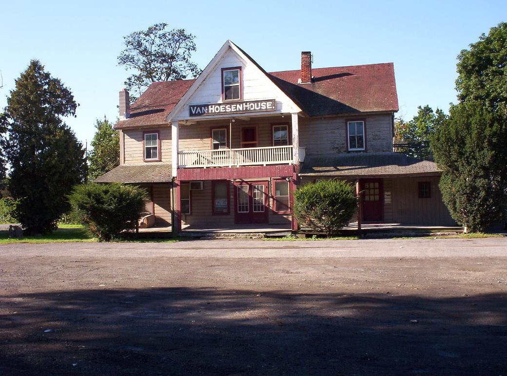
The Niver cousins—John Niver and John M. Niver—emigrated to the area from Germany in the early nineteenth century. They built the first gristmill for rye flour; their prosperity built the Niver mansion just across the bridge along County Route 28 in 1848. The hamlet was ultimately named "Niverville" after the prosperous Nivers, although it was long known as Kinderhook Station, after its Boston and Albany Railroad, and Kinderhook and Hudson Railroad turntable, built in 1841. The railroad restaurant known as the Van Hoesen House (not to be confused with the Jan Van Hoesen House some 20 miles south in Claverack) has since become the Niverville Pub.
In 1846, the Niverville Post Office was established with less than twenty business and residential addresses. Niverville's first park—Kinderhook Lake Park, aka The Old Park—was established in 1870 as a picnic and meeting place.
From the History section of Niverville, New York on Wikipedia, under CC BY-SA 4.0.
Schools, colleges and libraries4
Map of Niverville
15 places. The map loads OpenStreetMap tiles when you open it.
Climate by month
Monthly table
| Month | High | Low | Rain |
|---|---|---|---|
| Jan | 34°F | 16°F | 2.2 in |
| Feb | 37°F | 18°F | 2.2 in |
| Mar | 45°F | 27°F | 2.9 in |
| Apr | 59°F | 37°F | 3.3 in |
| May | 71°F | 48°F | 3.8 in |
| Jun | 79°F | 58°F | 4.5 in |
| Jul | 84°F | 62°F | 3.8 in |
| Aug | 82°F | 60°F | 4.4 in |
| Sep | 75°F | 52°F | 4.6 in |
| Oct | 62°F | 41°F | 4.3 in |
| Nov | 50°F | 32°F | 3.2 in |
| Dec | 39°F | 23°F | 2.9 in |
U.S. Climate Normals 1991-2020 for Valatie 1 N (2 mi away), NOAA NCEI.
People and cost of living
American Community Survey 5-year estimates, 2020-2024, U.S. Census Bureau. Estimates have margins of error, larger for small towns.
Disaster history
Columbia County has had 22 federal disaster declarations since 2000, most often for severe storms.
- 2021-08-22: Hurricane Henri (Hurricane)
- 2020-03-20: Covid-19 Pandemic (Biological)
- 2020-03-13: Covid-19 (Biological)
- 2017-07-12: Severe Winter Storm And Snowstorm (Snowstorm)
- 2012-10-28: Hurricane Sandy (Hurricane)
- 2011-08-31: Hurricane Irene (Hurricane)
OpenFEMA disaster declarations summaries.
Getting there and nearby towns
Pittsfield Municipal Airport (PSF) is the nearest airport with scheduled flights listed in OpenStreetMap, 18 miles away.
- Kinderhook 5 mi southwest, about 8 min by car
- Nassau 5 mi northeast, about 8 min by car
- Chatham 7 mi south, about 11 min by car
- Castleton-on-Hudson 8 mi northwest, about 13 min by car
- Lorenz Park 14 mi southwest, about 23 min by car
- Averill Park 14 mi north, about 23 min by car
- Athens 15 mi southwest, about 24 min by car
- Albany 17 mi northwest, about 27 min by car
- Troy 20 mi north, about 32 min by car
- Pittsfield 20 mi east, about 32 min by car
Drive times are estimates from straight-line distance, not routes.
Local news
Headlines from INDB, the NEMICO news database.
Reviews, tips and questions
Loading what members have shared...
Sources and licences
- NCES EDGE (Public domain): public schools
- NOAA NCEI U.S. Climate Normals 1991-2020 (Public domain): climate by month
- OpenFEMA (Public domain): disaster declarations
- OpenStreetMap contributors (ODbL 1.0): places, airports, map data
- U.S. Census Bureau (Public domain): population, income, housing, education, commute
- Wikidata (CC0 1.0): elevation, founding date, time zone, website, landmarks and historic places
- Wikimedia Commons (see each image): photos
- Wikipedia (CC BY-SA 4.0): overview and history text
Photo credits
- Van Hoesen House, Niverville, NY, Tpjets62, Public domain
- Spangler Bridge Old Chatham, NY, rossograph, CC BY-SA 4.0
- First Presbyterian Church Valatie NY Feb 11, Doug Kerr from Albany, New York, United States, CC BY-SA 2.0
- Peck House in North Chatham NY, UtsukushiHikariNY, CC BY-SA 4.0
Page built October 30, 2026. Spotted a mistake? Tell us or suggest a place.