


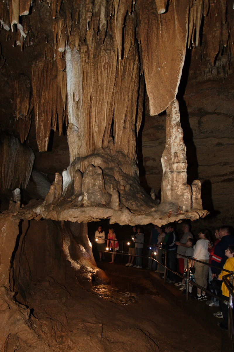


Why visit Sullivan
Townapedia lists 1 museum or landmark, 3 parks and trails, 20 places to eat, 6 places to stay and 3 attractions in and around town.
Highlights include Meramec Caverns, Meramec State Park and Maj. Gen. William S. Harney Summer Home.
July is the warmest month, with average highs of 88°F; January lows average 19°F.
Weather in Sullivan
Forecast from the National Weather Service. Full forecast
About Sullivan
Sullivan is a city that straddles the border of Franklin and Crawford counties in the U.S. state of Missouri. The population was 6,906 at the 2020 census.
From the Wikipedia article Sullivan, Missouri (this version), under CC BY-SA 4.0.
Things to do3

Meramec State Park
Monument and historic site · 3.4 mi
State park in Missouri, USA

Museums and landmarks1
Maj. Gen. William S. Harney Summer Home
Monument and historic site · National Register of Historic Places · 0.6 mi
Historic house in Missouri, United States
Parks, trails and playgrounds3

Restaurants and cafes20


Pizza Hut
Restaurant · Pizza
100 South Service Road West, Sullivan



Domino's
Fast food · Pizza · 0.4 mi
121 North Service Road, Sullivan
Mo-Th 10:30-23:00; Fr-Sa 10:30-24:00; Su 10:30-23:00
Subway
Fast food · Sandwich · 0.6 mi
166 South Service Road East, Sullivan
Mo-Th 07:00-21:00; Fr 07:00-22:00; Sa 07:00-21:00; Su 09:00-21:00
8 more on the map.
History
On January 28, 1839, 120 acres were conveyed by the U.S. Government to Garretson (also spelled Garrison) P. Hardy. Purchased according to provisions of the Act of Congress for the sale of public lands (dated April 1820). Then in June 1848, Garretson sold the acreage to William & Mary Smith for $150. In June 1856, Stephen & Dorcas Sullivan purchased the acreage, plus an additional 49 acres from Smith for the sum of $400. This was the future site of the original town. On July 25, 1856, when a post office was established in present-day Sullivan, the local postmaster named the place "Mount Helicon". This short-lived name was after an actual mountain in Greece that was the mythical sanctuary of the Muses. In 1859, Stephen Sullivan donated ground for railroad right-of-way and built the depot himself. The railroad named the station “Sullivan” prompting the post office to change to Sullivan.
Between 1920 and 1960, the city grew from 900 to more than 4,000 residents, making Sullivan the second fastest-growing city in the state during that time.
The Maj. Gen. William S. Harney Summer Home was listed on the National Register of Historic Places in 1984.
From the History section of Sullivan, Missouri on Wikipedia, under CC BY-SA 4.0.
Where to stay6
Americas Best Value Inn Sullivan
Motel and hotel · 0.4 mi
307 North Service Road West, Sullivan
Shopping3
Gas and EV charging4
Schools, colleges and libraries6
Healthcare1
Map of Sullivan
47 places. The map loads OpenStreetMap tiles when you open it.
Climate by month
Monthly table
| Month | High | Low | Rain | Snow |
|---|---|---|---|---|
| Jan | 42°F | 19°F | 2.7 in | 2.2 in |
| Feb | 48°F | 21°F | 2.5 in | 2.1 in |
| Mar | 57°F | 29°F | 3.7 in | 1.3 in |
| Apr | 69°F | 39°F | 5.1 in | 0.0 in |
| May | 77°F | 50°F | 5.2 in | 0.0 in |
| Jun | 84°F | 58°F | 4.3 in | 0.0 in |
| Jul | 88°F | 63°F | 4.0 in | 0.0 in |
| Aug | 87°F | 60°F | 3.5 in | 0.0 in |
| Sep | 79°F | 51°F | 3.5 in | 0.0 in |
| Oct | 70°F | 39°F | 3.3 in | 0.0 in |
| Nov | 56°F | 29°F | 3.6 in | 0.3 in |
| Dec | 46°F | 22°F | 2.4 in | 2.2 in |
U.S. Climate Normals 1991-2020 for Steelville 2 N (18 mi away), rain and snow from Sullivan, NOAA NCEI.
People and cost of living
American Community Survey 5-year estimates, 2020-2024, U.S. Census Bureau. Estimates have margins of error, larger for small towns.
Disaster history
Crawford County has had 21 federal disaster declarations since 2000, most often for severe storms.
- 2026-09-01: Severe Storms, Straight-Line Winds, And Flooding (Severe Storm)
- 2025-01-01: Severe Storms, Tornadoes, Straight-Line Winds, And Flooding (Severe Storm)
- 2023-09-21: Severe Storms, Straight-Line Winds, Tornadoes, And Flooding (Severe Storm)
- 2020-03-26: Covid-19 Pandemic (Biological)
- 2020-03-13: Covid-19 (Biological)
- 2017-06-02: Severe Storms, Tornadoes, Straight-Line Winds And Flooding (Flood)
OpenFEMA disaster declarations summaries.
Getting there and nearby towns
Rolla National Airport (VIH) is the nearest airport with scheduled flights listed in OpenStreetMap, 34 miles away.
- Bourbon 6 mi southwest, about 10 min by car
- St. Clair 13 mi northeast, about 21 min by car
- Cuba 17 mi southwest, about 27 min by car
- Union 18 mi northeast, about 29 min by car
- Owensville 20 mi northwest, about 33 min by car
- Steelville 20 mi southwest, about 32 min by car
- Villa Ridge 23 mi northeast, about 37 min by car
- Washington 25 mi north, about 40 min by car
- Gray Summit 27 mi northeast, about 43 min by car
- New Haven 27 mi north, about 44 min by car
Drive times are estimates from straight-line distance, not routes.
Local news
Headlines from INDB, the NEMICO news database.
Reviews, tips and questions
Loading what members have shared...
Sources and licences
- NCES EDGE (Public domain): public schools
- NOAA NCEI U.S. Climate Normals 1991-2020 (Public domain): climate by month
- OpenFEMA (Public domain): disaster declarations
- OpenStreetMap contributors (ODbL 1.0): places, airports, map data
- U.S. Census Bureau (Public domain): population, income, housing, education, commute
- Wikidata (CC0 1.0): elevation, founding date, time zone, website, landmarks and historic places
- Wikimedia Commons (see each image): photos
- Wikipedia (CC BY-SA 4.0): overview and history text
Photo credits
- International Shoe Company Building in Sullivan, TCP04, CC BY 4.0
- Sullivan, Missouri, TCP04, CC BY 4.0
- Gen. William Harney house in Sullivan, MO, fafinney, CC BY-SA 4.0
- Fisher Cave Stalactiflat, Rklawton, CC BY-SA 2.5
- Shamrock Court Full Perspective View, Martin Casagrand, CC BY-SA 4.0
- Perspective with Stonework Detail, Martin Casagrand, CC BY-SA 4.0
- Main Office-Shamrock, Martin Casagrand, CC BY-SA 4.0

Page built October 30, 2026. Spotted a mistake? Tell us or suggest a place.