
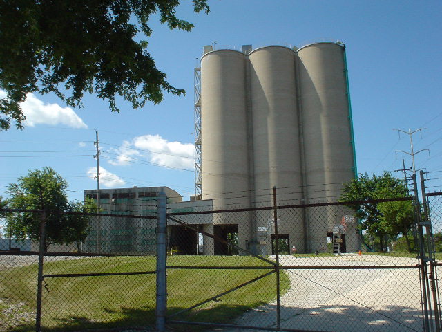


Summit, Illinois
Summit is a village of 10,846 people in Cook County, Illinois, founded in 1890.
Why visit Summit
Townapedia lists 13 museums and landmarks, 15 parks and trails, 43 places to eat, 2 places to stay and 1 attraction in and around town.
Highlights include Chicago Portage National Historic Site, Arcade Building, Normandy Park and Stars & Stripes Park.
July is the warmest month, with average highs of 85°F; January lows average 19°F.
Weather in Summit
Forecast from the National Weather Service. Full forecast
About Summit
Summit is a city in Cook County, Illinois, United States. The population was 11,161 at the 2020 census. The name Summit, in use since 1836, refers to the highest point on the Chicago Portage between the northeast-flowing Chicago River and the southwest-flowing Des Plaines River located just north of the city.
From the Wikipedia article Summit, Illinois (this version), under CC BY-SA 4.0.
Things to do1

Museums and landmarks13

Chicago Portage National Historic Site
Monument and historic site · National Register of Historic Places · 1.2 mi
Historic site in Lyons, Illinois
4800 South Harlem Avenue, Lyons

Arcade Building
Monument and historic site · National Register of Historic Places · 2.7 mi
Historic building in Riverside, Illinois, United States

Arthur J. Dunham House
Monument and historic site · National Register of Historic Places · 3.3 mi
Historic house in Berwyn, Illinois

Benda House
Monument and historic site · National Register of Historic Places · 3.5 mi
Historic house in Illinois, United States

Coonley House
Monument and historic site · National Register of Historic Places · 2.3 mi
United States national historic place

F. F. Tomek House
Monument and historic site · National Register of Historic Places · 3.0 mi
Historic house in Illinois, United States

Grossdale Station
Monument and historic site · National Register of Historic Places · 2.8 mi
Historic railway station in Brookfield, Illinois, United States

La Grange Village Hall
Monument and historic site · National Register of Historic Places · 3.3 mi
Building in Illinois, United States

La Grange Village Historic District
Monument and historic site · National Register of Historic Places · 3.4 mi
Historic district in Illinois, United States

Mr. Robert Silhan House
Monument and historic site · National Register of Historic Places · 3.0 mi
Historic house in Illinois, United States

Riverside Historic District
Monument and historic site · National Register of Historic Places · 3.0 mi
Historic district in Riverside, Illinois

Hofmann Tower
Monument and historic site · National Register of Historic Places · 2.2 mi
1 more on the map.
Parks, trails and playgrounds15




3 more on the map.
Restaurants and cafes43


Healthy Substance
Restaurant · Mexican · 1.1 mi
6852 West Archer Avenue, Chicago
Mo-Sa 11:30-20:00; Su 11:30-18:00



A Cup of Joe
Cafe · Coffee Shop · 1.1 mi
6806 West Archer Avenue, Chicago
Ash GastroPub
Restaurant · 1.1 mi
6822 West Archer Avenue, Chicago
La Cabaña Restaurant
Restaurant · Mexican · 1.1 mi
6312 South Harlem Avenue, Summit
Tom’s Tap
Bar and pub · 1.3 mi
6707 West Archer Avenue, Chicago
31 more on the map.
History
The area around Summit has been hunted and traveled through for 12,000 years but only continuously occupied since 900 CE. When Europeans first arrived the area was inhabited or used by the Meskwaki, Illini, Miami, Sauk, and Chippewa-Ottawa-Potawatomi tribes.
In 1673, the Marquette-Joliet expedition arrived at the portage north of the city and went on to the location of Chicago. At that time the importance of a portage was noted. A local trading network developed from that time until the Native Americans were removed beginning in 1816.
Surveyed in 1821, land was for sale by the Illinois and Michigan Canal Commission nine years later. There may have been a tavern at "Summit Ford" in 1832, but by 1835, there was a sub-divided settlement with a tavern, blacksmith shop, and stagecoach stop. "Summit Corners" was where westbound Archer Ave. turned south and Lyons-Summit Rd. (now approximately Lawndale Ave.) went west. Chicago politician "Long John" Wentworth bought much of the surrounding area and used it for farming.
Between 1836 and 1848, the Illinois and Michigan Canal was built through the subdivision. Most of the canal workers were Irish laborers and many were able to buy property with their canal script pay.
From the History section of Summit, Illinois on Wikipedia, under CC BY-SA 4.0.
Where to stay2
Churches and places of worship17
Emmanuel Episcopal Church
Church · National Register of Historic Places · 3.5 mi
Garfield Ridge Baptist Church
Church · Baptist · 1.6 mi
5520 South Narragansett Avenue
Iglesia Cristiana Del Nazareno
Church · Nazarene · 0.9 mi
741 63rd Street, Summit
New Hope Missionary Baptist Church
Church · Baptist · 0.9 mi
7240 62nd Street, Summit
Saint Daniel the Prophet Roman Catholic Church
Church · Catholic · 1.4 mi
6600-6612 West 54th Street, Chicago
Saint Matthew African Methodist Episcopal Church
Church · African Methodist Episcopal · 1.1 mi
64th Place, Summit
Saint Rene Roman Catholic Church
Church · Catholic · 1.3 mi
6928-6938 West 64th Street, Chicago
Shopping4
Gas and EV charging13
Schools, colleges and libraries56
Graves Elementary & Heritage Middle Schools
School · 0.6 mi
6021 74th Avenue, Summit
Walker Elementary School
School · 1.3 mi
7735 66th Place, Bedford Park
Healthcare4
MacNeal Healt Care Center
Clinic and pharmacy · 1.3 mi
6649-6653 West Archer Avenue
Nordica Medical Center
Clinic and pharmacy · 0.9 mi
7017 West Archer Avenue, Chicago
Map of Summit
168 places. The map loads OpenStreetMap tiles when you open it.
Climate by month
Monthly table
| Month | High | Low | Rain |
|---|---|---|---|
| Jan | 33°F | 19°F | 1.5 in |
| Feb | 37°F | 23°F | 1.5 in |
| Mar | 48°F | 32°F | 1.9 in |
| Apr | 60°F | 41°F | 3.6 in |
| May | 71°F | 52°F | 4.1 in |
| Jun | 81°F | 62°F | 4.0 in |
| Jul | 85°F | 68°F | 3.5 in |
| Aug | 83°F | 66°F | 4.0 in |
| Sep | 76°F | 59°F | 2.8 in |
| Oct | 63°F | 46°F | 3.5 in |
| Nov | 49°F | 35°F | 2.4 in |
| Dec | 38°F | 25°F | 1.8 in |
U.S. Climate Normals 1991-2020 for Chicago Midway Ap 72534 (3 mi away), NOAA NCEI.
People and cost of living
American Community Survey 5-year estimates, 2020-2024, U.S. Census Bureau. Estimates have margins of error, larger for small towns.
Disaster history
Cook County has had 12 federal disaster declarations since 2000, most often for severe storms.
- 2024-09-20: Severe Storms, Tornadoes, Straight-Line Winds, And Floodng (Flood)
- 2023-11-20: Severe Storms And Flooding (Flood)
- 2023-08-15: Severe Storms And Flooding (Severe Storm)
- 2020-03-26: Covid-19 Pandemic (Biological)
- 2020-03-13: Covid-19 (Biological)
- 2013-05-10: Severe Storms, Straight-Line Winds, And Flooding (Flood)
OpenFEMA disaster declarations summaries.
Getting there and nearby towns
Chicago Midway International Airport (MDW) is the nearest airport with scheduled flights listed in OpenStreetMap, 3 miles away.
- Lyons 2 mi north, about 3 min by car
- Justice 3 mi south, about 4 min by car
- Brookfield 3 mi northwest, about 5 min by car
- La Grange 3 mi west, about 5 min by car
- Bridgeview 3 mi south, about 5 min by car
- Berwyn 4 mi north, about 6 min by car
- Burbank 4 mi southeast, about 6 min by car
- La Grange Park 4 mi northwest, about 7 min by car
- Hickory Hills 4 mi south, about 7 min by car
- Cicero 5 mi northeast, about 8 min by car
Drive times are estimates from straight-line distance, not routes.
Local news
Headlines from INDB, the NEMICO news database.
Reviews, tips and questions
Loading what members have shared...
Sources and licences
- NCES EDGE (Public domain): public schools
- NOAA NCEI U.S. Climate Normals 1991-2020 (Public domain): climate by month
- OpenFEMA (Public domain): disaster declarations
- OpenStreetMap contributors (ODbL 1.0): places, airports, map data
- U.S. Census Bureau (Public domain): population, income, housing, education, commute
- Wikidata (CC0 1.0): elevation, founding date, time zone, website, landmarks and historic places
- Wikimedia Commons (see each image): photos
- Wikipedia (CC BY-SA 4.0): overview and history text
Photo credits
- Cement silo - panoramio, vx700, CC BY 3.0
- Chicago Portage National Historic Site, Zol87 from Chicago, IL, USA, CC BY-SA 4.0
- Arcade Building in 2011, partway through restoration - Riverside, IL, David Wilson from Oak Park, Illinois, USA, Public domain
- OldBrookfieldStation, Teemu08 at en.wikipedia, CC BY-SA 3.0
- LaGrange Village Hall exterior 02, MrHarman, CC BY 3.0
- Arthur J. Dunham House, Berwyn, IL, ChicagoGeek, CC BY-SA 2.0
- Coonley House, Riverside, Illinois 2013 04, davidwilson1949, CC BY 2.0
- Emmanuel Episcopal Church (LaGrange, Illinois), Jim Roberts, CC BY-SA 4.0
- Mr. Robert Silhan House, Zol87 from Chicago, IL, USA, CC BY-SA 4.0
- Benda House, Danfulwiler, CC BY-SA 4.0
- LaGrangeHD, Teemu08 at en.wikipedia, CC BY-SA 3.0
- TomekHouse, Teemu08 at en.wikipedia, CC BY-SA 3.0
- Photocopy of photograph, plate -117 TERRACE FRONT - Avery Coonley House, 300 Scottswood Road, 281 Bloomingbank Road, Riverside, Cook County, IL, Unknown author, Public domain
- HofmannTower, Teemu08 at en.wikipedia, CC BY-SA 3.0
- Brookfield zoo 0235, Ronincmc, CC BY-SA 4.0

Page built October 30, 2026. Spotted a mistake? Tell us or suggest a place.