


Summit, New Jersey
Summit is a city of 22,705 people in Union County, New Jersey, founded in 1710.
Why visit Summit
Townapedia lists 33 museums and landmarks, 34 parks and trails, 95 places to eat, 4 places to stay and 3 attractions in and around town.
Highlights include Bowcraft Amusement Park, Paper Mill Playhouse, Reeves-Reed Arboretum and Summit Playhouse.
July is the warmest month, with average highs of 86°F; January lows average 22°F, and about 24 inches of snow fall in a normal year.
Weather in Summit
Forecast from the National Weather Service. Full forecast
About Summit
Summit is the northernmost city of Union County, in the U.S. state of New Jersey, located within the New York metropolitan area. Situated on a ridge in northern–central New Jersey, the city is located within the Raritan Valley and Rahway Valley regions, and also borders both Essex and Morris counties in the Passaic Valley region. Summit is a commercial hub and commuter town for New York City. As of the 2020 United States census, the city's population was 22,719, an increase of 1,262 (+5.9%) from the 2010 census count of 21,457, which in turn reflected an increase of 326 (+1.5%) from the 21,131 counted in the 2000 census.
From the Wikipedia article Summit, New Jersey (this version), under CC BY-SA 4.0.
Things to do3

Bowcraft Amusement Park
Monument and historic site · 3.7 mi
Amusement park in New Jersey, United States

Paper Mill Playhouse
Cinema and theater · 3.0 mi
Theater in Millburn, New Jersey
Museums and landmarks33

Reeves-Reed Arboretum
Monument and historic site · National Register of Historic Places · 1.2 mi
Arboretum and garden in Summit, New Jersey, United States
Summit Playhouse
Cinema and theater · National Register of Historic Places
Theater in Summit, New Jersey, originally built as a library
Baltusrol Golf Club
Monument and historic site · National Register of Historic Places · 2.1 mi
Golf course in New Jersey, USA

Deacon Andrew Hetfield House
Monument and historic site · National Register of Historic Places · 3.0 mi
Historic house in New Jersey, United States

Dusenberry House
Monument and historic site · National Register of Historic Places · 1.9 mi
Historic house in New Jersey, United States

Feltville Historic District
Monument and historic site · National Register of Historic Places · 2.6 mi
Human settlement in New Jersey, United States of America

Hutchings Homestead
Monument and historic site · National Register of Historic Places · 3.0 mi
Building in New Jersey, United States

Madison
Monument and historic site · National Register of Historic Places · 3.9 mi
New Jersey Transit station in Madison, Morris County, New Jersey, United States

Madison Civic Commercial District
Monument and historic site · National Register of Historic Places · 4.0 mi
Historic district in New Jersey, United States

Miller-Cory House
Monument and historic site · National Register of Historic Places · 3.7 mi
Historic house in New Jersey, United States
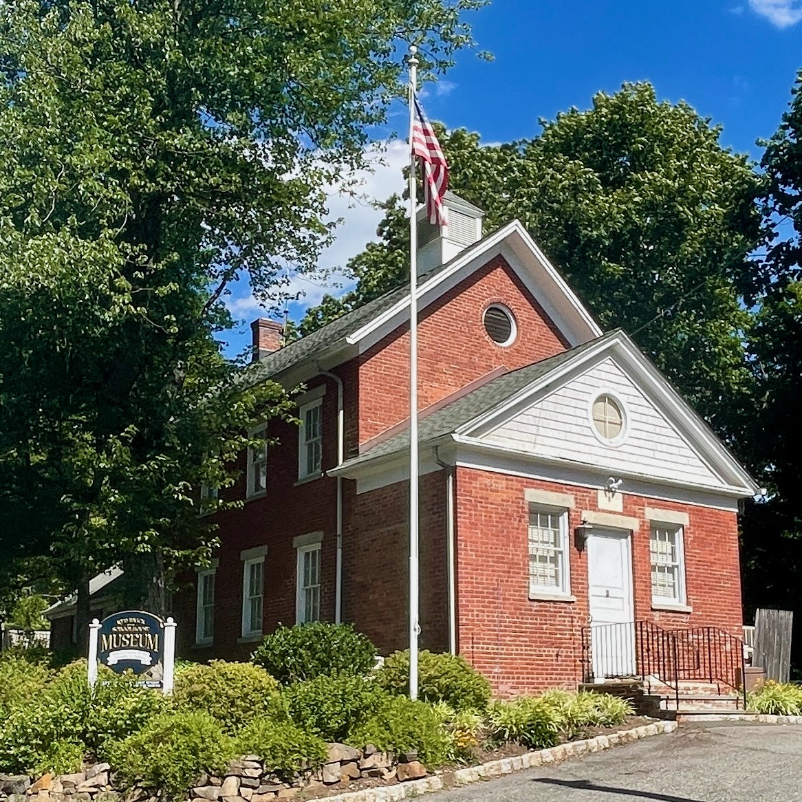
Mount Vernon School
Monument and historic site · National Register of Historic Places · 2.1 mi
Historic building in Morris County, New Jersey


Murray Hill
Monument and historic site · National Register of Historic Places · 2.5 mi
NJ Transit rail station
21 more on the map.
Parks, trails and playgrounds34


22 more on the map.
Restaurants and cafes95


Pizza Vita
Restaurant · Pizza · 0.4 mi
Pizza Vita in Summit, NJ, serves award-winning Neapolitan pizza and authentic Italian dishes. Enjoy crispy wood-fired pizzas, pasta,...
7 Union Palace, Summit
Mo-Sa 11:30-20:30; Su 11:30-20:00

Old Glory Restaurant
Restaurant · American, Polish · 2.2 mi
1259 Springfield Avenue, New Providence
Mo-Fr 06:00-21:00; Sa 08:00-21:00; Su 08:00-14:00


Magic Fountain
Ice cream · 0.8 mi
498 Morris Avenue, Summit
Mo-Th 12:00-22:00; Fr-Sa 12:00-22:30; Su 12:00-22:00

83 more on the map.
Where to stay4
Best Western Plus Murray Hill Inn and Suites
Motel and hotel · 2.3 mi
535 Central Avenue, New Providence
Churches and places of worship34
Madison Masonic Lodge
Church · National Register of Historic Places · 3.7 mi
Springfield Presbyterian Church
Church · National Register of Historic Places · 2.9 mi
Wallace Chapel AME Zion Church
Church · National Register of Historic Places · 1.1 mi
Shopping23
Gas and EV charging9
Schools, colleges and libraries65
Healthcare9
Map of Summit
250 places. The map loads OpenStreetMap tiles when you open it.
Climate by month
Monthly table
| Month | High | Low | Rain | Snow |
|---|---|---|---|---|
| Jan | 40°F | 22°F | 3.5 in | 5.8 in |
| Feb | 42°F | 23°F | 3.0 in | 8.4 in |
| Mar | 50°F | 31°F | 4.2 in | 4.6 in |
| Apr | 62°F | 40°F | 4.0 in | 0.4 in |
| May | 72°F | 50°F | 4.0 in | 0.0 in |
| Jun | 82°F | 60°F | 4.8 in | 0.0 in |
| Jul | 86°F | 66°F | 4.7 in | 0.0 in |
| Aug | 85°F | 64°F | 4.9 in | 0.0 in |
| Sep | 78°F | 56°F | 4.6 in | 0.0 in |
| Oct | 66°F | 44°F | 4.6 in | 0.0 in |
| Nov | 54°F | 35°F | 3.6 in | 0.7 in |
| Dec | 44°F | 28°F | 4.4 in | 4.1 in |
U.S. Climate Normals 1991-2020 for Canoe Brook (2 mi away), NOAA NCEI.
People and cost of living
American Community Survey 5-year estimates, 2020-2024, U.S. Census Bureau. Estimates have margins of error, larger for small towns.
Disaster history
Union County has had 18 federal disaster declarations since 2000, most often for hurricanes.
- 2021-09-05: Remnants Of Hurricane Ida (Hurricane)
- 2021-09-02: Remnants Of Hurricane Ida (Hurricane)
- 2020-03-25: Covid-19 Pandemic (Biological)
- 2020-03-13: Covid-19 (Biological)
- 2016-03-14: Severe Winter Storm And Snowstorm (Severe Storm)
- 2012-10-30: Hurricane Sandy (Hurricane)
OpenFEMA disaster declarations summaries.
Getting there and nearby towns
Morristown Municipal Airport (MMU) is the nearest airport with scheduled flights listed in OpenStreetMap, 6 miles away.
- New Providence 2 mi southwest, about 4 min by car
- Short Hills 3 mi northeast, about 4 min by car
- Madison 4 mi northwest, about 7 min by car
- Florham Park 4 mi north, about 7 min by car
- Roselle Park 6 mi southeast, about 10 min by car
- Roselle 7 mi southeast, about 11 min by car
- Plainfield 7 mi south, about 12 min by car
- North Plainfield 8 mi southwest, about 12 min by car
- Morristown 8 mi northwest, about 13 min by car
- East Orange 9 mi northeast, about 14 min by car
Drive times are estimates from straight-line distance, not routes.
Local news
Headlines from INDB, the NEMICO news database.
Reviews, tips and questions
Loading what members have shared...
Sources and licences
- NCES EDGE (Public domain): public schools
- NOAA NCEI U.S. Climate Normals 1991-2020 (Public domain): climate by month
- OpenFEMA (Public domain): disaster declarations
- OpenStreetMap contributors (ODbL 1.0): places, airports, map data
- U.S. Census Bureau (Public domain): population, income, housing, education, commute
- Wikidata (CC0 1.0): elevation, founding date, time zone, website, landmarks and historic places
- Wikimedia Commons (see each image): photos
- Wikipedia (CC BY-SA 4.0): overview and history text
Photo credits
- Summit skyline, Original uploader was Daniel Case at en.wikipedia, CC BY-SA 3.0
- Summit Playhouse jeh, Jim.henderson, Public domain
- Christ UCC ABC Summit jeh, Jim.henderson, CC0
- Rosary Shrine Summit jeh, Jim.henderson, CC0
- VZ rt 512 Summit jeh, Jim.henderson, CC0
- Theresa RCC Morris Av Summit jeh, Jim.henderson, Public domain
- 2018-06-21 10 12 21 View west along Union County Route 512 (Morris Avenue) at Locust Drive in Summit, Union County, New Jersey, Famartin, CC BY-SA 4.0
- Summit NJ Unitarian Church, Tomwsulcer, CC0
- Reeves-Reed Arboretum, Daniel Case, CC BY-SA 3.0
- Shady Rest Clubhouse, Scotch Plains, NJ, Zeete, CC BY-SA 4.0
- SHORT HILLS PARK HISTORIC DISTRICT, MILLBURN, ESSEX COUNTY, NJ, JERRYE & ROY KLOTZ, M.D., CC BY-SA 4.0
- Wallace Chapel AME Zion Church, Daniel Case, CC BY-SA 3.0
- Feltville NJ, Jared Kofsky/PlaceNJ.com, CC BY-SA 3.0
- Deacon Andrew Hetfield House, Mountainside, NJ, Josconklin, CC BY-SA 3.0
- Madison NJ Sayre House, Josconklin, CC BY-SA 3.0
- Downtown Summit, NJ, The original uploader was Daniel Case at English Wikipedia ., CC BY-SA 3.0
- Madison NJ train station, Leifern - Photography by Leif Knutsen, CC BY-SA 2.5
- Berkeley Heights, NJ, Nathaniel Smith House, Josconklin, CC BY-SA 3.0
- Murray Hill station, July 2010, Adam Moss, CC BY-SA 2.0
- Miller Cory NJ, Jared Kofsky/PlaceNJ.com, CC BY-SA 3.0
- Springfield, NJ, Presbyterian Church, Daniel Case, CC BY-SA 3.0
- Twin Maples, The original uploader was Daniel Case at English Wikipedia ., CC BY-SA 3.0
- Madison New Jersey downtown, Unknown author, CC BY-SA 2.5
- Mount Vernon School, Chatham Township, NJ, Zeete, CC BY-SA 4.0
- Dusenberry House, Chatham, NJ, Daniel Case, CC BY-SA 3.0
- Madison Masonic jeh, Jim.henderson, CC0
- HutchingsHomesteadSpringfield, KForce at English Wikipedia, CC BY-SA 3.0
- METC Madison library jeh, Jim.henderson, CC0
- Ralph Grishman, Sleepsong, CC BY-SA 4.0
- ABOedit2015-57, BrillLyle, CC0
- ABOedit2015-52, BrillLyle, CC0
- ABOedit2015-32, BrillLyle, CC0
- ABOedit2015-33, BrillLyle, CC0
- ABOedit2015-29, BrillLyle, CC0
- ABOedit2015-76, BrillLyle, CC0
- ABOedit2015-77, BrillLyle, CC0
- ABOedit2015-66, BrillLyle, CC0
- ABOedit2015-54, BrillLyle, CC0
- ABOedit2015-82, BrillLyle, CC0
- ABOedit2015-87, BrillLyle, CC0


Page built October 30, 2026. Spotted a mistake? Tell us or suggest a place.