


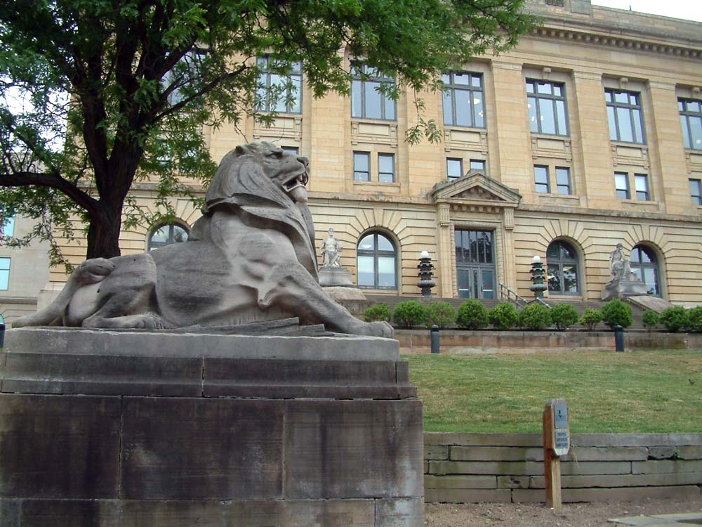


Tallmadge, Ohio
Tallmadge is a city of 18,335 people in Portage County, Ohio, founded in 1807.
Why visit Tallmadge
Townapedia lists 31 museums and landmarks, 45 parks and trails, 107 places to eat, 1 place to stay and 4 attractions in and around town.
Highlights include Linda Theatre, All-America Bridge, Aaron Ferrey House and Akron Fulton International Airport Administration Building.
July is the warmest month, with average highs of 82°F; January lows average 18°F.
Weather in Tallmadge
Forecast from the National Weather Service. Full forecast
About Tallmadge
Tallmadge is a city in eastern Summit County, Ohio, United States, with a small district in neighboring Portage County. It is a suburb of Akron and part of the Akron metropolitan area. The population was 18,394 at the 2020 census. Tallmadge was founded in 1807 and is the second-oldest city in Summit County, following Hudson, which was founded in 1799.
From the Wikipedia article Tallmadge, Ohio (this version), under CC BY-SA 4.0.
Things to do4


All-America Bridge
Bridge · 4.6 mi
Bridge in United States of America
Kent Stage
Cinema and theater · 4.8 mi
Theater and movie theater in Kent, Ohio, United States

Museums and landmarks31

Aaron Ferrey House
Monument and historic site · National Register of Historic Places · 3.4 mi
House in Kent, Ohio

Akron Fulton International Airport Administration Building
Monument and historic site · National Register of Historic Places · 4.8 mi
Administration building

Akron Post Office and Federal Building
Monument and historic site · National Register of Historic Places · 4.8 mi
Building in Ohio, United States

Akron Public Library
Monument and historic site · National Register of Historic Places · 4.9 mi
Carnegie library in Akron, Ohio
Cascade Locks Historic District
Monument and historic site · National Register of Historic Places · 5.1 mi
Historic district in Akron, Ohio, USA

Charles Kent House
Monument and historic site · National Register of Historic Places · 4.6 mi
Kent, Ohio, NRHP-listed in Portage County

CitiCenter Building
Monument and historic site · National Register of Historic Places · 5.1 mi
Historic building in Akron, Ohio, United States

Eagles Temple
Monument and historic site · National Register of Historic Places · 4.8 mi
Building in Ohio, United States of America

Francis D. Alling House
Monument and historic site · National Register of Historic Places · 0.4 mi
Historic house in Ohio, United States
Franklin Hotel
Monument and historic site · National Register of Historic Places · 4.7 mi
Historic building in Kent, Ohio, U.S
Franklin Township Hall
Monument and historic site · National Register of Historic Places · 4.8 mi
Historic town hall in Kent, Ohio, US


Goodyear Hall-Ohio Savings and Trust Company
Monument and historic site · National Register of Historic Places · 4.1 mi
Building in Akron, United States of America
19 more on the map.
Parks, trails and playgrounds45

Tom S. Cooperrider-Kent Bog State Nature Preserve
Park · 4.0 mi
State Nature Preserve in Portage County, Ohio

33 more on the map.
Restaurants and cafes107

Mikado
Restaurant · Japanese, Sushi, Chinese, Asian · 2.2 mi
Specialties: Japanese Hibachi and Sushi, Bubble Tea, Ramen noodles, Asian cuisines and popular Chinese specialties like General...
1662 Brittain Road, Akron
Tu-Su 11:00-22:00
Altieri's Pizza
Restaurant · Pizza · 0.9 mi
18 Tallmadge Circle, Tallmadge
Mo-Th 13:00-22:00; Fr-Sa 11:00-23:00; Su 11:00-22:00

Applebee's
Diner · American · 2.8 mi
508 Howe Avenue, Cuyahoga Falls
Mo-Fr 11:00-24:00; Sa-Su 11:00-01:00
Aura The Himalayan Kitchen
Restaurant · Indian, Nepalese, Chinese · 0.9 mi
12 Tallmadge Circle, Tallmadge
Mo 11:00-21:00; Tu 09:00-21:00; We-Sa 11:00-21:00
Breakfast at Tiffani's Cafe and Catering
Restaurant · Breakfast, Brunch · 0.6 mi
137 East Avenue, Tallmadge
Mo-Su 08:00-14:00
Great Garden
Restaurant · Chinese · 2.7 mi
1065 East Tallmadge Avenue
Mo-Th 11:00-21:00; Fr 11:00-21:30; Sa 11:30-21:30; Su 11:30-20:30
Romeo's pizza
Restaurant · Pizza · 0.8 mi
31 Erie Road, Tallmadge
Mo-Th 10:00-21:00; Fr-Sa 10:00-22:00, Su 11:00-21:00
Aloha Kine Grindz
Restaurant · Hawaiian · 1.5 mi
284 West Avenue, Tallmadge
Mo-Fr 11:00-14:00,16:00-20:00; Sa-Su 11:00-20:00
95 more on the map.
History
Historically, Tallmadge was a part of the Connecticut Western Reserve, which was a three million acre plot of land in northeast Ohio. Prior to being named Tallmadge, it was part of Town 2, Range 10 in the Western Reserve. In 1807, the Reverend David Bacon founded and organized Tallmadge, placing a square road in the center of town where several other roads met, modeled after New England designs of the time period. The town was named after Benjamin Tallmadge, an American Revolutionary War figure and local landowner.
In the nineteenth century, Tallmadge continued to develop around the square as its centerpiece, which years later became a traffic circle named "Tallmadge Circle" (or simply "the Circle"). The Circle as it is today represents New England's role in the settlement of the Ohio Western Reserve. The rest of the city was designed in a grid pattern, with industry tending to develop near the railroad.
No alcohol could be bought or consumed in public in Tallmadge until the early 1990s, when the law was amended to allow the retail sale of alcohol in stores, but public consumption was still illegal. In 2001, the law was repealed and alcohol could be sold and consumed in restaurants, provided that alcohol not account for more than 30% of any establishment's revenue. The first restaurant to offer alcohol in Tallmadge was Delanie's on West Avenue.
From the History section of Tallmadge, Ohio on Wikipedia, under CC BY-SA 4.0.
Where to stay1
Churches and places of worship39
East Market Street Church of Christ
Church · National Register of Historic Places · 4.2 mi
First Congregational Church
Church · National Register of Historic Places · 4.7 mi
First Congregational Church of Cuyahoga Falls
Church · National Register of Historic Places · 3.6 mi
St. Paul's Sunday School and Parish House
Church · National Register of Historic Places · 4.6 mi
Wesley Temple AME Church
Church · National Register of Historic Places · 4.7 mi
Shopping25
Gas and EV charging23
Schools, colleges and libraries54
Healthcare9
Akron Children's Hospital Pediatrics - Tallmadge
Clinic and pharmacy · 1.1 mi
143 Northwest Avenue, Tallmadge
Map of Tallmadge
250 places. The map loads OpenStreetMap tiles when you open it.
Climate by month
Monthly table
| Month | High | Low | Rain |
|---|---|---|---|
| Jan | 33°F | 18°F | 3.1 in |
| Feb | 36°F | 19°F | 2.5 in |
| Mar | 46°F | 25°F | 3.2 in |
| Apr | 60°F | 37°F | 3.7 in |
| May | 70°F | 47°F | 4.1 in |
| Jun | 78°F | 56°F | 4.1 in |
| Jul | 82°F | 60°F | 4.2 in |
| Aug | 81°F | 59°F | 3.5 in |
| Sep | 74°F | 52°F | 3.8 in |
| Oct | 61°F | 41°F | 3.3 in |
| Nov | 49°F | 32°F | 3.0 in |
| Dec | 38°F | 24°F | 3.1 in |
U.S. Climate Normals 1991-2020 for Stow 4 Se (2 mi away), NOAA NCEI.
People and cost of living
American Community Survey 5-year estimates, 2020-2024, U.S. Census Bureau. Estimates have margins of error, larger for small towns.
Disaster history
Portage County has had 8 federal disaster declarations since 2000, most often for severe storms.
- 2020-03-31: Covid-19 Pandemic (Biological)
- 2020-03-13: Covid-19 (Biological)
- 2012-06-30: Severe Storms (Severe Storm)
- 2005-09-13: Hurricane Katrina Evacuation (Hurricane)
- 2004-09-19: Severe Storms And Flooding (Severe Storm)
- 2004-06-03: Severe Storms And Flooding (Severe Storm)
OpenFEMA disaster declarations summaries.
Getting there and nearby towns
Akron Fulton International Airport (AKC) is the nearest airport with scheduled flights listed in OpenStreetMap, 6 miles away.
- Kent 4 mi northeast, about 7 min by car
- Akron 5 mi west, about 9 min by car
- Stow 5 mi north, about 8 min by car
- Cuyahoga Falls 9 mi northwest, about 14 min by car
- Hudson 9 mi north, about 15 min by car
- Streetsboro 10 mi northeast, about 16 min by car
- Ravenna 10 mi east, about 17 min by car
- Green 11 mi south, about 17 min by car
- Barberton 12 mi southwest, about 19 min by car
- Norton 13 mi southwest, about 20 min by car
Drive times are estimates from straight-line distance, not routes.
Local news
Headlines from INDB, the NEMICO news database.
Reviews, tips and questions
Loading what members have shared...
Sources and licences
- NCES EDGE (Public domain): public schools
- NOAA NCEI U.S. Climate Normals 1991-2020 (Public domain): climate by month
- OpenFEMA (Public domain): disaster declarations
- OpenStreetMap contributors (ODbL 1.0): places, airports, map data
- U.S. Census Bureau (Public domain): population, income, housing, education, commute
- Wikidata (CC0 1.0): elevation, founding date, time zone, website, landmarks and historic places
- Wikimedia Commons (see each image): photos
- Wikipedia (CC BY-SA 4.0): overview and history text
Photo credits
- Tallmadge church 2007, IanManka, CC BY 3.0
- Tallmadge High School rear 1, JonRidinger, CC BY-SA 3.0
- Tallmadge High School front, JonRidinger, CC BY-SA 3.0
- Summit County Courthouse, Akron, OH, USA, Carptrash, CC BY-SA 3.0
- FRANCIS D. ALLING HOUSE, TALLMADGE, SUMMIT COUNTY, Jerrye & Roy Klotz, MD, CC BY-SA 4.0
- Oakwood Cemetery Chapel, Cuyahoga Falls, Nyttend, Public domain
- Charles Kent House, JonRidinger, CC BY 3.0
- Kent West Main 1, JonRidinger, CC BY 3.0
- John Davey House, JonRidinger, CC BY 3.0
- KentMasonicLodge, JonRidinger, CC BY 3.0
- Aaron Ferrey House, Nyttend, Public domain
- Akron-Fulton International Airport Administration Building, KitKat65, CC BY-SA 3.0
- Akron First Congregational Church, Nyttend, Public domain
- Wesley Temple from Prospect Street, Nola Bev, CC BY-SA 3.0
- Market and Summit in Akron, empty lot, Nyttend, Public domain
- QuakerSquareNE, Dcamp314, Public domain
- Akron Public Library (Akron, Ohio), Robbie Schneider, CC BY-SA 3.0
- LNGross1, JonRidinger, CC BY-SA 4.0
- FirstMeritTower, Gbaddorf at English Wikipedia, Public domain
- East Market Street Church of Christ, Nyttend, Public domain
- Akron CitiCenter Building 2025, Dillguy9, CC0
- St. Paul's Sunday School and Parish House (Akron, Ohio), Robbie Schneider, CC BY-SA 3.0
- Ohio Savings and Trust Company (front) and Goodyear Hall (rear), Akron, Ohio - 20200926, Andre Carrotflower, CC BY-SA 4.0
- ISS060-E-3529 - View of Earth, Earth Science and Remote Sensing Unit, NASA Johnson Space Center, Public domain
- ISS067-E-118830 - View of Earth, Earth Science and Remote Sensing Unit , Lyndon B. Johnson Space Center, Public domain
- ISS030-E-62582 - View of Earth, Earth Science and Remote Sensing Unit , Lyndon B. Johnson Space Center, Public domain
- ISS060-E-3530 - View of Earth, Earth Science and Remote Sensing Unit, NASA Johnson Space Center, Public domain
- ISS023-E-44106 - View of Earth, Earth Science and Remote Sensing Unit , Lyndon B. Johnson Space Center, Public domain
- ISS065-E-208748 - View of Earth, Earth Science and Remote Sensing Unit , Lyndon B. Johnson Space Center, Public domain
- Cornelius Guise House, Nyttend, Public domain
- Mattress Warehouse Front and Side - panoramio, Mark Turnauckas, CC BY-SA 3.0
- Mattress Warehouse Side - panoramio, Mark Turnauckas, CC BY-SA 3.0
- Chapel hill penney, Mike Kalasnik, CC BY-SA 2.0
- City Hall of Munroe Falls 01, Munroe Falls photographer, CC BY-SA 3.0
- Kayakers in the Cuyahoga, NPS, Public domain
- Train near Kent Ohio (21003823361), Raymond Wambsgans from Akron Ohio, USA, CC BY-SA 2.0
- Cuyahoga Falls Fire Department Engine 1 (28828304451), Raymond Wambsgans from Akron Ohio, USA, CC BY-SA 2.0
- Cuyahoga Falls Fire Department Engine 1 (28828304071), Raymond Wambsgans from Akron Ohio, USA, CC BY-SA 2.0
- Cuyahoga Falls Fire Department Engine 1 (28828305281), Raymond Wambsgans from Akron Ohio, USA, CC BY-SA 2.0
- Cuyahoga Falls Police K-9 Ford F-150 (28115574644), Raymond Wambsgans from Akron Ohio, USA, CC BY-SA 2.0


Page built October 30, 2026. Spotted a mistake? Tell us or suggest a place.