


Why visit Tonawanda
Townapedia lists 25 museums and landmarks, 23 parks and trails, 73 places to eat, 1 place to stay and 1 attraction in and around town.
Highlights include South Grand Island Bridge, Herschell Carrousel Factory Museum, Riviera Theatre and Isle View Park.
July is the warmest month, with average highs of 83°F; January lows average 17°F, and about 80 inches of snow fall in a normal year.
Weather in Tonawanda
Forecast from the National Weather Service. Full forecast
About Tonawanda
Tonawanda is a city in Erie County, New York, United States. The population was 15,129 at the 2020 census. It is at the northern edge of Erie County, south across the Erie Canal (Tonawanda Creek) from North Tonawanda, east of Grand Island, and north of Buffalo. It is part of the Buffalo-Niagara Falls metropolitan area.
From the Wikipedia article Tonawanda, New York (this version), under CC BY-SA 4.0.
Things to do1

Museums and landmarks25

Herschell Carrousel Factory Museum
Museum · National Register of Historic Places · 1.3 mi
History museum in North Tonawanda, New York state, USA
180 Thompson Street, North Tonawanda


Riviera Theatre
Cinema and theater · National Register of Historic Places · 0.9 mi
Theater and movie theater in North Tonawanda, New York, United States
67 Webster Street, North Tonawanda

Carnegie Library
Monument and historic site · National Register of Historic Places · 1.2 mi
Historic building in North Tonawanda, New York, United States
Dick Block
Monument and historic site · National Register of Historic Places · 0.9 mi
Historic commercial building in New York, United States
Eberhardt Mansion
Monument and historic site · National Register of Historic Places · 3.7 mi
Historic house in New York, United States
Herschell–Spillman Motor Company Complex
Monument and historic site · National Register of Historic Places · 0.9 mi
Historic daylight factory complex located at North Tonawanda, Niagara County, New York
Kibler High School
Monument and historic site · National Register of Historic Places
High school in New York, United States
Tonawanda Armory
Monument and historic site · National Register of Historic Places · 2.3 mi
Listed on the National Register of Historic Places in Tonawanda, New York
United States Post Office
Monument and historic site · National Register of Historic Places · 1.0 mi
Government building in North Tonawanda, New York
United States Post Office
Monument and historic site · National Register of Historic Places · 0.4 mi
Government building in Tonawanda, New York
Tonawanda Municipal Building
Monument and historic site · National Register of Historic Places · 3.4 mi

Railroad Museum of the Niagara Frontier
Museum · 1.1 mi
111 Oliver Street, North Tonawanda
13 more on the map.
Parks, trails and playgrounds23



11 more on the map.
Restaurants and cafes73

Acapulco Mexican Restaurant
Restaurant · Mexican · 0.7 mi
707 Main Street, Tonawanda
Mo-Th 11:00-22:00; Fr,Sa 11:00-22:30; Su 11:00-21:00
Dockside Inn
Restaurant · Burger, Pizza, Chicken, Sandwich, Fish And Chips, Barbecue · 0.8 mi
153 Sweeney Street, North Tonawanda
Mo-Th 15:00-21:00; Fr,Sa 12:00-23:00
Joe's NY Style Pizza
Restaurant · Pizza · 0.6 mi
92 Niagara Street, Tonawanda
Mo-Th 10:00-22:00; Fr,Sa 10:00-23:00; Su 12:00-22:00
T.C. Wheelers
Restaurant · Pizza · 0.4 mi
341 Wheeler Street, Tonawanda
Mo-Th 11:00-23:00; Fr 11:00-24:00; Sa 00:00-04:00,12:00-22:00; Su...
Texas Roadhouse
Restaurant · Steak House · 1.6 mi
900 Young Street, Tonawanda
Mo-Fr 15:00-22:00; Sa 12:00-22:00; Su 12:00-21:00

Tim Hortons
Cafe · Coffee Shop · 0.6 mi
71 Niagara Street, Tonawanda
Mo-We 06:00-19:00; Fr-Su 06:00-19:00
Coffee & Stone
Cafe · Coffee Shop · 0.8 mi
54 Webster Street, North Tonawanda
Tu-Sa 07:00-16:00; Su 07:00-15:00
61 more on the map.
History
The city's name is from the word Tahnawá•teh in Tuscarora meaning 'confluent stream'.
Post-Revolutionary War white settlement at Tonawanda began with Henry Anguish, who built a log home in 1808. He added to the hamlet in 1811 with a tavern, both on the south side of Tonawanda Creek where it empties into the Niagara River. The hamlet grew slowly until the opening of the Erie Canal, completed in the course of the creek in 1825. The Town of Tonawanda was incorporated in 1836. The Erie Canal and the railroads that soon followed it provided economic opportunity. By the end of the 19th century, both sides of the canal were devoted to businesses as part of a leading lumber processing center. In the mid-19th century, the business center of Tonawanda was incorporated as a village within the town. The village united in a corporation with North Tonawanda across the canal. This corporation fell apart, and in 1904 the village was incorporated as the City of Tonawanda.
On September 26, 1898, a tornado struck the City of Tonawanda. After crossing over the river from Grand Island, the tornado damaged the old Murray School as well as several homes along Franklin and Kohler streets. Its worst havoc was wreaked along Fuller Avenue, where a dozen homes were severely damaged, several being leveled to the ground. No one was killed by the fierce storm, but there were numerous injuries.
From the History section of Tonawanda, New York on Wikipedia, under CC BY-SA 4.0.
Where to stay1
Center Way Hotel Tonawanda
Motel and hotel · 1.4 mi
225 Crestmount Avenue, Tonawanda
Churches and places of worship11
Our Lady of Czestochowa Catholic Church
Church · Roman Catholic · 1.9 mi
630 Oliver Street, North Tonawanda
First United Methodist Church
Church · Methodist · 0.9 mi
65 Main Street, North Tonawanda
Grace Lutheran Church
Church · Lutheran · 1.7 mi
375 Payne Avenue, North Tonawanda
Lighthouse Baptist Church
Church · Baptist · 1.9 mi
383 Wheatfield Street, North Tonawanda
St Mary and St Moses Coptic Orthodox Church
Church · Coptic Orthodox · 1.8 mi
344 Wheatfield Street, North Tonawanda
Open Bible Baptist Church
Place of worship · 1.0 mi
4229 Delaware Avenue, Tonawanda
Shopping13
Gas and EV charging12
Schools, colleges and libraries51
Charter School For Applied Technologies
School · 3.2 mi
2303 Kenmore Ave, Buffalo
Healthcare4
Map of Tonawanda
214 places. The map loads OpenStreetMap tiles when you open it.
Climate by month
Monthly table
| Month | High | Low | Rain | Snow |
|---|---|---|---|---|
| Jan | 33°F | 17°F | 3.2 in | 22.9 in |
| Feb | 36°F | 17°F | 2.4 in | 16.1 in |
| Mar | 44°F | 24°F | 2.9 in | 13.1 in |
| Apr | 57°F | 34°F | 3.6 in | 2.7 in |
| May | 70°F | 45°F | 3.4 in | 0.0 in |
| Jun | 79°F | 55°F | 3.3 in | 0.0 in |
| Jul | 83°F | 59°F | 3.5 in | 0.0 in |
| Aug | 82°F | 58°F | 3.1 in | 0.0 in |
| Sep | 74°F | 50°F | 3.9 in | 0.0 in |
| Oct | 61°F | 40°F | 3.9 in | 0.5 in |
| Nov | 49°F | 31°F | 3.5 in | 6.0 in |
| Dec | 38°F | 23°F | 3.4 in | 18.5 in |
U.S. Climate Normals 1991-2020 for N Tonawanda (3 mi away), NOAA NCEI.
People and cost of living
American Community Survey 5-year estimates, 2020-2024, U.S. Census Bureau. Estimates have margins of error, larger for small towns.
Disaster history
Erie County has had 20 federal disaster declarations since 2000, most often for snowstorms.
- 2023-03-15: Severe Winter Storm And Snowstorm (Snowstorm)
- 2022-12-26: Severe Winter Storm (Winter Storm)
- 2022-11-20: Severe Winter Storm And Snowstorm (Winter Storm)
- 2020-03-20: Covid-19 Pandemic (Biological)
- 2020-03-13: Covid-19 (Biological)
- 2019-12-19: Severe Storms, Straight-Line Winds, And Flooding (Severe Storm)
OpenFEMA disaster declarations summaries.
Getting there and nearby towns
Niagara Falls International Airport (IAG) is the nearest airport with scheduled flights listed in OpenStreetMap, 7 miles away.
- North Tonawanda 3 mi north, about 4 min by car
- Kenmore 3 mi south, about 5 min by car
- Eggertsville 5 mi southeast, about 8 min by car
- Buffalo 8 mi south, about 13 min by car
- Niagara Falls 9 mi northwest, about 14 min by car
- Cheektowaga 10 mi southeast, about 16 min by car
- Depew 11 mi southeast, about 18 min by car
- Lancaster 13 mi southeast, about 21 min by car
- Lackawanna 14 mi south, about 22 min by car
- Lockport 14 mi northeast, about 23 min by car
Drive times are estimates from straight-line distance, not routes.
Local news
Headlines from INDB, the NEMICO news database.
Reviews, tips and questions
Loading what members have shared...
Sources and licences
- NCES EDGE (Public domain): public schools
- NOAA NCEI U.S. Climate Normals 1991-2020 (Public domain): climate by month
- OpenFEMA (Public domain): disaster declarations
- OpenStreetMap contributors (ODbL 1.0): places, airports, map data
- U.S. Census Bureau (Public domain): population, income, housing, education, commute
- Wikidata (CC0 1.0): elevation, founding date, time zone, website, landmarks and historic places
- Wikimedia Commons (see each image): photos
- Wikipedia (CC BY-SA 4.0): overview and history text
Photo credits
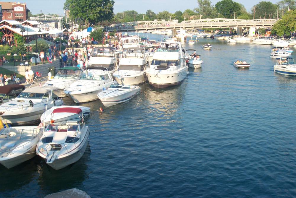
- The North Tonawanda side of Gateway Harbor during a summer Canal Concert, Brandon Peterman ( Zyrshnikashnu at en.wikipedia ), CC BY-SA 3.0
- US Post Office Tonawanda NY Sep 12, Pubdog, CC BY-SA 3.0
- Tonawanda Banner, Pubdog, CC BY-SA 3.0
- Historical Society of the Tonawandas - fmr New York Central Railroad depot - Tonawanda, New York - 20230124, Andre Carrotflower, CC BY-SA 4.0
- St. Francis of Assisi RC Church, Tonawanda, New York - 20230225, Andre Carrotflower, CC BY-SA 4.0
- Soldiers' Monument, City Cemetery, Tonawanda, New York - 20220819, Andre Carrotflower, CC BY-SA 4.0
- Niche statue of St. Francis of Assisi on façade of church of same name, Tonawanda, New York - 20230209, Andre Carrotflower, CC BY-SA 4.0
- Veterans' Monument, Tonawanda, New York - 20230106, Andre Carrotflower, CC BY-SA 4.0
- Stamps The Bar - fmr Hotel Compton et al. - Tonawanda, New York - 20230106, Andre Carrotflower, CC BY-SA 4.0
- St. Francis of Assisi Chapel and Columbarium, Tonawanda, New York - 20230225, Andre Carrotflower, CC BY-SA 4.0
- TonawandaNewYorkCityHall, DanielPenfield, CC BY-SA 4.0
- Tonawanda, New York - 4096103922, Dougtone, CC BY-SA 2.0
- Tonawanda, New York - 4095343785, Dougtone, CC BY-SA 2.0
- Tonawanda, New York - 4095342881, Dougtone, CC BY-SA 2.0
- Tonawanda, New York - 4095344413, Dougtone, CC BY-SA 2.0
- Tonawanda, New York, Dougtone, CC BY-SA 2.0
- Tonawanda, New York - 4095344617, Dougtone, CC BY-SA 2.0
- Tonawanda, New York - 4096102734, Dougtone, CC BY-SA 2.0
- Tonawanda, New York - 4095343651, Dougtone, CC BY-SA 2.0
- Tonawanda, New York - 4095344217, Dougtone, CC BY-SA 2.0
- Tonawanda, New York - 4095342481, Dougtone, CC BY-SA 2.0
- Tonawanda, New York - 4095343935, Dougtone, CC BY-SA 2.0
- Tonawanda, New York - 4096103260, Dougtone, CC BY-SA 2.0
- Tonawanda, New York - 4096103704, Dougtone, CC BY-SA 2.0
- Tonawanda, New York - 4095344853, Dougtone, CC BY-SA 2.0
- Tonawanda, New York - 4095343491, Dougtone, CC BY-SA 2.0
- Tonawanda, New York - 4095342203, Dougtone, CC BY-SA 2.0
- NFTA Metro Bus 25 @ Delaware St & Killewald Ave, Tonawanda, New York - 20210719, Andre Carrotflower, CC BY-SA 4.0
- TonawandaCreekOutletViewedFromNiaWandaPark, DanielPenfield, CC BY-SA 4.0
- Former American Kardex Company, Tonawanda, New York - 20211123, Andre Carrotflower, CC BY-SA 4.0
- John Simson House, Tonawanda, New York - 20230331, Andre Carrotflower, CC BY-SA 4.0
- NFTA Main & Niagara Transit Center, Tonawanda, New York - 20210719, Andre Carrotflower, CC BY-SA 4.0
- Main Street, Tonawanda, New York - 20220429, Andre Carrotflower, CC BY-SA 4.0
- Former Fraternal Order of Eagles Aerie No. 1411, Cooper Memorial Hall, et al. - Tonawanda, New York - 20230321, Andre Carrotflower, CC BY-SA 4.0
- Former First Trust Company, Tonawanda, New York - 20211123, Andre Carrotflower, CC BY-SA 4.0
- NorthTonawandaCreekOutletViewedFromTheTonawandaRiverwalkLookingWest, DanielPenfield, CC BY-SA 4.0
- NorthTonawanda banner, DanielPenfield, CC BY-SA 4.0
- CSX - Erie Canal Bridge, Tonawanda, NY, Doug Kerr from Albany, NY, United States, CC BY-SA 2.0
- Allan Herschell Carousel Factory, November 2008, Pubdog ( talk ), Public domain
- Riviera from the Stage, Dheckler510, CC BY-SA 4.0


Page built October 30, 2026. Spotted a mistake? Tell us or suggest a place.