


Why visit Bartın
Townapedia lists 4 museums and landmarks, 12 parks and trails, 45 places to eat, 2 places to stay and 3 attractions in and around town.
Highlights include Bartın Kent Müzesi, Kemal Samancıoğlu Etnografya Müzesi and Kaynarca Spor Ve Yaşam Parkı.
Weather in Bartın
Forecast from MET Norway (CC BY 4.0). Full forecast
About Bartın
Bartın is a city in northern Turkey, near the Black Sea. It is the seat of Bartın Province and Bartın District. Its population is 81,692 (2021).
From the Wikipedia article Bartın (this version), under CC BY-SA 4.0.
Things to do3

Museums and landmarks4



Parks, trails and playgrounds12



Restaurants and cafes45





33 more on the map.
History
The history of the antique Parthenios city (Παρθένιος in Greek), or Parthenia, dates back to 1200 BC, when its area was inhabited by the Kaskian tribe. In the following centuries, the region had entered under the dominance of Hittites, Phrygians, Cimmerians, Lydians, Greeks, and Persians. Later, it was part of the Roman Empire and then of the Byzantine Empire, until it fell to the Seljuk Turks and the Candaroğulları State between the 11th and the 13th centuries AD. Bartın was conquered by the Ottoman sultan Mehmet II in 1460. In the late 19th and early 20th century, Bartın was part of the Kastamonu Vilayet of the Ottoman Empire.
From the History section of Bartın on Wikipedia, under CC BY-SA 4.0.
Where to stay2
Churches and places of worship11
Shopping30
Gas and EV charging8
Schools, colleges and libraries8
Bartin Şehit Mustafa Yaman Anadolu İmam Hatip Lisesi Fen ve Sosyal Bilimler Proje Okulu
School · 2.0 km
Healthcare48
Map of Bartın
171 places. The map loads OpenStreetMap tiles when you open it.
Getting there and nearby towns
Çaycuma Havaalanı (ONQ) is the nearest airport with scheduled flights listed in OpenStreetMap, 25 km away.
- Dallıca 3 km north, about 3 min by car
- Kocareis 3 km northwest, about 3 min by car
- Topluca 4 km northwest, about 4 min by car
- Kabagöz 4 km east, about 4 min by car
- Çakırkadı 7 km southwest, about 7 min by car
- Tuzcular 8 km south, about 8 min by car
- Zonguldak 50 km southwest, about 50 min by car
- Safranbolu 52 km southeast, about 52 min by car
- Karabük 54 km southeast, about 54 min by car
- Ereğli 86 km southwest, about 1 h 30 min by car
Drive times are estimates from straight-line distance, not routes.
Local news
Headlines from INDB.
Reviews, tips and questions
Loading what members have shared...
Sources and licences
- GeoNames (CC BY 4.0): population, coordinates, regions and time zone
- Mapillary (see each image): photos
- OpenStreetMap contributors (ODbL 1.0): places, airports, map data
- Wikidata (CC0 1.0): elevation, founding date, time zone, website
- Wikimedia Commons (see each image): photos
- Wikipedia (CC BY-SA 4.0): overview and history text
Photo credits
- Bartın 45, Vikiçizer, CC BY-SA 4.0
- Bartın Kent Müzesi 2021-06-02 21.18.53 1791551740, Necmettin Sobutay, CC BY-SA 4.0
- Kemer Köprü, Bartın, Ali Osman Dilekoğlu, CC BY-SA 4.0
- Kemer Köprü, Bartın Kitabe 1, Ali Osman Dilekoğlu, CC BY-SA 4.0
- Kemer Köprü, Bartın Kitabe 2, Ali Osman Dilekoğlu, CC BY-SA 4.0
- Kemer Köprü, Bartın 2022-08-05 20.31.54 1791550614, Necmettin Sobutay, CC BY-SA 4.0
- Bartın Özel İdare Binası - panoramio, SADIK YURTMAN, CC BY-SA 3.0
- Çeşme 2022-03-19 16.54.01 1791549946, Necmettin Sobutay, CC BY-SA 4.0
- Orduyeri Köprüsü 2022-01-24 16.04.55 1791550270, Necmettin Sobutay, CC BY-SA 4.0
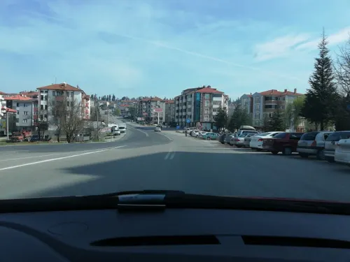
- Street-level photo, sefaonur, CC BY-SA 4.0
- Street-level photo, sefaonur, CC BY-SA 4.0
- Street-level photo, turkhalit, CC BY-SA 4.0
- Street-level photo, sefaonur, CC BY-SA 4.0
- Street-level photo, sefaonur, CC BY-SA 4.0
- Street-level photo, avci1995, CC BY-SA 4.0


Page built November 8, 2026. Spotted a mistake? Tell us or suggest a place.