
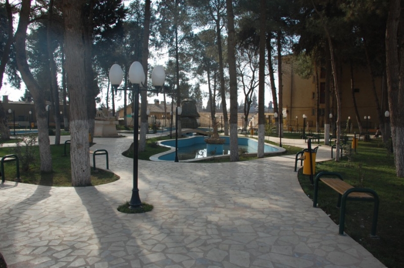


Ceylanpınar, Turkey
Ceylanpınar (Türkiye'deki ilçe merkezi)
Ceylanpınar is a town of 31,488 people in Şanlıurfa, Turkey, founded in January 21, 1982.
Why visit Ceylanpınar
Townapedia lists 5 museums and landmarks and 2 places to eat in and around town.
Highlights include Rhesaina and Tell el Fakhariya.
Weather in Ceylanpınar
Forecast from MET Norway (CC BY 4.0). Full forecast
About Ceylanpınar
Ceylanpınar (Kurdish: Serêkaniyê, Arabic: رأس العين Ra's al 'Ayn, Ottoman Turkish: رأس العين Resülayn) is a municipality and district of Şanlıurfa Province, Turkey. Its area is 1,589 km2, and its population is 90,440 (2022). On the border with Syria, it is reached by a long straight road D.905 across the plain south from Viranşehir. It forms a divided city with Ra's al-'Ayn in Syria and there is a border crossing.
From the Wikipedia article Ceylanpınar (this version), under CC BY-SA 4.0.
Museums and landmarks5

Rhesaina
Monument and historic site · 1.9 km
Ancient Roman city, now Ra's al-'Ayn

Tell el Fakhariya
Monument and historic site · 1.8 km
Archaeological site in Syria


Tell Halaf
Monument and historic site · 2.5 km
Archaeological site in Syria
Restaurants and cafes2

Churches and places of worship1

Shopping4

Healthcare15
Map of Ceylanpınar
27 places. The map loads OpenStreetMap tiles when you open it.
Getting there and nearby towns
Mardin Prof. Dr. Aziz Sancar Airport (MQM) is the nearest airport with scheduled flights listed in OpenStreetMap, 66 km away.
- Yukarı Karataş 9 km north, about 9 min by car
- Damlacık 9 km northeast, about 9 min by car
- Aşağıdoruklu 9 km northeast, about 9 min by car
- Muratlı 13 km north, about 13 min by car
- Boğalı 12 km northeast, about 12 min by car
- Avcılı 14 km northeast, about 14 min by car
- Yukarı Taşyalak 15 km northeast, about 15 min by car
- Aydoğdu 14 km northeast, about 14 min by car
- Kızıltepe 60 km northeast, about 1 h by car
- Mardin 80 km northeast, about 1 h 15 min by car
Drive times are estimates from straight-line distance, not routes.
Local news
Headlines from INDB.
Reviews, tips and questions
Loading what members have shared...
Sources and licences
- GeoNames (CC BY 4.0): population, coordinates, regions and time zone
- OpenStreetMap contributors (ODbL 1.0): places, airports, map data
- Wikidata (CC0 1.0): elevation, founding date, time zone, website, landmarks and historic places
- Wikimedia Commons (see each image): photos
- Wikipedia (CC BY-SA 4.0): overview and history text
Photo credits
- Belediyeparkı, Wejevan at Kurdish Wikipedia, CC BY-SA 3.0
- TellHalaf,NE-palace1, Bertramz, CC BY 3.0
- TellFecheriyeSyria, Sebastian Hageneuer, CC BY-SA 3.0
- Sari Kani, Syria - panoramio, hothifa sharks, CC BY 3.0
Page built November 8, 2026. Spotted a mistake? Tell us or suggest a place.