


Why visit Dinar
Townapedia lists 5 museums and landmarks, 1 park or trail, 3 places to eat and 3 places to stay in and around town.
Highlights include Apamea and Celaenae.
Weather in Dinar
Forecast from MET Norway (CC BY 4.0). Full forecast
About Dinar
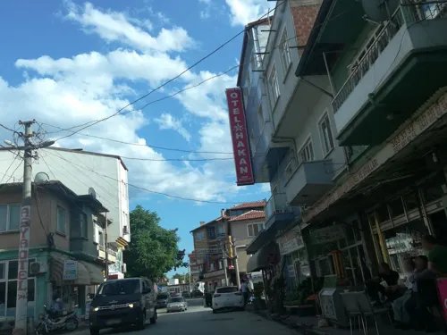
Dinar (Ancient Greek: Κελαιναί-Ἀπάμεια, romanized: Kelainaí-Apámeia,) is a town of Afyonkarahisar Province in the Aegean region of Turkey, 106 km from the city of Afyon. It is the seat of Dinar District. Its population is 26,300 (2021). The mayor was Saffet Acar (MHP) between 2019 and 2024.
From the Wikipedia article Dinar, Afyonkarahisar (this version), under CC BY-SA 4.0.
Museums and landmarks5

Apamea
Monument and historic site · 0.7 km
Ancient city of Phrygia, in modern-day Turkey

Celaenae
Monument and historic site · 0.7 km
Ancient city of Phrygia in modern-day Turkey
Parks, trails and playgrounds1

Restaurants and cafes3



Where to stay3



History
From 1867 until 1922, Dinar was part of the Hüdavendigâr vilayet of the Ottoman Empire.
From the History section of Dinar, Afyonkarahisar on Wikipedia, under CC BY-SA 4.0.
Churches and places of worship1
Shopping1
Gas and EV charging4
Schools, colleges and libraries3
Healthcare19
Map of Dinar
40 places. The map loads OpenStreetMap tiles when you open it.
Getting there and nearby towns
Isparta Süleyman Demirel Airport (ISE) is the nearest airport with scheduled flights listed in OpenStreetMap, 29 km away.
- Dikici 5 km south, about 5 min by car
- Keçiborlu 18 km southeast, about 18 min by car
- Gökçek 19 km west, about 19 min by car
- Kızılören 22 km north, about 22 min by car
- Altınova 21 km west, about 21 min by car
- Başmakçı 23 km southwest, about 23 min by car
- Uluborlu 25 km east, about 25 min by car
- Sandıklı 45 km north, about 45 min by car
- Isparta 48 km southeast, about 48 min by car
- Afyonkarahisar 84 km northeast, about 1 h 30 min by car
Drive times are estimates from straight-line distance, not routes.
Local news
Headlines from INDB.
Reviews, tips and questions
Loading what members have shared...
Sources and licences
- GeoNames (CC BY 4.0): population, coordinates, regions and time zone
- Mapillary (see each image): photos
- OpenStreetMap contributors (ODbL 1.0): places, airports, map data
- Wikidata (CC0 1.0): elevation, founding date, time zone, website, landmarks and historic places
- Wikimedia Commons (see each image): photos
- Wikipedia (CC BY-SA 4.0): overview and history text
Photo credits
- Dinar, Gertrude Bell, Public domain
- 8.23 Apameia, Haubi|Gerhard Haubold, CC BY-SA 4.0
- Street-level photo, fbkoksal, CC BY-SA 4.0
- Street-level photo, ktahyam-Mapping, CC BY-SA 4.0
- Street-level photo, fbkoksal, CC BY-SA 4.0
- Street-level photo, ferahkoksal, CC BY-SA 4.0
- Street-level photo, ktahyam-Mapping, CC BY-SA 4.0
Page built November 8, 2026. Spotted a mistake? Tell us or suggest a place.