
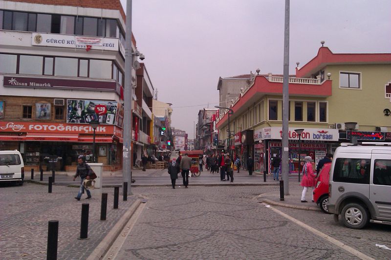


Why visit Düzce
Townapedia lists 5 museums and landmarks, 46 parks and trails, 112 places to eat, 33 places to stay and 6 attractions in and around town.
Highlights include Embolos, Konuralp Museum, Bitki Bahçesi and Çocuk Parkı.
Weather in Düzce
Forecast from MET Norway (CC BY 4.0). Full forecast
About Düzce
Düzce (Turkish pronunciation: [dyz'dʒe]) is a city in northwestern Turkey, the capital city of Düzce Province, the eighty-first province in the country. It is the seat of Düzce District. Its population is 194,097 (as of 2022).
From the Wikipedia article Düzce (this version), under CC BY-SA 4.0.
Things to do6


Museums and landmarks5

Embolos
Monument and historic site · 7.4 km
Ancient city of Bithynia in modern-day Turkey


Prusias ad Hypium
Monument and historic site · 1.3 km
Ruined city located in Düzce Province
Parks, trails and playgrounds46


34 more on the map.
Restaurants and cafes112

Quechi Coffee Bakery
Cafe · Coffee Shop, Dessert, Chocolate · 0.7 km
4A Bankalar Sokak, Düzce
Mo-Su 09:00-01:00

Cadde Balık
Restaurant · Seafood, Barbecue · 2.0 km
40 2423. Cadde, Düzce
Hacı Baba Lezzet Lokantası
Restaurant · Turkish · 0.9 km
10 Akçakoca Yolu


Hoşgör Ocakbaşı
Restaurant · Turkish · 1.7 km
45 Zaid Kevseri Bulvarı
Pizza Mizza
Restaurant · Pizza · 0.9 km
59 İstanbul Caddesi, Düzce

hill brasserie & cafe
Diner · American · 0.8 km
Mehmet Akif Cadde, Düzce
100 more on the map.
History
Historical Konuralp is 8 km north of Düzce; the first settlements there go back to 3rd century BC. Until 74 BC, it was one of the most important cities belonging to Bithynia, which included Bilecik, Bolu, Sakarya, Kocaeli. It was conquered by Pontus and then by the Roman Empire. During the Roman period, the city was influenced by Latin culture, and it changed its name to Prusias ad Hypium. Later on, Christianity affected the city and after the separation of the Roman Empire in 395, it was controlled by the Eastern Roman Empire (the later Byzantine Empire).
In 1204, the Crusader armies invaded Constantinople, establishing the Latin Empire. Düzce and its surroundings are thought to have been under the dominance of the Latin Empire during this period. Düzce was under Byzantine rule again from 1261 to 1323.
Konuralp Bey, one of Osman Gazi's commanders, was ordered to conquer Düzce and its surroundings to expand Ottoman lands. The first Ottoman administrators in Düzce were Konuralp Bey, Sungur Bey, Semsi Bey and Gunduz Alp.
During the Ottoman Empire, Düzce provided navy timber, and it became an important centre of transportation between Istanbul and cities further east, such as Sivas and Erzurum.
From the History section of Düzce on Wikipedia, under CC BY-SA 4.0.
Where to stay33
Zahid Kevseri Öğrenci Yurdu
Motel and hotel · 1.6 km
Zahid Kevseri Bulvarı, Düzce
Churches and places of worship65
Shopping84
Gas and EV charging28
Schools, colleges and libraries52
Healthcare82
Map of Düzce
250 places. The map loads OpenStreetMap tiles when you open it.
Getting there and nearby towns
Cengiz Topel Havaalanı (KCO) is the nearest airport with scheduled flights listed in OpenStreetMap, 92 km away.
- Sinirci 3 km south, about 3 min by car
- Otluoğlu 4 km southwest, about 4 min by car
- Gökçe 4 km southeast, about 4 min by car
- Karaçalı 5 km south, about 5 min by car
- Gümüşpınar 5 km southeast, about 5 min by car
- Taşköprü 5 km northwest, about 5 min by car
- Ozanlar 5 km southwest, about 5 min by car
- Bolu 39 km east, about 39 min by car
- Adapazarı 64 km west, about 1 h by car
- Zonguldak 86 km northeast, about 1 h 30 min by car
Drive times are estimates from straight-line distance, not routes.
Local news
Headlines from INDB.
Reviews, tips and questions
Loading what members have shared...
Sources and licences
- GeoNames (CC BY 4.0): population, coordinates, regions and time zone
- Mapillary (see each image): photos
- OpenStreetMap contributors (ODbL 1.0): places, airports, map data
- Wikidata (CC0 1.0): elevation, founding date, time zone, website, landmarks and historic places
- Wikimedia Commons (see each image): photos
- Wikipedia (CC BY-SA 4.0): overview and history text
Photo credits
- Düzce-435, İncelemeelemani, CC BY-SA 3.0
- Düzce Merkez Büyük Camii, Ahmet Yurtbakan, CC BY-SA 4.0
- Düzce - panoramio, fatihset, CC BY 3.0
- After Earthquake-Düzce Çoban Restoran - panoramio, Halit Edip Özcan, CC BY-SA 3.0
- GÜZELDERE WATERFALL NATURE PARK, Gölyaka, Düzce, Turkey - Murat Özsoy 13, Murat Özsoy 1958, CC BY-SA 4.0
- Ank-İst Highway Serial Photos-Düzce-West - panoramio, Halit Edip Özcan, CC BY-SA 3.0
- Ank-İst Highway Serial Photos-Düzce,East - panoramio, Halit Edip Özcan, CC BY-SA 3.0
- GÜZELDERE WATERFALL NATURE PARK, Gölyaka, Düzce, Turkey - Murat Özsoy 08, Murat Özsoy 1958, CC BY-SA 4.0
- GÜZELDERE WATERFALL NATURE PARK, Gölyaka, Düzce, Turkey - Murat Özsoy 09, Murat Özsoy 1958, CC BY-SA 4.0
- GÜZELDERE WATERFALL NATURE PARK, Gölyaka, Düzce, Turkey - Murat Özsoy 10, Murat Özsoy 1958, CC BY-SA 4.0
- Prusias ad Hypium 46, Ingeborg Simon, CC BY-SA 3.0
- Prusias ad Hypium 10, Ingeborg Simon, CC BY-SA 3.0
- Merkez Cedidiye Camii, Ahmet Yurtbakan, CC BY-SA 4.0
- Efteni kuş cenneti, Çileklipudingim, CC BY-SA 4.0
- Lightning in DUZCE - panoramio, Ahmet KAYNARPUNAR, CC BY-SA 3.0
- Yavuz At Çiftliği - panoramio, fatihset, CC BY 3.0
- Yahyalar - panoramio, fatihset, CC BY 3.0
- Anadolu Otoyolu - panoramio, fatihset, CC BY 3.0
- Sarayyeri - panoramio, fatihset, CC BY 3.0
- Kazukoğlu Cami - panoramio, fatihset, CC BY 3.0
- ISS053-E-48023 - View of Earth, Earth Science and Remote Sensing Unit , Lyndon B. Johnson Space Center, Public domain
- ISS031-E-68708 - View of Earth, Earth Science and Remote Sensing Unit , Lyndon B. Johnson Space Center, Public domain
- ISS053-E-49105 - View of Earth, Earth Science and Remote Sensing Unit , Lyndon B. Johnson Space Center, Public domain
- ISS031-E-26136 - View of Earth, Earth Science and Remote Sensing Unit , Lyndon B. Johnson Space Center, Public domain
- K. Melen Nehri - panoramio, Allen Turner, CC BY-SA 3.0
- Itfaiye yangın, Gncfb41, CC BY-SA 4.0
- Kızılay Ankara kent meydanı, BurakOtto, CC BY-SA 4.0
- Atatürk Bulvarı Kızılay, BurakOtto, CC BY-SA 4.0
- Sarsılmaz 2020, Akarsoz, CC BY-SA 4.0
- Gazania flower Türkiye, Hazem zein alabdin, CC BY-SA 4.0
- Clerodendrum bungei fiower, Hazem zein alabdin, CC BY-SA 4.0
- Beyköy - panoramio, fatihset, CC BY 3.0
- ISS026-E-14959 - View of Israel, Earth Science and Remote Sensing Unit , Lyndon B. Johnson Space Center, Public domain
- ISS031-E-68707 - View of Earth, Earth Science and Remote Sensing Unit , Lyndon B. Johnson Space Center, Public domain
- ISS031-E-26135 - View of Earth, Earth Science and Remote Sensing Unit , Lyndon B. Johnson Space Center, Public domain
- ISS053-E-49104 - View of Earth, Earth Science and Remote Sensing Unit , Lyndon B. Johnson Space Center, Public domain
- ISS053-E-48022 - View of Earth, Earth Science and Remote Sensing Unit , Lyndon B. Johnson Space Center, Public domain
- ISS042-E-70860 - View of Earth, Earth Science and Remote Sensing Unit , Lyndon B. Johnson Space Center, Public domain
- Red Autumn trees, Hazem zein alabdin, CC BY-SA 4.0
- Portugal laurel (Prunus lusitanica), Hazem zein alabdin, CC BY-SA 4.0
- Street-level photo, sefaonur, CC BY-SA 4.0
- Street-level photo, sessiznotalar, CC BY-SA 4.0
- Street-level photo, sessiznotalar, CC BY-SA 4.0
- Street-level photo, sefaonur, CC BY-SA 4.0
- Street-level photo, sefaonur, CC BY-SA 4.0
- Street-level photo, sefaonur, CC BY-SA 4.0
- Street-level photo, sefaonur, CC BY-SA 4.0
- Street-level photo, sefaonur, CC BY-SA 4.0
- Street-level photo, sefaonur, CC BY-SA 4.0
- Street-level photo, sessiznotalar, CC BY-SA 4.0
- Street-level photo, sefaonur, CC BY-SA 4.0


Page built November 8, 2026. Spotted a mistake? Tell us or suggest a place.