


Eğil, Turkey
Eğil is a town of 4,820 people in Diyarbakır Province, Turkey, founded in July 4, 1987.
Why visit Eğil
Townapedia lists 3 museums and landmarks, 2 parks and trails and 4 attractions in and around town.
Highlights include Abdülaziz Dağı and Eğil Tacıyan Camisi.
Weather in Eğil
Forecast from MET Norway (CC BY 4.0). Full forecast
About Eğil
Eğil (Hittite: 𒅔𒃲𒀀𒉿, romanized: Ingalawa; Ottoman Turkish: اکيل; Kurdish: Gêl) is a municipality and district of Diyarbakır Province, Turkey. Its area is 449 km2, and its population is 21,434 (2022). It is populated by Kurds.
From the Wikipedia article Eğil (this version), under CC BY-SA 4.0.
Travel tips from other travellers: Eğil on Wikivoyage (CC BY-SA 4.0).
Things to do4

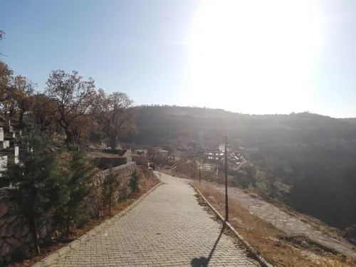
Museums and landmarks3

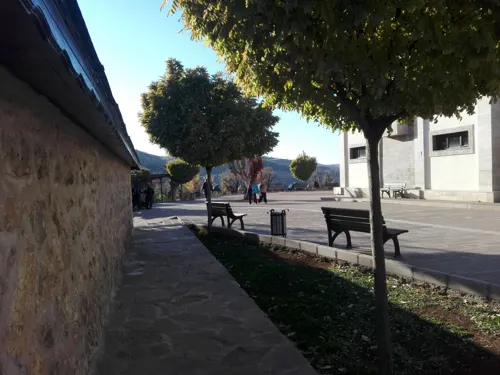
Parks, trails and playgrounds2


Churches and places of worship4

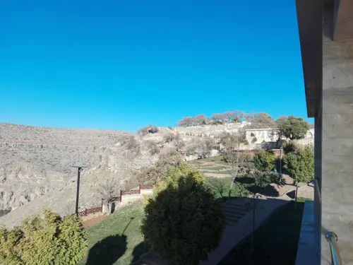


History
Most scholars identify Eğil with the ancient city of Carcathiocerta (Armenian: Կարկաթիոկերտ, Karkatiokert or Արկաթիակերտ, Arkatiakert; Ancient Greek: Καρκαθιόκερτα, Karkathiokerta). It was the first capital of Sophene until Arsames I founded the new capital Arshamshat around 230 BCE. Its original site is located on a rocky plateau just east of Eğil (38°15′17″N 40°05′34″E). The Seleucid king Antiochus IV Epiphanes renamed the city into Epiphania. Strabo in his Geography, calls it "The royal city of Sophene". It was assigned to the late Roman province of Mesopotamia. It also bore the names Artagigarta, Baras, Basileon Phrourion, and Ingila. Under the name Ingila, it became a bishopric; no longer the seat of a residential bishop, it remains a titular see of the Roman Catholic Church.
The city, with its strategic location overlooking the west bank of the Tigris, is the oldest in the region, with remains dating back to the Assyrian and Hellenistic periods. Later on, the city was known in Armenian as Angł, capital of the district of Angełtun, which was known as Ingilene in Greco-Roman sources. It was part of the larger province of Sophene. Armenian sources described Angł as housing "the tombs of the former kings of Armenia", apparently taking the rulers of Sophene as a branch of the Armenian kings' dynasty. The rock-cut tombs still exist today at Eğil.
From the History section of Eğil on Wikipedia, under CC BY-SA 4.0.
Gas and EV charging1
Schools, colleges and libraries1
Healthcare12
Map of Eğil
27 places. The map loads OpenStreetMap tiles when you open it.
Getting there and nearby towns
Diyarbakır Airport (DIY) is the nearest airport with scheduled flights listed in OpenStreetMap, 42 km away.
- Bahşılar 5 km west, about 5 min by car
- Sarmaşık 8 km east, about 8 min by car
- Dicle 12 km north, about 12 min by car
- Baysu 12 km south, about 12 min by car
- Oyalı 14 km south, about 14 min by car
- Diyarbakır 40 km south, about 40 min by car
- Çermik 57 km west, about 57 min by car
- Bingöl 79 km northeast, about 1 h 15 min by car
- Elazığ 87 km northwest, about 1 h 30 min by car
- Siverek 87 km southwest, about 1 h 30 min by car
Drive times are estimates from straight-line distance, not routes.
Local news
Headlines from INDB.
Reviews, tips and questions
Loading what members have shared...
Sources and licences
- GeoNames (CC BY 4.0): population, coordinates, regions and time zone
- Mapillary (see each image): photos
- OpenStreetMap contributors (ODbL 1.0): places, airports, map data
- Wikidata (CC0 1.0): elevation, founding date, time zone, website
- Wikimedia Commons (see each image): photos
- Wikipedia (CC BY-SA 4.0): overview and history text
Photo credits
- Gêl, Dûrzan cîrano, CC BY-SA 3.0
- EĞİL BARAJI - panoramio, Necim, CC BY-SA 3.0
- EĞİL - panoramio, Necim, CC BY-SA 3.0
- ISS031-E-83226 - View of Earth, Earth Science and Remote Sensing Unit , Lyndon B. Johnson Space Center, Public domain
- ISS031-E-85504 - View of Earth, Earth Science and Remote Sensing Unit , Lyndon B. Johnson Space Center, Public domain
- ISS053-E-35830 - View of Earth, Earth Science and Remote Sensing Unit , Lyndon B. Johnson Space Center, Public domain
- ISS053-E-35091 - View of Earth, Earth Science and Remote Sensing Unit , Lyndon B. Johnson Space Center, Public domain
- ISS053-E-35090 - View of Earth, Earth Science and Remote Sensing Unit , Lyndon B. Johnson Space Center, Public domain
- ISS031-E-85297 - View of Earth, Earth Science and Remote Sensing Unit , Lyndon B. Johnson Space Center, Public domain
- ISS053-E-35829 - View of Earth, Earth Science and Remote Sensing Unit , Lyndon B. Johnson Space Center, Public domain
- ISS065-E-401159 - View of Earth, Earth Science and Remote Sensing Unit , Lyndon B. Johnson Space Center, Public domain
- ISS065-E-401160 - View of Earth, Earth Science and Remote Sensing Unit , Lyndon B. Johnson Space Center, Public domain
- ISS031-E-83227 - View of Earth, Earth Science and Remote Sensing Unit , Lyndon B. Johnson Space Center, Public domain
- ISS031-E-81170 - View of Earth, Earth Science and Remote Sensing Unit , Lyndon B. Johnson Space Center, Public domain
- ISS031-E-81171 - View of Earth, Earth Science and Remote Sensing Unit , Lyndon B. Johnson Space Center, Public domain
- ISS041-E-111047 - View of Earth, Earth Science and Remote Sensing Unit , Lyndon B. Johnson Space Center, Public domain
- ISS031-E-83225 - View of Earth, Earth Science and Remote Sensing Unit , Lyndon B. Johnson Space Center, Public domain
- ISS031-E-85503 - View of Earth, Earth Science and Remote Sensing Unit , Lyndon B. Johnson Space Center, Public domain
- ISS006-E-30483 - View of Syria, Earth Science and Remote Sensing Unit , Lyndon B. Johnson Space Center, Public domain
- ISS031-E-81169 - View of Earth, Earth Science and Remote Sensing Unit , Lyndon B. Johnson Space Center, Public domain
- ISS066-E-2653 - View of Earth, Earth Science and Remote Sensing Unit , Lyndon B. Johnson Space Center, Public domain
- ISS041-E-111045 - View of Earth, Earth Science and Remote Sensing Unit , Lyndon B. Johnson Space Center, Public domain
- ISS065-E-401156 - View of Earth, Earth Science and Remote Sensing Unit , Lyndon B. Johnson Space Center, Public domain
- ISS065-E-401158 - View of Earth, Earth Science and Remote Sensing Unit , Lyndon B. Johnson Space Center, Public domain
- ISS065-E-401155 - View of Earth, Earth Science and Remote Sensing Unit , Lyndon B. Johnson Space Center, Public domain
- ISS027-E-26973 - View of Earth, Earth Science and Remote Sensing Unit , Lyndon B. Johnson Space Center, Public domain
- ISS041-E-111046 - View of Earth, Earth Science and Remote Sensing Unit , Lyndon B. Johnson Space Center, Public domain
- ISS065-E-401157 - View of Earth, Earth Science and Remote Sensing Unit , Lyndon B. Johnson Space Center, Public domain
- Street-level photo, nesim, CC BY-SA 4.0
- Street-level photo, nesim, CC BY-SA 4.0
- Street-level photo, nesim, CC BY-SA 4.0


Page built November 8, 2026. Spotted a mistake? Tell us or suggest a place.