

Why visit Emirdağ
Townapedia lists 3 museums and landmarks, 9 parks and trails, 12 places to eat, 5 places to stay and 1 attraction in and around town.
Weather in Emirdağ
Forecast from MET Norway (CC BY 4.0). Full forecast
About Emirdağ
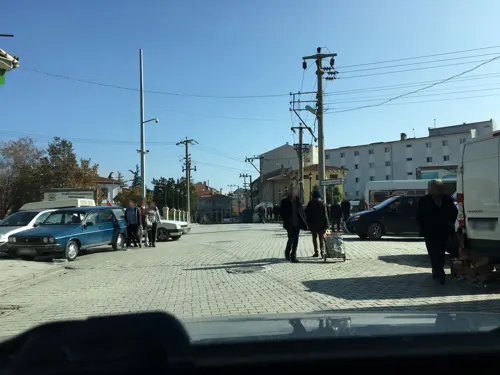
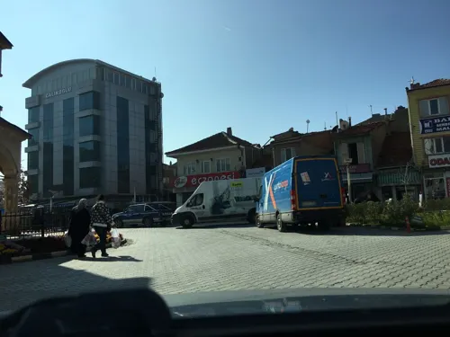
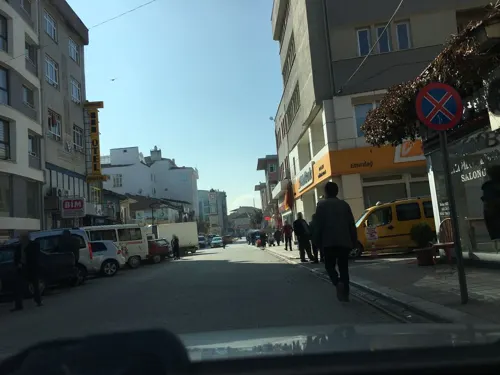
Emirdağ is a town of Afyonkarahisar Province in Turkey, between the cities of Afyon and Eskişehir. It is the seat of Emirdağ District.Emirdağ district has a total population of 43,484 according to the 2024 census.
From the Wikipedia article Emirdağ (this version), under CC BY-SA 4.0.
Things to do1

Museums and landmarks3


Parks, trails and playgrounds9


Restaurants and cafes12


History
The area has been occupied since at least 1437 BC by a succession of peoples beginning with Hittites, Lydians, Persians, and Greeks.
The ruins of the Hellenistic and Byzantine city of Amorium lie about 12 km east of Emirdağ. Amorium was one of the four principal Byzantine cities in Anatolia, and was the home of the Byzantine Amorian dynasty. It was conquered in 838-845 by the Abbasid Caliph Al-Mu'tasim.
The area was settled by Turkmen from 1068 onwards and particularly following the battle of nearby Bolvadin, between the Byzantines and the Seljuk Turks. Later further waves of Turkmen followed including the Dulkadirids; Yörük nomads were settled here by the Ottoman Empire.
From 1867 until 1922, Emirdağ (Azîziyye) was part of the Hüdavendigâr vilayet of the Ottoman Empire. During the Greco-Turkish War, Emirdağ was occupied by Greek forces from 16 August 1921 till 22 September 1921.
From the History section of Emirdağ on Wikipedia, under CC BY-SA 4.0.
Where to stay5
Churches and places of worship18
Shopping11
Gas and EV charging4
Schools, colleges and libraries13
Healthcare13
Map of Emirdağ
89 places. The map loads OpenStreetMap tiles when you open it.
Getting there and nearby towns
Afyon Air Base (AFY) is the nearest airport with scheduled flights listed in OpenStreetMap, 58 km away.
- Karacalar 9 km southeast, about 9 min by car
- Yüreğil 11 km west, about 11 min by car
- Adayazı 11 km northeast, about 11 min by car
- Kemerkaya 16 km southwest, about 16 min by car
- Güveççi 18 km southeast, about 18 min by car
- Bayat 20 km west, about 20 min by car
- Davulga 20 km east, about 20 min by car
- Karayokuş 26 km south, about 26 min by car
- Bolvadin 35 km south, about 35 min by car
- Afyonkarahisar 60 km southwest, about 1 h by car
Drive times are estimates from straight-line distance, not routes.
Local news
Headlines from INDB.
Reviews, tips and questions
Loading what members have shared...
Sources and licences
- GeoNames (CC BY 4.0): population, coordinates, regions and time zone
- Mapillary (see each image): photos
- OpenStreetMap contributors (ODbL 1.0): places, airports, map data
- Wikidata (CC0 1.0): elevation, founding date, time zone, website
- Wikimedia Commons (see each image): photos
- Wikipedia (CC BY-SA 4.0): overview and history text
Photo credits
- Emirdag eski hamam, FoPen, CC BY-SA 3.0
- Street-level photo, kaymakam, CC BY-SA 4.0
- Street-level photo, kaymakam, CC BY-SA 4.0
- Street-level photo, kaymakam, CC BY-SA 4.0
- Street-level photo, kaymakam, CC BY-SA 4.0
- Street-level photo, kaymakam, CC BY-SA 4.0
- Street-level photo, kaymakam, CC BY-SA 4.0
- Street-level photo, kaymakam, CC BY-SA 4.0
- Street-level photo, kaymakam, CC BY-SA 4.0
- Street-level photo, kaymakam, CC BY-SA 4.0
- Street-level photo, kaymakam, CC BY-SA 4.0
- Street-level photo, kaymakam, CC BY-SA 4.0
- Street-level photo, kaymakam, CC BY-SA 4.0
- Street-level photo, kaymakam, CC BY-SA 4.0
- Street-level photo, kaymakam, CC BY-SA 4.0
- Street-level photo, kaymakam, CC BY-SA 4.0
- Street-level photo, kaymakam, CC BY-SA 4.0
- Street-level photo, kaymakam, CC BY-SA 4.0
Page built November 8, 2026. Spotted a mistake? Tell us or suggest a place.