


Why visit İnegol
Townapedia lists 4 museums and landmarks, 10 parks and trails, 47 places to eat, 3 places to stay and 4 attractions in and around town.
Highlights include Oylat Cave.
Weather in İnegol
Forecast from MET Norway (CC BY 4.0). Full forecast
About İnegol
İnegöl (known as Ἀγγελόκωμις, Angelokomis in the Byzantine period) is a municipality and district of Bursa Province, Turkey. Its area is 1,118 km2 (432 sq mi), and its population is 302,251 (2024). İnegöl is one of the centers of the Turkish furniture industry, and is also known for its meatball (İnegöl köftesi) which has its origins in ćevapi brought to the region by Bosnian immigrants (Bosniaks) during the Balkan Wars.
From the Wikipedia article İnegöl (this version), under CC BY-SA 4.0.
Travel tips from other travellers: İnegol on Wikivoyage (CC BY-SA 4.0).
Things to do4


Museums and landmarks4
Parks, trails and playgrounds10



Restaurants and cafes47

Kızılelma Riding Cafe & Restorant
Restaurant · 4.4 km
Deydinler-Ortaköy Caddesi
Mo-Su 10:00-00:00
TA-Pİ LAND KANATÇINIZ
Restaurant · 0.9 km
osmaniye mh. şebboy cd




35 more on the map.
History
From 1867 until 1922, İnegöl was part of Hüdavendigâr vilayet. It was occupied by the Greek Army during the Greco-Turkish War (1919–1922); however, it was retaken by the Turks during the Great Offensive.
From the History section of İnegöl on Wikipedia, under CC BY-SA 4.0.
Where to stay3
Churches and places of worship60
Shopping37
Gas and EV charging25
SHARZ İmotiv Mobilya Avm
EV charging · 6.5 km
Yeniceköy, Bursa Karayolu 4.km, 16400 İnegöl/Bursa, İNEGÖL
Schools, colleges and libraries37
Healthcare80
Map of İnegol
250 places. The map loads OpenStreetMap tiles when you open it.
Getting there and nearby towns
Yenişehir Yolören Hava Meydan Komutanlığı (YEI) is the nearest airport with scheduled flights listed in OpenStreetMap, 19 km away.
- Alanyurt 3 km north, about 3 min by car
- Akhisar 6 km northwest, about 6 min by car
- Cerrah 6 km west, about 6 min by car
- Hamzabey 7 km north, about 7 min by car
- Yenice 8 km west, about 8 min by car
- Kurşunlu 13 km east, about 13 min by car
- Kozluören 15 km west, about 15 min by car
- Tahtaköprü 18 km southeast, about 18 min by car
- Yenişehir 24 km northeast, about 24 min by car
- Bursa 41 km west, about 41 min by car
Drive times are estimates from straight-line distance, not routes.
Local news
Headlines from INDB.
Reviews, tips and questions
Loading what members have shared...
Sources and licences
- GeoNames (CC BY 4.0): population, coordinates, regions and time zone
- Mapillary (see each image): photos
- OpenStreetMap contributors (ODbL 1.0): places, airports, map data
- Wikidata (CC0 1.0): elevation, founding date, time zone, website, landmarks and historic places
- Wikimedia Commons (see each image): photos
- Wikipedia (CC BY-SA 4.0): overview and history text
Photo credits
- Inegöl İshak Paşa Külliyesi 1561 (cropped), Dosseman, CC BY-SA 4.0
- Deydinler Dostluk Parkı (Mart 2025) 1, 1cookielover, CC0
- Deydinler Mahallesi Camii (Mart 2025), 1cookielover, CC0
- İnegöl - panoramio, HALUK COMERTEL, CC BY 3.0
- ISS051-E-29610 - View of Earth, Earth Science and Remote Sensing Unit , Lyndon B. Johnson Space Center, Public domain
- ISS043-E-105834 - View of Earth, Earth Science and Remote Sensing Unit , Lyndon B. Johnson Space Center, Public domain
- ISS043-E-105836 - View of Earth, Earth Science and Remote Sensing Unit , Lyndon B. Johnson Space Center, Public domain
- ISS006-E-24255 - View of Turkey, Earth Science and Remote Sensing Unit , Lyndon B. Johnson Space Center, Public domain
- ISS043-E-105833 - View of Earth, Earth Science and Remote Sensing Unit , Lyndon B. Johnson Space Center, Public domain
- ISS051-E-29609 - View of Earth, Earth Science and Remote Sensing Unit , Lyndon B. Johnson Space Center, Public domain
- ISS067-E-266206 - View of Earth, Earth Science and Remote Sensing Unit , Lyndon B. Johnson Space Center, Public domain
- ISS043-E-105835 - View of Earth, Earth Science and Remote Sensing Unit , Lyndon B. Johnson Space Center, Public domain
- 16400 Kulaca-İnegöl-Bursa, Turkey - panoramio, nami yildirim, CC BY 3.0
- Geyikli Baba Türbesi ve Baba Sultan Camii, İsosfer, CC BY-SA 4.0
- ISS051-E-29611 - View of Earth, Earth Science and Remote Sensing Unit , Lyndon B. Johnson Space Center, Public domain
- ISS043-E-105837 - View of Earth, Earth Science and Remote Sensing Unit , Lyndon B. Johnson Space Center, Public domain
- ISS061-E-48238 - View of Earth, Earth Science and Remote Sensing Unit, NASA Johnson Space Center, Public domain
- ISS051-E-29612 - View of Earth, Earth Science and Remote Sensing Unit , Lyndon B. Johnson Space Center, Public domain
- Boğazköy barajı1, Acar54, CC BY-SA 4.0
- ISS041-E-81056 - View of China, Earth Science and Remote Sensing Unit , Lyndon B. Johnson Space Center, Public domain
- ISS023-E-55960 - View of Earth, Earth Science and Remote Sensing Unit , Lyndon B. Johnson Space Center, Public domain
- ISS041-E-81054 - View of China, Earth Science and Remote Sensing Unit , Lyndon B. Johnson Space Center, Public domain
- ISS041-E-81055 - View of China, Earth Science and Remote Sensing Unit , Lyndon B. Johnson Space Center, Public domain
- ISS041-E-81057 - View of China, Earth Science and Remote Sensing Unit , Lyndon B. Johnson Space Center, Public domain
- STS126-E-18550 - View of Earth, NASA, Public domain
- Uludağ from plane, GrandEscogriffe, CC BY-SA 4.0
- Uludağ and Bursa from plane, GrandEscogriffe, CC BY-SA 4.0
- ISS041-E-81053 - View of China, Earth Science and Remote Sensing Unit , Lyndon B. Johnson Space Center, Public domain
- ISS041-E-81052 - View of Nepal, Earth Science and Remote Sensing Unit , Lyndon B. Johnson Space Center, Public domain
- ISS023-E-55959 - View of Earth, Earth Science and Remote Sensing Unit , Lyndon B. Johnson Space Center, Public domain
- ISS006-E-24254 - View of Turkey, Earth Science and Remote Sensing Unit , Lyndon B. Johnson Space Center, Public domain
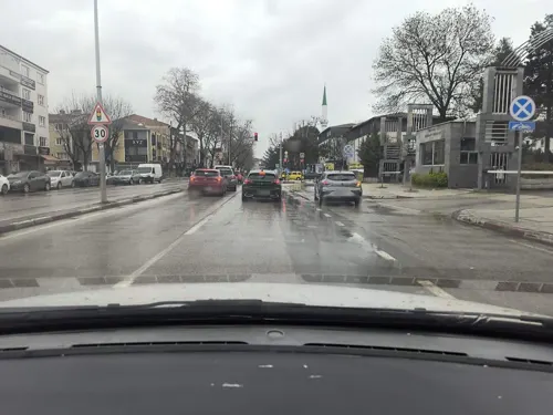
- Street-level photo, semi, CC BY-SA 4.0
- Street-level photo, sessiznotalar, CC BY-SA 4.0
- Street-level photo, AmbientDriveAsmr, CC BY-SA 4.0
- Street-level photo, empty, CC BY-SA 4.0


Page built November 8, 2026. Spotted a mistake? Tell us or suggest a place.