
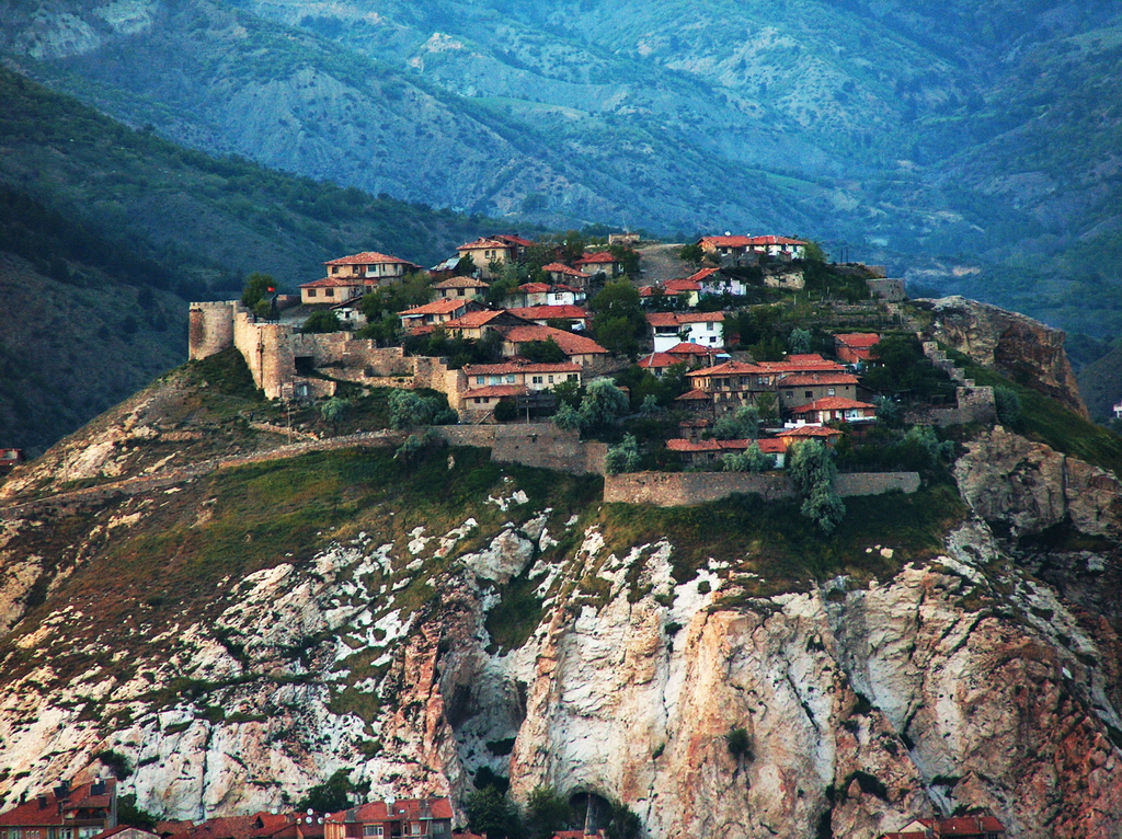


Why visit İskilip
Townapedia lists 1 museum or landmark, 1 park or trail, 1 place to eat, 1 place to stay and 1 attraction in and around town.
Highlights include Iskilip Castle.
Weather in İskilip
Forecast from MET Norway (CC BY 4.0). Full forecast
About İskilip
İskilip is a district of Çorum Province, Turkey, on the left bank of the River Kızılırmak, located at 56 km from the city of Çorum, 100 miles (160 km) northeast of Ankara and 60 miles (100 km) southeast of Kastamonu. It is the seat of İskilip District. Its population is 17,612 (2022). The mayor is Ali Sülük.
From the Wikipedia article İskilip (this version), under CC BY-SA 4.0.
Things to do1

Museums and landmarks1

Parks, trails and playgrounds1

Restaurants and cafes1

İskilip Belediyesi Şelale Sosyal Tesisleri
Cafe · Burger, Pizza, Regional · 0.6 km
Mo-Su 10:00-23:00
History
People have been attracted to the saline springs of İskilip since the earliest times, and the town stands on a route through the mountains to the Black Sea coast. Therefore, this is one of the longest-settled areas of Anatolia; copper was smelted here in ancient times, when the plain was settled by the Hittite and Hatti civilizations (from 3000 BC). Rock carvings on the hill of Yivlik are said to date to the Hittite period. The area which consists of İskilip and Tosya district of Kastamonu Province was known as Tarittara or Turmitta during the Hittite era.
The Hattic city was then possessed by Paphlagonian kings (from 900-700 BC), was mentioned in the Iliad, and was visited by Herodotus. Then came the Galatians and the kings of Pontus, but these were soon displaced by a much stronger civilization. For the ancient Romans, who paid their soldiers in salt, the area had great importance. The Romans and, subsequently, the Byzantines settled here for a thousand years, making İskilip one of their key strongholds on the Kızılırmak. Byzantine rule of Anatolia ended in 1071 following the Byzantines' defeat by the Seljuk Turks at the Battle of Manzikert, and İskilip was soon settled (1074) by the Danishmend Turkomans, who brought Islam to the region. Centuries of fighting ensued between further Turkoman clans and, from the 13th century, waves of Mongol and Tatar invaders.
From the History section of İskilip on Wikipedia, under CC BY-SA 4.0.
Where to stay1
Churches and places of worship3
Shopping4
Schools, colleges and libraries5
Healthcare12
Map of İskilip
29 places. The map loads OpenStreetMap tiles when you open it.
Getting there and nearby towns
Kastamonu Airport (KFS) is the nearest airport with scheduled flights listed in OpenStreetMap, 86 km away.
- Bayat 20 km southwest, about 20 min by car
- Ahacık 30 km west, about 30 min by car
- Uğurludağ 32 km south, about 32 min by car
- Çukuröz 32 km west, about 32 min by car
- Kuruçay 32 km southwest, about 32 min by car
- Laçin 35 km east, about 35 min by car
- Osmancık 39 km northeast, about 39 min by car
- Çorum 45 km southeast, about 45 min by car
- Gümüşhacıköy 64 km east, about 1 h by car
- Merzifon 85 km east, about 1 h 30 min by car
Drive times are estimates from straight-line distance, not routes.
Local news
Headlines from INDB.
Reviews, tips and questions
Loading what members have shared...
Sources and licences
- GeoNames (CC BY 4.0): population, coordinates, regions and time zone
- Mapillary (see each image): photos
- OpenStreetMap contributors (ODbL 1.0): places, airports, map data
- Wikidata (CC0 1.0): elevation, founding date, time zone, website
- Wikimedia Commons (see each image): photos
- Wikipedia (CC BY-SA 4.0): overview and history text
Photo credits
- ISKILIP Kale 1024, LandSCape at Turkish Wikipedia, Public domain
- İskilip Kaya Mezarı, Aerdemsenturk, CC BY-SA 4.0
- Street-level photo, aliaktrk52, CC BY-SA 4.0
Page built November 8, 2026. Spotted a mistake? Tell us or suggest a place.