


Kastamonu, Turkey
Kastamonu is a regional capital of 125,622 people in Kastamonu, Turkey.
Why visit Kastamonu
Townapedia lists 52 museums and landmarks, 14 parks and trails, 49 places to eat, 21 places to stay and 8 attractions in and around town.
Highlights include Nasrullah Bridge, Topçu Tepesi, Kastamonu Kent Tarihi Müzesi and Arabapazarı Hamamı.
Weather in Kastamonu
Forecast from MET Norway (CC BY 4.0). Full forecast
About Kastamonu
Kastamonu is a city in northern Turkey. It is the seat of Kastamonu Province and Kastamonu District. Its population is 125,622 (2021). The city lies at an elevation of 904 m (2,966 ft).
From the Wikipedia article Kastamonu (this version), under CC BY-SA 4.0.
Travel tips from other travellers: Kastamonu on Wikivoyage (CC BY-SA 4.0).
Things to do8



Museums and landmarks52
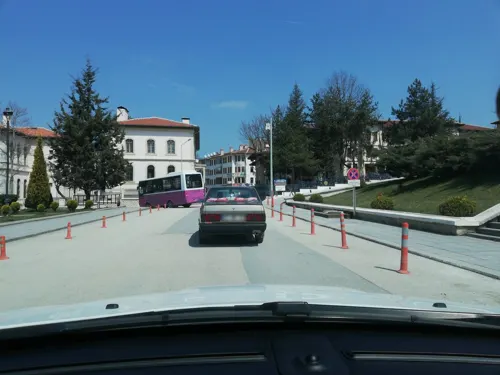


Atatürk and Şerife Bacı Monument
Monument and historic site
Monument in Kastamonu, Turkey






40 more on the map.
Parks, trails and playgrounds14



2 more on the map.
Restaurants and cafes49




37 more on the map.
History
There are many ideas about the derivation of the name Kastamonu:
According to the first view, it should be considered that the name Kastamonu is Turkishized from the name Paphlagonía [Greek "land of Paphlagon (people)"]. The region covering the West Black Sea and Central Black Sea regions was called Paphlagonia before the Turks. Today, Kastamonu, Sinop, Bartın, Çankırı and Karabük are located in this region, while parts of Çorum, Bolu, Zonguldak and Samsun provinces remain within the region. The Paphlagonians, who dominated this region in 1000 BC, gave their name to this geography.
According to a second opinion, the city of Kastamonu took its name from the name Kastama, which was used for the same region in the Hittite period. The name Kastama turned into Kastamonu over time.
According to another view, the city of Kastamonu took its name from the combination of the words Gas and Tumanna. Gas, or better known as Kashkas, are among the first settlers of Kastamonu. Tumanna is the name of a city/region located on Kastamonu at that time. The combination of these two words took the form of Kastamonu over time.
From the History section of Kastamonu on Wikipedia, under CC BY-SA 4.0.
Where to stay21
Churches and places of worship49
Shopping43
Gas and EV charging14
Schools, colleges and libraries24
Healthcare38
Map of Kastamonu
250 places. The map loads OpenStreetMap tiles when you open it.
Getting there and nearby towns
Kastamonu Airport (KFS) is the nearest airport with scheduled flights listed in OpenStreetMap, 7 km away.
- Gölköy 9 km north, about 9 min by car
- Yukarıbatak 18 km northeast, about 18 min by car
- Devrekani 26 km north, about 26 min by car
- İhsangazi 27 km southwest, about 27 min by car
- Daday 28 km northwest, about 28 min by car
- Seydiler 27 km north, about 27 min by car
- Örencik 36 km north, about 36 min by car
- Taşköprü 39 km east, about 39 min by car
- Araç 40 km west, about 40 min by car
- Tosya 46 km southeast, about 46 min by car
Drive times are estimates from straight-line distance, not routes.
Local news
Headlines from INDB.
Reviews, tips and questions
Loading what members have shared...
Sources and licences
- GeoNames (CC BY 4.0): population, coordinates, regions and time zone
- Mapillary (see each image): photos
- OpenStreetMap contributors (ODbL 1.0): places, airports, map data
- Wikidata (CC0 1.0): elevation, founding date, time zone, website, landmarks and historic places
- Wikimedia Commons (see each image): photos
- Wikipedia (CC BY-SA 4.0): overview and history text
Photo credits
- Kaleden Cumhuriyet Meydanı ve Çevresi, Barış37, CC BY-SA 3.0
- Kastamonu Yılanlı Külliyesi Taç Kapısı, Engin Mutlu 58, CC BY-SA 4.0
- 30 Ağustos sabahı Kastamonu sokaklarında... - panoramio, Lacivert71, CC BY 3.0
- Kastamonu dan (2012) - panoramio (8), Lacivert71, CC BY 3.0
- Kastamonu Cumhuriyet caddesi Karaçomak çayı Nasrullah köprüsü Ağustos 2011 - panoramio, Lacivert71, CC BY 3.0
- Kastamonu dan (2012) - panoramio, Lacivert71, CC BY 3.0
- Kastamonu dan (2012) - Meydan - panoramio, Lacivert71, CC BY 3.0
- Kastamonu Cumhuriyet meydanı - Alparslan Türkeş Parkı 2004 - panoramio, Lacivert71, CC BY 3.0
- Kastamonu dan (2012) - panoramio (2), Lacivert71, CC BY 3.0
- Kastamonu dan (2012) - panoramio (1), Lacivert71, CC BY 3.0
- Kastamonu saat kulesinden Cumhuriyet meydanı - Alparslan Türkeş Parkı PTT ve Askerlik Şubesi (2004) - panoramio, Lacivert71, CC BY 3.0
- Kastamonu dan (2012) - panoramio (3), Lacivert71, CC BY 3.0
- Kastamonu dan (2012) - panoramio (7), Lacivert71, CC BY 3.0
- Kastamonu dan (2012) - Saat kulesine çıkar - panoramio, Lacivert71, CC BY 3.0
- Saat kulesinden Kastamonu nun güneyi (2004) - panoramio, Lacivert71, CC BY 3.0
- Kastamonu da ara sokak (Cebrail mahallesi Bay Sk.) Ağustos 2011 - panoramio, Lacivert71, CC BY 3.0
- Kastamonu dan (2012) - Saat kulesi - panoramio, Lacivert71, CC BY 3.0
- Kastamonu saat kulesinden Cebrail mahallesi 2004 - panoramio, Lacivert71, CC BY 3.0
- Kastamonu dan (2012) - panoramio (5), Lacivert71, CC BY 3.0
- Kastamonu, Akşam üzeri, Saat kulesi ve kale silüeti Temmuz 2015 - panoramio, Lacivert71, CC BY 3.0
- Kastamonu dan (2012) - panoramio (4), Lacivert71, CC BY 3.0
- Kastamonu dan (2012) - Kastamonu kalesi - panoramio, Lacivert71, CC BY 3.0
- Kale den Kastamonu... - panoramio (4), Lacivert71, CC BY 3.0
- Kale den Kastamonu... - panoramio, Lacivert71, CC BY 3.0
- Kale den Kastamonu... - panoramio (2), Lacivert71, CC BY 3.0
- Kastamonu Kalesine çıkış - panoramio, Lacivert71, CC BY 3.0
- Nasrullah Bridge, Nedim Ardoğa, CC BY-SA 4.0
- VALi KONAGI - panoramio, DOST_6080, CC BY 3.0
- Kastamonu Hükümet Konağı panoramik, The original uploader was Barış37 at Turkish Wikipedia ., GFDL
- Abdurrahman Paşa Lisesi, Mustafa MVC, CC BY-SA 4.0
- Kastamonu Archaeological Museum 8760, Dosseman, CC BY-SA 4.0
- Onderkokturk-canakkale01, Onder Kokturk, CC BY-SA 4.0
- Kastamonu Saat Kulesi, Acar54, CC BY-SA 4.0
- Mahmut Bey Mosque 1642, Dosseman, CC BY-SA 4.0
- Kastamonu Castle, Turkey, Nedim Ardoğa, CC BY-SA 4.0
- Kastamonu5, Original uploader was Unal at tr.wikipedia, CC BY-SA 3.0
- Şehitler Abidesi Çanakkale, RIFAT AĞAR, CC BY-SA 4.0
- Kastamonu Museum from Clock Tower hill 8771, Dosseman, CC BY-SA 4.0
- Kastamonu Kalesi, Acar54, CC BY-SA 4.0
- Tabakoglu Pastirma 1240876, Nevit Dilmen ( talk ), CC BY-SA 3.0
- Street-level photo, sefaonur, CC BY-SA 4.0
- Street-level photo, sefaonur, CC BY-SA 4.0
- Street-level photo, sefaonur, CC BY-SA 4.0
- Street-level photo, sefaonur, CC BY-SA 4.0
- Street-level photo, sefaonur, CC BY-SA 4.0
- Street-level photo, sefaonur, CC BY-SA 4.0
- Street-level photo, sefaonur, CC BY-SA 4.0
- Street-level photo, sefaonur, CC BY-SA 4.0
- Street-level photo, sefaonur, CC BY-SA 4.0
- Street-level photo, sefaonur, CC BY-SA 4.0


Page built November 8, 2026. Spotted a mistake? Tell us or suggest a place.