


Why visit Muratpaşa
Townapedia lists 4 museums and landmarks, 6 places to eat, 1 place to stay and 2 attractions in and around town.
Highlights include Düden Waterfalls, Atatürk's House Museum and Doğu Garajı.
Weather in Muratpaşa
Forecast from MET Norway (CC BY 4.0). Full forecast
About Muratpaşa
Muratpaşa is a municipality and district of Antalya Province, Turkey. Its area is 96 km2, and its population is 526,293 (2022). The district covers part of the city centre of Antalya, and has a coastline of 20 km (12 mi). The Mediterranean Sea lies to the south of the district. Ümit Uysal is the mayor of Muratpaşa.
From the Wikipedia article Muratpaşa (this version), under CC BY-SA 4.0.
Things to do2

Düden Waterfalls
Waterfall · 4.8 km
Group of waterfalls in the province of Antalya, Turkey

Museums and landmarks4

Doğu Garajı
Monument and historic site · 4.7 km
Bus depot and archaeological site in Turkey

Limnae
Monument and historic site · 2.5 km
Ancient city of Pamphylia, in modern-day Turkey
Magydus
Monument and historic site · 5.0 km
Settlement of ancient Pamphylia
Restaurants and cafes6


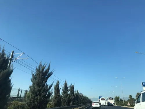


Where to stay1

History
Modern day district of Muratpaşa is home to Kaleiçi, the historic center founded by Attalus II, King of Pergamon around 150 BC. Since then, the district has been under Lydian, Roman, Persian, Byzantine, Seljuk, Cypriot, Teke, Ottoman, and —after the Italian occupation— Turkish rule.
From the History section of Muratpaşa on Wikipedia, under CC BY-SA 4.0.
Churches and places of worship8
Shopping10
Gas and EV charging10
Schools, colleges and libraries4
Healthcare5
Map of Muratpaşa
50 places. The map loads OpenStreetMap tiles when you open it.
Getting there and nearby towns
Antalya Airport (AYT) is the nearest airport with scheduled flights listed in OpenStreetMap, 3 km away.
- Antalya 6 km west, about 6 min by car
- Karaçallı 9 km east, about 9 min by car
- Varsak 12 km north, about 12 min by car
- Fettahlı 12 km north, about 12 min by car
- Duacı 14 km northwest, about 14 min by car
- Solakköy 15 km northeast, about 15 min by car
- Topallı 16 km north, about 16 min by car
- Kumköy 17 km east, about 17 min by car
- Odabaşı 17 km northwest, about 17 min by car
- Bahtılı 17 km west, about 17 min by car
Drive times are estimates from straight-line distance, not routes.
Local news
Headlines from INDB.
Reviews, tips and questions
Loading what members have shared...
Sources and licences
- GeoNames (CC BY 4.0): population, coordinates, regions and time zone
- Mapillary (see each image): photos
- OpenStreetMap contributors (ODbL 1.0): places, airports, map data
- Wikidata (CC0 1.0): elevation, founding date, time zone, website, landmarks and historic places
- Wikimedia Commons (see each image): photos
- Wikipedia (CC BY-SA 4.0): overview and history text
Photo credits
- Kaleiçi görünümü, Cobija, CC0
- Duden steps, karmakolle, CC0
- Antalya Atatürk Müzesi, User:E-92 in Turkish Wikipedia, Public domain
- Antalya, Turkey - panoramio (2), александр--161, CC BY 3.0
- Mersin - Alanya - Antalya Anayolu 30 - panoramio, Nihat1988, CC BY 3.0
- Antalya Ticaret ve Sanayi Odası - panoramio (5), Muhsin Sevgen, CC BY 3.0
- Antalya Ticaret ve Sanayi Odası - panoramio, Muhsin Sevgen, CC BY 3.0
- Antalya Ticaret ve Sanayi Odası - panoramio (1), Muhsin Sevgen, CC BY 3.0
- Antalya Ticaret ve Sanayi Odası - panoramio (3), Muhsin Sevgen, CC BY 3.0
- Antalya Ticaret ve Sanayi Odası - panoramio (2), Muhsin Sevgen, CC BY 3.0
- Antalya Ticaret ve Sanayi Odası - panoramio (7), Muhsin Sevgen, CC BY 3.0
- Antalya Ticaret ve Sanayi Odası - panoramio (6), Muhsin Sevgen, CC BY 3.0
- Argos Jewellery - Antalya - 2010 - panoramio, StevenL, CC BY-SA 3.0
- Ggg - panoramio, ako-aleko, CC BY-SA 3.0
- Ressam Gökhan Yıldırım., Gyildirimarte, CC BY-SA 4.0
- Antalya, Turkey - panoramio (46), Andre Speelmans, CC BY-SA 3.0
- Airplane - panoramio (1), Fr0nt, CC BY-SA 3.0
- Street-level photo, Guria, CC BY-SA 4.0
- Street-level photo, semi, CC BY-SA 4.0
- Street-level photo, ferahkoksal, CC BY-SA 4.0
- Street-level photo, Guria, CC BY-SA 4.0
- Street-level photo, Guria, CC BY-SA 4.0
- Street-level photo, Guria, CC BY-SA 4.0
- Street-level photo, ferahkoksal, CC BY-SA 4.0
- Street-level photo, Guria, CC BY-SA 4.0
- Street-level photo, Guria, CC BY-SA 4.0
- Street-level photo, Guria, CC BY-SA 4.0
- Street-level photo, semi, CC BY-SA 4.0
- Street-level photo, semi, CC BY-SA 4.0
- Street-level photo, ferahkoksal, CC BY-SA 4.0
- Street-level photo, ferahkoksal, CC BY-SA 4.0
- Street-level photo, semi, CC BY-SA 4.0
- Street-level photo, ferahkoksal, CC BY-SA 4.0
- Street-level photo, ferahkoksal, CC BY-SA 4.0
- Street-level photo, Guria, CC BY-SA 4.0
- Street-level photo, Guria, CC BY-SA 4.0
- Street-level photo, Guria, CC BY-SA 4.0
- Street-level photo, Guria, CC BY-SA 4.0
- Street-level photo, Guria, CC BY-SA 4.0


Page built November 8, 2026. Spotted a mistake? Tell us or suggest a place.