


Why visit Ordu
Townapedia lists 4 museums and landmarks, 3 parks and trails, 80 places to eat, 7 places to stay and 2 attractions in and around town.
Highlights include Ordu Ethnographical Museum.
Weather in Ordu
Forecast from MET Norway (CC BY 4.0). Full forecast
About Ordu
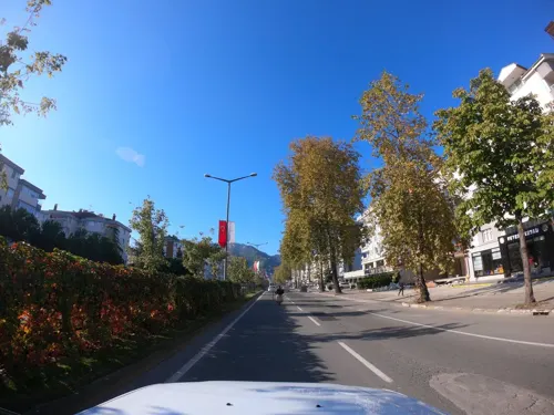
Ordu (Turkish pronunciation: [ˈoɾdu]) or Altınordu, is a port city on the Black Sea coast of Turkey and the capital of Ordu Province. The city forms the urban part of the Altınordu district, with a population of 235,096 in 2023.
From the Wikipedia article Ordu (this version), under CC BY-SA 4.0.
Travel tips from other travellers: Ordu on Wikivoyage (CC BY-SA 4.0).
Things to do2

Museums and landmarks4


Parks, trails and playgrounds3

Restaurants and cafes80

BEREKET DÖNER
Restaurant · Turkish, Burger, Sandwich, Chicken, Kebab, Juice, Tea, Steak House, Dessert, Salad, Breakfast · 1.7 km
75/A Ahmet Cemal Mağden Cadde, ORDU
11:00-03:00
Rafine Cafe
Restaurant · Regional, International · 2.0 km
15 Temmuz Milli İrade Caddesi, Ordu
Mo-Su 09:00-24:00




68 more on the map.
History
In the 8th century BC, Cotyora (Κοτύωρα) was founded by the Miletians as one of a string of colonies along the Black Sea coast. The town lay on a bay that shared its name, having been named after the town. Xenophon's Anabasis states that the city was a colony of Sinop, and that the Ten Thousand rested there for 45 days before embarking for home. Xenophon also mentioned that when the Ten Thousand reached Cotyora, ambassadors arrived from Sinope, expressing their fears. They explained that not only did the city belong to them, but the entire area as well.
The area came under the control of the Danishmends, then the Seljuk Turks in 1214 and 1228, and the Hacıemiroğulları Beylik in 1346. Afterwards, it passed to the dominion of the Ottomans in 1461 along with the Empire of Trebizond.
The modern city was founded by the Ottomans as Bayramlı near Eskipazar as a military outpost 5 km (3 mi) west of Ordu.
In 1869, the city's name was changed to Ordu and it was united with the districts of Bolaman, Perşembe, Ulubey, Hansamana (Gölköy), and Aybastı. At the turn of the 20th century, the city was more than half Christian (Greek and Armenian), and was known for its Greek schools.
On 4 April 1921, Ordu province was created by separating from Trebizond Vilayet.
From the History section of Ordu on Wikipedia, under CC BY-SA 4.0.
Where to stay7
Churches and places of worship23
Shopping28
Gas and EV charging6
Schools, colleges and libraries24
Healthcare100
Map of Ordu
250 places. The map loads OpenStreetMap tiles when you open it.
Getting there and nearby towns
Ordu Giresun Havalimanı (OGU) is the nearest airport with scheduled flights listed in OpenStreetMap, 16 km away.
- Turnasuyu 8 km east, about 8 min by car
- Kabadüz 13 km south, about 13 min by car
- Perşembe 14 km northwest, about 14 min by car
- Ulubey 17 km southwest, about 17 min by car
- Kestane 16 km southeast, about 16 min by car
- Mustafalı 16 km east, about 16 min by car
- Piraziz 21 km east, about 21 min by car
- Bulancak 29 km east, about 29 min by car
- Gürgentepe 32 km southwest, about 32 min by car
- Fatsa 33 km west, about 33 min by car
Drive times are estimates from straight-line distance, not routes.
Local news
Headlines from INDB.
Reviews, tips and questions
Loading what members have shared...
Sources and licences
- GeoNames (CC BY 4.0): population, coordinates, regions and time zone
- Mapillary (see each image): photos
- OpenStreetMap contributors (ODbL 1.0): places, airports, map data
- Wikidata (CC0 1.0): elevation, founding date, time zone, website, landmarks and historic places
- Wikimedia Commons (see each image): photos
- Wikipedia (CC BY-SA 4.0): overview and history text
Photo credits
- Ordu, Turkey, Ahmet Gürsakal, CC BY-SA 3.0
- Ordu Feb 2020 19 23 25 873000, Robot8A, CC BY-SA 4.0
- Ordu Feb 2020, Robot8A, CC BY-SA 4.0
- Ordu Feb 2020 19 20 11 061000, Robot8A, CC BY-SA 4.0
- Ordu - panoramio (21), sami yılmaz, CC BY 3.0
- Ordu - panoramio (20), sami yılmaz, CC BY 3.0
- Ordu, Ordu Merkez-Ordu, Turkey - panoramio (1), Dalibor Z. Chvatal, CC BY 3.0
- Ordu - panoramio (13), sami yılmaz, CC BY 3.0
- Ordu Feb 2020 19 20 54 348000, Robot8A, CC BY-SA 4.0
- Ordu - panoramio (22), sami yılmaz, CC BY 3.0
- Ordu, Ordu Merkez-Ordu, Turkey - panoramio, Dalibor Z. Chvatal, CC BY 3.0
- Ordu Feb 2020 19 20 17 019000, Robot8A, CC BY-SA 4.0
- Ordu sahil - panoramio, Öner Akgün, CC BY-SA 3.0
- Ordu Feb 2020 19 23 53 514000, Robot8A, CC BY-SA 4.0
- Ordu Feb 2020 19 20 48 771000, Robot8A, CC BY-SA 4.0
- Ordu Feb 2020 19 20 23 966000, Robot8A, CC BY-SA 4.0
- Ordu Feb 2020 19 20 43 239000, Robot8A, CC BY-SA 4.0
- Ordu Feb 2020 19 20 35 448000, Robot8A, CC BY-SA 4.0
- Ordu Feb 2020 19 20 29 908000, Robot8A, CC BY-SA 4.0
- Ordu Feb 2020 19 23 47 333000, Robot8A, CC BY-SA 4.0
- Ordu - panoramio - Öner Akgün (7), Öner Akgün, CC BY-SA 3.0
- Ordu - panoramio - Öner Akgün (8), Öner Akgün, CC BY-SA 3.0
- Ordu park - panoramio, Öner Akgün, CC BY-SA 3.0
- Ordu park - panoramio - Öner Akgün, Öner Akgün, CC BY-SA 3.0
- Ordu - panoramio - Öner Akgün (6), Öner Akgün, CC BY-SA 3.0
- Ordu Kemer Köprü 3118, Dosseman, CC BY-SA 4.0
- Ordu sahil - panoramio - Öner Akgün (4), Öner Akgün, CC BY-SA 3.0
- Ordu - panoramio - Öner Akgün (11), Öner Akgün, CC BY-SA 3.0
- Ordu Feb 2020 19 23 41 002000, Robot8A, CC BY-SA 4.0
- Ordu Feb 2020 19 23 30 337000, Robot8A, CC BY-SA 4.0
- Ordu Feb 2020 19 23 35 057000, Robot8A, CC BY-SA 4.0
- Ordu Feb 2020 19 22 25 414000, Robot8A, CC BY-SA 4.0
- Ordu Feb 2020 19 23 19 312000, Robot8A, CC BY-SA 4.0
- Ordu - panoramio (19), sami yılmaz, CC BY 3.0
- Ordu Feb 2020 19 22 38 930000, Robot8A, CC BY-SA 4.0
- Ordu Feb 2020 19 22 46 749000, Robot8A, CC BY-SA 4.0
- Ordu Feb 2020 19 22 31 515000, Robot8A, CC BY-SA 4.0
- Ordu Feb 2020 19 22 54 706000, Robot8A, CC BY-SA 4.0
- Taşbaşı Kilise'sinin genel görünümü, Demir dude, CC BY-SA 4.0
- Taşbaşı Church, Panegyrics of Granovetter, CC BY-SA 2.0
- Street-level photo, cbsordu, CC BY-SA 4.0
- Street-level photo, asturksever, CC BY-SA 4.0
- Street-level photo, asturksever, CC BY-SA 4.0
- Street-level photo, asturksever, CC BY-SA 4.0
- Street-level photo, robot8a, CC BY-SA 4.0
- Street-level photo, robot8a, CC BY-SA 4.0


Page built November 8, 2026. Spotted a mistake? Tell us or suggest a place.