



Why visit Sarayköy
Townapedia lists 15 museums and landmarks, 2 parks and trails, 4 places to eat, 4 places to stay and 3 attractions in and around town.
Highlights include Bozdağ Tepesi, Dela Dağı, Carura and Apollonia.
Weather in Sarayköy
Forecast from MET Norway (CC BY 4.0). Full forecast
About Sarayköy
Sarayköy is a municipality and district of Denizli Province, Turkey. Its area is 379 km2, and its population is 30,834 (2022). It is 20 km west of the city of Denizli, on a plain between mountains and watered by Büyük Menderes River.
From the Wikipedia article Sarayköy (this version), under CC BY-SA 4.0.
Things to do3


Museums and landmarks15

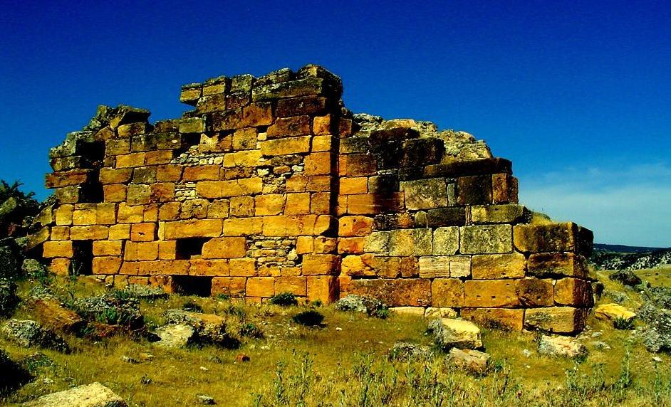
Carura
Monument and historic site · 9.1 km
Ancient town of Asia Minor
Apollonia
Monument and historic site · 15.7 km
Ancient city of Mysia in modern-day Turkey
Apollonos-Hieron
Monument and historic site · 15.8 km
Ancient city of Lydia in modern-day Turkey

Hierapolis
Monument and historic site · 17.6 km
Ancient city of Phrygia in modern-day Turkey
Kilaraza
Monument and historic site · 13.5 km
Ancient city of Caria in modern-day Turkey


Pamukkale Archeology Museum
Museum · 17.4 km
Archaeology museum in Denizli
Ploutonion at Hierapolis
Monument and historic site · 17.6 km
Ancient shrine to god Pluto in Turkey
Syneta
Monument and historic site · 16.6 km
Ancient city of Caria, in modern-day Turkey
Trapezopolis
Monument and historic site · 7.7 km
Ancient city of Caria, in modern-day Turkey
Tripolis
Monument and historic site · 12.9 km
Ancient city at the crossroads of Caria, Lydia, and Phrygia in modern-day Turkey
3 more on the map.
Parks, trails and playgrounds2

Restaurants and cafes4

Köytat Butik Bahçe Saruhan
Restaurant · Turkish, Breakfast · 14.7 km
12047 Sokak, Denizli
Tu-Su 09:00-17:00


Maraş UsulüToros Dondurma
Fast food · Ice Cream, Turkish
Şht. Astsubay Ömer Halisdemir Cd, Denizli
09:00-23:00
History
The town was previously a village named Sarıbey after the Turkmen lord that settled his tribe here in the 14th century.
Sarayköy was an important point of resistance to the Greek Army in the Turkish War of Independence. Volunteers assembled here were able to defend the bridge across the River Menderes and thus prevent the Greeks from occupying the city of Denizli. There is a statue in the town of a fighter in local efe costume to commemorate this struggle.
From the History section of Sarayköy on Wikipedia, under CC BY-SA 4.0.
Where to stay4
Denizli Akköy Sema Abdurrahman Karamanlıoğlu Otelcilik ve Turizm Meslek Lisesi Uygulama Oteli
Motel and hotel · 13.9 km
Churches and places of worship10
Shopping3
Gas and EV charging11
SHARZ Kocabaylar PO
EV charging · 4.8 km
Beylerbeyi Mahallesi, D585, 20325 Sarayköy/Denizli, SARAYKÖY
Schools, colleges and libraries3
Healthcare18
Map of Sarayköy
73 places. The map loads OpenStreetMap tiles when you open it.
Getting there and nearby towns
Denizli Çardak Airport (DNZ) is the nearest airport with scheduled flights listed in OpenStreetMap, 70 km away.
- Gerali 3 km southwest, about 3 min by car
- Sığma 4 km east, about 4 min by car
- Uyanık 6 km northeast, about 6 min by car
- Aşağışamlı 9 km east, about 9 min by car
- Yenicekent 13 km north, about 13 min by car
- Merkezefendi 17 km southeast, about 17 min by car
- Denizli 22 km southeast, about 22 min by car
- Tavas 41 km south, about 41 min by car
- Nazilli 53 km west, about 53 min by car
- Çine 84 km southwest, about 1 h 30 min by car
Drive times are estimates from straight-line distance, not routes.
Local news
Headlines from INDB.
Reviews, tips and questions
Loading what members have shared...
Sources and licences
- GeoNames (CC BY 4.0): population, coordinates, regions and time zone
- Mapillary (see each image): photos
- OpenStreetMap contributors (ODbL 1.0): places, airports, map data
- Wikidata (CC0 1.0): elevation, founding date, time zone, website, landmarks and historic places
- Wikimedia Commons (see each image): photos
- Wikipedia (CC BY-SA 4.0): overview and history text
Photo credits
- The Roman theatre, built in the 2nd century AD under Hadrian on the ruins of an earlier theatre, later renovated under Septimius Severus, Hierapolis, Turkey - 17033895960, Carole Raddato, CC BY-SA 2.0
- Hierapolis Archaeological Museum 09, Biologg, CC BY-SA 4.0
- Tripolis in Phrygia Buldan Denizli2, Mr. Arif Solak, CC BY 3.0
- Tripolis on the Meander, Lydia, Turkey (19499394805), Carole Raddato from FRANKFURT, Germany, CC BY-SA 2.0
- Street-level photo, lutfullah, CC BY-SA 4.0
Page built November 8, 2026. Spotted a mistake? Tell us or suggest a place.