


Sarıgöl, Turkey
Sarıgöl is a town of 12,794 people in Manisa, Turkey, founded in September 1, 1957.
Why visit Sarıgöl
Townapedia lists 15 parks and trails, 3 places to eat, 1 place to stay and 4 attractions in and around town.
Highlights include Uysal Dağı.
Weather in Sarıgöl
Forecast from MET Norway (CC BY 4.0). Full forecast
About Sarıgöl
Sarıgöl is a municipality and district of Manisa Province, Turkey. Its area is 432 km2, and its population is 35,537 (2022). The town lies at an elevation of 220 m (722 ft).
From the Wikipedia article Sarıgöl (this version), under CC BY-SA 4.0.
Things to do4

Parks, trails and playgrounds15

Sarıgöl Toki Afet Konutları Çocuk Parkı
Playground · 2.7 km
10 Arnavutlar Caddesi, Manisa



3 more on the map.
Restaurants and cafes3

Sarıgöl Belediyesi Kafeteryası
Cafe · Coffee Shop, Dessert
1/2 İstiklal Caddesi, Manisa
Mo-Fr 08:00-17:00

Sorban Bağları Şarap Üretim Tesisi
Brewery and winery · 13.8 km
Where to stay1

History
Sarıgöl is a small town located between the provinces of Denizli and Manisa. According to some historians, it has been an important city throughout history. There was an ancient city called Callatebus (Ancient Greek: Καλλάτηβος) in the vicinity of today's Sarıgöl. The city of Kallatebos (Callatebus) was mentioned by Herodotus in his Histories 7th book's 31st paragraph. The city was between Philadelphia (Alaşehir) and Hierapolis (Pamukkale).
From the History section of Sarıgöl on Wikipedia, under CC BY-SA 4.0.
Churches and places of worship3
Gas and EV charging1
Schools, colleges and libraries1
Healthcare15
Map of Sarıgöl
43 places. The map loads OpenStreetMap tiles when you open it.
Getting there and nearby towns
Uşak Havalimanı (USQ) is the nearest airport with scheduled flights listed in OpenStreetMap, 84 km away.
- Alaşehir 20 km northwest, about 20 min by car
- Buldan 25 km southeast, about 25 min by car
- Nazilli 49 km southwest, about 49 min by car
- Salihli 55 km northwest, about 55 min by car
- Denizli 62 km southeast, about 1 h by car
- Uşak 78 km northeast, about 1 h 15 min by car
- Tavas 81 km southeast, about 1 h 15 min by car
- Tire 86 km west, about 1 h 30 min by car
- Aydın 87 km southwest, about 1 h 30 min by car
- Çine 89 km southwest, about 1 h 30 min by car
Drive times are estimates from straight-line distance, not routes.
Local news
Headlines from INDB.
Reviews, tips and questions
Loading what members have shared...
Sources and licences
- GeoNames (CC BY 4.0): population, coordinates, regions and time zone
- Mapillary (see each image): photos
- OpenStreetMap contributors (ODbL 1.0): places, airports, map data
- Wikidata (CC0 1.0): elevation, founding date, time zone, website
- Wikimedia Commons (see each image): photos
- Wikipedia (CC BY-SA 4.0): overview and history text
Photo credits
- ISS055-E-33725 - View of Earth, Earth Science and Remote Sensing Unit, NASA Johnson Space Center, Public domain
- ISS034-E-60996 - View of Earth, Earth Science and Remote Sensing Unit , Lyndon B. Johnson Space Center, Public domain
- ISS034-E-60997 - View of Earth, Earth Science and Remote Sensing Unit , Lyndon B. Johnson Space Center, Public domain
- ISS034-E-60995 - View of Earth, Earth Science and Remote Sensing Unit , Lyndon B. Johnson Space Center, Public domain
- ISS047-E-58739 - View of Earth, Earth Science and Remote Sensing Unit , Lyndon B. Johnson Space Center, Public domain
- STS124-E-7029 - View of Earth, NASA, Public domain
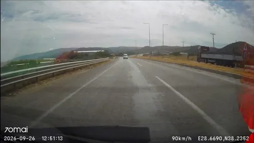
- Street-level photo, doriel, CC BY-SA 4.0
- Street-level photo, doriel, CC BY-SA 4.0
Page built November 8, 2026. Spotted a mistake? Tell us or suggest a place.