




Why visit Sarıkamış
Townapedia lists 1 museum or landmark, 2 parks and trails, 3 places to eat, 4 places to stay and 53 attractions in and around town.
Highlights include Bayraktepe, Büyükkumru Tepesi and Sarıkamış-Allahuekber Mountains National Park.
Weather in Sarıkamış
Forecast from MET Norway (CC BY 4.0). Full forecast
About Sarıkamış
Sarıkamış or Sarikamish (Kurdish: Zerqamîş, Armenian: Սարիղամիշ, romanized: Sariġamiš) is a town in Kars Province in the Eastern Anatolia region of Turkey. It is the seat of Sarıkamış District. Its population is 15,260 (2022).
From the Wikipedia article Sarıkamış (this version), under CC BY-SA 4.0.
Things to do53

41 more on the map.
Museums and landmarks1

Kızılkilise Yeri
Monument and historic site · 13.4 km
Ermeni yerleşimcilerden kalma Kilise kalıntısı alanı. İsmini inşa ederken kullanılan bölgedeki toprak ve taşların renginden almıştır.
Parks, trails and playgrounds2

Sarıkamış-Allahuekber Mountains National Park
Park · 3.7 km
National park in Turkey
Restaurants and cafes3

History
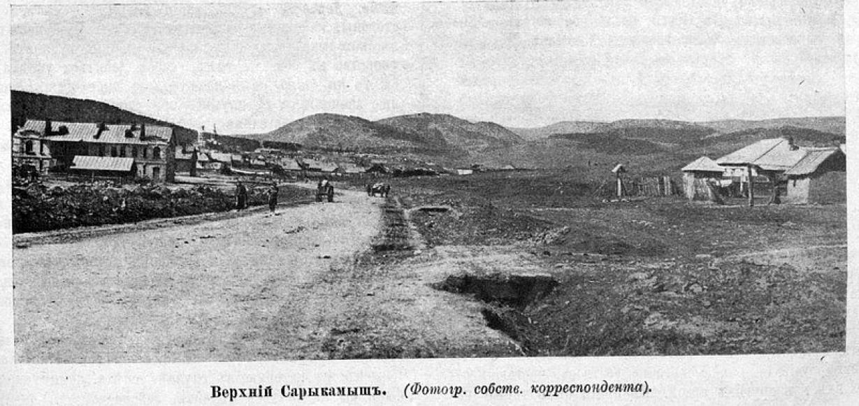
For most of the 19th century, Sarikamish was an insignificant settlement that was divided into two parts: upper Sarikamish and lower Sarikamish.
Obsidian from Sarikamish was found at several Neolithic sites in South Caucasus, such as at Aratashen, and at Khramis Didi-gora dating from the 6th millennium BC. Obsidian from Meydan Dağ (to the south of Sarikamish) was also found in South Caucasus.
During the later history, nearby archaeological sites date from Urartian times: there is a Urartian fortress on a hill beside upper Sarikamish, another, 12 km (7.5 mi) away, beside Chatak village, and a third, 15 km (9.3 mi) away, at a site known as Yedikilise. In 1878, archaeologist Alexander Yeritsian discovered near Sarıkamış a cuneiform inscription made during the reign of Urartian king Argishti I. To the east and south of the town, in the forests of Soğanlı, there were many medieval Armenian monasteries, but most were in ruins by 1878.
Seljuk sultan Alp Arslan invaded the Sarikamish area including Allahüekber and Soğanlı mountains in 1064, only a few years prior to the battle of Manzikert between the armies of Alp Arslan and Byzantines. The area was then taken by Selim I in 1514 and became a liva of Kars sancak of the Ottoman Empire.
From the History section of Sarıkamış on Wikipedia, under CC BY-SA 4.0.
Where to stay4
Churches and places of worship1
Gas and EV charging1
Schools, colleges and libraries1
Healthcare6
Map of Sarıkamış
72 places. The map loads OpenStreetMap tiles when you open it.
Getting there and nearby towns
Kars Harakani Airport (KSY) is the nearest airport with scheduled flights listed in OpenStreetMap, 52 km away.
- Alisofu 8 km east, about 8 min by car
- Yayıklı 12 km northeast, about 12 min by car
- Mescitli 13 km south, about 13 min by car
- Şehitemin 16 km southeast, about 16 min by car
- Gecikmez 18 km southeast, about 18 min by car
- Belencik 19 km southeast, about 19 min by car
- Çamyazı 20 km southwest, about 20 min by car
- Selim 22 km northeast, about 22 min by car
- Beşyol 23 km south, about 23 min by car
- Ağrı 78 km southeast, about 1 h 15 min by car
Drive times are estimates from straight-line distance, not routes.
Local news
Headlines from INDB.
Reviews, tips and questions
Loading what members have shared...
Sources and licences
- GeoNames (CC BY 4.0): population, coordinates, regions and time zone
- OpenStreetMap contributors (ODbL 1.0): places, airports, map data
- Wikidata (CC0 1.0): elevation, founding date, time zone, website, landmarks and historic places
- Wikimedia Commons (see each image): photos
- Wikipedia (CC BY-SA 4.0): overview and history text
Photo credits
- Sarikamish-Atatürk monument, Киликиец, CC BY-SA 3.0
- Upper Sarikamish (1916), Собственный корреспондент Журнала "Разведчик" (1916), Public domain
- Sarikamish market (1916), Собственный корреспондент Журнала "Разведчик" (1916), Public domain
- Lower Sarikamish (SE part, 1916), Собственный корреспондент Журнала "Разведчик" (1916), Public domain
- SARIKAMIŞ KAYAK MERKEZİ - panoramio, hüseyin yeşil, CC BY 3.0
- Mt. Ararat from Kars, Panegyrics of Granovetter, CC BY-SA 2.0
- ISS018-E-10210 - View of Turkey, Earth Science and Remote Sensing Unit , Lyndon B. Johnson Space Center, Public domain
- ISS030-E-22352 - View of Earth, Earth Science and Remote Sensing Unit , Lyndon B. Johnson Space Center, Public domain
- ISS038-E-20779 - View of Earth, Earth Science and Remote Sensing Unit , Lyndon B. Johnson Space Center, Public domain


Page built November 8, 2026. Spotted a mistake? Tell us or suggest a place.