
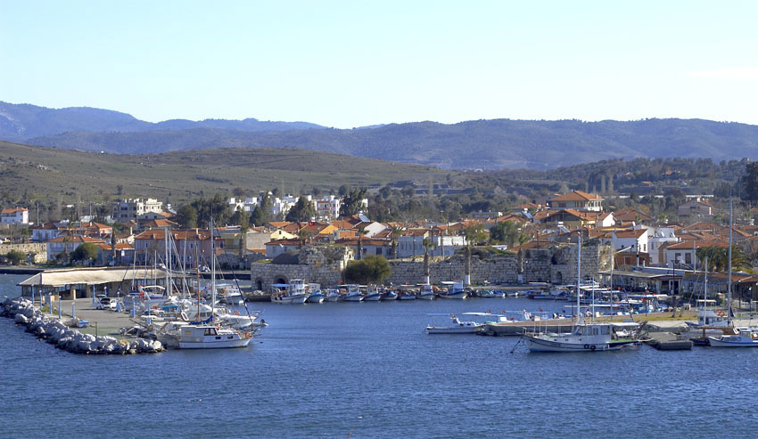


Why visit Seferihisar
Townapedia lists 16 museums and landmarks, 18 parks and trails, 58 places to eat, 27 places to stay and 4 attractions in and around town.
Highlights include Teos Theater, Teos, Chytrium and Teos Marina.
Weather in Seferihisar
Forecast from MET Norway (CC BY 4.0). Full forecast
About Seferihisar
Seferihisar is a municipality and district of İzmir Province, Turkey. Its area is 375 km2, and its population is 60,914 (2024). Seferihisar district area borders on other İzmir districts of Urla to the west and Menderes to the east, and touches İzmir's westernmost metropolitan district of Güzelbahçe in the north. Seferihisar town center is situated slightly inland at an altitude of 28 m and the urban area extends towards the Aegean Sea.
From the Wikipedia article Seferihisar (this version), under CC BY-SA 4.0.
Things to do4



Museums and landmarks16


Chytrium
Monument and historic site · 17.8 km
Ancient city of Ionia, in modern-day Turkey
Gerriadai
Monument and historic site · 4.4 km
Ancient city of Ionia, in modern-day Turkey

Lebedus
Monument and historic site · 17.8 km
Ancient city of Ionia, in modern-day Turkey


4 more on the map.
Parks, trails and playgrounds18





6 more on the map.
Restaurants and cafes58

Orhanlı Büyülü Vadi Butik Otel-Cafe
Cafe · 11.5 km
Sadece misafirlere açık panoramik manzaralı, şömineli, mutfak ve cafe, karmaşadan uzak, kuş sesleri eşliğinde doğaya bir kaçamak, şömine...
14 7107 Sk, İzmir
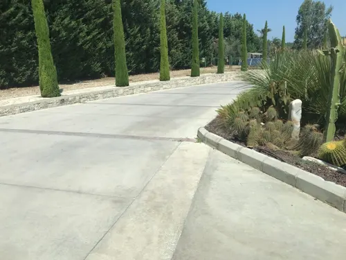
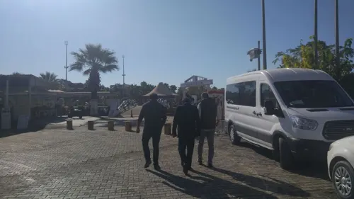




Ege Siesta Et&Mangal
Restaurant · Barbecue, Burger, Fish, Mediterranean · 4.3 km
Akarca Sahil
46 more on the map.
History
Apart from Teos, a major Ionian port and artistic and cult center, two other ancient settlements datable to the ancient Greek period and beyond are located along Seferihisar district's seashore, both to the south of Teos. Near the southern boundary of the district is Lebedos, the smallest of the twelve original Ionian settlements along the Anatolian coastline. Pausanias mentions that the town was initially inhabited by Carians, for whom the region is normally a very northern one, and that Ionian Greeks immigrated there under the guidance of Andræmon, while Strabo gives the name the colonizing leader as Andropompus and that it previously bore the name of Artis of ancient Lydia. Although it is known to have engaged in maritime commerce, was famous for its mineral springs and a member of the Ionian League, the peninsular settlement of Lebedos suffered from the limited space of its hinterland and a comparatively unsuitable port. It has not been excavated and the visible ruins are scanty.
From the History section of Seferihisar on Wikipedia, under CC BY-SA 4.0.
Where to stay27
Churches and places of worship8
Shopping18
Gas and EV charging6
Schools, colleges and libraries18
Dokuz Eylül Üniversitesi Fevziye Hepkon Sosyal Bilimler Meslek Yüksek Okulu
School · 0.6 km
Healthcare23
Map of Seferihisar
196 places. The map loads OpenStreetMap tiles when you open it.
Getting there and nearby towns
Adnan Menderes Airport (ADB) is the nearest airport with scheduled flights listed in OpenStreetMap, 30 km away.
- Urla 15 km northwest, about 15 min by car
- Konak 32 km northeast, about 32 min by car
- Karabağlar 33 km northeast, about 33 min by car
- İzmir 35 km northeast, about 35 min by car
- Karşıyaka 38 km northeast, about 38 min by car
- Torbalı 43 km east, about 43 min by car
- Bornova 47 km northeast, about 47 min by car
- Kuşadası 52 km southeast, about 52 min by car
- Selçuk 54 km southeast, about 54 min by car
- Manisa 69 km northeast, about 1 h 15 min by car
Drive times are estimates from straight-line distance, not routes.
Local news
Headlines from INDB.
Reviews, tips and questions
Loading what members have shared...
Sources and licences
- GeoNames (CC BY 4.0): population, coordinates, regions and time zone
- Mapillary (see each image): photos
- OpenStreetMap contributors (ODbL 1.0): places, airports, map data
- Wikidata (CC0 1.0): elevation, founding date, time zone, website, landmarks and historic places
- Wikimedia Commons (see each image): photos
- Wikipedia (CC BY-SA 4.0): overview and history text
Photo credits
- Sığacık, Equolaizer, CC BY-SA 3.0
- Seferihisar Hükümet Konağı, İncelemeelemani, CC BY-SA 3.0
- Seferihisar askerlik şubesi, İncelemeelemani, CC BY-SA 3.0
- Seferihisar Adalet Sarayı 01, BSRF, CC BY-SA 4.0
- A quiet scene. - Seferihisar. - panoramio, Yağmur Aydın, CC BY-SA 3.0
- Seferihisar landscape - panoramio, mehmet şan, CC BY-SA 3.0
- Seferihisar - Akarca - panoramio, Yağmur Aydın, CC BY-SA 3.0
- Seferihisar Marina, Imperissionist, CC BY-SA 4.0
- Teos, Sığacık, Kadı, CC BY-SA 4.0
- Kisik or Lebedos Peninsula Urkmez Seferihisar Izmir Turkey, Ms. Sevil Ege, CC BY 3.0
- Sığacık Castle 01, BSRF, CC BY-SA 4.0
- Teos Marina 01, BSRF, CC BY-SA 4.0
- Teos Sarnıç, Aerdemsenturk, CC BY-SA 4.0
- Teos Antik Tiyatro - geniş açı, Ozlmktv, CC BY-SA 4.0
- Sığacık, Seferihisar, İzmir, 2020 18, Gargarapalvin, CC BY-SA 4.0
- Teos Meclis Binası 2026-07-20 21.04.24 1784570857, Emirhan Sağdır, CC BY-SA 4.0
- Островец атомная станция, Островецкий район, Гродненская область, Беларусь 19, Denis Blisch, CC BY-SA 4.0
- Morning in Sığacık (07-21-24), DJLeamen, CC0
- Sığacık Waterfront 2 (07-28-24), DJLeamen, CC0
- Sığacık Waterfront (07-28-24), DJLeamen, CC0
- Sığacık Waterfront (evening, 08-02-24), DJLeamen, CC0
- Rebecca Georgia 2017 (Unsplash), Rebecca Georgia rebeccageorgia, CC0
- Sığacık Waterfront (evening 2, 08-02-24), DJLeamen, CC0
- Sığacık - sokak, Ozlmktv, CC BY-SA 4.0
- Sığacık - sokak 3, Ozlmktv, CC BY-SA 4.0
- Sığacık - sokak 2, Ozlmktv, CC BY-SA 4.0
- Sığacık 03, BSRF, CC BY-SA 4.0
- Sığacık panorama 04, BSRF, CC BY-SA 4.0
- Sığacık Castle, Harbour and Teos Marina 08, BSRF, CC BY-SA 4.0
- Sığacık 01, BSRF, CC BY-SA 4.0
- Sığacık 02, BSRF, CC BY-SA 4.0
- Sığacık 2, Imperissionist, CC BY-SA 4.0
- Sığacık Castle 06, BSRF, CC BY-SA 4.0
- Sığacık Kalesi, Imperissionist, CC BY-SA 4.0
- Cittaslow Sığacık, Nedim Ardoğa, CC BY-SA 4.0
- Teos bouleuterion, Isabeau, CC BY-SA 4.0
- Teos Meclis Binası 2026-07-20 21.04.42 1784570854, Emirhan Sağdır, CC BY-SA 4.0
- Sığacık Castle 03, BSRF, CC BY-SA 4.0
- Sığacık Castle 04, BSRF, CC BY-SA 4.0
- Sığacık Castle 02, BSRF, CC BY-SA 4.0
- Ekmeksiz Beach Nature Park, Fivitria, CC BY-SA 4.0
- Street-level photo, hderinoz, CC BY-SA 4.0
- Street-level photo, orkut, CC BY-SA 4.0
- Street-level photo, orkut, CC BY-SA 4.0
- Street-level photo, unen, CC BY-SA 4.0
- Street-level photo, ozenharun, CC BY-SA 4.0
- Street-level photo, ozenharun, CC BY-SA 4.0


Page built November 8, 2026. Spotted a mistake? Tell us or suggest a place.