


Why visit Siirt
Townapedia lists 1 museum or landmark, 5 parks and trails, 11 places to eat and 2 places to stay in and around town.
Highlights include Botan Valley National Park and KENT MEYDANI ( 15 TEMMUZ MEYDANI ).
Weather in Siirt
Forecast from MET Norway (CC BY 4.0). Full forecast
About Siirt
Siirt (Kurdish: سێرت, romanized: Sêrt; Arabic: سِعِرْد, romanized: Si'ird; Armenian: Սղերդ, romanized: Sġerd; Syriac: ܣܥܪܬ, romanized: Siirt;) is a city in the Siirt District of Siirt Province in Turkey. It had a population of 160,340 in 2021. The city is predominantly inhabited by Kurds.
From the Wikipedia article Siirt (this version), under CC BY-SA 4.0.
Travel tips from other travellers: Siirt on Wikivoyage (CC BY-SA 4.0).
Museums and landmarks1

Parks, trails and playgrounds5


Restaurants and cafes11

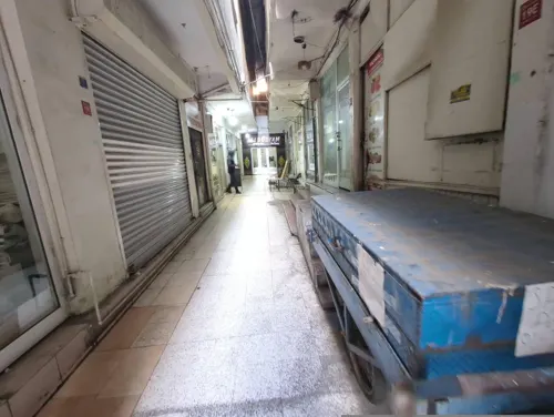
Boğaziçi Et Lokantası
Restaurant
54 Güreş Caddesi
Mo-Su 07:00-22:00

Burger King
Fast food · Burger · 1.0 km
61/1 Cengiz Topel, SİİRT
Mo-Su 10:00-22:00


Where to stay2

Churches and places of worship6
Shopping12
Gas and EV charging2
Schools, colleges and libraries10
Healthcare55
Map of Siirt
104 places. The map loads OpenStreetMap tiles when you open it.
Getting there and nearby towns
Siirt Airport (SXZ) is the nearest airport with scheduled flights listed in OpenStreetMap, 10 km away.
- Gökçebağ 6 km southwest, about 6 min by car
- Tillo 7 km east, about 7 min by car
- İkizbağlar 6 km northeast, about 6 min by car
- Doluharman 7 km north, about 7 min by car
- Aktaş 12 km west, about 12 min by car
- Meydandere 14 km east, about 14 min by car
- Şirvan 17 km northeast, about 17 min by car
- Bağlıca 15 km south, about 15 min by car
- Ekmekçiler 17 km east, about 17 min by car
- Silopi 89 km southeast, about 1 h 30 min by car
Drive times are estimates from straight-line distance, not routes.
Local news
Headlines from INDB.
Reviews, tips and questions
Loading what members have shared...
Sources and licences
- GeoNames (CC BY 4.0): population, coordinates, regions and time zone
- Mapillary (see each image): photos
- OpenStreetMap contributors (ODbL 1.0): places, airports, map data
- Wikidata (CC0 1.0): elevation, founding date, time zone, website, landmarks and historic places
- Wikimedia Commons (see each image): photos
- Wikipedia (CC BY-SA 4.0): overview and history text
Photo credits
- City center, No machine-readable author provided. Veleye assumed (based on copyright claims)., Public domain
- Siirt Ulu Camii 1761629779, Mkurtel, CC BY-SA 4.0
- Siirt unidentified street in 2010 8425, Dosseman, CC BY-SA 4.0
- Siirt Güres street or nearby in 2010 8426, Dosseman, CC BY-SA 4.0
- Siirt unidentified street Kurtalan Yolu Caddesi in 2010 8415, Dosseman, CC BY-SA 4.0
- Siirt Mega AVM in 2010 8455, Dosseman, CC BY-SA 4.0
- Siirt bıttım at Valilik in 2010 8419, Dosseman, CC BY-SA 4.0
- Siirt Mega AVM in 2010 8456, Dosseman, CC BY-SA 4.0
- Siirt Güres street or nearby in 2010 8428, Dosseman, CC BY-SA 4.0
- Siirt Hükumet caddesi... - panoramio (1), Lacivert71, CC BY 3.0
- Siirt Güres street or nearby in 2010 8457, Dosseman, CC BY-SA 4.0
- Siirt Saat Kulesi 8416, Dosseman, CC BY-SA 4.0
- Siirt Hükumet caddesi... - panoramio, Lacivert71, CC BY 3.0
- Siirt Mega AVM in 2010 8454, Dosseman, CC BY-SA 4.0
- Karlı kış gününde Siirt saat kulesi - panoramio, Lacivert71, CC BY 3.0
- Siirt te kış çalışması , Kardan Ayı ve Penguen - panoramio, Lacivert71, CC BY 3.0
- Siirt Güres street or nearby in 2010 8429, Dosseman, CC BY-SA 4.0
- Siirt Atatürk Monument in 2010 8380, Dosseman, CC BY-SA 4.0
- Siirt Street scene 8381, Dosseman, CC BY-SA 4.0
- Siirt Güres street or nearby in 2010 8430, Dosseman, CC BY-SA 4.0
- Siirt Şeyh el Hazin Caddesi in 2010 8528, Dosseman, CC BY-SA 4.0
- Siirt Şeyh el Hazin Caddesi in 2010 8527, Dosseman, CC BY-SA 4.0
- Siirt Güres street or nearby in 2010 8452, Dosseman, CC BY-SA 4.0
- Siirt Güres street or nearby in 2010 8451, Dosseman, CC BY-SA 4.0
- Siirt Uryan Cami in 2010 8462, Dosseman, CC BY-SA 4.0
- Siirt Güres street or nearby in 2010 8432, Dosseman, CC BY-SA 4.0
- Siirt Güres street or nearby in 2010 8433, Dosseman, CC BY-SA 4.0
- Siirt market area in 2010 8389, Dosseman, CC BY-SA 4.0
- Siirt Market area 8466, Dosseman, CC BY-SA 4.0
- Siirt market area in 2010 8390, Dosseman, CC BY-SA 4.0
- Siirt Güres street or nearby in 2010 8435, Dosseman, CC BY-SA 4.0
- Siirt Market area 8478, Dosseman, CC BY-SA 4.0
- Siirt Güres street or nearby in 2010 8436, Dosseman, CC BY-SA 4.0
- Siirt Şeyh Ebarik Camisi in 2010 8524, Dosseman, CC BY-SA 4.0
- Siirt market area in 2010 8392, Dosseman, CC BY-SA 4.0
- Siirt in 2010 8394, Dosseman, CC BY-SA 4.0
- Siirt Güres street or nearby in 2010 8439, Dosseman, CC BY-SA 4.0
- Siirt Şeyh el Hazin Caddesi in 2010 8523, Dosseman, CC BY-SA 4.0
- Siirt June 2010 8406, Dosseman, CC BY-SA 4.0
- Siirt Güres street or nearby in 2010 8441, Dosseman, CC BY-SA 4.0
- Botan Valley, Senol Demir, CC BY 2.0
- Street-level photo, rafialacahan, CC BY-SA 4.0
- Street-level photo, theraphim, CC BY-SA 4.0
- Street-level photo, theraphim, CC BY-SA 4.0
- Street-level photo, rafialacahan, CC BY-SA 4.0
- Street-level photo, rafialacahan, CC BY-SA 4.0


Page built November 8, 2026. Spotted a mistake? Tell us or suggest a place.