


Why visit Söke
Townapedia lists 45 museums and landmarks, 15 parks and trails, 66 places to eat, 22 places to stay and 8 attractions in and around town.
Highlights include Ladies Beach, Durmuş Dağı, Priene and Anaea.
Weather in Söke
Forecast from MET Norway (CC BY 4.0). Full forecast
About Söke
Söke is a municipality and district of Aydın Province, Turkey. Its area is 1,064 km2, and its population is 123,301 (2022). It is the largest district of Aydın Province by area. Söke is 54 km (34 miles) south-west of the city of Aydın, near the Aegean coast.
From the Wikipedia article Söke (this version), under CC BY-SA 4.0.
Things to do8



Museums and landmarks45

Priene
Monument and historic site · 13.6 km
Ancient city of Ionia, in modern-day Turkey
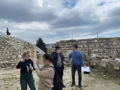
Anaea
Monument and historic site · 12.9 km
Ancient city of Ionia, in modern-day Turkey

Çamlık Railway Museum
Museum · 15.4 km
Railway museum in Izmir Province, Turkey

Hieron, Caria
Monument and historic site · 16.7 km
Ancient city of Caria, in modern-day Turkey
Kadyie
Monument and historic site · 17.1 km
Ancient city of Ionia, in modern-day Turkey
Maeandropolis
Monument and historic site
Ancient city of Ionia, in modern-day Turkey

Magnesia on the Maeander
Monument and historic site · 15.7 km
Ancient city of Ionia, in modern-day Turkey

Melia
Monument and historic site · 17.1 km
Ancient city of Ionia, in modern-day Turkey

Myus
Monument and historic site · 17.2 km
Ancient city of Caria in modern-day Turkey
Neapolis
Monument and historic site · 16.2 km
Ancient city of Ionia, in modern-day Turkey
Ortygia
Monument and historic site · 10.8 km
Ancient city of Ionia, in modern-day Turkey

Panionium
Monument and historic site · 8.3 km
Ancient sanctuary and settlement of the Ionians
33 more on the map.
Parks, trails and playgrounds15




3 more on the map.
Restaurants and cafes66
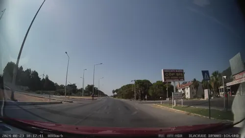

Panorama Restaurant
Restaurant · Sandwich, Chicken, Kebab, Breakfast, Burger, Tea · 9.8 km
2 Pine Valley Sk, aydın
Mo-Su 09:00-21:00
Sökeli Adakçı
Restaurant · 2.6 km
Yenikent mahallesi
Mo-Su 10:00-22:00
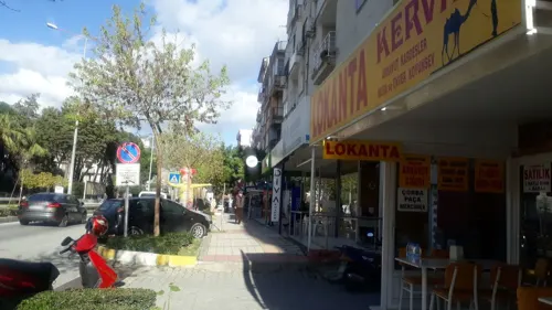
KERVAN RESTAURANT
Restaurant · Kebab, Meatball, Beef Liver, Soup · 1.3 km
AYDIN CADDESİ, Söke
Mo-Sa 08:00-20:00
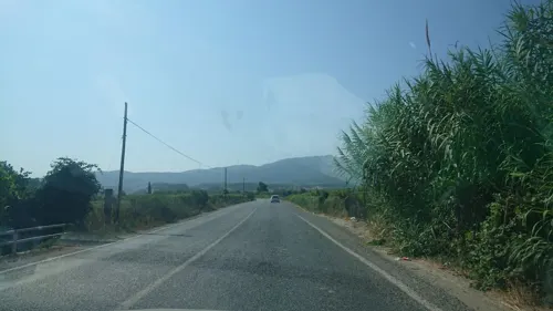
Saraydamı Gözleme Kahvalti Ve Ev Yemekleri
Restaurant · 10.2 km
122 Kuşadası - Davutlar Yolu, Aydın
Mo-Fr 08:00-22:00



Tarihi Çınaraltı Et Lokantası
Restaurant · 10.3 km
Kuşadası - Davutlar Yolu, Aydın
54 more on the map.
History
Settled for centuries before the Common Era, the region was called Aneon (Greek: Ανέων) and was inhabited by Greeks.
Stephanus of Byzantium, quoting Ephorus, mention that the tomb of the amazon Anaea was at the city.
During the Peloponnesian War, some Samian exiles migrated there. In addition, Thucydides mentioned that there was a naval station, and it was near enough to annoy Samos.
In 1426 the city was captured by the Ottoman Empire under Murad II as the remaining capital of the Sanjak of Menteşe. From 1867 until 1922, Söke was part of the Aidin Vilayet of the Ottoman Empire. After the First Balkan War, many Muslim refugees from the Balkans settled around this area.
According to the 1914 Ottoman population statistics, the district of Karaburun had a total population of 36.976, consisting of 20.028 Muslims, 16.720 Greeks, 133 Armenians, and 95 Jews.
On 18 May 1919, Italian troops landed at Söke. The Allies were afraid that the Italian landing might provoke trouble with the Greek troops, who were near Smyrna. Although Italy and Greece were allies during WWI, their relations were not good.
After the end of World War I, fighting continued in a power struggle after the break-up of the Ottoman Empire. In 1920, large Turkish and Arab forces were fighting against the occupying Italian forces.
From the History section of Söke on Wikipedia, under CC BY-SA 4.0.
Where to stay22
Churches and places of worship28
Shopping43
Gas and EV charging33
SHARZ Kuşadası Avm
EV charging · 13.1 km
Yavansu Mahallesi, Yavansu Mah. Karaovo Sok. B Blok 8/2 18 Kuşad, KUŞADASI
Schools, colleges and libraries12
Healthcare42
Map of Söke
250 places. The map loads OpenStreetMap tiles when you open it.
Getting there and nearby towns
Selçuk-Efes Havaalanı (IZM) is the nearest airport with scheduled flights listed in OpenStreetMap, 23 km away.
- Savulca 1 km southwest, about 1 min by car
- Aydın 40 km east, about 40 min by car
- Didim 42 km south, about 42 min by car
- Karabağlar 74 km north, about 1 h 15 min by car
- İzmir 78 km north, about 1 h 15 min by car
- Konak 77 km north, about 1 h 15 min by car
- Bornova 83 km north, about 1 h 30 min by car
- Nazilli 83 km east, about 1 h 30 min by car
- Karşıyaka 83 km north, about 1 h 30 min by car
- Turgutlu 87 km north, about 1 h 30 min by car
Drive times are estimates from straight-line distance, not routes.
Local news
Headlines from INDB.
Reviews, tips and questions
Loading what members have shared...
Sources and licences
- GeoNames (CC BY 4.0): population, coordinates, regions and time zone
- Mapillary (see each image): photos
- OpenStreetMap contributors (ODbL 1.0): places, airports, map data
- Wikidata (CC0 1.0): elevation, founding date, time zone, website, landmarks and historic places
- Wikimedia Commons (see each image): photos
- Wikipedia (CC BY-SA 4.0): overview and history text
Photo credits
- Söke'den genel bir görünüm 2010, Tarih, CC BY 3.0
- Söke Sokakları - panoramio, Halit Edip Özcan, CC BY-SA 3.0
- Söke station, Btian Paul Dorsam, CC BY-SA 4.0
- Basmane-Söke Regional, Btian Paul Dorsam, CC BY-SA 4.0
- 08.02.26 Söke MT15431, Phil Richards, CC BY-SA 4.0
- 08.02.06 Söke MT15431, Phil Richards, CC BY-SA 4.0
- Söke (yol ayrimi) - panoramio, Nihat1988, CC BY 3.0
- Söke OSB Panoramik Görüntüsü, Senol009, CC BY-SA 4.0
- Söke Anayolu (Söke'ye girerken) - panoramio, Nihat1988, CC BY 3.0
- Ege Yolculuk 69 - Söke - panoramio, Bir_Ege_Hikayesi ©, CC BY 3.0
- Yol ayrimi (davutlar - söke) - panoramio, Nihat1988, CC BY 3.0
- Yol ayrimi (davutlar - söke - kusadasi) - panoramio, Nihat1988, CC BY 3.0
- Yenidoğan, Söke, Warren LeMay, CC BY-SA 2.0
- Ege Yolculuk 68 - Söke - panoramio, Bir_Ege_Hikayesi ©, CC BY 3.0
- Söke Cement Factory, Warren LeMay, CC BY-SA 2.0
- Ortaklar - Söke Anayolu 4 - panoramio, Nihat1988, CC BY 3.0
- Ortaklar - Söke Anayolu 2 - panoramio, Nihat1988, CC BY 3.0
- Kadınlar Denizi - Kuşadası 02, Özlem Demiir, CC BY-SA 4.0
- Temple of Athena at Priene, Ken and Nyetta, CC BY 2.0
- 57 01 Camlik1, Mef.ellingen, CC BY-SA 4.0
- Магнесия на Меандре. Пропилеи, Vadimph, CC BY-SA 3.0
- Myus1, Isabeau, CC BY-SA 4.0
- Panionium theatre, Isabeau, CC BY-SA 4.0
- Mykali, Niksal84, CC BY-SA 4.0
- Davutlar'a dogru - panoramio, Nihat1988, CC BY 3.0
- ISS043-E-259010 - View of Earth, Earth Science and Remote Sensing Unit , Lyndon B. Johnson Space Center, Public domain
- ISS030-E-22827 - View of Earth, Earth Science and Remote Sensing Unit , Lyndon B. Johnson Space Center, Public domain
- ISS050-E-69206 - View of Earth, Earth Science and Remote Sensing Unit , Lyndon B. Johnson Space Center, Public domain
- ISS053-E-184514 - View of Earth, Earth Science and Remote Sensing Unit , Lyndon B. Johnson Space Center, Public domain
- ISS067-E-200483 - View of Earth, Earth Science and Remote Sensing Unit , Lyndon B. Johnson Space Center, Public domain
- ISS053-E-180987 - View of Earth, Earth Science and Remote Sensing Unit , Lyndon B. Johnson Space Center, Public domain
- ISS043-E-259009 - View of Earth, Earth Science and Remote Sensing Unit , Lyndon B. Johnson Space Center, Public domain
- ISS067-E-200484 - View of Earth, Earth Science and Remote Sensing Unit , Lyndon B. Johnson Space Center, Public domain
- ISS022-E-33615 - View of Earth, Earth Science and Remote Sensing Unit , Lyndon B. Johnson Space Center, Public domain
- Hotel Kusadasi Golf Spa ^ Resort - panoramio, geoka.ru, CC BY 3.0
- ISS053-E-180986 - View of Earth, Earth Science and Remote Sensing Unit , Lyndon B. Johnson Space Center, Public domain
- ISS053-E-393857 - View of Earth, Earth Science and Remote Sensing Unit , Lyndon B. Johnson Space Center, Public domain
- ISS053-E-184513 - View of Earth, Earth Science and Remote Sensing Unit , Lyndon B. Johnson Space Center, Public domain
- ISS053-E-393858 - View of Earth, Earth Science and Remote Sensing Unit , Lyndon B. Johnson Space Center, Public domain
- ISS043-E-259012 - View of Earth, Earth Science and Remote Sensing Unit , Lyndon B. Johnson Space Center, Public domain
- Street-level photo, unen, CC BY-SA 4.0
- Street-level photo, kubikanber, CC BY-SA 4.0
- Street-level photo, trailancha, CC BY-SA 4.0
- Street-level photo, amasya05055, CC BY-SA 4.0
- Street-level photo, amasya05055, CC BY-SA 4.0
- Street-level photo, tayfuryunlu, CC BY-SA 4.0
- Street-level photo, asturksever, CC BY-SA 4.0
- Street-level photo, kubikanber, CC BY-SA 4.0
- Street-level photo, doriel, CC BY-SA 4.0
- Street-level photo, unen, CC BY-SA 4.0
- Street-level photo, trailancha, CC BY-SA 4.0


Page built November 8, 2026. Spotted a mistake? Tell us or suggest a place.