


Why visit Yozgat
Townapedia lists 11 museums and landmarks, 7 parks and trails, 25 places to eat, 10 places to stay and 14 attractions in and around town.
Highlights include Corniaspa, Yozgat Museum and Yozgat Pine Grove National Park.
Weather in Yozgat
Forecast from MET Norway (CC BY 4.0). Full forecast
About Yozgat
Yozgat is a city in the Central Anatolia Region of Turkey. It is the seat of Yozgat Province and Yozgat District. Its population is 92,643 (2022).
From the Wikipedia article Yozgat (this version), under CC BY-SA 4.0.
Things to do14

2 more on the map.
Museums and landmarks11

Corniaspa
Monument and historic site · 6.4 km
Ancient city of Pontus in modern-day Turkey

Parks, trails and playgrounds7

Yozgat Pine Grove National Park
Park · 1.8 km
National park and and wildlife refuge in Turkey


Restaurants and cafes25

Bozok Social Facility
Restaurant · Savory Pancakes, Chicken, Regional, Hotdog, Noodles, Beef Bowl, Oriental, Sausage, Coffee Shop, Ice Cream, Local, Mediterranean, Barbecue, Fine Dining, Friture, Steak House, Turkish, Kebab, Breakfast · 5.2 km
0354 333 01 66 Bozok Üniversitesi Erdoğan Akdağ Kampüsü
Mo-Su 09:00-22:00
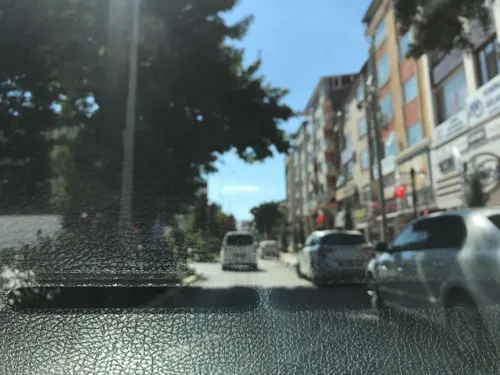
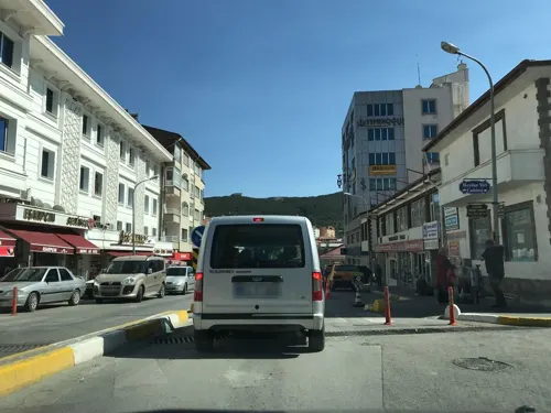



13 more on the map.
History
Formerly known as Bozok, the area surrounding Yozgat hosted many civilizations such as that of Pteria and Corniaspa (east of Yozgat).
The first surveys were started in the year 1993. Since then archaeologists have uncovered countless artifacts belonging to 5 different ancient civilizations from the area and as well as artifacts that belong to 5 different eras – the Bronze, Hellenistic, Hittite, Copper and Upper Byzantine eras.
Surface excavations and surveys were also undertaken on the Kerkenes plateau by Dr. Geoffery Summers, a British archaeologist. The plateau is believed to be the home to the lost city of Pteria. The search for this lost city as well as other old world constructions began in 2013, and it plans to go on till the month of August as well. The expedition covers an area which is surrounded by walls and is known to date back to almost 2600 years.
According to historical reports, Pteria was destroyed, burned and abandoned during the Battle of Pteria between the Lydians and the Medes. This battle ended during a solar eclipse on 28 May 585 BC, and it was understood to be an omen that the gods wanted the fighting to stop.
From the History section of Yozgat on Wikipedia, under CC BY-SA 4.0.
Where to stay10
Churches and places of worship31
Shopping19
Gas and EV charging15
Schools, colleges and libraries9
Healthcare33
Map of Yozgat
174 places. The map loads OpenStreetMap tiles when you open it.
Getting there and nearby towns
Nevşehir Kapadokya Airport (NAV) is the nearest airport with scheduled flights listed in OpenStreetMap, 119 km away.
- Sorgun 33 km east, about 33 min by car
- Yerköy 35 km southwest, about 35 min by car
- Şefaatlı 35 km south, about 35 min by car
- Alaca 39 km north, about 39 min by car
- Sungurlu 53 km northwest, about 53 min by car
- Aydıncık 54 km northeast, about 54 min by car
- Saraykent 62 km east, about 1 h by car
- Çekerek 65 km northeast, about 1 h by car
- Delice 68 km west, about 1 h 15 min by car
- Çorum 82 km north, about 1 h 15 min by car
Drive times are estimates from straight-line distance, not routes.
Local news
Headlines from INDB.
Reviews, tips and questions
Loading what members have shared...
Sources and licences
- GeoNames (CC BY 4.0): population, coordinates, regions and time zone
- Mapillary (see each image): photos
- OpenStreetMap contributors (ODbL 1.0): places, airports, map data
- Wikidata (CC0 1.0): elevation, founding date, time zone, website, landmarks and historic places
- Wikimedia Commons (see each image): photos
- Wikipedia (CC BY-SA 4.0): overview and history text
Photo credits
- Yozgat resim birleşik, Tacirci, CC BY-SA 3.0
- Fatih tabiat parkı Yozgat, Gökhan Demirbaş, CC BY-SA 4.0
- Yozgat 2014 (1), Tün, CC BY-SA 4.0
- Yozgat 2014, Tün, CC BY-SA 4.0
- Yozgat 2014 (2), Tün, CC BY-SA 4.0
- YOZGAT NİZAMOĞLU KONAĞI ETNOĞRAFYA MÜZESİ, Pollock De Martin, CC BY-SA 4.0
- Yozgat-çamlığı-milli-parkı, Sevdeartun, CC BY-SA 4.0
- Yozgat Clock Tower 3997, KediÇobanı, CC BY-SA 4.0
- Çapanoğlu Büyük Camii - panoramio - Ömer Faruk, Ömer Faruk, CC BY 3.0
- Çapanoğlu Büyük Camii - panoramio - Ömer Faruk (1), Ömer Faruk, CC BY 3.0
- Çapanoğlu Büyük Camii - panoramio, Ömer Faruk, CC BY 3.0
- SAAT KULESİ 2000 - panoramio, nurettingülay(from T…, CC BY-SA 3.0
- Dorcadion cinerarium (Fabricius, 1787) (6155090895), Udo Schmidt from Deutschland, CC BY-SA 2.0
- Dorcadion cinerarium (Fabricius, 1787) (6155090895) (2), Udo Schmidt from Deutschland, CC BY-SA 2.0
- Ormancıların Emekleri Burada - panoramio, AHMET AKGÜL, CC BY 3.0
- ISS030-E-44295 - View of Earth, Earth Science and Remote Sensing Unit , Lyndon B. Johnson Space Center, Public domain
- ISS045-E-40312 - View of Earth, Earth Science and Remote Sensing Unit , Lyndon B. Johnson Space Center, Public domain
- ISS047-E-84688 - View of Earth, Earth Science and Remote Sensing Unit , Lyndon B. Johnson Space Center, Public domain
- ISS047-E-84689 - View of Earth, Earth Science and Remote Sensing Unit , Lyndon B. Johnson Space Center, Public domain
- 20250928 View from aircraft in Turkey 01 (15717), Sergey A. Demidov, CC BY 4.0
- 20250928 View from aircraft in Turkey 01 (85298), Sergey A. Demidov, CC BY 4.0
- 20250928 View from aircraft in Turkey 01 (54005), Sergey A. Demidov, CC BY 4.0
- ISS047-E-84690 - View of Earth, Earth Science and Remote Sensing Unit , Lyndon B. Johnson Space Center, Public domain
- ISS045-E-37504 - View of Earth, Earth Science and Remote Sensing Unit , Lyndon B. Johnson Space Center, Public domain
- ISS045-E-37506 - View of Earth, Earth Science and Remote Sensing Unit , Lyndon B. Johnson Space Center, Public domain
- ISS045-E-37505 - View of Earth, Earth Science and Remote Sensing Unit , Lyndon B. Johnson Space Center, Public domain
- ISS051-E-23014 - View of Earth, Earth Science and Remote Sensing Unit , Lyndon B. Johnson Space Center, Public domain
- ISS051-E-23015 - View of Earth, Earth Science and Remote Sensing Unit , Lyndon B. Johnson Space Center, Public domain
- Street-level photo, ferahkoksal, CC BY-SA 4.0
- Street-level photo, yigidofurki, CC BY-SA 4.0
- Street-level photo, yigidofurki, CC BY-SA 4.0
- Street-level photo, yigidofurki, CC BY-SA 4.0
- Street-level photo, ferahkoksal, CC BY-SA 4.0
- Street-level photo, yigidofurki, CC BY-SA 4.0
- Street-level photo, yigidofurki, CC BY-SA 4.0
- Street-level photo, ferahkoksal, CC BY-SA 4.0
- Street-level photo, ferahkoksal, CC BY-SA 4.0
- Street-level photo, ferahkoksal, CC BY-SA 4.0
- Street-level photo, ferahkoksal, CC BY-SA 4.0
- Street-level photo, mapman66, CC BY-SA 4.0


Page built November 8, 2026. Spotted a mistake? Tell us or suggest a place.