


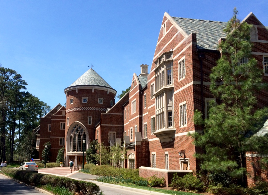


Tuckahoe, Virginia
Tuckahoe is a community of 49,183 people in Henrico County, Virginia.
Why visit Tuckahoe
Townapedia lists 36 museums and landmarks, 23 parks and trails, 161 places to eat, 8 places to stay and 13 attractions in and around town.
Highlights include CineBistro at Stony Point, Edward E. Willey Bridge, Agecroft Hall and Bellona Arsenal.
July is the warmest month, with average highs of 89°F; January lows average 28°F.
Weather in Tuckahoe
Forecast from the National Weather Service. Full forecast
About Tuckahoe
Tuckahoe is a census-designated place (CDP) in Henrico County, Virginia, United States. It is a suburb to the west of Richmond. The population of Tuckahoe was 48,049 at the 2020 census. It is named after the area's history as the site of Thomas Randolph's Tuckahoe Plantation which still stands along the James River.
From the Wikipedia article Tuckahoe, Virginia (this version), under CC BY-SA 4.0.
Things to do13


Edward E. Willey Bridge
Bridge · 2.1 mi
Bridge in United States of America
Huguenot Memorial Bridge
Bridge · 3.0 mi
Bridge in United States of America

University of Richmond School of Professional & Continuing Studies
School · 2.8 mi
School at the University of Richmond
World War II Veterans Memorial Bridge
Bridge · 5.1 mi
Bridge in United States of America

1 more on the map.
Museums and landmarks36

Agecroft Hall
Monument and historic site · National Register of Historic Places · 5.1 mi
Manor house
Bellona Arsenal
Monument and historic site · National Register of Historic Places · 2.8 mi
19th-century United States Army and Confederate arsenal in Virginia, U.S
Druin-Horner House
Monument and historic site · National Register of Historic Places · 1.2 mi
Historic house in Virginia, United States
Gordon-Baughan-Warren House
Monument and historic site · National Register of Historic Places · 3.4 mi
Historic house in Virginia, United States
Green's Farm
Monument and historic site · National Register of Historic Places · 3.2 mi
Historic house in Virginia, United States
Jerman House
Monument and historic site · National Register of Historic Places · 3.7 mi
Historic house in Virginia, United States
John Rolfe Apartments
Monument and historic site · National Register of Historic Places · 4.0 mi
Historic apartment building in Richmond, Virginia
Keswick
Monument and historic site · National Register of Historic Places · 4.6 mi
Historic plantation house near Powhatan, Virginia, United States of America
Laurel Industrial School Historic District
Monument and historic site · National Register of Historic Places · 5.7 mi
Historic district in Virginia, United States
Markel Building
Monument and historic site · National Register of Historic Places · 4.9 mi
Office building near Richmond, Virginia
North Court
Monument and historic site · National Register of Historic Places · 2.6 mi
University dorm in Virginia, United States
Pleasant View
Monument and historic site · National Register of Historic Places · 5.5 mi
Human settlement in Virginia, United States of America
24 more on the map.
Parks, trails and playgrounds23

Deep Run Park
Park · 2.6 mi
Park in Virginia, United States of America
9900 Ridgefield Parkway, Henrico


Surge Adventure Park
Sports field and stadium · 1.5 mi
1406 North Parham Road
Mo-Th 11:00-20:00; Fr 11:00-22:00; Sa 09:00-22:00; Su 12:00-20:00

The Country Club of Virginia - James River
Golf course · 1.7 mi
The Country Club of Virginia - Tuckahoe Creek
Golf course · 2.2 mi
11 more on the map.
Restaurants and cafes161

China Panda
Restaurant · Chinese · 1.6 mi
8970 Quioccasin Road, Richmond
Mo off; Tu-Th 11:30-21:30; Fr-Sa 11:30-22:00; Su 12:00-21:30

Cracker Barrel
Diner · American · 3.7 mi
3620 Mayland Court, Richmond
Su-Th 07:00-21:00; Fr-Sa 07:00-22:00
Desi Bites
Restaurant · Indian · 3.9 mi
3621 Cox Road, Henrico
Mo-Fr 12:00-21:30; Sa 09:00-21:30; Su 09:00-21:00
Farm + Oak
Restaurant · American, Southern · 3.8 mi
3601 Cox Road, Henrico
Mo-Th 11:00-22:00; Fr 11:00-23:00; Sa 10:00-23:00; Su 10:00-21:00
First Watch
Restaurant · American, Breakfast · 1.6 mi
8621 Quioccasin Road, Richmond
Su-Sa 07:00-14:30
Fleming's
Restaurant · Steak House · 2.7 mi
9200 Stony Point Parkway, Richmond
Mo-Sa 16:00-22:00; Su 16:00-21:00
Frank's
Restaurant · Pizza, Italian · 3.7 mi
3054 Stony Point Road, Richmond
Tu-Sa 11:00-21:00; Su 12:00-20:00; Mo off
Latitude Seafood
Restaurant · Seafood · 2.8 mi
9216 Stony Point Parkway, Richmond
Su-Th 11:00-22:00; Fr-Sa 11:00-23:00

Les Crepes
Cafe · 1.2 mi
Local fresh French inspired cuisine
1308 Gaskins Road
Mo-Fr 11:00-21:00; Sa 10:00-21:00; Su 10:00-20:00
149 more on the map.
Where to stay8
ECHO Suites Extended Stay by Wyndham Richmond West
Motel and hotel · 3.6 mi
9940 Independence Park Drive, Richmond
Extended Stay America - Richmond - West End - I-64
Motel and hotel · 3.9 mi
10961 West Broad Street, Glen Allen
Holiday Inn Express Richmond I-64 Short Pump Area
Motel and hotel · 3.7 mi
9933 Mayland Drive, Richmond
Churches and places of worship46
Deep Run Baptist Church
Church · Baptist · 3.5 mi
10907 Three Chopt Road, Henrico
Henry Mansfield Cannon Memorial Chapel
Church · National Register of Historic Places · 2.8 mi
Gayton Road Christian Church
Church · Protestant · 3.8 mi
12050 Ridgefield Parkway
Shopping33
Gas and EV charging23
Schools, colleges and libraries81
Healthcare23
Harness Health Pharmacy at Reynolds Crossing
Clinic and pharmacy · 3.8 mi
6900 Forest Avenue, Richmond
Virginia Urology - Stony Point Office & Surgery Center
Clinic and pharmacy · 2.9 mi
9101 Stony Point Drive, Richmond
Map of Tuckahoe
250 places. The map loads OpenStreetMap tiles when you open it.
Climate by month
Monthly table
| Month | High | Low | Rain |
|---|---|---|---|
| Jan | 47°F | 28°F | 3.5 in |
| Feb | 51°F | 30°F | 2.9 in |
| Mar | 59°F | 36°F | 3.9 in |
| Apr | 70°F | 45°F | 3.4 in |
| May | 77°F | 55°F | 4.3 in |
| Jun | 85°F | 63°F | 4.1 in |
| Jul | 89°F | 68°F | 4.0 in |
| Aug | 87°F | 66°F | 4.9 in |
| Sep | 81°F | 59°F | 4.0 in |
| Oct | 70°F | 48°F | 3.6 in |
| Nov | 60°F | 38°F | 3.4 in |
| Dec | 51°F | 31°F | 3.7 in |
U.S. Climate Normals 1991-2020 for Ashland Hanover Co Muni Ap (12 mi away), NOAA NCEI.
People and cost of living
American Community Survey 5-year estimates, 2020-2024, U.S. Census Bureau. Estimates have margins of error, larger for small towns.
Disaster history
Henrico County has had 12 federal disaster declarations since 2000, most often for hurricanes.
- 2026-01-23: Severe Winter Storm (Winter Storm)
- 2020-04-02: Covid-19 Pandemic (Biological)
- 2020-03-13: Covid-19 (Biological)
- 2018-09-11: Hurricane Florence (Hurricane)
- 2016-03-07: Severe Winter Storm And Snowstorm (Snowstorm)
- 2012-10-29: Hurricane Sandy (Hurricane)
OpenFEMA disaster declarations summaries.
Getting there and nearby towns
Richmond International Airport (RIC) is the nearest airport with scheduled flights listed in OpenStreetMap, 16 miles away.
- Short Pump 5 mi north, about 8 min by car
- Bon Air 5 mi south, about 8 min by car
- Laurel 6 mi northeast, about 9 min by car
- Lakeside 6 mi east, about 10 min by car
- Richmond 7 mi southeast, about 12 min by car
- Manchester 7 mi south, about 12 min by car
- Midlothian 8 mi southwest, about 13 min by car
- Glen Allen 8 mi northeast, about 13 min by car
- Rockwood 9 mi south, about 14 min by car
- East Highland Park 11 mi east, about 18 min by car
Drive times are estimates from straight-line distance, not routes.
Local news
Headlines from INDB, the NEMICO news database.
Reviews, tips and questions
Loading what members have shared...
Sources and licences
- NCES EDGE (Public domain): public schools
- NOAA NCEI U.S. Climate Normals 1991-2020 (Public domain): climate by month
- OpenFEMA (Public domain): disaster declarations
- OpenStreetMap contributors (ODbL 1.0): places, airports, map data
- U.S. Census Bureau (Public domain): population, income, housing, education, commute
- Wikidata (CC0 1.0): elevation, founding date, time zone, website, landmarks and historic places
- Wikimedia Commons (see each image): photos
- Wikipedia (CC BY-SA 4.0): overview and history text
Photo credits
- Tuckahoe Creek (Henrico and Goochland Counties, Virginia), Philroc, CC BY-SA 4.0
- 2017-07-07 12 17 41 View north along Virginia State Route 157 (Gaskins Road) at Virginia State Route 6 (Patterson Avenue) in Tuckahoe, Henrico County, Virginia, Famartin, CC BY-SA 4.0
- Robins School of Business, University of Richmond, Talbot0893, CC BY-SA 4.0
- Bacot-sepia, Jimrobb44, Public domain
- Collegiate School, Virginia, AboutMyTrip dotCom, CC BY 2.0
- StormcloudsOverMaybeuryElementary, Atcovi, CC BY-SA 4.0
- Crown molding in corner (8203841959), The Finishing Company Richmond Va from Richmond,Virginia, United States, CC BY 2.0
- Crown molding with beaded base (8203842051), The Finishing Company Richmond Va from Richmond,Virginia, United States, CC BY 2.0
- Hanging dental mouldings (8204933038), The Finishing Company Richmond Va from Richmond,Virginia, United States, CC BY 2.0
- Crown molding over arched window (8204933816), The Finishing Company Richmond Va from Richmond,Virginia, United States, CC BY 2.0
- Dentil crown on outside corner (8204933718), The Finishing Company Richmond Va from Richmond,Virginia, United States, CC BY 2.0
- Dentil-crown-molding (8204933450), The Finishing Company Richmond Va from Richmond,Virginia, United States, CC BY 2.0
- Man hangimg crown molding (8204933134), The Finishing Company Richmond Va from Richmond,Virginia, United States, CC BY 2.0
- Dental crown molding primed (8203841567), The Finishing Company Richmond Va from Richmond,Virginia, United States, CC BY 2.0
- Tools of the trade (8204933254), The Finishing Company Richmond Va from Richmond,Virginia, United States, CC BY 2.0
- General contractor laughing (8204933360), The Finishing Company Richmond Va from Richmond,Virginia, United States, CC BY 2.0
- Trim carpenter hanging molding (8203840913), The Finishing Company Richmond Va from Richmond,Virginia, United States, CC BY 2.0
- Dentil moldings (8203841649), The Finishing Company Richmond Va from Richmond,Virginia, United States, CC BY 2.0
- WoodlandAreasNearYMCA2018, Atcovi, CC BY-SA 4.0
- Westbury Lake Dam, Packer1028, CC0
- Dorset Woods, Packer1028, CC0
- Mooreland Farms, Packer1028, CC0
- VA-157 north, Philroc, CC BY-SA 3.0
- Westhampton Memorial Park and Cremation Park, Famartin, CC BY-SA 4.0
- SunriseOnTheStreet, Atcovi, CC BY-SA 4.0
- Virginiaroadinthefall2017, Atcovi, CC BY-SA 4.0
- HoneyNuts, Atcovi, CC BY-SA 4.0
- KFCHoursBeforeHeavyRain3232021, Atcovi, CC BY-SA 4.0
- CumulonimbusCloudsAboveWestburyLake, Atcovi, CC BY-SA 4.0
- Saint Mary's Catholic School, Packer1028, CC0
- LEAFVIP20182-1, v:User:Atcovi, Public domain
- Raymond B. Pinchbeck Elementary School, Packer1028, CC0
- ISS056-E-85131 - View of Earth, Earth Science and Remote Sensing Unit, NASA Johnson Space Center, Public domain
- ISS061-E-109687 - View of Earth, Earth Science and Remote Sensing Unit, NASA Johnson Space Center, Public domain
- ISS065-E-328086 - View of Earth, Earth Science and Remote Sensing Unit , Lyndon B. Johnson Space Center, Public domain
- ISS048-E-72196 - View of Earth, Earth Science and Remote Sensing Unit , Lyndon B. Johnson Space Center, Public domain
- ISS007-E-10356 - View of Maryland, Earth Science and Remote Sensing Unit , Lyndon B. Johnson Space Center, Public domain
- ISS030-E-144154 - View of Earth, Earth Science and Remote Sensing Unit , Lyndon B. Johnson Space Center, Public domain
- ISS061-E-109685 - View of Earth, Earth Science and Remote Sensing Unit, NASA Johnson Space Center, Public domain
- ISS030-E-144155 - View of Earth, Earth Science and Remote Sensing Unit , Lyndon B. Johnson Space Center, Public domain


Page built October 30, 2026. Spotted a mistake? Tell us or suggest a place.