


University, Mississippi
University is a community of 5,315 people in Lafayette County, Mississippi.
Why visit University
Townapedia lists 21 museums and landmarks, 13 parks and trails, 123 places to eat, 8 places to stay and 3 attractions in and around town.
Highlights include Malco Oxford Studio Cinema, The Lyric Oxford, Rowan Oak and Ammadelle.
July is the warmest month, with average highs of 91°F; January lows average 31°F.
Weather in University
Forecast from the National Weather Service. Full forecast
About University
University is a census-designated place (CDP) and the official name for an area covering a portion of the University of Mississippi (Ole Miss) campus, in Lafayette County, Mississippi, United States. The CDP is surrounded by the city of Oxford. Its official United States Postal Service designation is "University, Mississippi", with a ZIP Code of 38677.
From the Wikipedia article University, Mississippi (this version), under CC BY-SA 4.0.
Things to do3


University of Mississippi
School
Public university in the United States
Museums and landmarks21
Rowan Oak
Monument and historic site · National Register of Historic Places · 0.8 mi
William Faulkner's former home in Oxford, Mississippi
916 Old Taylor Road, Oxford
Ammadelle
Monument and historic site · National Register of Historic Places · 1.1 mi
United States historic place
621 North Lamar Boulevard, Oxford

University of Mississippi Museum
Museum · 0.7 mi
Art museum in Oxford, Mississippi
412 University Avenue, University

Barnard Observatory
Monument and historic site · National Register of Historic Places
Observatory at the University of Mississippi, USA

Isom Place
Monument and historic site · National Register of Historic Places · 1.1 mi
Historic house in Mississippi, United States

Lafayette County Courthouse
Monument and historic site · National Register of Historic Places · 1.1 mi
Courthouse in Mississippi, United States

Lucius Q. C. Lamar House
Monument and historic site · National Register of Historic Places · 1.4 mi
Historic house in Mississippi, United States
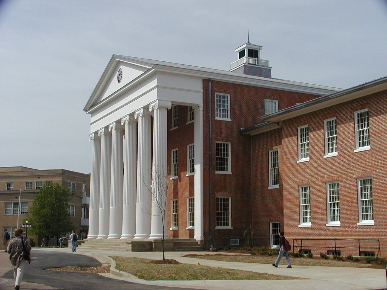
Lyceum-The Circle Historic District
Monument and historic site · National Register of Historic Places
Collection of historic buildings at the University of Mississippi in Oxford (USA)


Oxford Courthouse Square Historic District
Monument and historic site · National Register of Historic Places · 1.1 mi
Historic district located in Oxford, Mississippi

Confederate Monument (Oxford)
Monument and historic site
Confederate monument in Oxford, Mississippi, U.S.A.

9 more on the map.
Parks, trails and playgrounds13

Oxford-University Stadium
Sports field and stadium · 0.6 mi
400 University Place, University
Palmer/Salloum Tennis Center
Sports field and stadium
42 Magnolia Drive, University


1 more on the map.
Restaurants and cafes123

Big Bad Breakfast
Diner · American · 1.4 mi
719 North Lamar Boulevard, Oxford
Mo-Fr 07:00-01:30; Sa-Su 08:00-03:00

Circle and Square
Brewery and winery · 0.6 mi
Craft beer, Mississippi roasted coffee, and food (sandwiches, salads, appetizers)
100 Depot Street, Oxford
Mo-We 07:00-21:00; Th-Sa 07:00-22:00; Su 11:00-19:00


111 more on the map.
Where to stay8
Churches and places of worship17
St. Peter's Episcopal Church
Church · National Register of Historic Places · 1.0 mi
Saint Peters Episcopal Church
Church · Anglican · 1.0 mi
113 South 9th Street, Oxford
Christ Presbyterian Church
Church · Presbyterian · 1.5 mi
1720 University Avenue, Oxford
Shopping18
Gas and EV charging8
Schools, colleges and libraries14
Healthcare9
Medical Clinic of Oxford
Clinic and pharmacy · 1.4 mi
2161 South Lamar Boulevard, Oxford
Oxford Family Pharmacy
Clinic and pharmacy · 1.5 mi
2209 South Lamar Boulevard, Oxford
Red Med Urgent Care
Clinic and pharmacy · 1.0 mi
1902B Jackson Avenue West, Oxford
Map of University
234 places. The map loads OpenStreetMap tiles when you open it.
Climate by month
Monthly table
| Month | High | Low | Rain | Snow |
|---|---|---|---|---|
| Jan | 52°F | 31°F | 5.1 in | 0.8 in |
| Feb | 57°F | 34°F | 5.8 in | 0.2 in |
| Mar | 66°F | 41°F | 5.6 in | 0.1 in |
| Apr | 74°F | 49°F | 6.3 in | 0.0 in |
| May | 82°F | 59°F | 5.3 in | 0.0 in |
| Jun | 89°F | 67°F | 5.2 in | 0.0 in |
| Jul | 91°F | 70°F | 4.3 in | 0.0 in |
| Aug | 91°F | 69°F | 3.9 in | 0.0 in |
| Sep | 86°F | 62°F | 4.0 in | 0.0 in |
| Oct | 76°F | 49°F | 4.1 in | 0.0 in |
| Nov | 64°F | 40°F | 4.3 in | 0.0 in |
| Dec | 55°F | 33°F | 6.5 in | 0.1 in |
U.S. Climate Normals 1991-2020 for University Hcn (1 mi away), NOAA NCEI.
People and cost of living
American Community Survey 5-year estimates, 2020-2024, U.S. Census Bureau. Estimates have margins of error, larger for small towns.
Disaster history
Lafayette County has had 16 federal disaster declarations since 2000, most often for severe storms.
- 2026-02-06: Severe Winter Storm (Winter Storm)
- 2026-01-24: Severe Winter Storm (Winter Storm)
- 2021-10-22: Hurricane Ida (Hurricane)
- 2021-08-28: Hurricane Ida (Hurricane)
- 2021-05-04: Severe Winter Storms (Severe Ice Storm)
- 2020-04-16: Severe Storms, Tornadoes, Straight-Line Winds, And Flooding (Severe Storm)
OpenFEMA disaster declarations summaries.
Getting there and nearby towns
University-Oxford Airport (UOX) is the nearest airport with scheduled flights listed in OpenStreetMap, 1 miles away.
- Oxford 1 mi south, about 2 min by car
- Batesville 22 mi west, about 36 min by car
- Courtland 25 mi west, about 40 min by car
- Como 25 mi northwest, about 40 min by car
- Holly Springs 29 mi north, about 47 min by car
- Senatobia 30 mi northwest, about 49 min by car
- New Albany 31 mi east, about 49 min by car
- Pontotoc 31 mi east, about 50 min by car
- Coldwater 34 mi northwest, about 54 min by car
- Olive Branch 44 mi northwest, about 1 h 15 min by car
Drive times are estimates from straight-line distance, not routes.
Local news
Headlines from INDB, the NEMICO news database.
Reviews, tips and questions
Loading what members have shared...
Sources and licences
- NCES EDGE (Public domain): public schools
- NOAA NCEI U.S. Climate Normals 1991-2020 (Public domain): climate by month
- OpenFEMA (Public domain): disaster declarations
- OpenStreetMap contributors (ODbL 1.0): places, airports, map data
- U.S. Census Bureau (Public domain): population, income, housing, education, commute
- Wikidata (CC0 1.0): elevation, founding date, time zone, website, landmarks and historic places
- Wikimedia Commons (see each image): photos
- Wikipedia (CC BY-SA 4.0): overview and history text
Photo credits
- Rowan Oak 1, RowanOak.jpg : Gary Bridgman derivative work: . . . . Jim . . . . Jameslwoodward ( talk • contribs ), CC BY 2.5
- University of Mississippi Museum 2018 3, Fredlyfish4, CC BY-SA 4.0
- Ammadelle, 637 North Lamar Boulevard, Oxford (Lafayette County, Mississippi), Jack Boucher, Photographer, Public domain
- Isom Place Oxford Mississippi Front Facing, BobCummings, CC BY-SA 4.0
- Lamar House 2018, Fredlyfish4, CC BY-SA 4.0
- NRHP 77000791 Lafayette County Mississippi Courthouse North Facing, BobCummings, CC BY-SA 3.0
- NRHP 77000791 Lafayette County Mississippi Courthouse South Facing 01, BobCummings, CC BY-SA 3.0
- Barnard Observatory, Jack Boucher, Public domain
- St. Peter's Episcopal Church (Oxford, Mississippi) 01, JERRYE & ROY KLOTZ MD, CC BY-SA 3.0
- Olemisslyceum, The original uploader was Enjoybeta at English Wikipedia ., CC BY-SA 2.0

Page built October 30, 2026. Spotted a mistake? Tell us or suggest a place.