
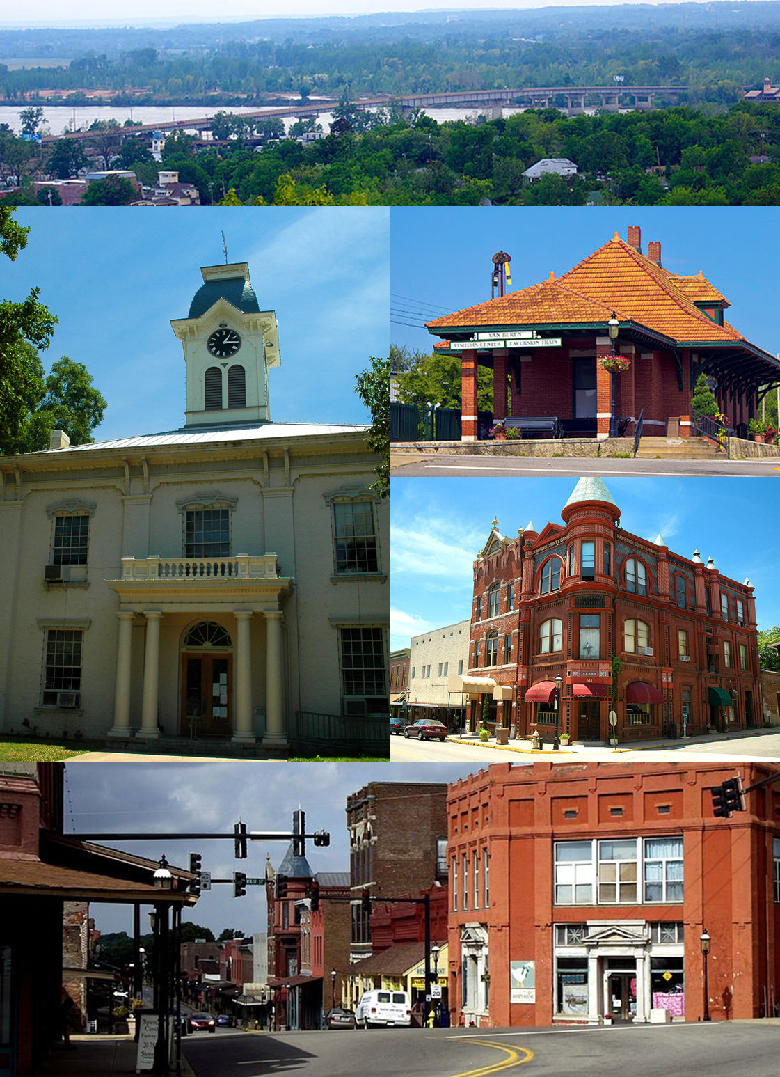


Van Buren, Arkansas
Van Buren is a city of 23,763 people in Crawford County, Arkansas, founded in 1831.
Why visit Van Buren
Townapedia lists 22 museums and landmarks, 15 parks and trails, 39 places to eat, 6 places to stay and 4 attractions in and around town.
Highlights include King Opera House, University of Arkansas-Fort Smith, Bob Burns House and Van Buren Historic District.
July is the warmest month, with average highs of 94°F; January lows average 30°F.
Weather in Van Buren
Forecast from the National Weather Service. Full forecast
About Van Buren
Van Buren ( van BURE-ən) is the second-largest city in the Fort Smith, Arkansas–Oklahoma Metropolitan Statistical Area and the county seat of Crawford County, Arkansas, United States. The city is located directly northeast of Fort Smith at the Interstate 40 – Interstate 540 junction. The city was incorporated in 1845 and as of the 2020 census had a population of 23,218, ranking it as the state's 21st largest city. According to 2023 population estimates from the U.S.
From the Wikipedia article Van Buren, Arkansas (this version), under CC BY-SA 4.0.
Things to do4

King Opera House
Cinema and theater · 1.2 mi
Theater in Van Buren, Arkansas

University of Arkansas-Fort Smith
School · 4.8 mi
Public university in Fort Smith, Arkansas, United States

Museums and landmarks22

Bob Burns House
Monument and historic site · National Register of Historic Places · 1.1 mi
Historic house in Arkansas, United States
821 Jefferson Street, Van Bure

Van Buren Historic District
Monument and historic site · National Register of Historic Places · 1.2 mi
Historic district in Arkansas, United States
Bryan House
Monument and historic site · National Register of Historic Places · 0.9 mi
Historic house in Arkansas, United States
Clarke-Harrell-Burson House
Monument and historic site · National Register of Historic Places
Historic house in Arkansas, United States

Dr. Charles Fox Brown House
Monument and historic site · National Register of Historic Places · 1.3 mi
Historic house in Arkansas, United States

Drennen-Scott House
Monument and historic site · National Register of Historic Places · 1.0 mi
Historic house in Arkansas, United States
Fairview Cemetery
Monument and historic site · National Register of Historic Places · 0.7 mi
Cemetery in Van Buren, Arkansas
Henry "Harry" Charles Pernot House
Monument and historic site · National Register of Historic Places · 0.9 mi
Historic house in Van Buren, Arkansas
Henry Clay Mills House
Monument and historic site · National Register of Historic Places · 0.9 mi
Historic house in Arkansas, United States
Joseph Starr Dunham House
Monument and historic site · National Register of Historic Places · 1.3 mi
Historic house in Arkansas, United States

Lee Creek Bridge
Bridge · National Register of Historic Places · 2.2 mi
Listed on the NRHP in Crawford County


Van Buren Confederate Monument
Monument and historic site · National Register of Historic Places · 1.2 mi
10 more on the map.
Parks, trails and playgrounds15



3 more on the map.
Restaurants and cafes39


El Loritos
Restaurant · Mexican · 1.2 mi
511 Broadway St, Van Buren
Saku Saku Hibachi Grill
Restaurant · Sushi
Fayetteville Road, Van Buren

The Vault 1905 Sports Grill
Restaurant · 1.1 mi
624 East Main Street, Van Buren
27 more on the map.
Where to stay6
Comfort Inn & Suites Van Buren - Fort Smith
Motel and hotel · 0.8 mi
1633 North 12th Court, Van Buren
Holiday Inn Express Hotel & Suites Van Buren-Ft Smith Area
Motel and hotel · 0.7 mi
1637 North 12th Court, Van Buren
Super 8 by Wyndham Van Buren/Ft. Smith Area
Motel and hotel · 0.7 mi
106 North Plaza Court, Van Buren
Churches and places of worship66
Mount Olive United Methodist Church
Church · Methodist · National Register of Historic Places · 1.0 mi
Van Buren Presbyterian Church
Church · National Register of Historic Places · 1.0 mi
Old School Presbyterian Church (Van Buren, Arkansas)
Church · 1.0 mi
Saint Michael Catholic Church
Church · Roman Catholic · 0.6 mi
1025 Pointer Trail, Van Buren
Mount Olive United Methodist Church - Food Distribution Center
Church · Methodist · 1.2 mi
500 Jefferson Street, Van Buren
Shopping7
Gas and EV charging10
Schools, colleges and libraries34
Institute For The Creative Arts School
School · 5.3 mi
1101 Riverfront Dr, Fort Smith
Healthcare4
Map of Van Buren
207 places. The map loads OpenStreetMap tiles when you open it.
Climate by month
Monthly table
| Month | High | Low | Rain | Snow |
|---|---|---|---|---|
| Jan | 51°F | 30°F | 2.9 in | 1.4 in |
| Feb | 57°F | 33°F | 2.7 in | 0.6 in |
| Mar | 66°F | 42°F | 3.9 in | 0.3 in |
| Apr | 74°F | 50°F | 4.9 in | 0.0 in |
| May | 81°F | 60°F | 5.6 in | 0.0 in |
| Jun | 89°F | 68°F | 4.6 in | 0.0 in |
| Jul | 94°F | 72°F | 3.4 in | 0.0 in |
| Aug | 94°F | 71°F | 3.6 in | 0.0 in |
| Sep | 86°F | 63°F | 4.0 in | 0.0 in |
| Oct | 76°F | 51°F | 4.4 in | 0.0 in |
| Nov | 63°F | 40°F | 3.9 in | 0.0 in |
| Dec | 53°F | 32°F | 3.5 in | 0.6 in |
U.S. Climate Normals 1991-2020 for Ft Smith Rgnl Ap Gsn 72344 (8 mi away), NOAA NCEI.
People and cost of living
American Community Survey 5-year estimates, 2020-2024, U.S. Census Bureau. Estimates have margins of error, larger for small towns.
Disaster history
Crawford County has had 18 federal disaster declarations since 2000, most often for severe storms.
- 2026-01-24: Severe Winter Storm (Winter Storm)
- 2025-04-05: Severe Storms, Tornadoes, And Flooding (Severe Storm)
- 2020-08-27: Hurricane Laura (Hurricane)
- 2020-04-03: Covid-19 Pandemic (Biological)
- 2020-03-13: Covid-19 (Biological)
- 2019-06-08: Severe Storms And Flooding (Flood)
OpenFEMA disaster declarations summaries.
Getting there and nearby towns
Fort Smith Regional Airport (FSM) is the nearest airport with scheduled flights listed in OpenStreetMap, 7 miles away.
- Fort Smith 7 mi south, about 11 min by car
- Alma 8 mi east, about 14 min by car
- Roland 9 mi west, about 15 min by car
- Barling 9 mi southeast, about 15 min by car
- Arkoma 10 mi southwest, about 16 min by car
- Dyer 12 mi east, about 20 min by car
- Muldrow 14 mi west, about 23 min by car
- Pocola 15 mi southwest, about 24 min by car
- Mulberry 16 mi east, about 26 min by car
- Greenwood 18 mi south, about 29 min by car
Drive times are estimates from straight-line distance, not routes.
Local news
Headlines from INDB, the NEMICO news database.
Reviews, tips and questions
Loading what members have shared...
Sources and licences
- NCES EDGE (Public domain): public schools
- NOAA NCEI U.S. Climate Normals 1991-2020 (Public domain): climate by month
- OpenFEMA (Public domain): disaster declarations
- OpenStreetMap contributors (ODbL 1.0): places, airports, map data
- U.S. Census Bureau (Public domain): population, income, housing, education, commute
- Wikidata (CC0 1.0): elevation, founding date, time zone, website, landmarks and historic places
- Wikimedia Commons (see each image): photos
- Wikipedia (CC BY-SA 4.0): overview and history text
Photo credits
- Van Buren collage, Brandonrush, CC BY-SA 3.0
- Bryan House, Van Buren Arkansas, Detail 1, Valis55, CC BY-SA 3.0
- Bryan House, Van Buren Arkansas, East Elevation, Valis55, CC BY-SA 3.0
- Bryan House, Van Buren Arkansas, Detail 2, Valis55, CC BY-SA 3.0
- Bryan House, Van Buren Arkansas, South Elevation, Valis55, CC BY-SA 3.0
- Van Buren Historic District 001, Brandonrush, CC BY-SA 3.0
- Van Buren Train Depot 001, Brandonrush, CC BY-SA 3.0
- Highway 59 north in Van Buren, AR, Brandonrush, CC BY-SA 3.0
- Van buren ar post office, Larry D. Moore, CC BY 4.0
- Van Buren Post Office, Brandonrush, CC BY-SA 3.0
- Van buren ar post office cornerstone, Larry D. Moore, CC BY 4.0
- Van buren ar post office mural, Ernest Martin Hennings, Public domain
- Main Street in Van Buren, AR, Brandonrush, CC BY-SA 3.0
- Old School Presbyterian Church, Brandonrush, CC BY-SA 3.0
- William Ayers House, Front View, Valis55, CC BY-SA 3.0
- Drennen-Scott House, Lester Jones, Public domain
- Wilhauf House, Van Buren, AR, Front View, Valis55, CC BY-SA 3.0
- Lee Creek Bridge, Van Buren Arkansas, Detail 3, Valis55, CC BY-SA 3.0
- Dr. Charles Fox Brown House, Van Buren, AR, Front View, Valis55, CC BY-SA 3.0
- Van Buren Confederate Monument 001, Brandonrush, CC BY-SA 3.0
- Recreation and Wellness Center, Jtpost87, CC BY-SA 4.0
- King Opera House, Van Buren, Arkansas, Tom Check (flickr user: tombothetominator), CC BY 2.0
- Clarke-Harrell-Burson House 2, Valis55, CC BY-SA 3.0
- Clarke-Harrell-Burson House, Valis55, CC BY-SA 3.0
- Fairview monument for G. Phillips, Eringrapejuice, CC BY-SA 3.0
- Sympetrum corruptum Male, Valis55, CC BY-SA 3.0
- Wood Duck front view (Aix sponsa), Valis55, CC BY-SA 3.0
- Passiflora lutea bloom and fruit, Valis55, CC BY 3.0
- Passiflora lutea, Valis55, CC BY 3.0
- Fairview Cemetery, Confederate Section, Dedication Plaque, Valis55, CC BY-SA 3.0
- Fairview Cemetery, Confederate Section Plaque, Valis55, CC BY-SA 3.0
- Fairview Cemetery, Confederate Section, one of the identified graves, Valis55, CC BY-SA 3.0
- Fairview Cemetery, Confederate Section, Valis55, CC BY-SA 3.0
- Fairview Cemetery, Confederate Section, NRHP Plaque, Valis55, CC BY-SA 3.0
- HIrunda rustica mating, Valis55, CC BY-SA 3.0
- Milk Pea dehiscence, Valis55, CC BY 3.0
- Stagmomantis carolina nymph head-on, Valis55, CC BY 3.0
- Stagmomantis carolina nymph profile, Valis55, CC BY 3.0
- Admirable Grasshopper, Valis55, CC BY-SA 3.0
- Henry "Harry" Charles Pernot House, Valis55, CC BY-SA 4.0


Page built October 30, 2026. Spotted a mistake? Tell us or suggest a place.