


Ấp Xuân Sơn, Vietnam
Xuân Sơn
Ấp Xuân Sơn is a town of 9,117 people in Ho Chi Minh City (HCMC), Vietnam.
Why visit Ấp Xuân Sơn
Townapedia lists 1 museum or landmark, 8 places to eat, 2 places to stay and 5 attractions in and around town.
Weather in Ấp Xuân Sơn
Forecast from MET Norway (CC BY 4.0). Full forecast
About Ấp Xuân Sơn
Xuân Sơn (Vietnamese: Xã Xuân Sơn) is a commune of Ho Chi Minh City, Vietnam. It is one of the 168 new wards, communes and special zones of the city following the reorganization in 2025.
From the Wikipedia article Xuân Sơn, Ho Chi Minh City (this version), under CC BY-SA 4.0.
Things to do5


Museums and landmarks1

Restaurants and cafes8




Where to stay2



History
On June 16, 2025, the National Assembly Standing Committee issued Resolution No. 1685/NQ-UBTVQH15 on the arrangement of commune-level administrative units of Ho Chi Minh City in 2025 (effective from June 16, 2025). Accordingly, the entire land area and population of Suối Rao, Sơn Bình and Xuân Sơn communes of the former Châu Đức district will be integrated into a new commune named Xuân Sơn (Clause 158, Article 1).
From the History section of Xuân Sơn, Ho Chi Minh City on Wikipedia, under CC BY-SA 4.0.
Churches and places of worship21
Gas and EV charging3
Schools, colleges and libraries17
Healthcare9
Map of Ấp Xuân Sơn
66 places. The map loads OpenStreetMap tiles when you open it.
Getting there and nearby towns
Long Thanh International Airport (LTH) is the nearest airport with scheduled flights listed in OpenStreetMap, 36 km away.
- Thị Trấn Đất Đỏ 20 km southwest, about 20 min by car
- Phú Mỹ 31 km west, about 31 min by car
- Long Khánh 33 km north, about 33 min by car
- Xã Long Hải 32 km southwest, about 32 min by car
- Biên Hòa 66 km northwest, about 1 h by car
- Thủ Đức 67 km west, about 1 h by car
- Dĩ An 70 km northwest, about 1 h 15 min by car
- Quận Bốn 72 km west, about 1 h 15 min by car
- Thuận An 76 km northwest, about 1 h 15 min by car
- Ho Chi Minh City 81 km west, about 1 h 15 min by car
Drive times are estimates from straight-line distance, not routes.
Local news
Headlines from INDB.
Reviews, tips and questions
Loading what members have shared...
Sources and licences
- GeoNames (CC BY 4.0): population, coordinates, regions and time zone
- Mapillary (see each image): photos
- OpenStreetMap contributors (ODbL 1.0): places, airports, map data
- Wikidata (CC0 1.0): elevation, founding date, time zone, website
- Wikimedia Commons (see each image): photos
- Wikipedia (CC BY-SA 4.0): overview and history text
Photo credits
- Sơn Bình, Châu Đức District, Ba Ria - Vung Tau, Vietnam - panoramio (7), Lam Tr Th, CC BY-SA 3.0
- Sơn Bình, Châu Đức District, Ba Ria - Vung Tau, Vietnam - panoramio, Lam Tr Th, CC BY-SA 3.0
- Sơn Bình, Châu Đức District, Ba Ria - Vung Tau, Vietnam - panoramio (2), Lam Tr Th, CC BY-SA 3.0
- Sơn Bình, Châu Đức District, Ba Ria - Vung Tau, Vietnam - panoramio (3), Lam Tr Th, CC BY-SA 3.0
- Sơn Bình, Châu Đức District, Ba Ria - Vung Tau, Vietnam - panoramio (1), Lam Tr Th, CC BY-SA 3.0
- Sơn Bình, Châu Đức District, Ba Ria - Vung Tau, Vietnam - panoramio (6), Lam Tr Th, CC BY-SA 3.0
- Sơn Bình, Châu Đức District, Ba Ria - Vung Tau, Vietnam - panoramio (8), Lam Tr Th, CC BY-SA 3.0
- Sơn Bình, Châu Đức District, Ba Ria - Vung Tau, Vietnam - panoramio (5), Lam Tr Th, CC BY-SA 3.0
- Sơn Bình, Châu Đức District, Ba Ria - Vung Tau, Vietnam - panoramio (10), Lam Tr Th, CC BY-SA 3.0
- Sơn Bình, Châu Đức District, Ba Ria - Vung Tau, Vietnam - panoramio (9), Lam Tr Th, CC BY-SA 3.0
- Sơn Bình, Châu Đức District, Ba Ria - Vung Tau, Vietnam - panoramio (4), Lam Tr Th, CC BY-SA 3.0
- Sơn Bình, Châu Đức District, Ba Ria - Vung Tau, Vietnam - panoramio (11), Lam Tr Th, CC BY-SA 3.0
- Sơn Bình, Châu Đức District, Ba Ria - Vung Tau, Vietnam - panoramio (12), Lam Tr Th, CC BY-SA 3.0
- Sơn Bình, Châu Đức District, Ba Ria - Vung Tau, Vietnam - panoramio (14), Lam Tr Th, CC BY-SA 3.0
- Sơn Bình, Châu Đức District, Ba Ria - Vung Tau, Vietnam - panoramio (13), Lam Tr Th, CC BY-SA 3.0
- Cửa hàng điện gia dụng Vân Nam - xã Xuân Sơn -H. Châu Đức - Rà Rịa Vũng Tàu - panoramio, Nguyễn Trần Vũ - vuk…, CC BY 3.0
- Hồ thủy lợi Bàu Lâm - panoramio, ChieuTimViet, CC BY 3.0
- Nhà anh Ngoãn - panoramio, ChieuTimViet, CC BY 3.0
- Nhà Ông Di, Bàu Lâm - panoramio, ChieuTimViet, CC BY 3.0
- Bàu Lâm, Xuyên Mộc District, Ba Ria - Vung Tau, Vietnam - panoramio, ChieuTimViet, CC BY 3.0
- Nhà thờ Họ Nguyễn Nhất, Bàu Lâm - panoramio, ChieuTimViet, CC BY 3.0
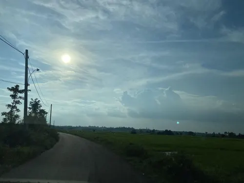
- Street-level photo, DriveWithHoang, CC BY-SA 4.0
- Street-level photo, DriveWithHoang, CC BY-SA 4.0
- Street-level photo, DriveWithHoang, CC BY-SA 4.0
- Street-level photo, DriveWithHoang, CC BY-SA 4.0
- Street-level photo, DriveWithHoang, CC BY-SA 4.0
- Street-level photo, DriveWithHoang, CC BY-SA 4.0


Page built November 8, 2026. Spotted a mistake? Tell us or suggest a place.