


Why visit Cà Mau
Townapedia lists 1 museum or landmark, 6 parks and trails, 9 places to eat and 12 places to stay in and around town.
Weather in Cà Mau
Forecast from MET Norway (CC BY 4.0). Full forecast
About Cà Mau
Cà Mau () is a former provincial city in southern Vietnam. It was the capital of Cà Mau province, a province in the Mekong Delta region, in the southernmost part of Vietnam's inland territory (mainland). The city is characterised by its system of transport canals, and most goods are transported there by boats and barges.
From the Wikipedia article Cà Mau (city) (this version), under CC BY-SA 4.0.
Travel tips from other travellers: Cà Mau on Wikivoyage (CC BY-SA 4.0).
Museums and landmarks1

Parks, trails and playgrounds6

Restaurants and cafes9

Tiệm bánh An's Cake
Restaurant · Cake, Cheesecake, Bread · 1.1 km
265 Nguyễn Trãi, Cà Mau
Mo-Su 08:00-20:00




Where to stay12

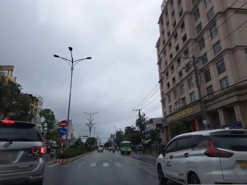
Khách sạn Mường Thanh Luxury Cà Mau
Motel and hotel · 1.8 km
Lô C3A - Khu Trung Tâm Hành Chính - Chính Trị Cà Mau Đường số 1, Thành phố Cà Mau


History
During the 1st millennium, the region of the present Cà Mau province was part of the Kingdom of Funan (Vietnamese: Phù Nam), which included Laos, Cambodia, parts of eastern Thailand, and southern Vietnam (Vietnamese: Nam Bộ). This region was later conquered by the kingdom of Chenla (Vietnamese: Chân Lạp) and the Khmer Empire. In 1757, the land belonging to Cà Mau province (Khmer: ទឹកខ្មៅ, "the black land") was ceded by the Khmer king to the Nguyễn lord of Đàng Trong (central Vietnam) with an early settlement of Vietnamese people. During French rule, Cà Mau was only a small town. During the Republic of Vietnam, the area nearby Cà Mau was a stronghold (Vietnamese: Chiến khu cách mạng) for the Việt Cộng, a Hanoi-backed guerrilla group fighting the United States Army and the South Vietnamese government during the Vietnam War. After 1975, Cà Mau was made the administrative seat and the governmental center of Minh Hải province, which included Cà Mau and Bạc Liêu province. In 1995, Cà Mau province broke off from Minh Hải province with Cà Mau as its capital. In 1999, the prime minister by a decree recognised Cà Mau as a borough (Vietnamese: Thị xã) – Cà Mau Borough (3rd class urban area as per Vietnamese law). In 2010, the Prime Minister further upgraded City of Cà Mau to a 2nd class urban area.
From the History section of Cà Mau (city) on Wikipedia, under CC BY-SA 4.0.
Churches and places of worship15
Shopping2
Gas and EV charging2
Schools, colleges and libraries11
Trường Trung học phổ thông chuyên Phan Ngọc Hiển
School · 3.0 km
Nguyễn Cư Trinh, Thành phố Cà Mau
Healthcare12
Map of Cà Mau
70 places. The map loads OpenStreetMap tiles when you open it.
Getting there and nearby towns
Ca Mau Airport (CAH) is the nearest airport with scheduled flights listed in OpenStreetMap, 3 km away.
- Thới Bình 21 km north, about 21 min by car
- Trần Văn Thời 22 km southwest, about 22 min by car
- Phong Thạnh 27 km northeast, about 27 min by car
- An Trạch 29 km southeast, about 29 min by car
- Ấp Hô Phòng 30 km east, about 30 min by car
- U Minh 33 km northwest, about 33 min by car
- Giá Rai 34 km east, about 34 min by car
- Gành Hào 34 km southeast, about 34 min by car
- Hưng Mỹ 36 km southwest, about 36 min by car
- Ông Yến 40 km northeast, about 40 min by car
Drive times are estimates from straight-line distance, not routes.
Local news
Headlines from INDB.
Reviews, tips and questions
Loading what members have shared...
Sources and licences
- GeoNames (CC BY 4.0): population, coordinates, regions and time zone
- Mapillary (see each image): photos
- OpenStreetMap contributors (ODbL 1.0): places, airports, map data
- Wikidata (CC0 1.0): elevation, founding date, time zone, website
- Wikimedia Commons (see each image): photos
- Wikipedia (CC BY-SA 4.0): overview and history text
Photo credits
- Cà Mau city center, [Tycho] talk , http://shansov.net, CC BY-SA 3.0
- Bệnh viện Sản - Nhi tỉnh Cà Mau, KIÊNFFBST, CC BY-SA 3.0
- Cà Mau banner City park, [Tycho] talk , http://shansov.net, CC BY 3.0
- Cà Mau Airport, [Tycho] talk , http://shansov.net, CC BY-SA 3.0
- A.IMAG2196, Phuocteo, CC BY-SA 3.0
- AaIMAG2186, Phuocteo, CC BY-SA 3.0
- Ca Mau, Vietnam (50733328997), Sentinel Hub, CC BY 2.0
- ISS053-E-420483 - View of Earth, Earth Science and Remote Sensing Unit, NASA Johnson Space Center, Public domain
- ISS053-E-420486 - View of Earth, Earth Science and Remote Sensing Unit, NASA Johnson Space Center, Public domain
- ISS053-E-420485 - View of Earth, Earth Science and Remote Sensing Unit, NASA Johnson Space Center, Public domain
- ISS053-E-404464 - View of Earth, Earth Science and Remote Sensing Unit, NASA Johnson Space Center, Public domain
- ISS053-E-404465 - View of Earth, Earth Science and Remote Sensing Unit, NASA Johnson Space Center, Public domain
- ISS053-E-420484 - View of Earth, Earth Science and Remote Sensing Unit, NASA Johnson Space Center, Public domain
- ISS053-E-404462 - View of Earth, Earth Science and Remote Sensing Unit, NASA Johnson Space Center, Public domain
- ISS053-E-404463 - View of Earth, Earth Science and Remote Sensing Unit, NASA Johnson Space Center, Public domain
- Street-level photo, hoangvietanh, CC BY-SA 4.0
- Street-level photo, hoangvietanh, CC BY-SA 4.0
- Street-level photo, hoangvietanh, CC BY-SA 4.0
- Street-level photo, hoangvietanh, CC BY-SA 4.0


Page built November 8, 2026. Spotted a mistake? Tell us or suggest a place.