


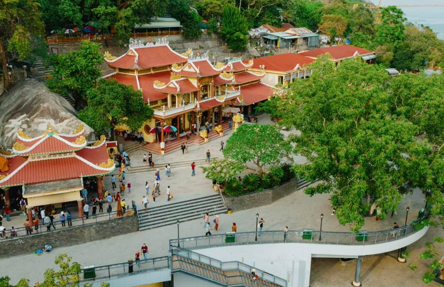


Dương Minh Châu, Vietnam
Dương Minh Châu is a town of 35,878 people in Tay Ninh, Vietnam.
Why visit Dương Minh Châu
Townapedia lists 24 museums and landmarks, 5 parks and trails, 56 places to eat, 4 places to stay and 5 attractions in and around town.
Highlights include The office of Defender of Dharma, The Holy See of Great Faith Third Universal Redemption Area and Khu du lịch Núi Bà Đen.
Weather in Dương Minh Châu
Forecast from MET Norway (CC BY 4.0). Full forecast
About Dương Minh Châu
Dương Minh Châu is a former rural district of Tây Ninh province in the Southeast region of Vietnam. As of 2003 the district had a population of 99,230. The district covers an area of 407 km2 (157 sq mi). The district capital lies at Dương Minh Châu.
From the Wikipedia article Dương Minh Châu district (this version), under CC BY-SA 4.0.
Things to do5


Museums and landmarks24

The office of Defender of Dharma
Monument and historic site · 14.2 km
House of the Guardian of The Divine Path to Eternal Life. Ngôi nhà của Người Bảo Vệ Con Đường Thiêng Liêng Hằng Sống . Ngài Phạm Công...
842M+50 , Phạm Hộ Pháp, Hoà Thành, Tây Ninh, Việt Nam
24/7
The Holy See of Great Faith Third Universal Redemption Area
Monument and historic site · 13.8 km
24/7
12 more on the map.
Parks, trails and playgrounds5




Restaurants and cafes56

Bò Tây Ninh - Nón Lá
Restaurant · 14.8 km
255 Nguyễn Chí Thanh, Phường 3
Mo-Su 09:00-22:00

44 more on the map.
Where to stay4
HOTEL Cây Thị - Khách Sạn Tây Ninh
Motel and hotel · 15.0 km
Căn C5 Khu Thương Mại Mai Anh Trường Chinh, Tây Ninh
Churches and places of worship60
Điện thờ Phật Mẫu Hiệp Định
Place of worship · Tòa Thánh Tây Ninh · 14.7 km
Đường Lạc Long Quân
Điện thờ Phật Mẫu Họ Đạo Ninh Phước
Place of worship · Tòa Thánh Tây Ninh · 13.0 km
Shopping4
Gas and EV charging6
Schools, colleges and libraries43
Trung tâm Giáo dục nghề nghiệp - Giáo dục thường xuyên khu vực 1 (cơ sở 2)
School · 14.4 km
Healthcare11
Map of Dương Minh Châu
218 places. The map loads OpenStreetMap tiles when you open it.
Getting there and nearby towns
Tan Son Nhat International Airport (SGN) is the nearest airport with scheduled flights listed in OpenStreetMap, 78 km away.
- Tây Ninh 17 km southwest, about 17 min by car
- Trảng Bàng 42 km south, about 42 min by car
- Bến Cát 48 km southeast, about 48 min by car
- Thuận An 73 km southeast, about 1 h 15 min by car
- Ho Chi Minh City 76 km southeast, about 1 h 15 min by car
- Dĩ An 79 km southeast, about 1 h 15 min by car
- Biên Hòa 81 km southeast, about 1 h 15 min by car
- Quận Mười Một 82 km southeast, about 1 h 15 min by car
- Thủ Đức 84 km southeast, about 1 h 30 min by car
- Quận Mười 83 km southeast, about 1 h 30 min by car
Drive times are estimates from straight-line distance, not routes.
Local news
Headlines from INDB.
Reviews, tips and questions
Loading what members have shared...
Sources and licences
- GeoNames (CC BY 4.0): population, coordinates, regions and time zone
- Mapillary (see each image): photos
- OpenStreetMap contributors (ODbL 1.0): places, airports, map data
- Wikidata (CC0 1.0): elevation, founding date, time zone, website
- Wikimedia Commons (see each image): photos
- Wikipedia (CC BY-SA 4.0): overview and history text
Photo credits
- Huyện Uỷ Dương Minh Châu, Skydtt, CC BY-SA 4.0
- Aerial tram in Black Virgin Mountain, Baoothersks, CC BY-SA 4.0
- Quần thể chùa Thượng ở núi Bà Đen, Trung Quân, CC BY 2.0
- ISS031-E-10877 - View of Earth, Earth Science and Remote Sensing Unit , Lyndon B. Johnson Space Center, Public domain
- Cáp treo, KDL Núi Bà Đen (2), Prenn, CC BY-SA 3.0
- Lối lên chùa Bà, KDL Núi Bà Đen, Prenn, CC BY-SA 3.0
- Chùa Bà và cảnh chân trời, KDL Núi Bà Đen, Prenn, CC BY-SA 3.0
- Lưỡng long trên mái chùa Bà, KDL Núi Bà Đen, Prenn, CC BY-SA 3.0
- Chùa Bà và cảnh chân trời, KDL Núi Bà Đen (2), Prenn, CC BY-SA 3.0
- Máng trượt, KDL Núi Bà Đen, Prenn, CC BY-SA 3.0
- Prenn - Unknown 20, Prenn, CC BY-SA 3.0
- Prenn - Unknown 21, Prenn, CC BY-SA 3.0
- Cáp treo, KDL Núi Bà Đen, Prenn, CC BY-SA 3.0
- Lối xuống (từ đỉnh núi), KDL Núi Bà Đen, Prenn, CC BY-SA 3.0
- Bảo tàng Lịch sử Núi Bà Đen Tây Ninh, KDL Núi Bà Đen, Prenn, CC BY-SA 3.0
- Tượng đài Dũng sĩ Núi Bà Đen, KDL Núi Bà Đen, Prenn, CC BY-SA 3.0
- Ba Den Mountain summit temple illuminated night fog Tay Ninh Vietnam, Vivu Vietnam, CC BY-SA 4.0
- DAU TIENG PROJECT BIRDSIGHT, TammyLe, CC BY-SA 4.0
- Tay Bo Da Son Bodhisattva statue above sea of clouds Ba Den Mountain Tay Ninh Vietnam, Vivu Vietnam, CC BY-SA 4.0
- Ga Bà Đen, Lý Kiến Quốc, CC0
- ISS062-E-73383 - View of Earth, Earth Science and Remote Sensing Unit, NASA Johnson Space Center, Public domain
- ISS062-E-73382 - View of Earth, Earth Science and Remote Sensing Unit, NASA Johnson Space Center, Public domain
- ISS062-E-73384 - View of Earth, Earth Science and Remote Sensing Unit, NASA Johnson Space Center, Public domain
- ISS031-E-10878 - View of Earth, Earth Science and Remote Sensing Unit , Lyndon B. Johnson Space Center, Public domain
- ISS062-E-73381 - View of Earth, Earth Science and Remote Sensing Unit, NASA Johnson Space Center, Public domain
- Cyrtodactylus nigriocularis - 683098669, Chris Oldnall, CC BY-SA 4.0
- Cyrtodactylus nigriocularis - 683098620, Chris Oldnall, CC BY-SA 4.0
- ISS062-E-73380 - View of Earth, Earth Science and Remote Sensing Unit, NASA Johnson Space Center, Public domain
- ISS062-E-73379 - View of Earth, Earth Science and Remote Sensing Unit, NASA Johnson Space Center, Public domain
- ISS062-E-73378 - View of Earth, Earth Science and Remote Sensing Unit, NASA Johnson Space Center, Public domain
- ISS062-E-73377 - View of Earth, Earth Science and Remote Sensing Unit, NASA Johnson Space Center, Public domain
- Street-level photo, sg_front_3, CC BY-SA 4.0
- Street-level photo, VPTD, CC BY-SA 4.0
- Street-level photo, sg_front_3, CC BY-SA 4.0


Page built November 8, 2026. Spotted a mistake? Tell us or suggest a place.